West Highland Way Part 3 – June 2018

Day 4

It was the morning of June 10, and I had covered about 67 km of the West Highland Way. I was up fairly early, and after a couple of fairly rough days at the start of the route, I felt like I was starting to hit my stride. I picked up a couple of things in the wee shop in the Beinglas Farm campground, and made some breakfast in the well equipped campers’ kitchen.

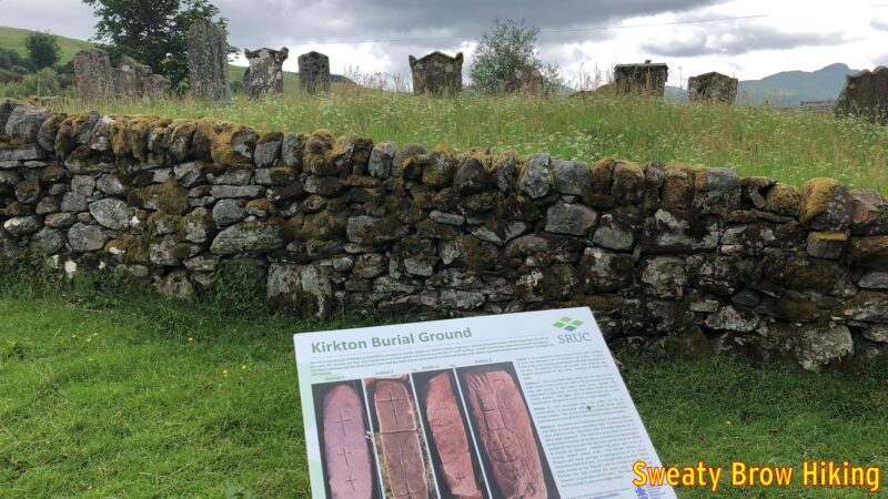
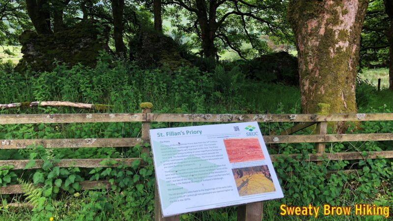
I was soon on my way, and began covering some distance. After about 15 km, there are some signs as you pass through a place called Kirkton. They point out an old burial ground dating back to the 8th century, and the ruins of an old priory dating to the 13th century. I love seeing this kind of history!

If watching Time Team has taught me anything, it’s that old burial grounds are pretty cool.
Old ruins that have been mostly reclaimed by foliage and trees. There is history everywhere around here.

I passed through the little town of Tyndrum around 1:30 or so, and stopped in at the Tyndrum Inn for a pint of Guinness. There was a dog sitting at its owner’s feet over at the bar, which I just loved. How I wish we could take our dogs in to pubs at home…

Crossing the Allt Kinglass on an 18th Century bridge, north of Tyndrum. The mountain climbing out of frame ahead is Beinn Dorain, a Munro of 1076 m elevation.

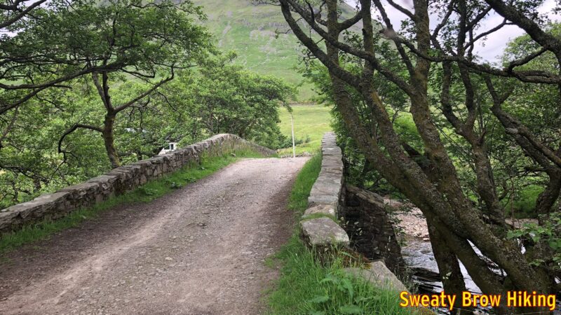
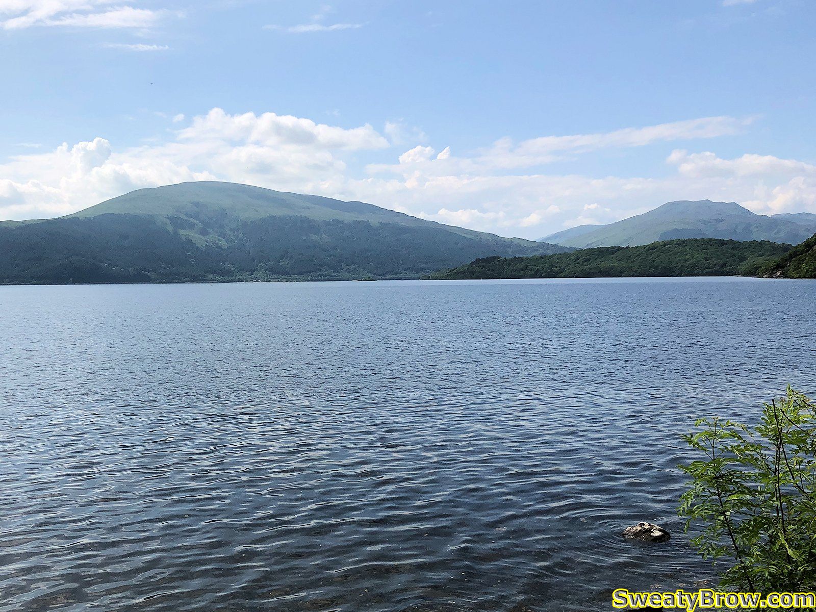
I think that the Guinness, much like Red Bull is supposed to, gave me wings. I continued through Bridge of Orchy, and along to Inveroran. A couple of hundred meters past the Inveroran Hotel, there is a small field beside a bridge over a small stream called Allt Tolaghan. This field is used for “wild camping” – that is to say, camping in an area that is not a serviced campground.

Descending a long gentle grade to Inveroran. The cluster of white buildings just left of centre is the Inveroran Hotel, a 19th century drover’s inn. The wild camping area is beyond the trees behind the hotel.

When I arrived and set up my tent, there were a couple of young women camping there as well. We sat together for a little while and chatted. One of the women was from Japan, but had lived in Scotland a few years previously, and was back to visit, traveling with a Scottish friend. I had the feeling there was possibly something romantic between them, but who knows? We didn’t stay out long visiting, because as the day approached night, the midges became pretty much unbearable, as they had been throughout the trip.

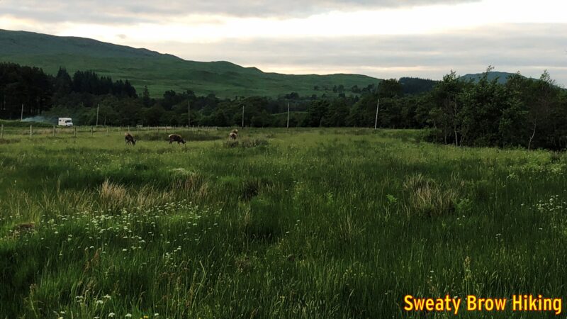
As I was heading back to my tent, a few deer wandered into the field beside the camping area, browsing in the grass and along the side of the stream, and I took a couple of photos.

Deer browsing in the field beside the wild camping area.

I had covered 34 km this day, and was asleep before dark. (Of course dark wasn’t until almost 11 in mid-June, at that latitude!)

Day 5

It was now Monday morning, June 11, and I had covered a little over 100 km of the West Highland Way, leaving just over 50 km to Fort William. I was up and on my way quite early (for me) at about 7:45. I wanted to get the balance of the trip done by Tuesday evening, as the weather was supposed to take a turn for the worse on Wednesday.

Climbing away from Inveroran and Loch Tulla, up toward Rannoch Moor.

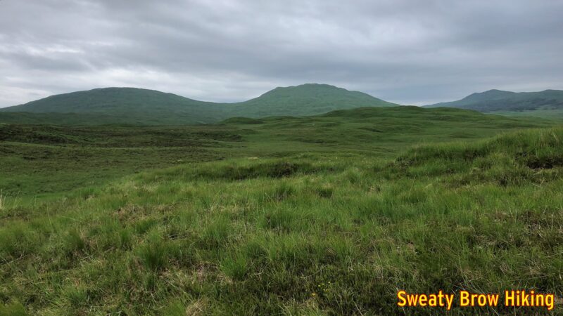
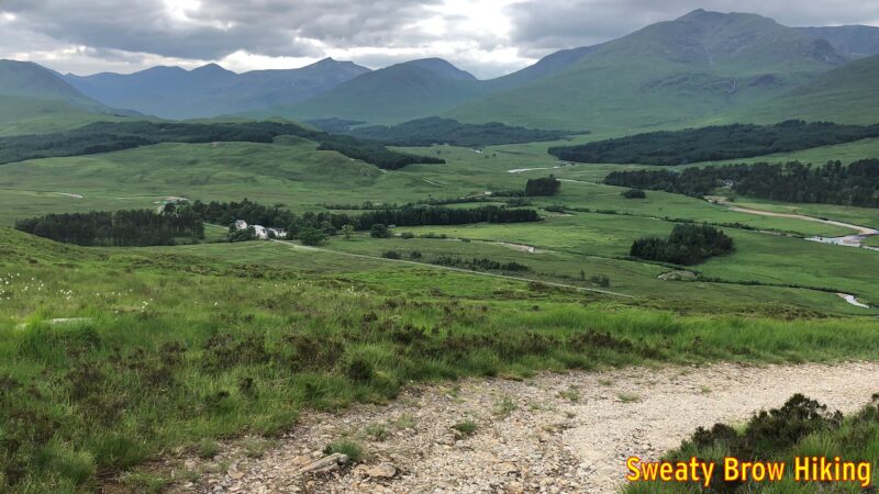
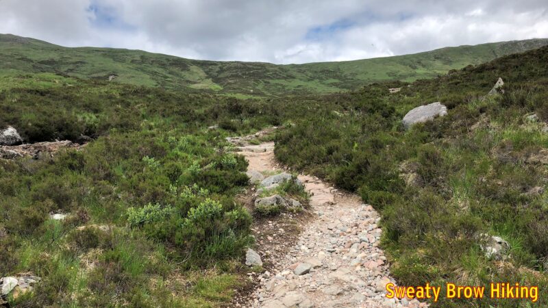
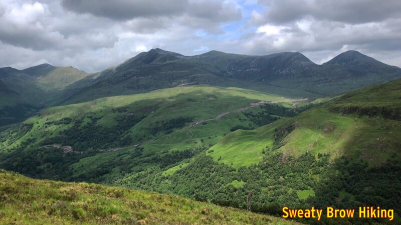
This was one of my favourite days on the trail, due to the scenery on the way. It was a fairly steady pull uphill for the first couple of hours, up and over a shoulder of a mountain at the Glencoe Mountain Resort, a ski area near Kingshouse, on Rannoch Moor. The trail then drops down to the Kingshouse Hotel, which was under renovation when I was there, so I wasn’t able to stop for a big fancy meal. The restrooms were open, though, so that was quite pleasant.

Dropping down into Kingshouse. The hotel is down among the trees. The mountain beyond is Beinn a’ Chrulaiste.

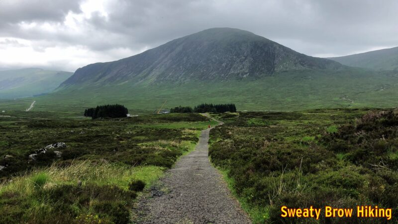
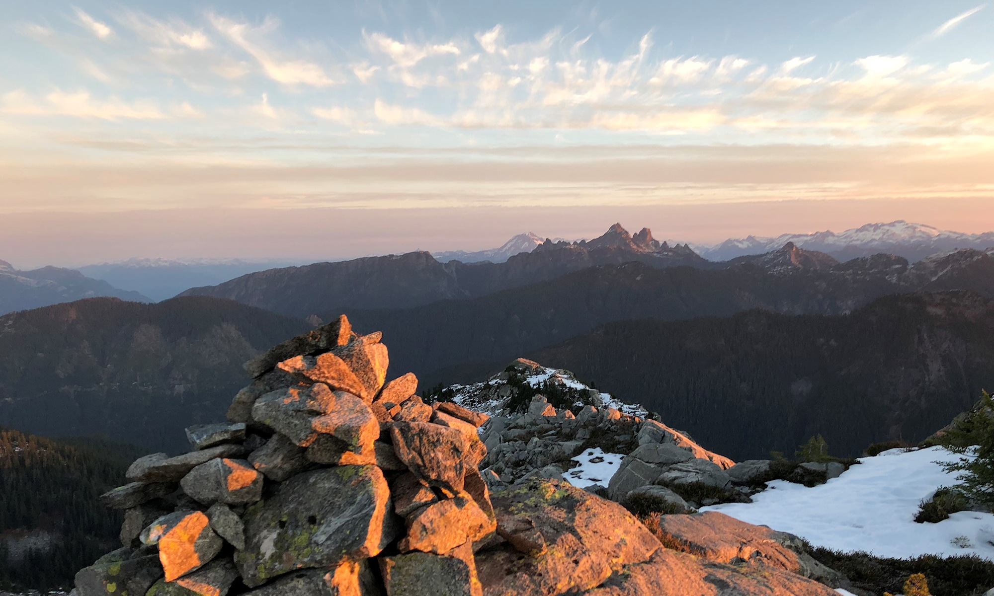
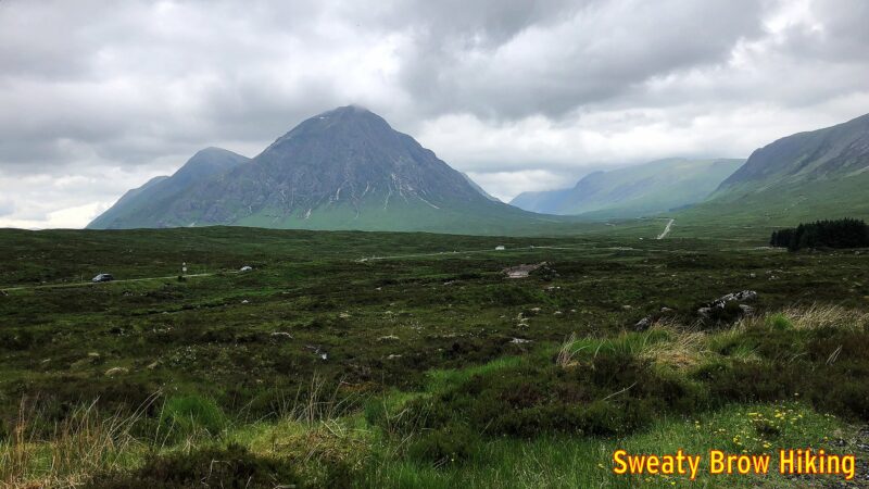
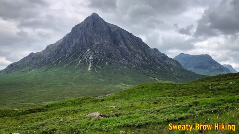
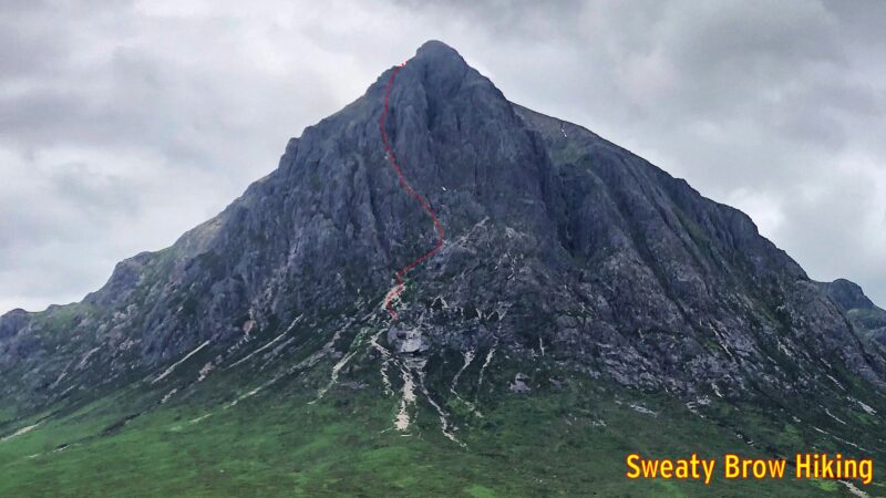
From Kingshouse, the trail continues across Rannoch Moor toward one of the most recognizable, and beautiful, mountains in Scotland: Buachaille Etive Mor.

One of my first views of Buachaille Etive Mor, while approaching Kingshouse. The renowned Glen Coe is the large rounded valley to the right of the mountain.
A gorgeous view of Buachaille Etive Mor.

As I hiked towards this captivating view, I was so distracted that I missed a turn on the trail. I continued until the gravel path I was on met up with, and crossed, the A82. I realized that the WHW stayed on the north side of the A82 along here, and figured out my mistake. I had to backtrack about 400 meters to get back on route. At least it wasn’t further…

I later learned that Buachaille Etive Mor (“The great shepherd of Glen Etive”) has one of the most famous scrambles in Scotland up its flanks – Curved Ridge – and I swore I would come back to climb it. (Less than a year later, I did!)

This zoomed in view shows the approximate route of Curved Ridge, up the mountain.

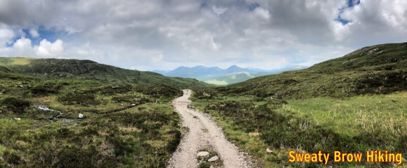
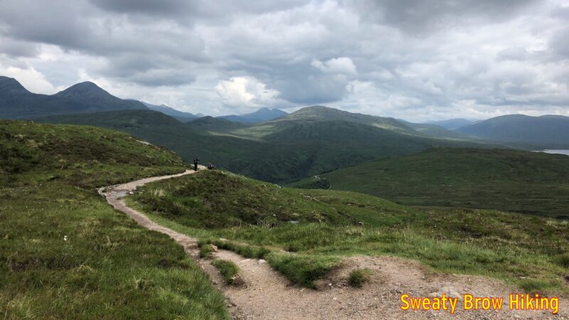
Back to the present, however, and the trail traversed along across the valley from the Buachaille, just uphill from the A82, offering great views along the way. Suddenly, just as the roadway turns down the top of the famed Glen Coe, the trail veers off to the right, and starts up the infamous Devil’s Staircase. Over the course of about 1.5 km, it gains about 250m. Now, that’s not a massively steep climb when you’re used to hoofing up BC’s coastal mountains – or the Munros of Scotland – but it does come as a bit of shock after a pleasant ramble along Rannoch Moor.

Getting started up the Devil’s Staircase. So far, so good.
Some people heading up the Devil’s Staircase.

The Devil’s Staircase takes you up and over a mountain pass, then drops down into the valley of the River Leven. On the way, there are some great views, first to the left, where you can see the south side of Glen Coe, then to the right, across the Blackwater Reservoir. As you descend into Kinlochleven, there are views ahead of the Mamores, a series of Munros to the north.

Coming over the top of the Devil’s Staircase, with views opening up.
And starting to round the corner toward Kinlochleven. The edge of the Blackwater Reservoir is visible on the right.
Starting the descent to Kinlochleven, some peaks of the Mamores range come into view across the valley.

As I was hiking for the day, I decided to book a night in a camping pod at Kinlochleven. The pods looked very cozy, and I could get away from the midges! I covered about 30 km this day, and arrived in Kinlochleven around 3 PM.

My cozy “glamping” pod for the night, at the Blackwater Hostel.

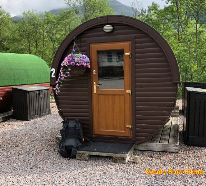
The place was very nice, with good shower and eating facilities, and the pod was quite pleasant. However, it had warmed up a lot that day, and it was actually very hot and stuffy inside the pod. The thing I couldn’t believe was that the midges seemed able to get into the pod somehow. I had a window open, but it had mesh across it. Maybe the mesh wasn’t fine enough.

Relaxing in my little wooden tube. This was before the midges infiltrated.

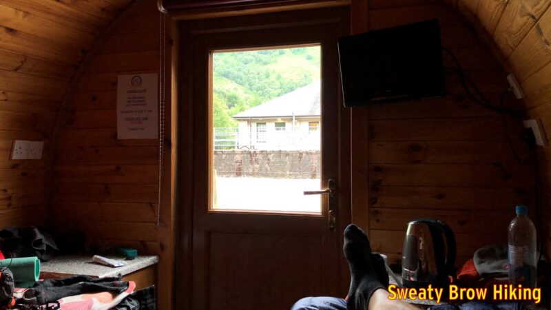
I lay upon the bed, on top of my quilt, trying to cool off, but the midges just kept attacking. I looked like I had measles, from all the bites on my torso. Over the past few days I’d learned that the midges don’t really emerge until the very end of May, and (as a bonus) that May is pretty much the driest month in the Scottish Highlands. I texted my wife that I would never camp or hike in Scotland in June ever again…

As the evening went on, I had a hard time deciding between being entirely under the covers, and sweltering, or staying uncovered and being bitten. Even after closing the window, and smacking every midge I could spot, it took hours before they thinned out enough to sit comfortably on top of my quilt. By about 1:30 AM, I was able to fall deeply asleep.

Day 6

This was it – the final day on the West Highland Way. The alarm woke me from a deep sleep at 8:00 AM. I had some breakfast and packed up my things. By 9 I set off to cover the last 25 km to Fort William.

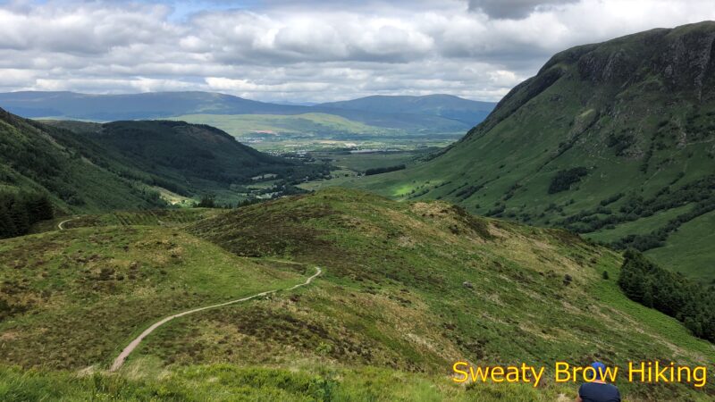
After a couple of hours, I rounded a curve in a valley, to where Ben Nevis (the UK’s tallest mountain) should be visible, but the summit was wreathed in cloud. A short time later, I broke off from the trail to hike a short, steep spur up to an old Iron Age hill fort, Dun Deardail. The fort was built over 2000 years ago, and destroyed by fire sometime between 100 and 200 years later.

A sign depicting how the old hill fort would have appeared upon the brink its demise.

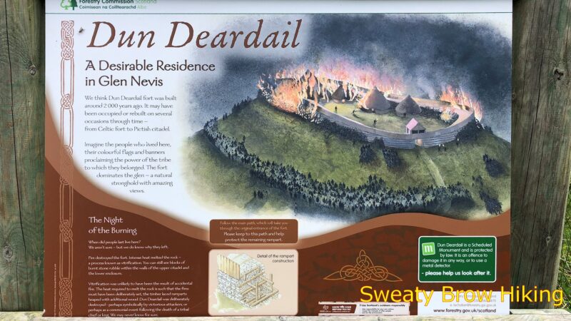
There wasn’t much to be seen at the hill fort, just a raised embankment in a roughly oval shape, with some stone projecting up out of the soil. The views across to Ben Nevis, and down the valley toward Fort William were quite spectacular, though!

Looking down Glen Nevis, toward Fort William (around the corner, to the left).
Looking across toward Ben Nevis from the hill fort location.

I continued down the trail toward Glen Nevis, the valley that leads to Fort William, and arrived at the visitor centre around 1:15 PM. I bought a drink and some crisps, and enjoyed them outside on a bench. Refreshed, I continued the final 4 km into Fort William.

Another view toward Ben Nevis, from further down the glen.

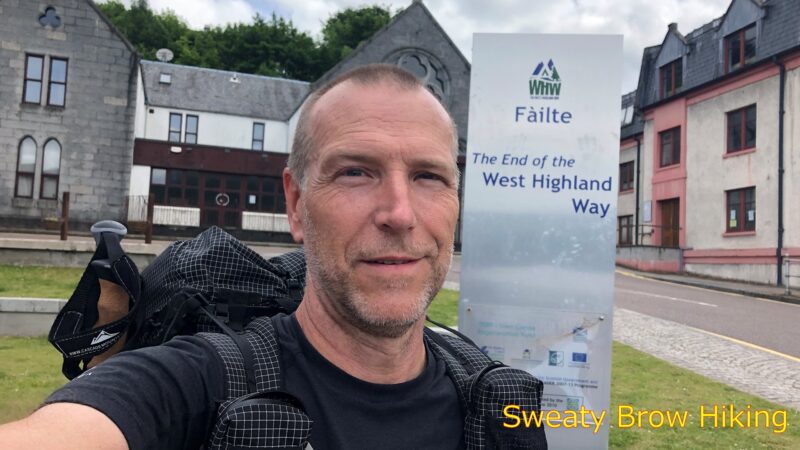
I strolled through town, and arrived at the end point of the West Highland Way at 2:30, tired and happy to be done – and to have done it! It was time to hit the pub!

And the trail is complete! Time to go to the pub!

A change in the weather – West Highland Way Part 2 – June 2018

Part two of my trip along the West Highland Way, from Glasgow to Fort William. Part one can be found here.

Day 3

I had a fairly good night’s sleep at Sallochy Campsite, and woke up shortly after 7:00. I was amazed at the number of midges that were swarming around the outside of the bug mesh of my tent. This would not be the last time – it was a recurring theme on this trip!

Most of the day was spent hiking north along the shoreline of Loch Lomond. Fortunately, the weather stayed nice for most of the day. Unfortunately, it kind of got ugly later in the day…

The route had now narrowed into an actual trail. Up to this point, it was mostly either a gravel or dirt road, or a pathway alongside a paved road.  Now the trail (very developed, with a groomed gravel surface) wandered along the lochside, through ferny forests, and across lovely babbling brooks.

The trail following a road, the day before.

view through tree branches across a lake toward forested mountains
Looking northward, along the edge of Loch Lomond

I passed a fairly large hotel, the Inversnaid Hotel, around 2:30 in the afternoon. There appeared to be a wedding going on, and I saw the bride and groom posing for photos near a waterfall below the trail. I made sure I didn’t photobomb them!

A view of the Inversnaid Hotel through the trees

At 3:00, I rounded a point, and had a view up toward the north end of the loch. There were some dark, foreboding clouds up that way, and I began to hear the sounds of distant thunder.

Along this section of trail, I came upon one of the more interesting trail features I saw: a little gathering of three tables and some chairs made of wood, in the form of oak leaves and acorns. Very cute!

Acorn and leaf trail-side accouterments!

Shortly after 4:00, a little bit of rain began. It was just a little light shower activity, but I donned my rain shell, just in case.  A little while later, I strolled across a field with an abandoned old house, and a smaller stone building at the far end. This was my first bothy!

What is a bothy, you ask? “A bothy is a basic shelter, usually left unlocked and available for anyone to use free of charge… Most bothies are ruined buildings which have been restored to a basic standard, providing a windproof and watertight shelter. They vary in size from little more than a large box up to two-storey cottages.“ – Wikipedia 

The bothy had a trio of people inside already, and I joined them. It began raining much harder outside, as an actual thunderstorm came rolling through. The bothy was a solid stone building, with a couple of raised sleeping platforms. There were just a few small, deep-set windows in the walls, which made the place quite dark inside.

I sat down on one of the sleeping platforms, just below a window, and pulled out my book for a while.  A few other people came in and dried out, then carried on. There was a bit of conversation among the occupants, but each group mostly seemed to keep to themselves. As a solo traveller, I didn’t chat much with the others…

Home for the night was going to be a campground at Beinglas Farm, which was a little over three km along the trail. The rain seemed to be pretty much done by about 6:00, so I packed my things back up, and got on my way.

Fifteen minutes before I got to the campground, the skies opened up. Seriously, the rain came down hard! Truly a deluge, for the remaining 20 minutes on the trail. I splashed into the campground, and was thrilled to see that there was a warm, dry pub on offer! I shed my rain layers, paid for a campsite, and sat down to a dinner of cullen skink, bread, and Guinness(es).

After a little while, the rain began to ease, and I went out to set up my tent. With the rain dying off, the midges began to reappear. I set up the tent and got right in. Later in the evening, someone was playing live music in the pub, and it sounded pretty good! Unfortunately, I knew that exiting the tent, and getting back in later, would permit far too many midges inside. I declined to do so…

A change of plans! – West Highland Way Part 1 – June 2018

Planning

6 June, 2018. It was about 4 in the afternoon when I arrived back at my campground for the night. I had just spent 8 hours hiking up and over Càrn Mòr Dearg and Ben Nevis, and I was bone tired. More than that, I was incredibly discouraged. The hike had been only about 18.5km, with a cumulative elevation gain and loss of less than 1500m.  On top of that, the whole thing began and ended very close to sea level. There was no reason that it should have tired me out the way it did! I was in good shape, and very accustomed to trips of that length and difficulty.

I thought about the general plans I had over the next few days. Nothing really well defined, but the goal was to do a lot of vertical, up and down a bunch of Munros for the next week or so. Feeling the way I did after Day 1, I realized I wasn’t ready for it.

I think the major problem was the jet lag, and lack of sleep from my sleepless 9 hour red-eye flight. An additional issue was that I was a bit anemic – a situation spotted during a platelet donation just a couple of days prior to my trip. I am basically a vegetarian (I do eat some seafood) and had not been keeping up on my supplemental iron recently. It was showing. I wasn’t desperately low on iron, but low enough that I had to be deferred for a couple of months. The low iron count was certainly a factor in the fatigue I felt.

Anyway, long story only very slightly less long, I didn’t feel up to tons of ascents and descents right away.

I hopped on the internet, and looked into some options. One that jumped out at me right away was the West Highland Way. When I was driving from Glasgow to Fort William, I had seen glimpses of people hiking a trail alongside the road, along this route.

The West Highland Way starts on the outskirts of Glasgow, and winds 154 km to Fort William. The elevation gain was fairly substantial overall (I ended up averaging about 600m of gain/loss per day over six days) but it started slowly over the first couple of days, increasing as the trail went on.

Anyway, with very little preparation, I lay in my tent that evening, and arranged my transportation online. I packed up my backpack, and tried to get some sleep.

Day 1

I woke early on the 7th of June, and packed up. Everything went either into my backpack, or into the trunk of my rental VW Golf.  I drove into Fort William, and tried to figure out where to park for a week, where I wouldn’t be towed. The “long term” lots around town were no good for anything over 24 hours. Finally I went and asked in the train station. I was told that I could park around the back of the station, at my own risk. No cost, no time limit, perfect!

I parked the car, and then kept looking back, hoping I had everything I needed. Mostly, I did…

I hopped on the CityLink bus to Glasgow, and we pulled out at 9:00 AM. While we traveled, I tried to figure out (on my phone) where I would stay that first night. I knew that I would be in a national park that had limited opportunities for camping permits. There were none available for that night, however. I did find a hotel in Drymen, though, which would give me a 19 km first day. No problem.

City Link bus interior
Time to take the bus to Glasgow!


After almost three hours, I arrived at the Anniesland station in Glasgow, and changed onto a train for the 12 minute, £2.80 trip to Milngavie.

It was just after 12:30 in the afternoon, and I had about 4-5 hours of walking ahead of me. I decided not to linger. I realized that I had left my toothpaste and toothbrush in the car, and made a quick stop in a grocery store to grab those things. At 12:45, I found the start of the walk, and began my trek!

Selfie with sign indicating the start of the trail
Starting the West Highland Way in Milngavie.


I realized later that I probably should have picked up some sort of guide or map or something near the start of the route. Turns out I never would pick one up, and just got by using Google Maps and my GPS app…

The first day took me through a lot of farmlands on the outskirts of Glasgow. It was more rural than suburban, but definitely was a very settled area.  There were a lot of gates that needed opening and closing, to keep livestock from escaping. One thing that I found very cool was all of the cuckoos that I kept hearing! That’s something we don’t have in BC, and it was strange to hear such a familiar sound (of a cuckoo clock) out in nature.

The 19 km trip, with about 250 meters of total elevation gain and loss was utterly exhausting for me. It took almost five hours, and I was really dragging my feet by the time I arrived at my hotel!

When I got checked in, I found it impossible to leave the room. I had thought I might head to a pub for food and a pint, but there was no way. I boiled water in the supplied kettle, and ate one of my dehydrated meals. Then I slept.  I slept fitfully, unfortunately, but at least I slept…

That first night, I realized that I’d forgotten a couple of other things in the car. I had no contact lens case with me.  That night, I ended up emptying a couple of small cream containers from the complimentary in-room coffee service, giving them a good wash, and filling them with contact lens solutions – which I fortunately had!

I also realized I’d forgotten my travel electrical adapter, so I had no way to plug in my USB charger. I was able to borrow one at some of the places I stayed at night (hotels and campgrounds) but I did have to be careful with my phone usage!

One more important lesson this day:  I learned that there are also private campgrounds in the area, in addition to the park campgrounds. Turns out I could have stayed in an £8 campsite instead of the £60 hotel…

Day 2

I was up fairly early on the 8th. I found the closest chemist and asked about a contact lens case. Well, the only way I could get one was included in a pack of two travel-sized bottles of solution. So that added to my pack weight…

Once I had that sorted, it was off for a bit of breakfast at Skoosh.  This place is a wee tearoom on the Drymen high street, and they make an excellent breakfast!  I had a full Scottish breakfast, with all the vegetarian options, and it was an excellent way to start the day!

Back to the hotel, to load up the pack and check out, and I was on the road at the crack of 10:30!

About an hour into the day, I started getting some glimpses of Loch Lomond in the distance.  It disappeared again for a while, as the trail climbed up the east side of Conic Hill. Cresting the top of Conic Hill,  two and a half hours into the day, there was a lovely view encompassing the southern third of the Loch. Lots of people were on top of the hill, about 350 meters above the lake. Pretty impressive, considering it was early on a Friday afternoon.

view over Loch Lomond from Conic Hill
Looking over Loch Lomond from Conic Hill

After taking a few photos, I started down the west side of Conic Hill, headed for the wee village of Balmaha. Once there, I popped in to the Oak Tree Inn for a pub lunch – Cullen Skink – and pint of Guinness.  Some fine sustenance for the rest of the day.

I continued up the side of Loch Lomond, northbound, and at about 4:00 I reached Sallochy Campground, my home for the night. I had booked it online the night before, and was pleased to get a site in this location. It made for another 20 km day, which was just fine, as I was still very tired and having trouble covering a lot of distance. This second day also included a lot more elevation than the first had – more than twice as much, at around 550 meters total. The weather had been fairly warm through the day, and I drank a lot of water when I arrived!

The campsite was just fantastic! I was in one of the lochside spots (Site 6), and it was quite secluded from the other sites.  An idyllic spot with great views over the loch.  The campground was quite busy in the large, central common camping field, it being a Friday evening. It was certainly quiet in my site, though.

View of Loch Lomond from the shoreline. Blue skies, some puffy clouds, mountains across the loch.
View from my campsite, looking across Loch Lomond


—-