Last year, I posted the first instalment of the time that I spent on the Pacific Crest Trail in 2023. The post took ages to type in, and covered a week on the trail. That’s it. One week.
I don’t feel like typing in anything more about that trip right now – at least, not in the detail that I provided about the first week. In fact, not much detail at all.
So I’m going to provide a very quick summary of that summer:
I spent about 3 weeks on the trail before our dog Chester became very sick. He had been having kidney issues for several months previously, but the situation became much more severe. Just outside of Big Bear Lake, California, I decided to head home to spend the last quality time that I could with my little buddy.
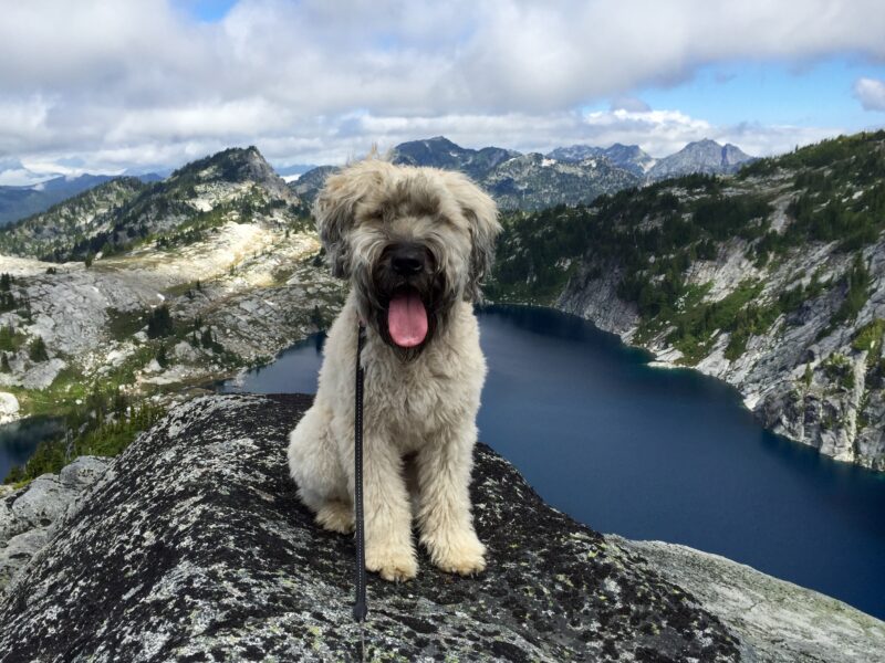
Chester, the best little adventure buddy.
I had just over three weeks with Chester. He had some good days, and he had some worse days, and then, on June 12, he was gone.
Four days later, I was back on the trail in Big Bear Lake. My whole cohort of hikers I’d begun with were about a month ahead of me. I saw a lot fewer hikers on the trail. It was getting hot.
On the fourth of July, I was in Tehachapi. It’s on the edge of the Mojave Desert, and it was hot. I decided to skip up to Oregon. A day and a half later, I arrived in Ashland, and began hiking north from there.
It was still hot. And my heart just wasn’t in the adventure any more. Crater Lake was cool, there were a lot of fine folks around, but my ankle hurt (I’d sprained it badly five years before, and it still causes me grief), I cried about Chester daily, and my mind was just constantly elsewhere. I wanted to get back to my boat, and back to my family, and back to my home where I could grieve for Chester properly.
A couple of days into Washington State, I called it. Caught a ride to a trail angel’s house, then a bus to Portland and from there, home to Vancouver.
After a total of just over 10 weeks on the trail (punctuated by a month off of it) and around 1100 miles hiked, I arrived late at night at the downtown Vancouver bus station, where Karyn was picking me up. Getting of the bus, I tripped on the curb and went down hard. Hurt my knee, whacked my chin on the sidewalk (my jawbone still has a big bump there) and broke the little finger on my left hand. The worst injury I got all summer was when I got home.
Another week has gone by, and planning for the PCT is proceeding. I have now booked my flight down to San Diego, as well as a night at a hostel in town, and a shuttle to (and night at) CLEEF. And what is that? CLEEF is the Camp Lockett Event and Equestrian Facility. It is a non-profit corporation that provides event and equestrian facilities on a 167 acre property just outside of Campo, California. The important thing to PCT hikers is that the property is located about a half mile from the start point of the trail.
CLEEF offers inexpensive camping prior to beginning one’s hike, as well as a twice-daily shuttle from San Diego to the campground – including stops along the way at the San Diego REI (outdoors equipment store) and a grocery store. It is not cheap, but it is incredibly convenient!
I have been working on figuring out my pack contents for at least the first quarter of the trail, from the Mexican border to Kennedy Meadows South – a point 700 miles along the trail that is considered the start of the Sierras. So this will take me through the southern desert sections, as well as up a couple of tall mountains along the way (Mount Baden-Powell and Mount San Jacinto).
As I get my gear more finalized (Buy a new quilt? Take a tarp instead of a tent for this section? Am I really going to cold soak??) I will post my plans. For now, I’m excited about my new Montbell Versalite jacket, and trying out some new Injinji socks instead of my old reliable Darn Toughs…
I just realized that my passport will expire in late August, at which point I plan to still be a couple of weeks away from home. I’ve just printed up an application for a new one, so hopefully they aren’t as backlogged on renewals as they were a few months ago…
One more thing – I went in for a consultation on having my eyes laserized. I’m planning on having a Lasik procedure two days after my final day at work, a month before I fly down to San Diego! I look forward to not having to carry multiple pairs of glasses and/or contact lenses along with me.
In the meantime, it’s time to update my Fitbit stats from last week. Not pretty, but at least I’m keeping the steps up!
Stats for 15 January – 21 January, 2023
Steps: 105201 (avg 15029) up 0.1% from last week
Calories burned: 21901 (avg 3172) up 1% from last week
Average resting heart rate: 55.9 (up from 54.6 the week before)
Well, it’s been almost 8 months since I last updated on here. A lot has happened in the meantime!
Last time I posted anything here, I was intending to get into better shape, because I was looking forward to backpacking the Pacific Crest Trail in 2023. When Chester the dog got sick, however, it threw a big spanner in the works… But here’s what’s happening now.
Chester is still doing well. He gets 500ml of subcutaneous fluids daily (or about 4 out of 5 days, really), which is a big commitment of time and effort for us, and for him. He continues to do chug along, though!
I got waaaay out of shape! With Chester in a very touch-and-go condition for a few months, not really knowing how his health would fare in the longer term, I kind of quit doing the serious mileage (treadmill/elliptical and hiking) I’d been doing in April.
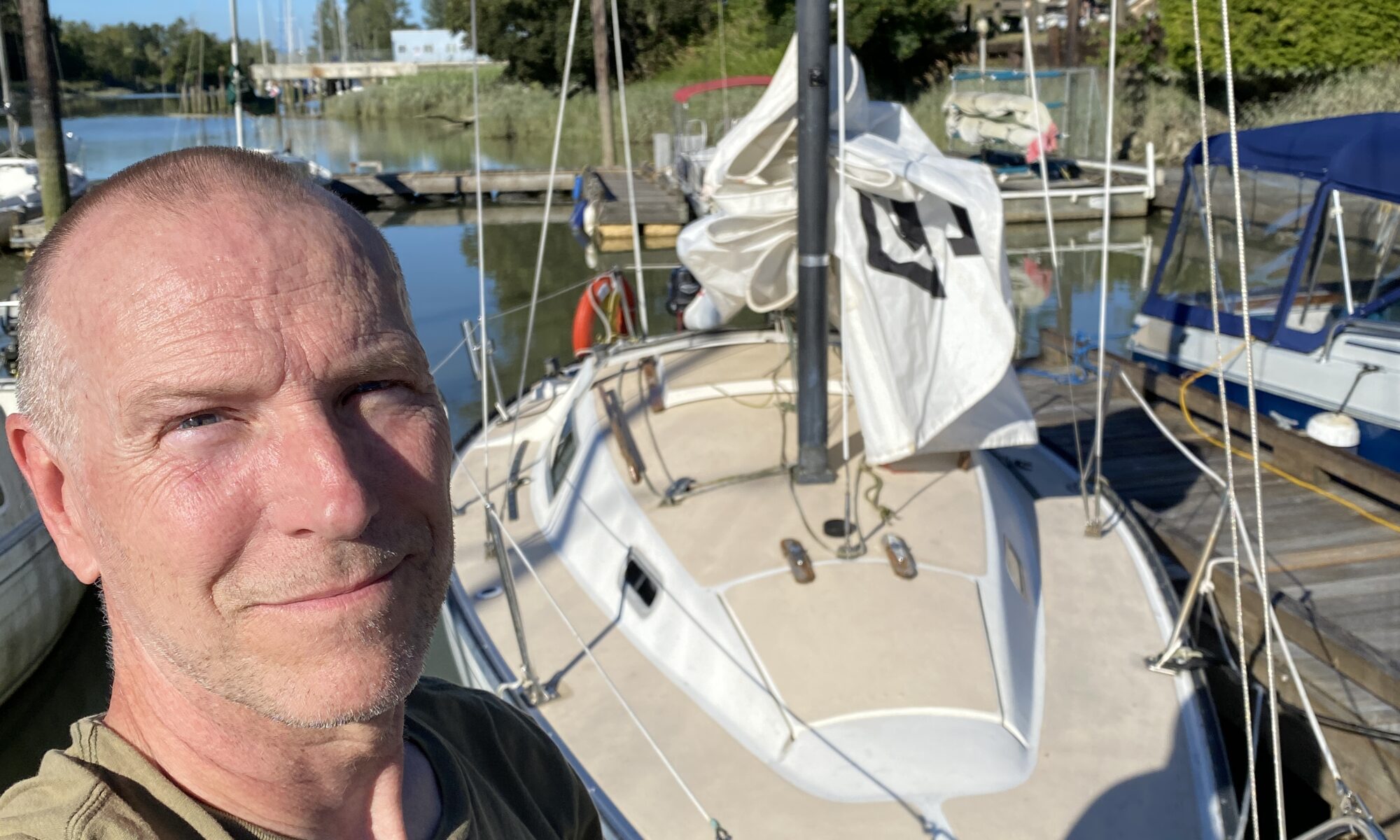
I discovered a passion for sailing! I’ve been interested in learning to sail for quite some time, but have never gotten around to it. However, a friend (who recently bought a serious bluewater boat, capable of ocean crossings) asked whether I’d be interested in sailing to Hawaii with him at some point. The answer: extremely. Because of my Pacific Crest Trail aspirations for 2023, we penciled in 2024 as a date to cast off.
Then I bought a boat! Yep, before I even learned to sail… I’ve done a bunch of work on the boat (I’ll post elsewhere about that) and read and watched as much as I could about how to sail.
Then, I learned to sail! So then I actually started to learn to sail. I took a Basic Cruising course with Simply Sailing, on Granville Island. The course went well, and the sailing bug is well and truly established in my system.
But – I still want to hike the PCT! None of this sailing business negates the fact that I still want to backpack home from the Mexican border in 2023.
I failed to get a PCT permit! In November, the first 70% of PCT permits were allocated for 2023. My designated time to log in and select a permit date was 2:38 PM. Permits ran out at 2:32 PM. I missed out on a permit by 6 minutes.
But that’s OK, maybe I’ll just sail! There was another opportunity to get one of the remaining 30% of permits available, on January 10. But if I was, again, unsuccessful in obtaining a permit, well, that’s OK, I would just spend the whole summer sailing and getting comfortable on the water! I could sail on my own boat, as well as with my friend on the boat we plan to sail to Hawaii on!
But wait – I did get a permit! On January 10, I got a much earlier time for permit selection, and applied for a permit to begin my hike on April 27 at the US/Mexican border at Campo, California! The permit application was reviewed and approved, so it is official – I am hiking the PCT in 2023!
Which brings me to now… Yup, I have 99 days to prepare to hike 2650 miles!
So I’m about to start posting again, and hopefully will keep it up this time! Please stay tuned…
According to my (current) grand plan, one year from today, 22 March 2023, will be my last working day at my current job. Almost exactly 31 years after I began my training as an air traffic controller, I will be making my final transmission to an aircraft.
Unfortunately, I’ve let myself get a little bit out of shape over the past year, despite a couple of good trips last summer and fall. This gives me a year to get into “post-career” shape. And why am I keen to get into better shape for my retirement? Because I plan to hike!
The purpose behind retiring at that time of year is quite simply so that I can leave my job, and begin a five-month long hike.
I intend to fly down to the US/Mexican border, and walk all the way, via the Pacific Crest Trail, home to Canada, where I will begin my life without work.
A lot of people say that hiking the 2650 miles (4265 km) of the PCT is a life-changing experience. I figure, why not do so when my life is about to undergo one of the most dramatic changes in my day-to-day life that I will ever experience?
Plans for this summer
I already have a few adventures planned for the next few months.
Two weeks in Scotland in May
A week in the Rockies in July
A trip around the Bowron Lakes Canoe Circuit in September
Hopefully, a trip up to Lake Lovelywater this summer
I hope to be a little more regular in updating this blog, documenting both my ongoing adventures, and my preparations for one of the biggest undertakings I expect I’ll ever set out on.
Don’t know whether anyone will read this, but I really want to chronicle it somewhere, even if it is only for myself.
So I haven’t been out doing much hiking at all lately. Aside from a couple of hours along the Baden Powell Trail in North Vancouver a month ago, I haven’t spend more than an hour on my feet in many many months.
Aside: I bought a new car almost exactly a year ago. It is a Volvo station wagon, but the Cross Country version. It is lifted about 5 cm from the regular wagon, and has all wheel drive. I wanted one with the smallest available rims (18″), so that I could put beefy tires on it, suitable for driving on rough gravel logging roads. The one I ended up buying had all the bells and whistles I was after (honestly, it offers to hold a kleenex for me if it thinks I may sneeze…) and for a screaming good deal – but it had the largest rims available (20″), with the lowest profile tires (245/40 R20). Moreover, the tires were summers. I haven’t (legally) been able to drive up to Squamish since October.
After intending to do so for months, I finally got around to buying new rims and tires for the vehicle. I got my 18″ rims, and some all-terrain, all-season tires, which I will keep on the car for, well, all seasons. Good in the snow in winter, and good off paved roads in summer… The reason I went into all of this? Because for the first time this year, I was also able to drive up the road to the Mount Seymour ski area, to access the trail to the First Peak of Mount Seymour!
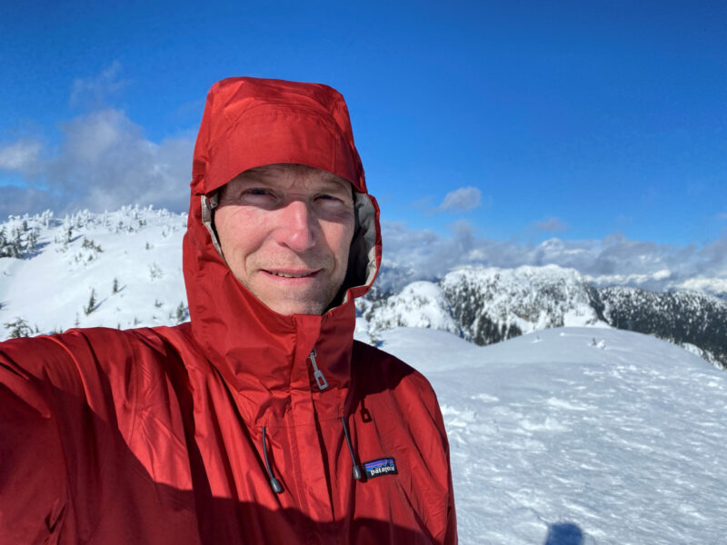
Anyway, conditions looked good this past Tuesday, and it was time to try out my five day old tires on a trip up to Mount Seymour. Of course, the roads were well plowed, and the tires didn’t touch a single flake of snow.
On the drive through the city, the weather was very pleasant, with a few puffy clouds around, but no precipitation. There were some fairly thick clouds over the mountains, though. Once I turned up the hill for the final 11 km winding road to the parking area, the rest of the drive was in the shadow of those clouds.
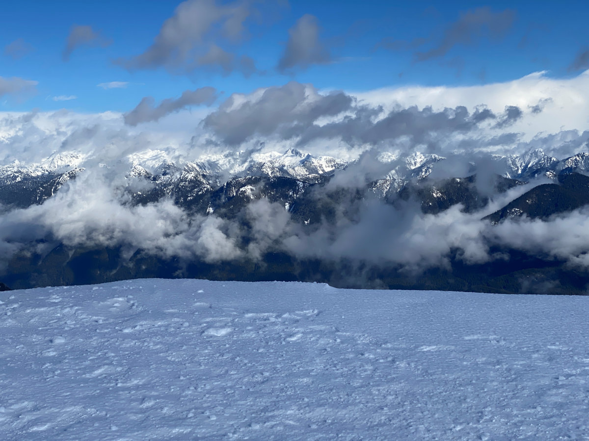
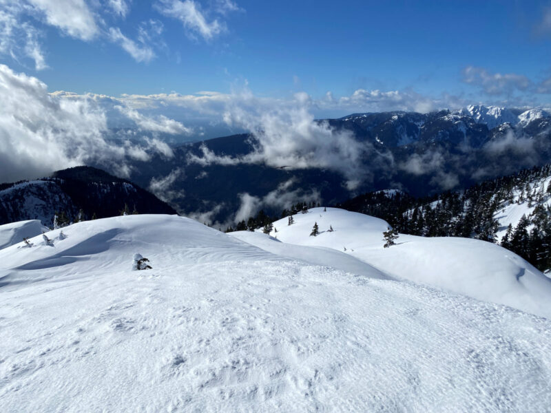
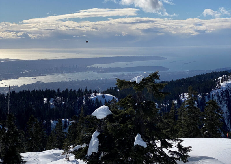
To cut a long story slightly shorter, the weather was cloudy and snowy for 2/3 of the way up to the first peak, then cleared up beautifully. The wind remained sharp and cold in exposed spots, especially on the summit. I could only stay for a couple of minutes, despite the brilliant sunlight.
It was a lovely trip out, I managed to open up the lungs a bit, and burned a few calories off. It was a good day out!
As BC started reopening its provincial parks in June 2020, it was nice to be able to get back out and visit some of them. However, others remained closed, since they were expected to be too busy due to their popularity. This included two of my favourite parks, Garibaldi Park and Stawamus Chief Park.
However, as of July 27, these parks are open to visitors – utilizing a new “day pass” system for day visitors, but also including overnight stays in established campgrounds.
So it was that my friend Jeff and I reserved a pair of tent pads in one of Garibaldi’s more remote campgrounds, Rampart Ponds. We booked two nights, Wednesday and Thursday, July 29 and 30. We knew that the hike in would be fairly arduous, but wanted to get deeply into the park, and away from other visitors at the much more popular Elfin Lakes Campground.
We arrived at the trailhead a little after 8:30, and had our permits checked by a ranger stationed in the parking lot. There were around 6 other vehicles parked there at the time. We were on the trail by 9:00.
Conditions were lovely, and the day was certainly warming up. As we headed up the old road toward Red Heather shelter, we stopped after 2.5 km and stashed a couple cans of light, frothy refreshments into a creek, for the trip back. We saw a couple of people on their way back from Elfin Lakes, and there were just a few people there when we arrived.
One of the very few tents set up at Elfin Lakes.
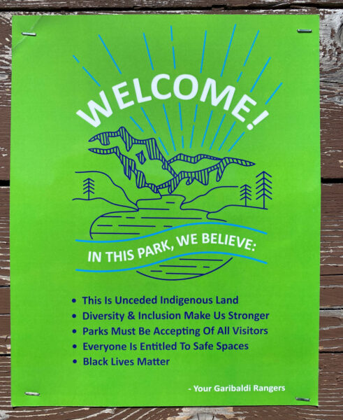
We were also pleased to see the following sign posted at the campground there:
Well done, Garibaldi rangers!
We stopped for a quick snack, then kept going.
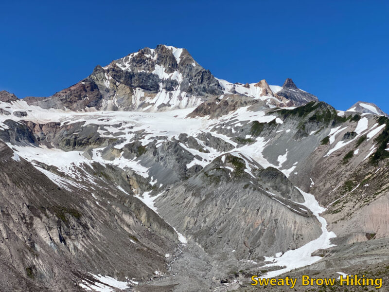
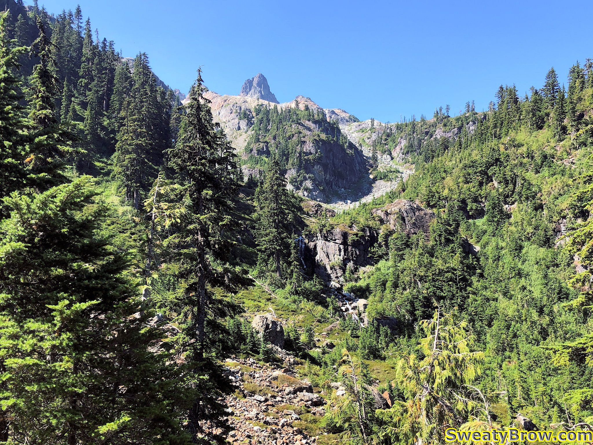
After Elfin Lakes, the trail does a long descent into Ring Creek, and climbs back out the other side, up to the base of Opal Cone (an ancient cinder cone beside Mount Garibaldi).
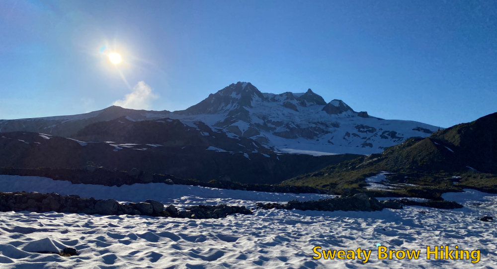
Looking up toward Garibaldi, while climbing out of Ring Creek.
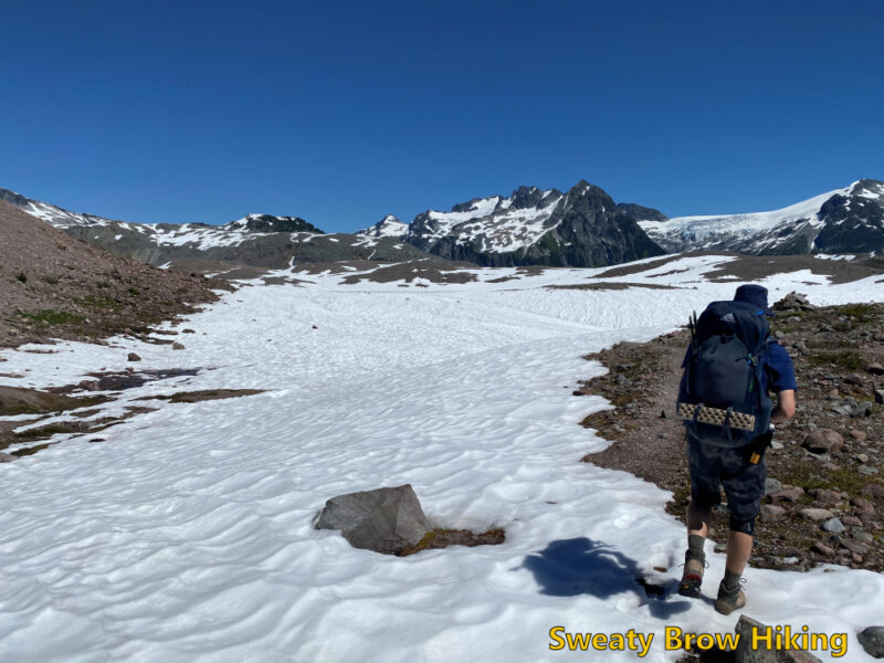
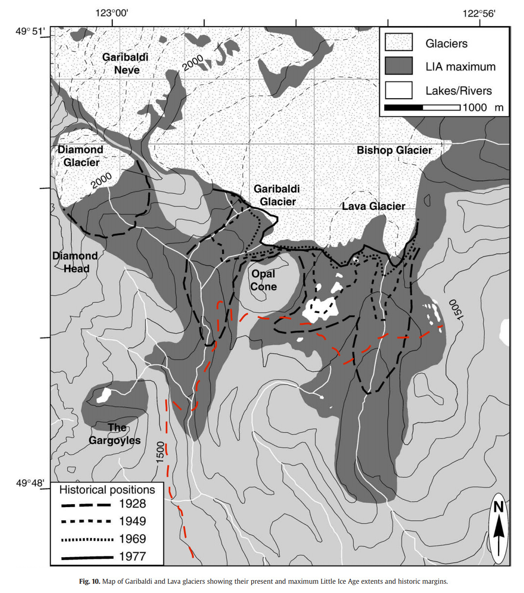
After rounding the base of Opal Cone, the trail drops into a shallow, wide valley that used to contain Lava Glacier. This glacier appears to be mostly gone, now, and there is a lake in the middle of a snowfield now.
I have superimposed the approximate location of the trail we hiked to Rampart Ponds, in red. The darkest area shows the extent of the glacier around 1700 AD, the maximum extent during the Little Ice Age, and then at various years through the 20th century.
At about 3:45, 6 hours and 45 minutes after setting out, we arrived at Rampart Ponds. There were two other people staying at the camping area that night. One had already arrived and set up his site prior to our arrival, and the other arrived just after us (she had stayed at Elfin Lakes the night before, and climbed Opal Cone on her way to Rampart Ponds.)
Jeff and I set up at two adjacent tent pads, which were partly covered in snow. After some dinner, some beer, and some conversation, we watched the sun disappear behind the shoulder of Mount Garibaldi.
As soon as the sun was down, it got cold fast! We hopped into our tents and bedded down for the night. I hadn’t taken my warmest down quilt – just my lightweight synthetic, and I ended up a little bit cold during the night. I have regrets…
In the morning, I was up as soon as the sun fully lit Garibaldi, across from us. The shadow of the ridge behind us soon crept along the valley floor, and things warmed up quickly!
The others at the campsite packed up and left, heading back toward Elfin Lakes and the exit. We had one more night to spend, and decided to spend the day doing some exploring. On the way in, we had talked about making an ascent of Opal Cone, but decided that we would save that for the final day, on our way back toward Elfin Lakes and the trailhead.
After a leisurely breakfast, we were on our way at about 10:00. We headed northwest, up onto the ridge that is visible at the centre of the photo above.
We followed the ridge north for a while, through some snowfields, talus slopes, and rock slabs, until we were looking over a creek draining the Bishop Glacier into Pitt Creek. From there we turned east and followed the ridge further.
The point at which we turned east.
After about an hour and a half, we turned around to head back to camp.
The view from our high point, looking back toward camp (down the valley, and toward the left.)
On the way down the ridge, we ran into a guy who was day hiking in the area. He had ridden a bike up to Elfin Lakes, and hiked from there. He had certainly come a long way, already, and had a long way to go back out! He told us about some of his explorations around the area, and was quite inspiring!
By 1:00 we were back at camp, where we gathered some things (like lunch and towels) and set off for Mamquam Lake. It was about 2 km away, with a drop of about 250 m on the way, and took half an hour to reach. By this time, the day had gotten very warm – like vicinity of 30 degrees warm. We reached the lake and were swimming in no time! We couldn’t stay in long, however – the air was warm, but the lake was cold! We ate a few snacks, and lingered a while.
Photo from the shore of Mamquam Lake. I would love to say that there wasn’t a cloud in the sky, but there was… That tiny puffball in the photo.
After a little over an hour, swimming, eating, relaxing, we started back up the hill. Progress was slow, but steady, and after about 55 minutes we were back at camp.
When we got back, the heat was oppressive. There was no shade in the campsite other than behind the outhouse, the food lockers, and a large sign board that didn’t really have anything posted on it. We were hungry, and didn’t have many options – so we sat behind the sign, in its small square of shade, and prepared dinner.
Cowering behind the sign, avoiding the glaring sun.“Enjoying” a freeze-dried meal in the only shady spot around.The sunshine bathing the entire campground. So hot…
Again, the sun disappeared behind the horizon around 8:10 PM (quite early, due to the high ridge of Mount Garibaldi) and it got cold fast. Fortunately, this night didn’t get as cold as the previous one, and I was a comfortable temperature all night.
In the early morning hours, a little bit of rain spattered our tents. At 7:12, I took a bit of video, mainly to capture the sound…
The sky was pretty mixed – there were some lovely patches of blue, but waves of showery clouds kept passing through. Fortunately, the rain never came down heavily – it was really quite gentle, and not particularly cold.
Some of the moody clouds on Friday morning.
We packed up our tents, and by 9:00 we started to retrace our route back out of the park. Upon reaching the base of Opal Cone, we started up a trail that curls around from the south slopes, toward the east side of the mountain. The trail follows the crest of a lateral moraine from the old Lava Glacier, and is just a lovely path to follow.
Approaching Opal Cone from the east, while hiking out. The trail follows the crest of the “ramp” rising from the left side, before turning steeply uphill.
Finally, the trail reaches the base of a gully that heads steeply upwards. We dropped our packs, and started up. It didn’t take long before we were approaching the top of this ancient volcanic cone, and we looked left and right, trying to determine the best way to get to the highest point – and where exactly that “highest point” was.
We turned left, for what seemed to be a likely target, and slogged our way up to a summit. After a moment, we realized that the actual high point was much further around the cone. We deliberated for a couple of minutes – say “close enough” and head back, or continue down, and up, and down, and up around to the summit? It didn’t take long, and we decided that we would make a complete circuit around the entire ancient, crumbly crater.
The first high point we reached atop Opal Cone.
That was certainly the right decision! Following the ridge all the way around Opal Cone took us maybe half an hour, and was just gorgeous. The views were spectacular, and the terrain was really interesting to hike around.
After our full circuit, we slid and scrambled back down the steep gully to our packs, then followed the sharp ridge of that lateral moraine back to the main trail. From there, it was the long, long descent into Ring Creek, and back up the other side. On occasion, we were still getting short showers passing through, but they were quite refreshing. We were just happy not to have the heat of the previous day, as we laboured uphill with full packs.
Crossing the bridge over Ring Creek.Jeff keeping his spirits up, approaching Elfin Lakes.
We reached Elfin Lakes at 1:00 and enjoyed a bit of lunch, and refilled our empty water bottles/bladders for the balance of the trip. After half an hour, we were on our way again.
A little cloudy and gloomy, hiking away from Elfin Lakes.
In another hour and a half, we reached our stashed beverages, and enjoyed them as we hiked the last forty minutes to the parking lot. The many people we saw hiking the other way, steeply uphill, looked as if they wished they’d thought that far ahead as well.
We reached the (crowded!) parking lot at 3:45, and changed into fresh t-shirts and sandals. Finally, we headed back to Squamish, where we stopped for a hearty meal at The Copper Coil.
Looking back on the trip, we were amazed at how quiet the park still was. The park had opened again on Monday, and we were there on Wednesday and Thursday nights. And yet, once we were past Elfin Lakes, we only saw a grand total of four other human beings. Stunning wilderness, only a couple of hours from the bustling metropolis, in almost perfect weather, and we just about had it to ourselves… An opportunity to be savoured, and long remembered!
The weather had been good for a few days, but I hadn’t had an opportunity to go hiking (aside from a couple of short hikes near Whistler – more on that here).
Saturday the 29th looked like the weather would start out fine, and end up showering by around dinner time – probably earlier in the mountains. So I decided to tackle a couple of peaks on the North Shore that I had never hiked before. They are relatively easy hikes, without any sort of technical difficulties, and very easy routefinding. That way, if the rains came early, I wouldn’t be stuck in a challenging situation.
The only issue with hiking these two peaks (Mount Strachan and Black Mountain) is that they are on the opposite sides of the parking area at Cypress Bowl – which means basically two out-and-back hikes, with no opportunity to traverse from one to the other. So: Gain all the elevation, lose all the elevation, and then gain all the elevation again!
I got a bit of a late start, not arriving at the parking lot until about 11:30. The place was packed! So many vehicles, so many people. Everyone wanted to take what might be one of the last not (yet) rainy weekends of the hiking season.
I started out heading east from the parking lot on the Baden-Powell Trail, and hiked right past the turnoff to head up the Mount Strachan Trail – it was well hidden by some logs and snags. I checked my GPS, and backtracked about 200m to find it; from there it was easy to follow.
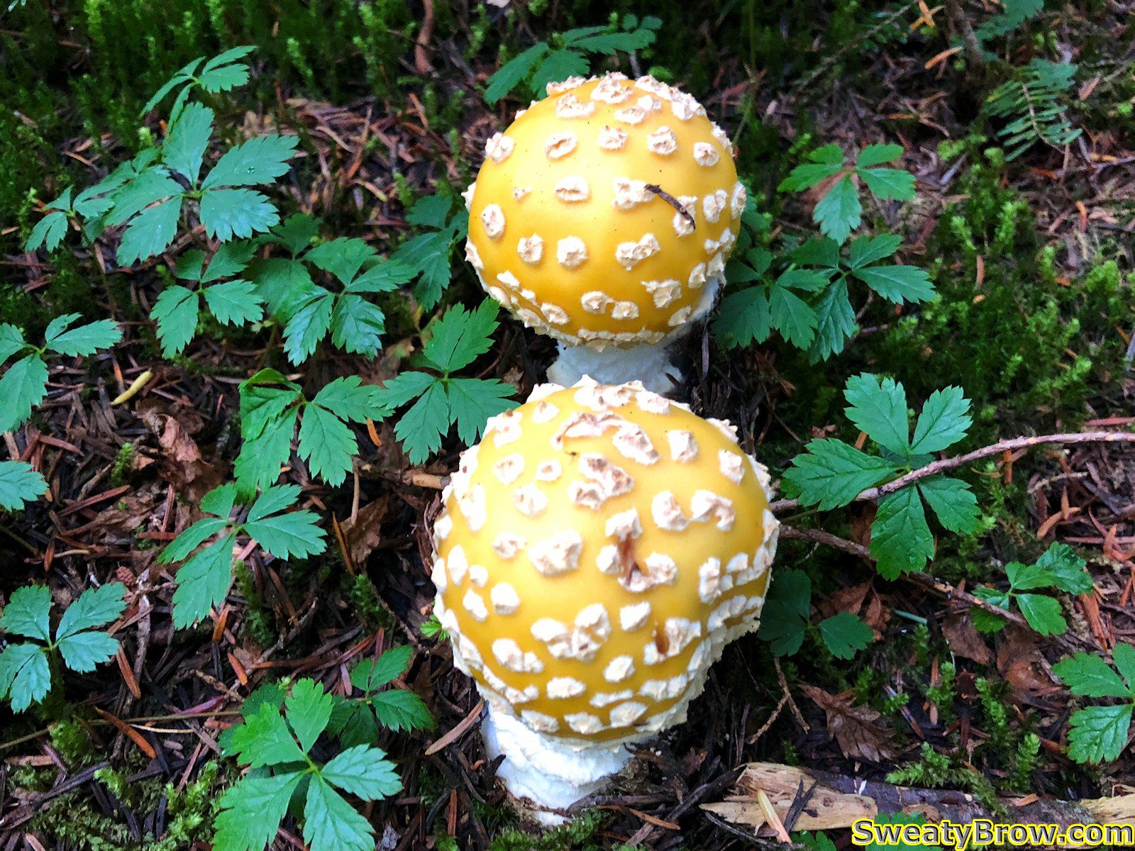
There were a few big, beautiful old growth trees along the way, as I climbed through the forest. Lots of delicious blueberries were on offer as well – I had a few, just to sample them. A few mushrooms were gaudily on display, too.
Some funky looking, but poisonous, mushrooms growing on the way up Mount Strachan. I’m pretty sure these are Fly Agaric (amanita muscaria) mushrooms, though they are usually redder in colour…
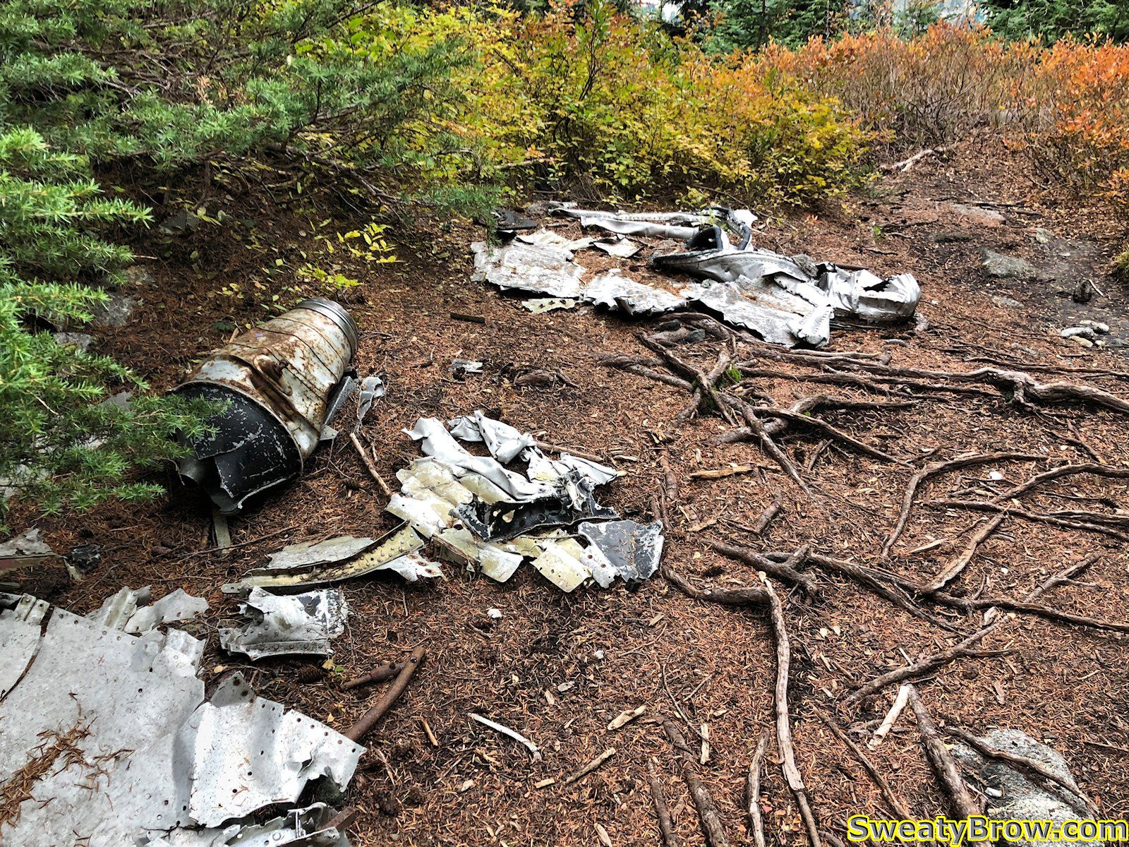
After about an hour on the trail, I reached the site of a 1963 plane crash. Debris from the aircraft, a small two-seater jet training aircraft, is scattered across the trail. Two members of the Royal Canadian Navy died in the crash, which wasn’t found until three days after the accident.
Some of the debris that remains from the Royal Canadian Navy T-33 that crashed on Mount Strachan, 23 November 1963.
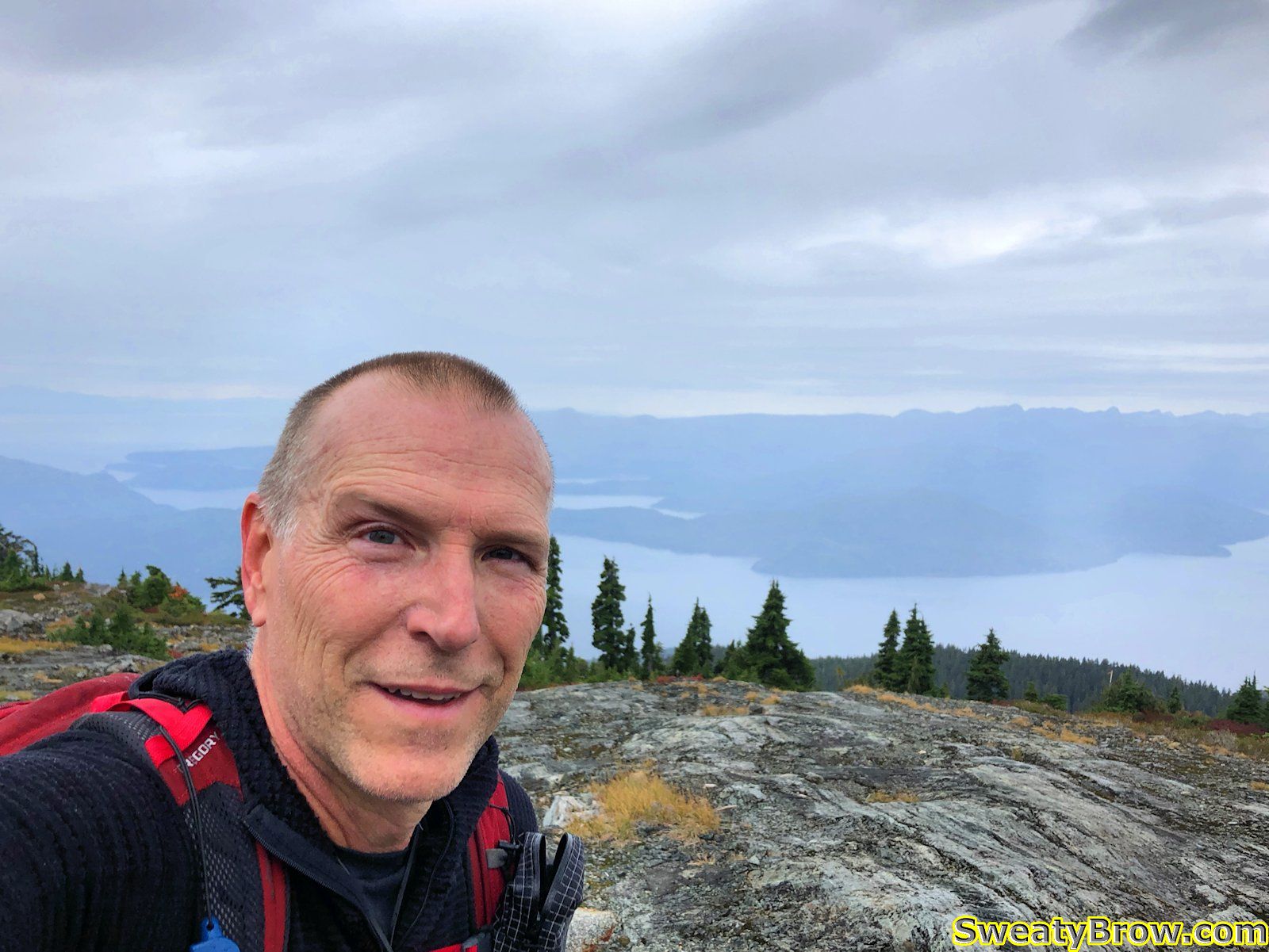
After this point, I began to feel occasional raindrops – the rain was arriving a little bit early! Fortunately, it didn’t come down heavily at all, and was quite intermittent. I reached the south summit after about an hour and a quarter. This is the peak that the Sky Chair ski lift reaches. It was a little windy, with occasional raindrops continuing to fall, but the view was pretty nice toward the southwest, looking over Howe Sound.
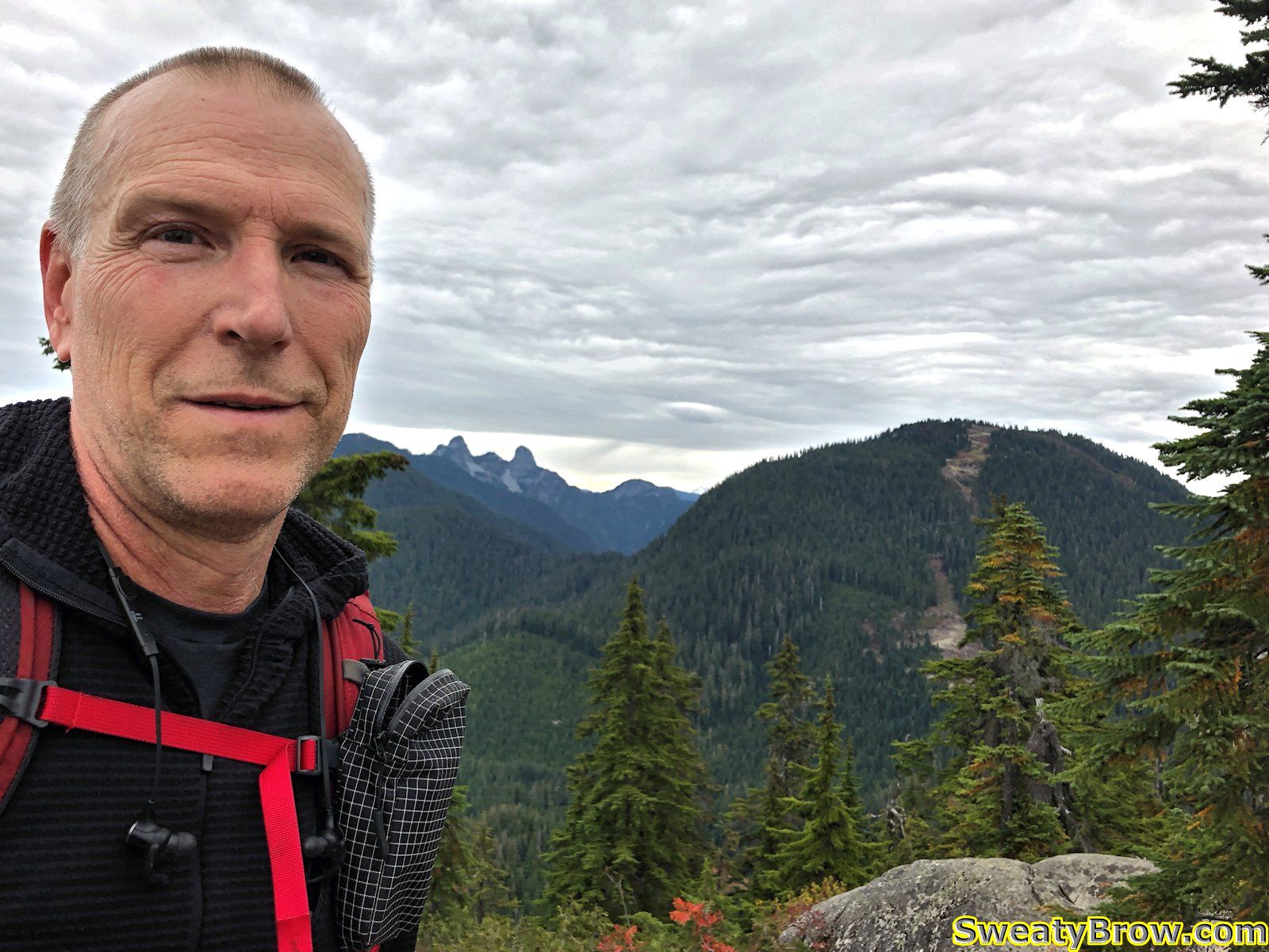
Selfie from the south summit of Mount Strachan, looking down over Howe Sound.
From here, there was a drop of about 30 meters or so, down into a saddle, then up the other side about 35 meters to reach the north, true summit of the mountain. In the saddle there were quite a few people taking a break, and enjoying the whiskey jacks that were flying around, cadging food.
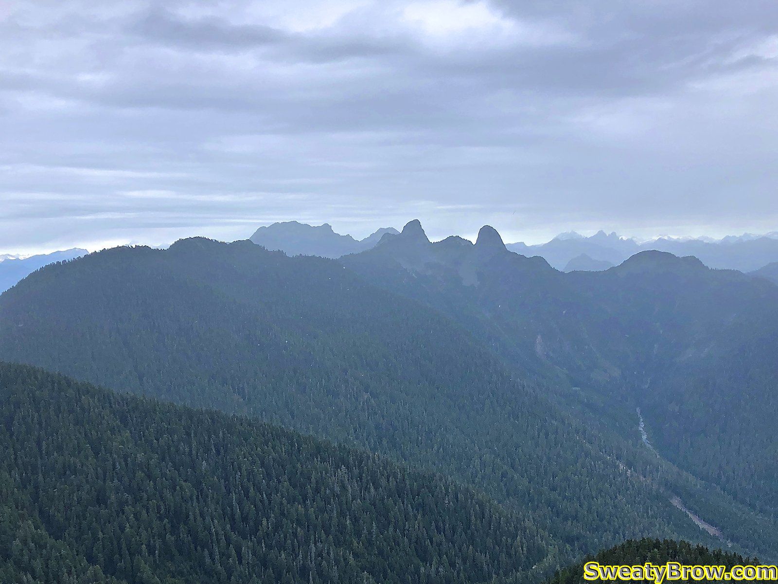
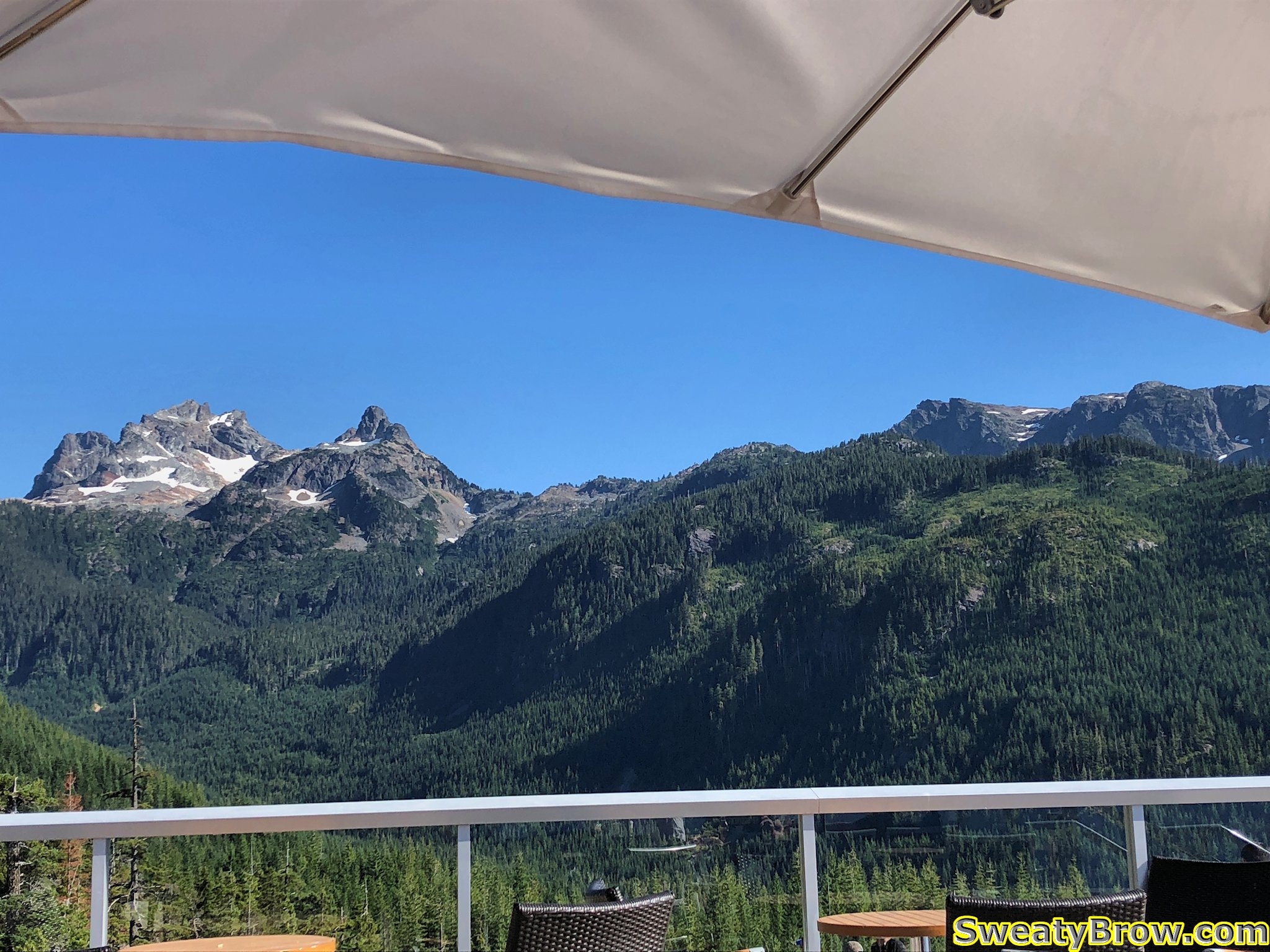
Quickly up the other side of the saddle, up some fun little slightly scrambly steps, and I was on the north summit. Considering the weather conditions, the view north was pretty good – it would be quite lovely in better weather! There were showers visible further to the east, but pretty clear looking toward Brunswick, The Twins (Lions) and the Sky Pilot group (Co-pilot, Sky Pilot, and Ledge).
The view north from Mount Strachan. Unnecessary Mountain, Brunswick beyond, a glimpse of Hanover, the Lions, and the Sky Pilot group way off in the distance.
A couple of minutes to look around, and I set off back down the trail. I still had another mountain to climb, and wanted to do it before the rain struck in earnest! I followed the trail until the vicinity of the T-33 crash site, then moved onto the service road, following it down to make better time. At this point the drizzle was fairly steady, but still light. It faded away before I reached the parking lot.
I was back at the parking lot at 2:05 PM, a little under two-and-a-half hours after setting out, and began to make my way up the Baden-Powell trail in the other direction – toward Black Mountain.
This trail is much more clear, maintained, and well-defined. There were a lot of people going up and down there!
I reached Cabin Lake in about half an hour. Lovely little lake, that!
Cabin Lake, between the North and South summits of Black Mountain.
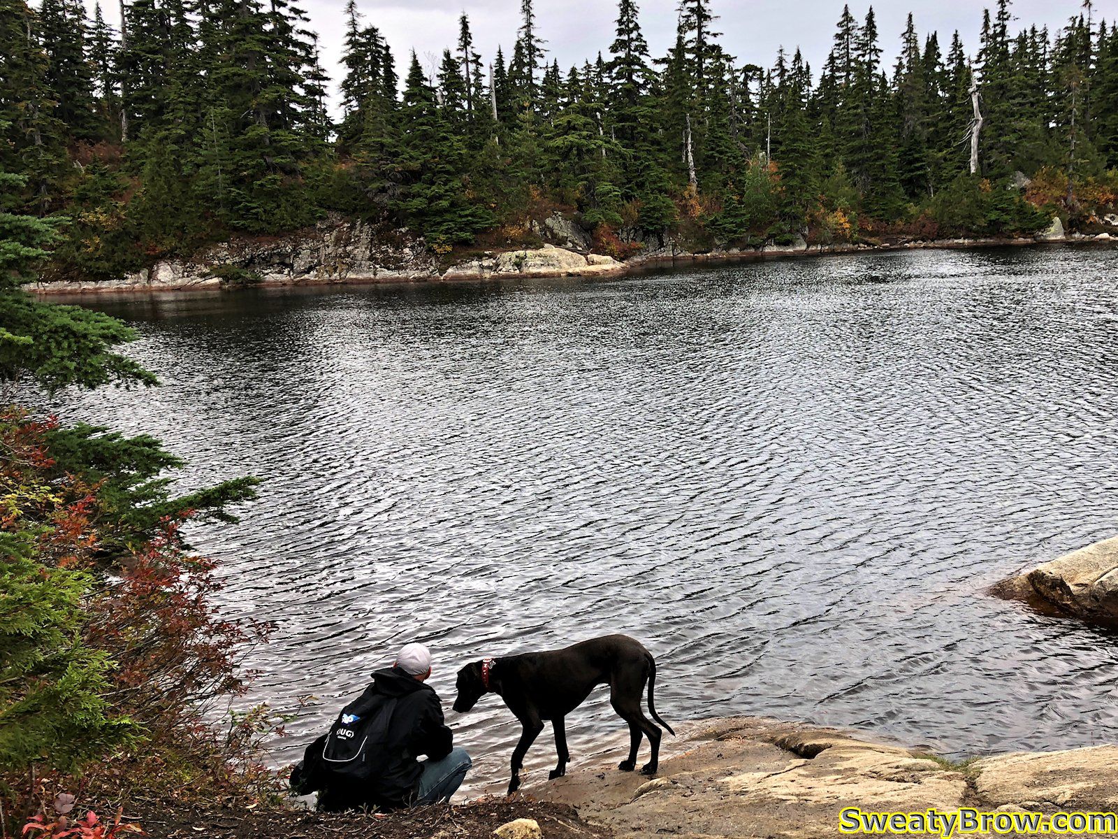
A man and his dog, on the shore of Cabin Lake, Black Mountain.
I turned left and hiked to the south summit of Black Mountain in a few minutes. There were nice views over the city and Howe Sound, but I don’t think I took photos that way…
Dramatic sky north of Black Mountain.
I then returned to Cabin Lake, and set off toward the north summit, via a far less traveled trail, despite the fact that the north summit is actually the higher of the two. The views from the top, however, are not as dramatic as from the south summit.
North summit of Black Mountain, looking toward Mount Strachan (only the lower south summit is visible from here) and The Lions (The Twins) beyond.
After a couple of minutes, I returned the way I came, and was soon back at the car. The rain held off the entire time I went up and down Black Mountain – perfect!
Total of about 12 km hiked, and up/down a total of around 800 meters or so. All in a little less than four hours – and I was home in time for dinner!
It was Thursday morning, and I had been camping in Squamish at the Chief’s Climber’s Campground since Monday. The last couple of days, I had gotten up fairly early, driven up to Whistler, and headed up the lifts to scramble up some peaks in the area. I decided it was time to do something closer (later start in the morning) via the Sea to Sky Gondola.
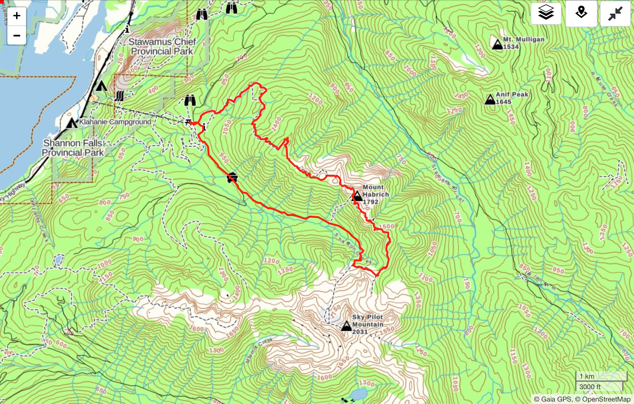
I decided that I would begin with what Marc Bourdon calls the “Sky Pilot to Mount Habrich Loop” in his book, “Squamish Hiking” but remain on the top of Habrich Ridge, all the way out to the end, then follow marked trails (Robin’s Connector, and Al’s Habrich Ridge Trail) back to the Gondola. In Marc’s book, the ridge is shown as having an “intermittent, poorly marked” trail west of Mount Habrich. I had also read online that people were occasionally having trouble over the past couple of years with linking up the full ridge.
I figured that the trip would be fairly difficult, and a long day out, but wanted to give it a try!
I was on the gondola fairly early, and began hiking up Sky Pilot Valley shortly before 10:00 AM. Shortly after 11, I broke out into an open talus slope at the top of the valley, and turned off of the Sky Pilot Mountain route.
The route up Sky Pilot continues straight ahead. I turned left about 5 minutes further on.
Here is the spot where I turned off of the Sky Pilot route, looking northwest toward Habrich Ridge. Mount Habrich itself is just visible on the right.
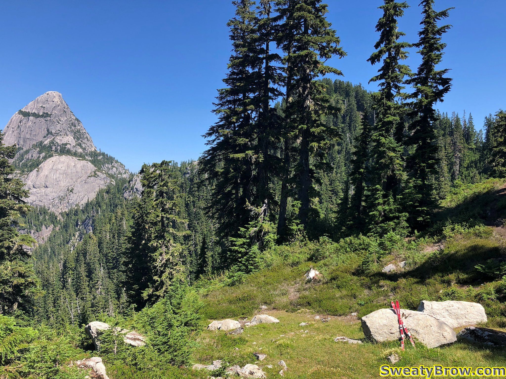
The route then took me through some forest and across some meadows, toward the col between Sky Pilot and Habrich.
A pair of broken skis mark the low point on the Sky Pilot – Habrich col.
Looking back toward Ledge Mountain, Sky Pilot, and the Co-Pilot (L-R).
The low point was about 1440 meters, and then quickly climbed again to about 1600 meters. This was very close to the highest point of the day – there was one minor summit just west of Habrich that was slightly higher, at about 1650 meters. The rest of the day was to be relatively short, but frequent and steep, up- and downhill ridge-walking. Atop the 1600 meter bump, I stopped for about 20 minutes to have some water, and take some photos. The views were getting good!
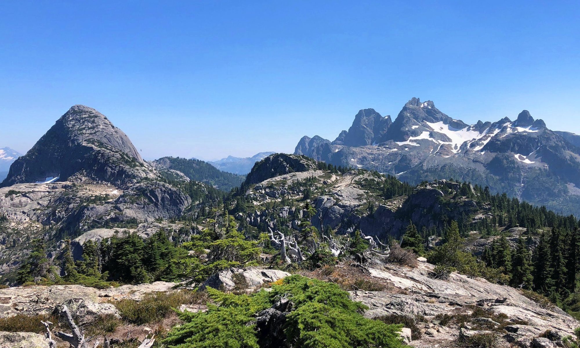
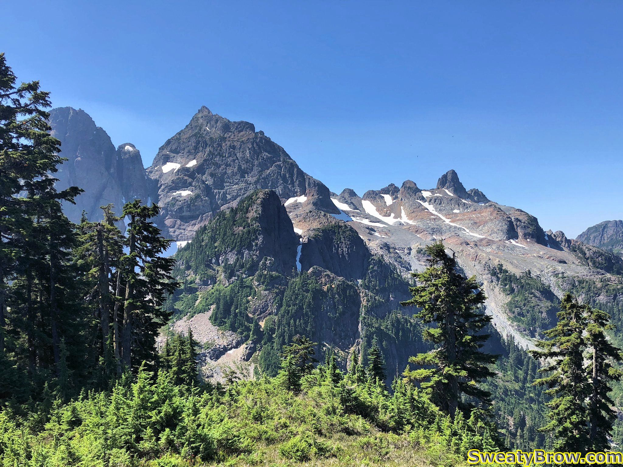
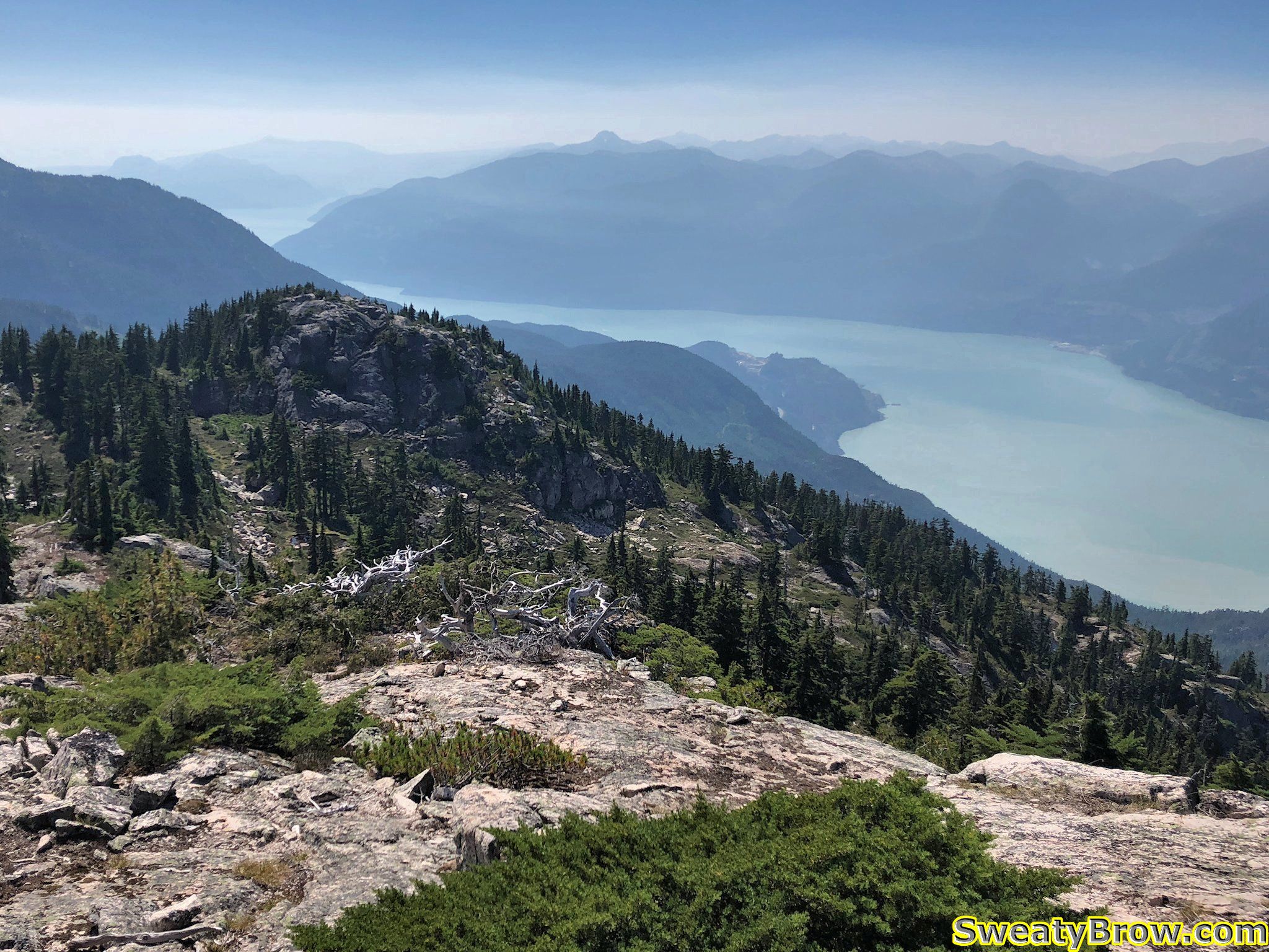
View of Mount Habrich and its ridge from the high point to the east.
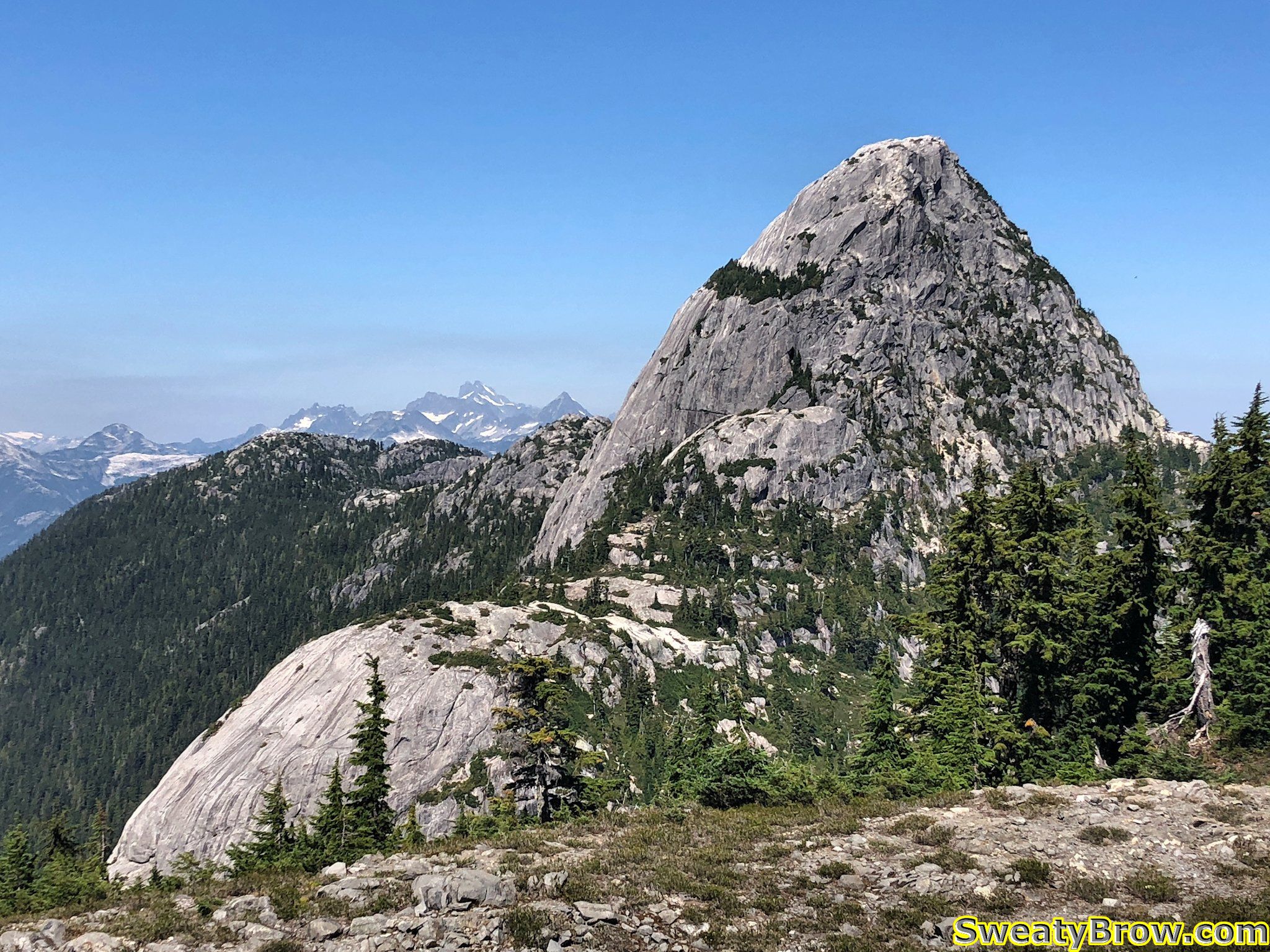
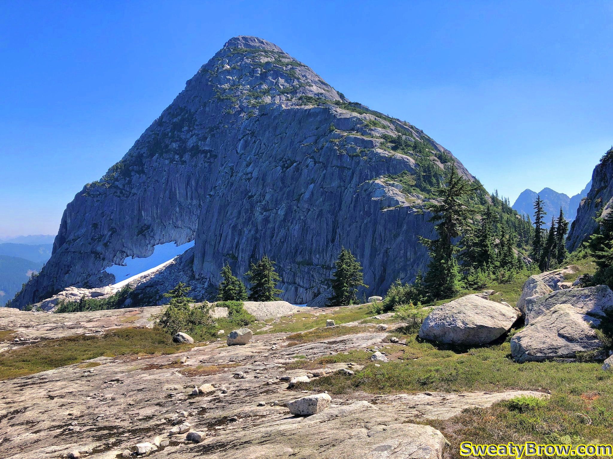
There is a feature on the southeast side of Mount Habrich that was about to become rather important to the progress of my day… The large rounded cliff just below and to the left of the peak is known as “The Brain”.
This big rounded cliff is known as The Brain.
I read through the description of the route in the Squamish Hiking guidebook earlier in the day, and I was aware that I would need to use a fixed rope to ascend the right side of The Brain. The book said that if I had any doubts about my ability to complete the loop (returning to the valley below via a gully on the far side of Mount Habrich), then this high point would be a good point to return the way I came. I was operating under the premise that I would be comfortable completing the loop, so I continued.
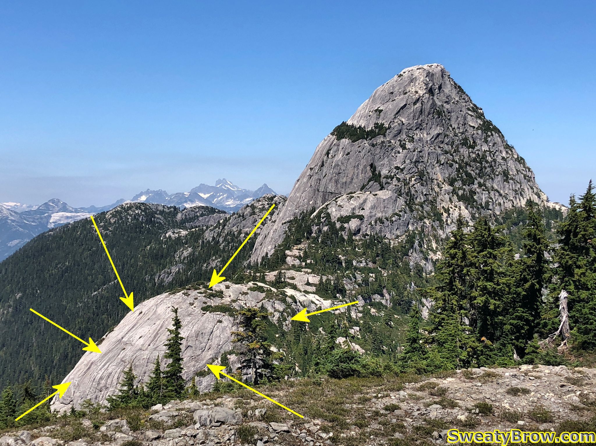
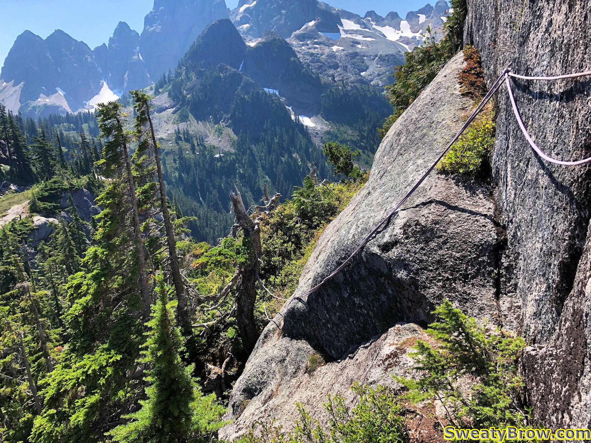
Down a few steep gullies, a couple of semi-exposed steps, etc. and I was soon at another low point on the ridge. The Brain stood before me, mostly to my left, with the right edge of it directly in front of me. A clear path headed straight ahead, leading to a steep cliff with a rock corner and a knotted rope hanging down from a tree about 8 meters up. I could see another rope following a steep ramp above and to the right of it.
My route up the right side of The Brain
Naturally, I saw the ropes, and didn’t need to pull out the guidebook and check the description. It was right in front of me!
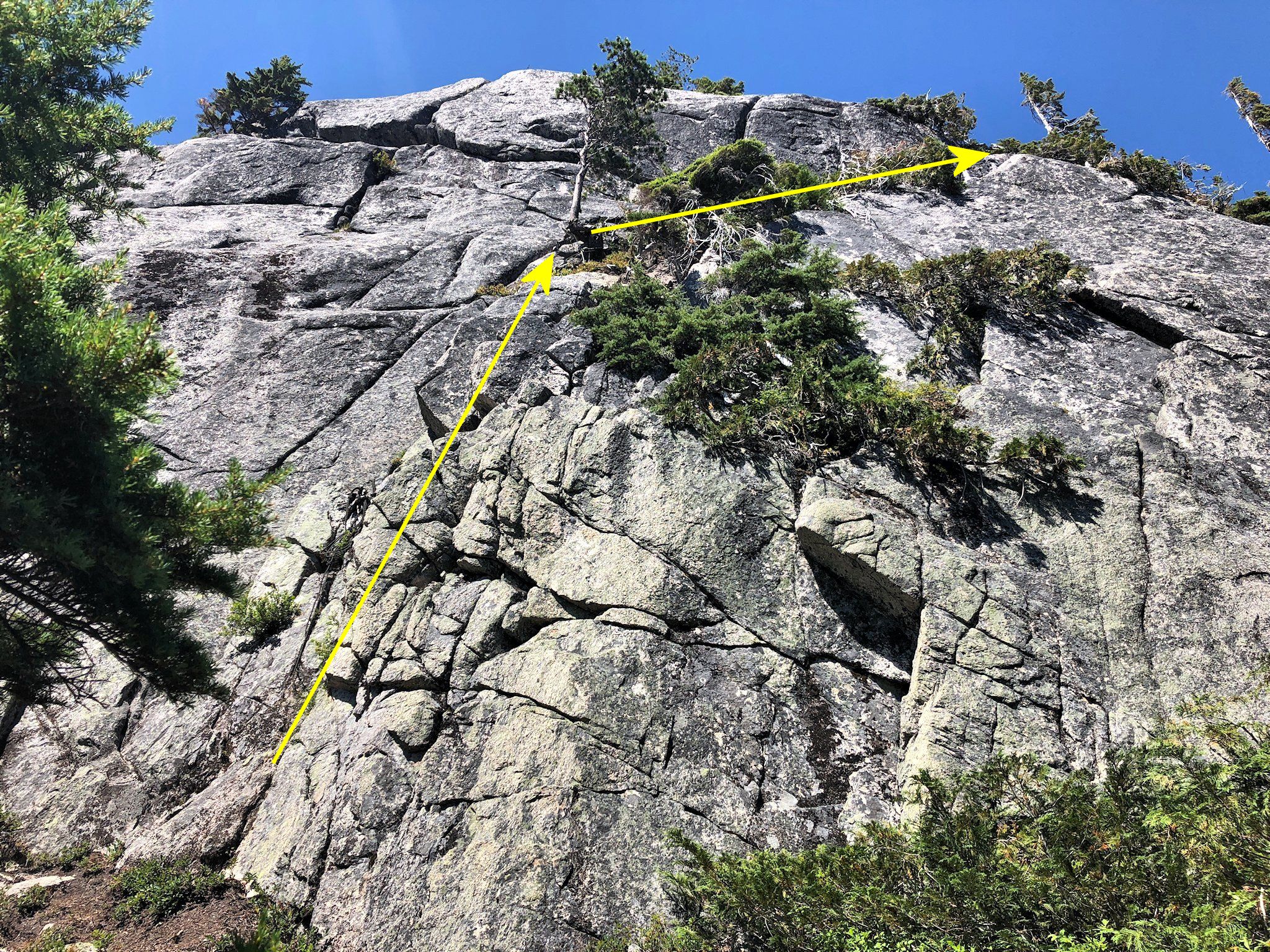
Before I knew it, I was batmanning up a super steep (almost vertical) corner, with very sparse footholds, and was about 6-7 meters off the deck. I scrambled my way onto a tiny stance beside a small tree, and gathered my wits. When my heart rate had eased off a bit, I continued up the steep ramp, again protected by a steep rope.
I continued up some steep, much less exposed, ground for a couple of minutes, then reached a bulge extending out from the wall. There was a barely discernible “ledge” traversing to the far side, protected by a couple of ropes (one of which was rather frayed at its attach point on the nearer side), and with a serious drop, probably 25 meters, into a gully below.
Unfortunately, I didn’t take a photo or video prior to traversing it. I gathered my wits, steeled my resolve, hiked up my big boy shorts, and started across…
I survived. I knew that I would, but wow… Being solo, and having forgotten to bring along my InReach satellite communicator, I had no way of telling anyone where I was, or where to look if I were never heard from again. Oops. This was pretty much the most committing move I’d ever made while entirely on my own.
A photo of the spooky traverse I made while solo, after I’d crossed it.
After this traverse, there was a little more travel up steep, rope-protected ramps, then things eased right off. It was about 1:00 PM, so just over three hours into the day. As I walked along a little farther, I spotted a gully coming up from the right, with a rope hanging down it. Of course, I had to then pull out the guidebook and have a look. Turns out, I was not supposed to head straight up the wall – the “hiking” route dropped way down to the right, at that point, and then up a long, steep, grassy gully. In fact, later that evening, I stopped by the guidebook’s webpage, and looked at the latest updates:
When following the route described in the guidebook, I’ve been told that some hikers are missing the handline descent into the gully just prior to reaching the “Brain”. Instead, they are following a well-defined trail which leads directly to the base of the Brain and a very steep rock wall with a rope fixed in place. Ascending this fixed rope leads to very dangerous and exposed fifth-class rock climbing terrain, which gains the top of the Brain. This is not the route described in the book. Look for the descent into the wide gully right (east) of the base of the Brain to stay on route.
Aha! OK, I did that wrong… The rest of this thing should be much easier!
After overcoming The Brain, it was time to traverse below the south face of Mount Habrich. There was a gully to drop down, again with a fixed rope, and a little bit of exposure, then a trail along the bottom of the face. It popped back into the forest, and almost immediately started downhill. There was a fainter, but well flagged, trail that broke off to the right, though, and headed very steeply uphill. I followed this.
Did I mention steep? Very steeply, up through the trees. The trail popped out into the bottom of a notch between Mount Habrich and the next summit along the ridge. This summit was the highest point reached for the day, at about 1650 meters. The terrain through here was fun, pleasant scrambling, in a glorious location – the views to the north and south were just gorgeous.
Looking back at Mount Habrich from the west. Hard to make out, but there is a summit between me and the peak, directly over the top of which I hiked. The sunlit snow patch on the left is extending out of the gully between the peak and that summit.
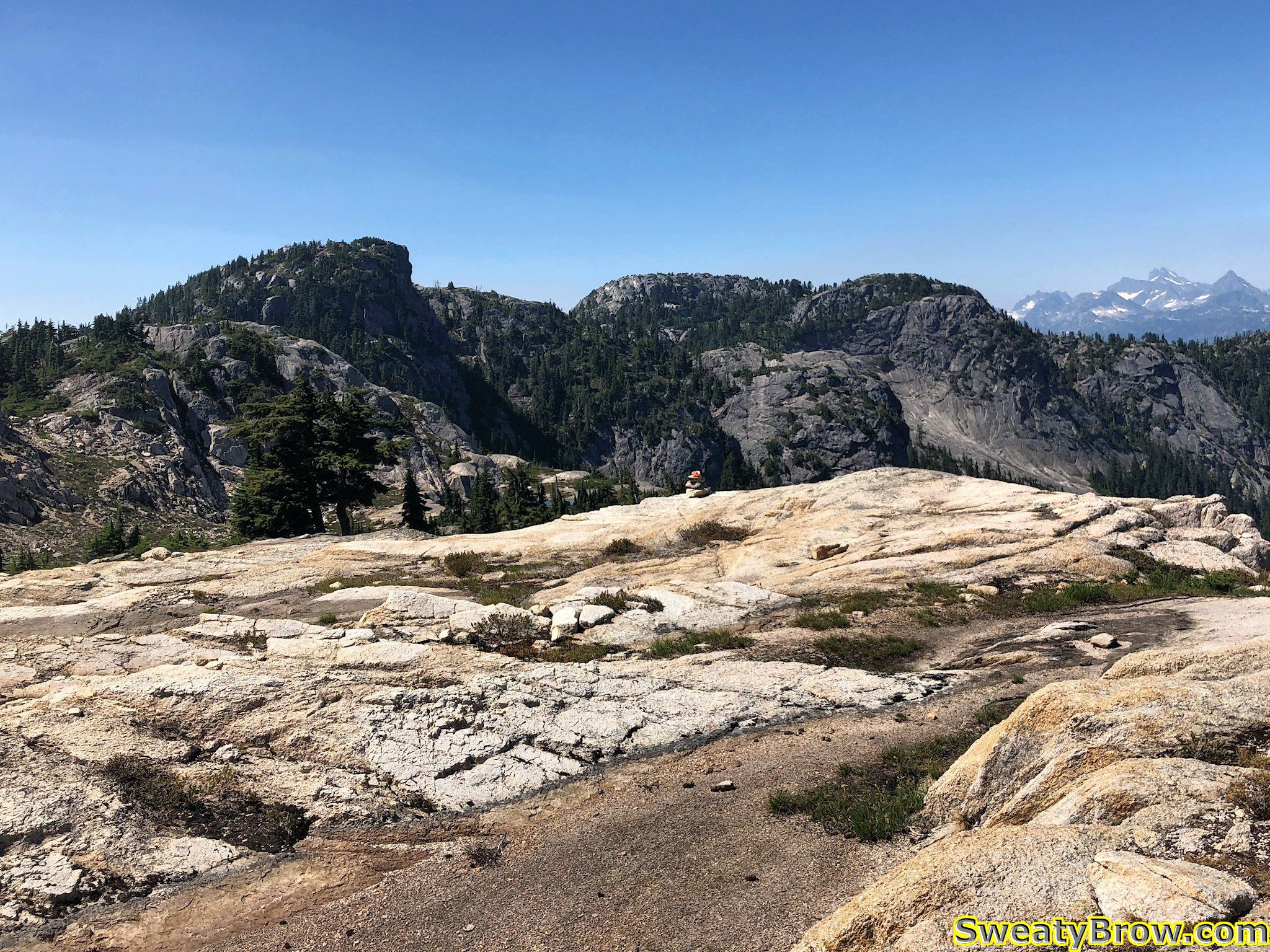
After going up and over that first summit on the ridge, I came around the north side of the next summit, along a huge, flat slab system. I then dropped through a little basin area, where I ran into a group of four people coming the other way!
Coming around the nice flat esplanade, and looking beyond to the far end of the ridge.
They were laden with a bunch of climbing equipment, and were off to ascend “Life on Earth” – a 5 pitch, 5.10c-ish rock route up the southwest arete of Mount Habrich. I stopped to have a little snack and some water with them, and chatted briefly. One of the fellows was celebrating his birthday (which was the following day) with this climb. They joked about how they’d picked the hottest day of the year to do it, and that they hoped they’d be able to finish the climb and return to the gondola in time for the last ride down at 9:00 PM. It did seem a little dubious… Hope they made it!
I continued along for a while, up and down along the ridge. There were a couple of descents that had ropes fixed in place, but they were mostly in places where there were steep, dirty hills, which would be slippery in wetter conditions. There was one spot where I had to make a bit of an exposed step around an arete that had no real protection, and I was surprised because there had been some ropes in spots where they seemed unnecessary. Nevertheless, everything was pretty easy after the ascent I made up the side of The Brain!
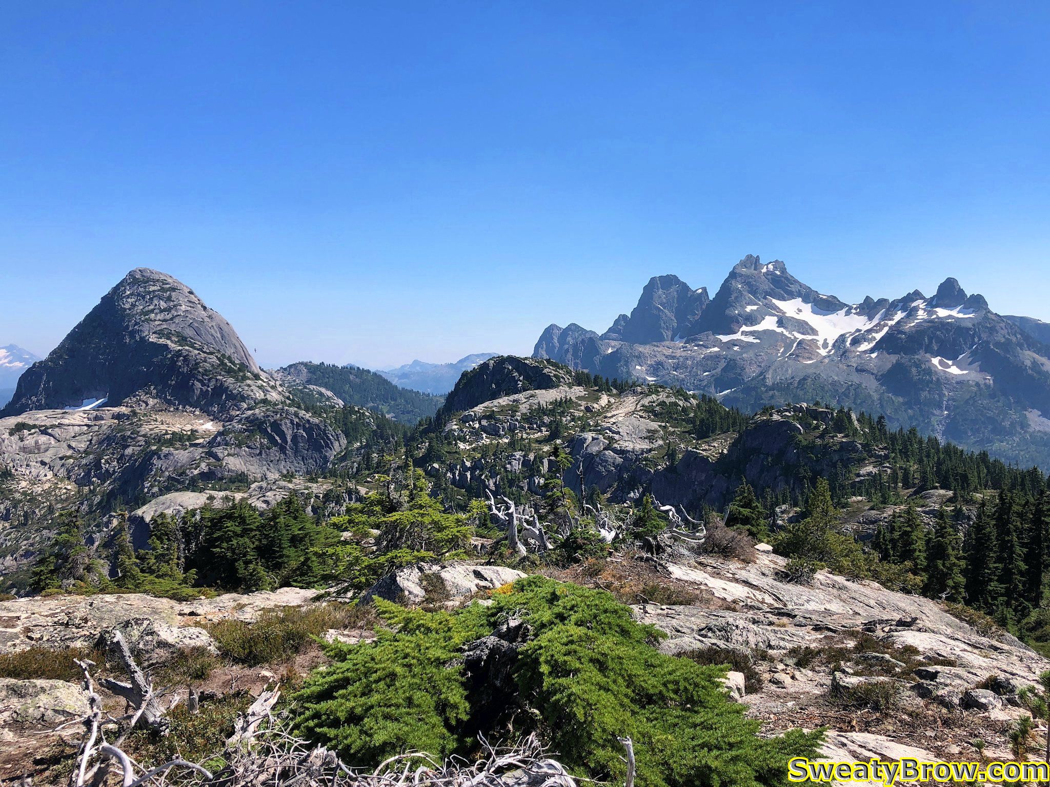
Finally, shortly before 4:00 I reached the far western end of the ridge, where my GPS and the guidebook showed “Robin’s Connector Trail” reaching the same promontory from the other side – from the gondola.
The far west end of Habrich Ridge, looking back toward Mount Habrich and Sky Pilot.
I stopped here for a while, taking some photos – and chatting/gloating online with a work colleague about what a great spot I was in!
West end of Habrich Ridge, looking down toward Howe Sound.
I started hunting around for the trail, and had some difficulty finding it. Eventually, I found a bit of a footbed, and began following it downhill, but kept losing and finding it again along some rocky, talus filled slopes. I ended up being unable to find the actual “Robin’s Connector Trail”, but was able to follow another trail that is marked in the guidebook. It is a steeper, and apparently less well marked, trail that leads down to Neverland Lake, where it joins “Al’s Habrich Trail”.
Looking down at the three peaks of The Chief from the trail down Habrich Ridge.
I followed this down, down, down, and eventually managed to reach the Gondola shortly after 5:40.
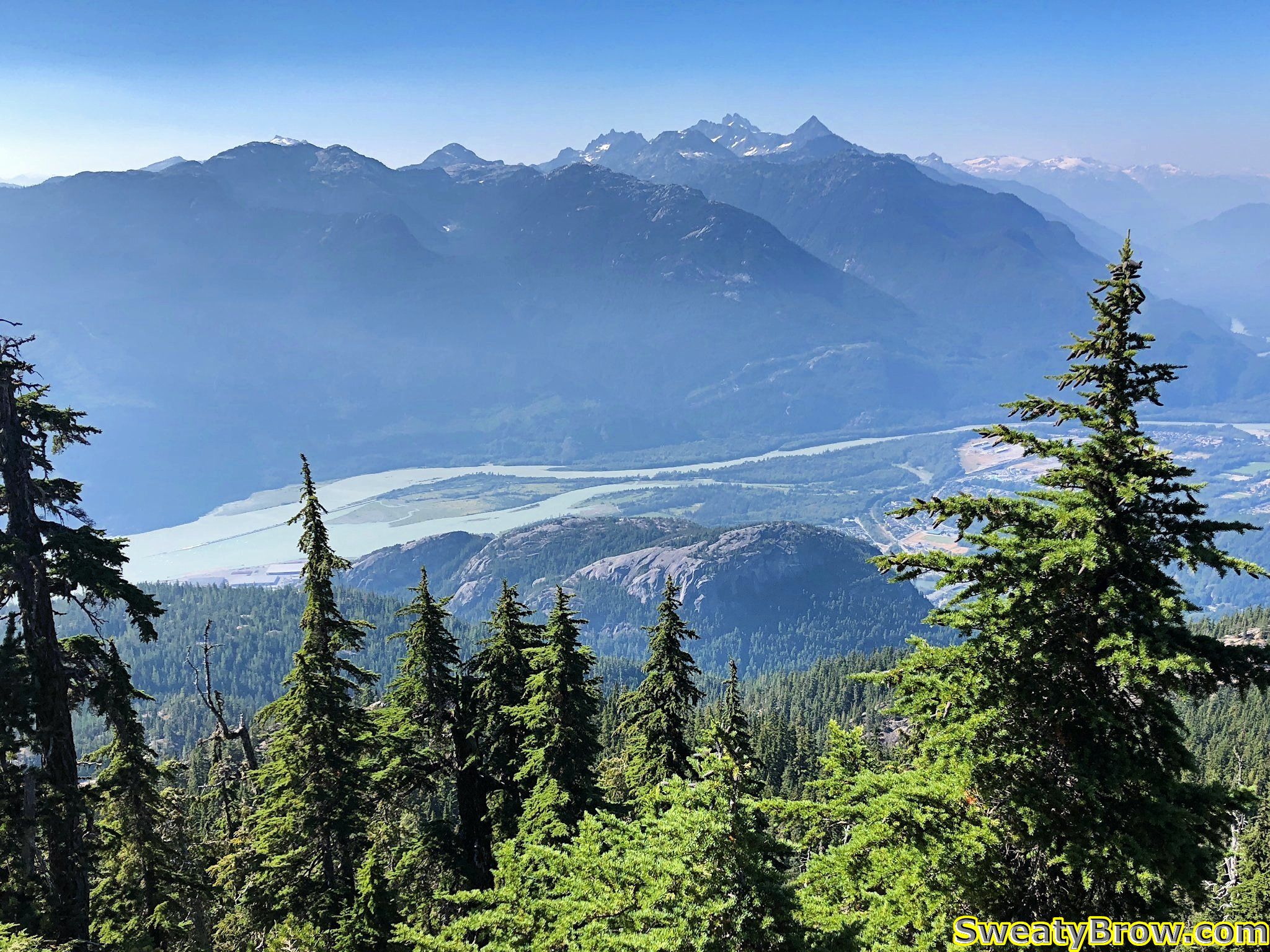
I feasted upon a plate of Victory Fries, and a massive Caesar Salad, washed down with a can of Guinness Stout. Truly, a meal of champions.
Enjoying a fine meal on the deck at the Sea to Summit Gondola. Looking up the valley toward Sky Pilot Mountain.
As I mentioned at the start, I was camping at the Squamish Chief Climbers Campground, a short 5-10 minute walk from the bottom of the Gondola. This meant that my tent was merely stumbling distance from my ride down the hill. Naturally, more beer was consumed, as I continued to celebrate a wonderful day in the mountains!
A GPS track of my route up and along Habrich Ridge.
Total time: 7:50 (6:10 “moving” – says Gaia GPS)
Distance: 16.9 km
Elevation: 1450 m gain/loss