Castle Towers – Backpacking and Scrambling in Garibaldi Park – July 11-12, 2019

Castle Towers is a mountain that Jeff and I had been wanting to climb for a while. It involves a long trek into the Garibaldi Park backcountry, an overnight stay, and a lot of up and down over many kilometers!

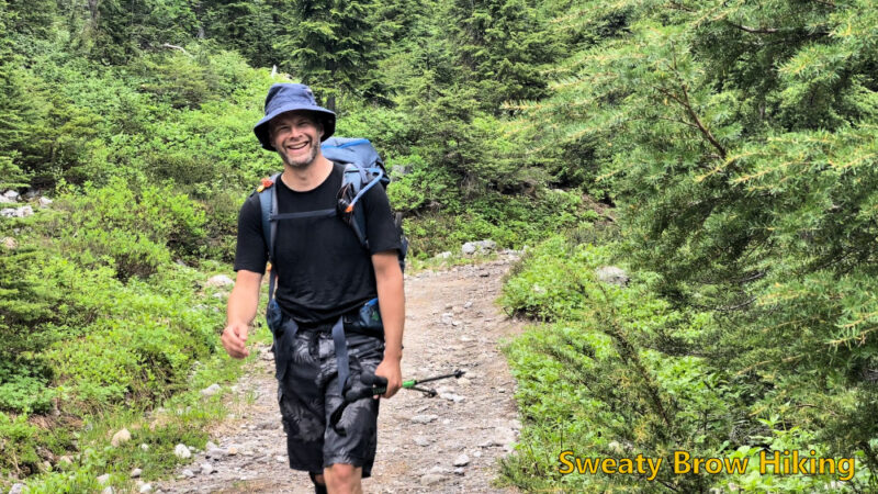
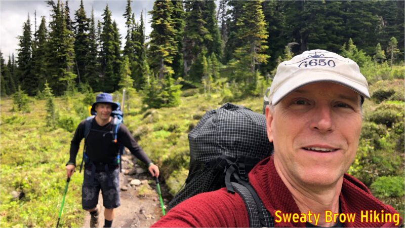
We met at Jeff’s place in North Vancouver at just after 5:30 AM, and were soon on our way. After a quick stop at the Zephyr Cafe in Squamish, we arrived at the parking lot for Cheakamus Lake a little before 8:00, and did a final gear sort. We were on the trail by 8:15.

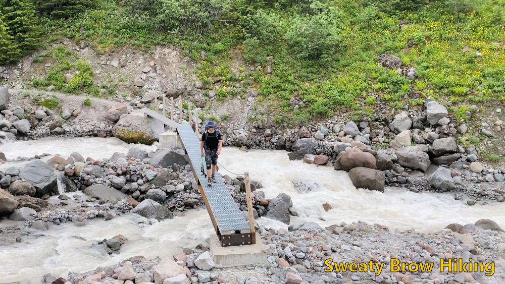
After stashing a brace of beers in the creek for the return, we crossed the Cheakamus River and started steeply up toward Helm Creek Campground.

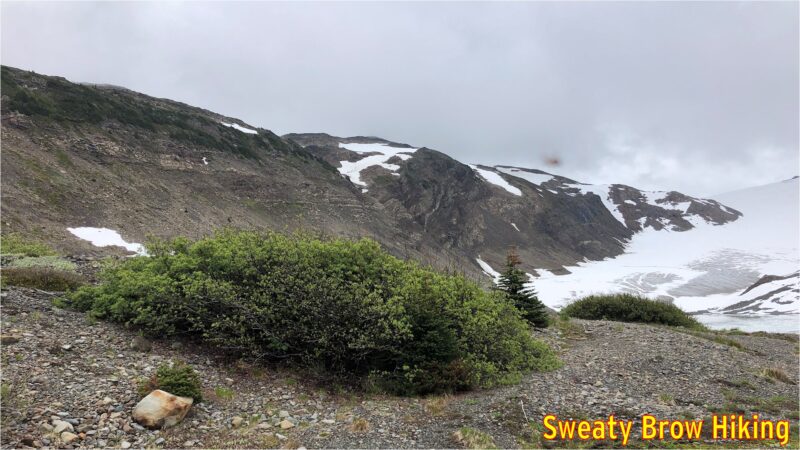
As we climbed steadily up into the heart of the park, despite some blue patches in the sky, the weather slowly became worse. We reached the campground after about 3 hours of hiking, and stopped for a bite to eat.

Reaching the open area of meadows near Helm Creek Campground. The Black Tusk is playing peek-a-boo directly ahead.
Two happy hikers approaching Helm Creek Campground.

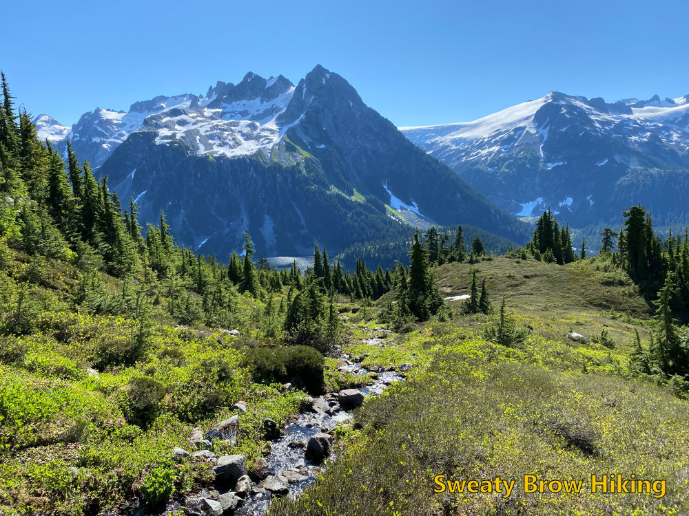
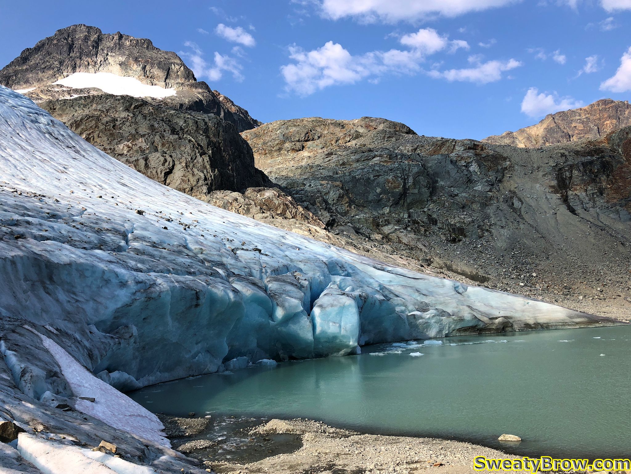
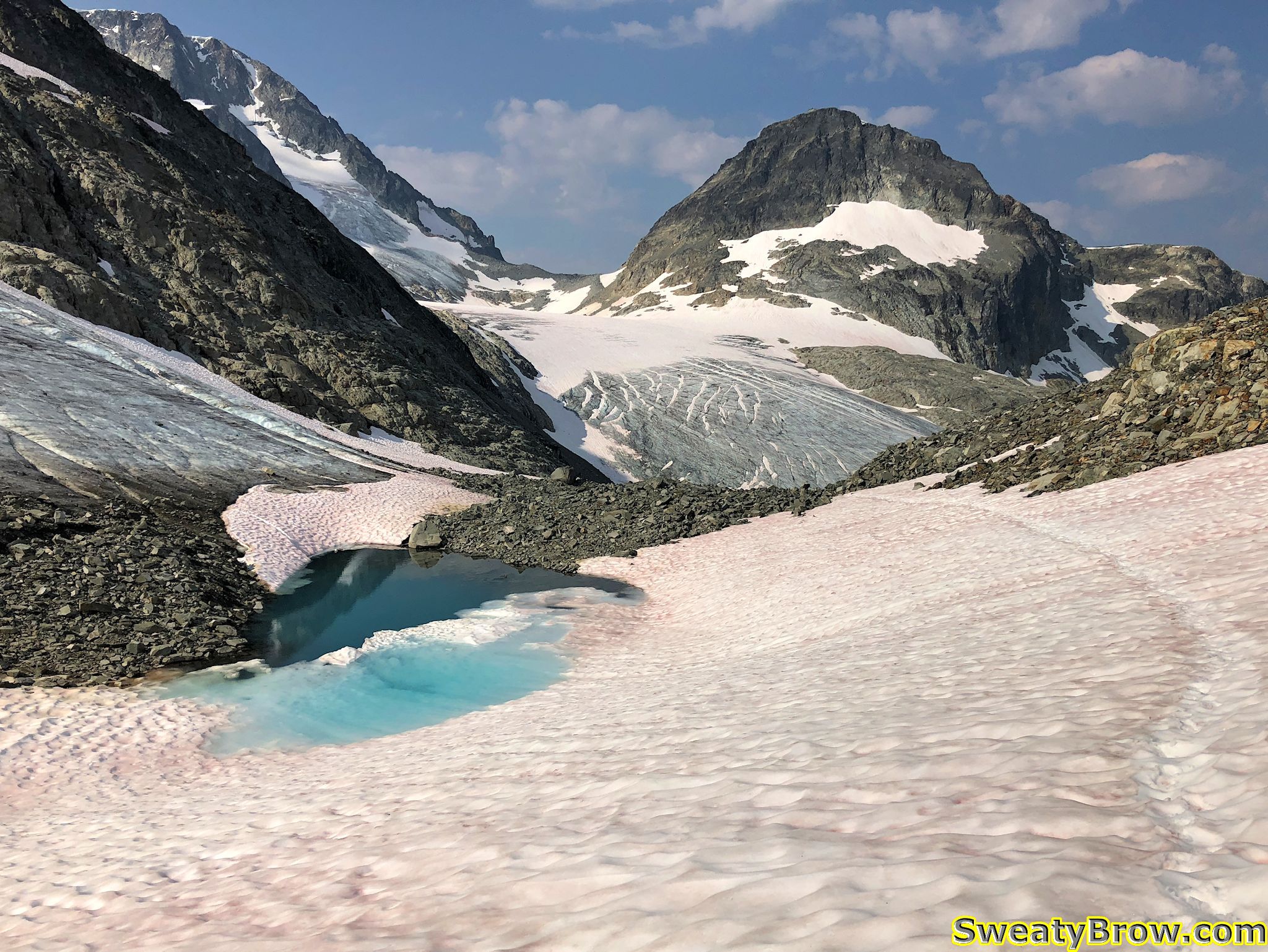
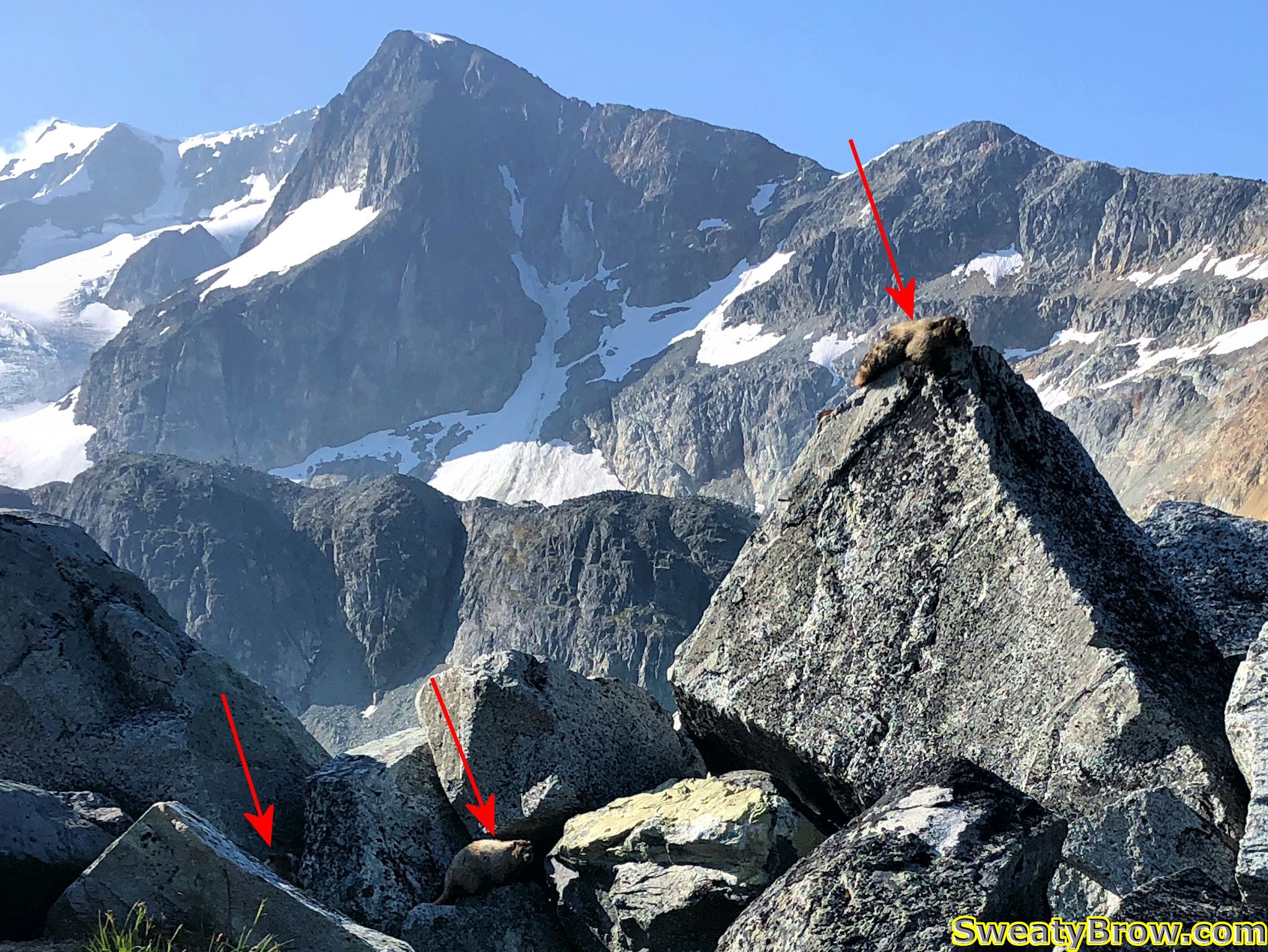
We continued up toward the Helm Glacier, and planned to traverse up on the left side of the glacier, all the way up to the head of the valley. As we turned up the valley, we watched a couple of marmots who were having a bit of a tussle. Another was nearby. I have some video somewhere, and will upload soon…

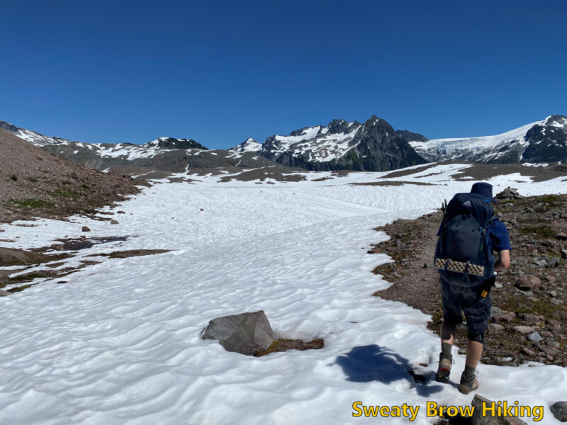
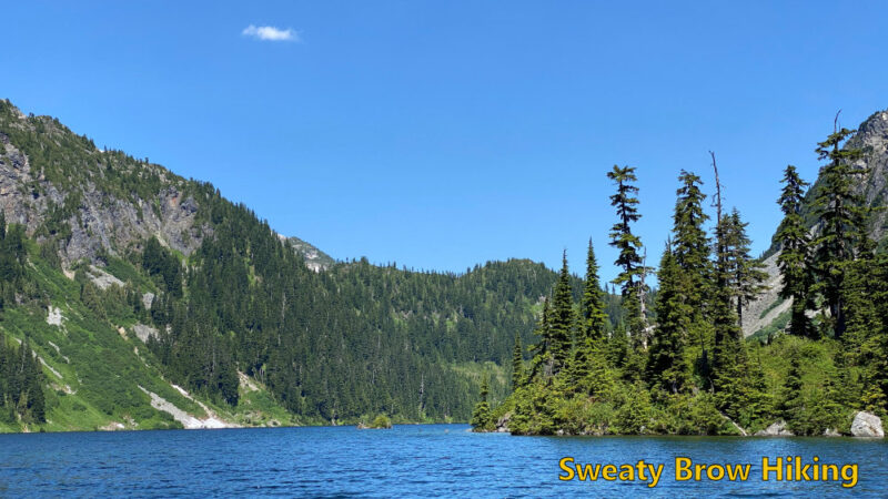
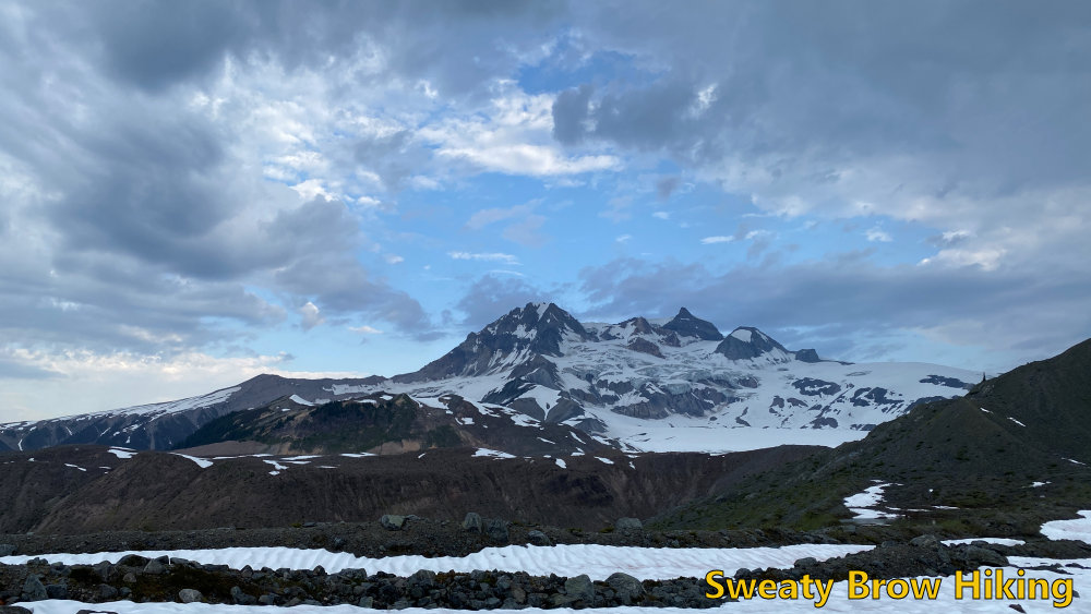
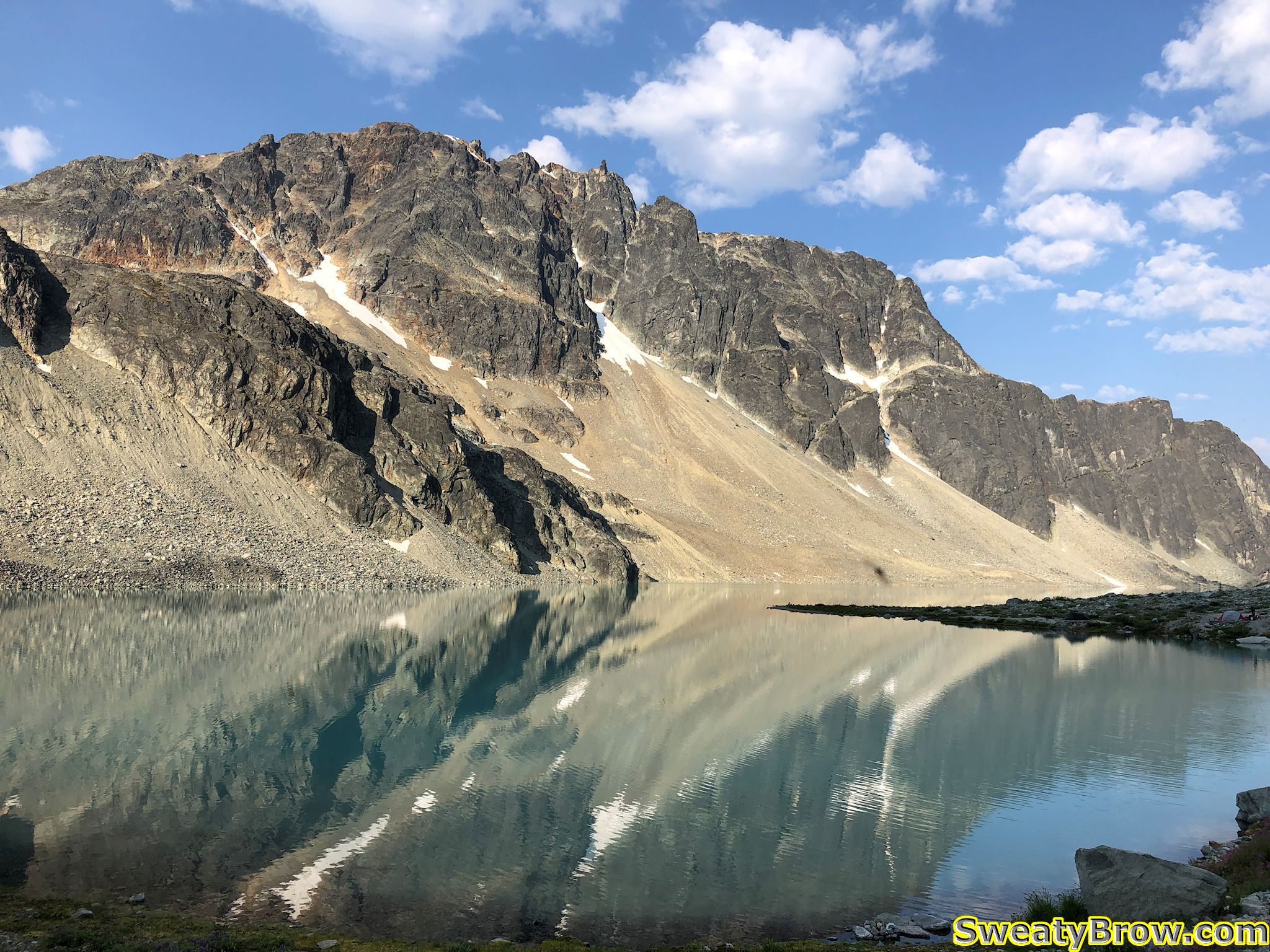
As we looked up the valley, we were disappointed to see more snow than we expected trailing up the slopes beside the glacier. The going didn’t look nearly as good from this vantage point as we had hoped.

Looking up the Helm Glacier. The snow on the left side was going to be our route. Didn’t look great from here. Instead we cut left, up a steep slope (not visible) to joint the left skyline.

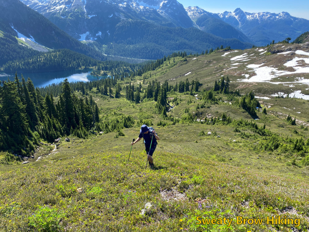
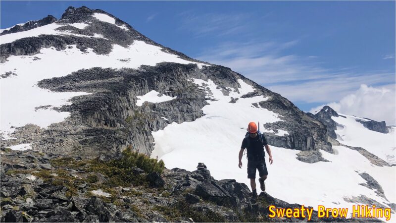
We made a quick change of plan, and headed steeply up to the left, to reach the ridge line east of the glacier, and south of Helm Peak. It was a steep, gruelling ascent, and once we reached the top of the ridge, the weather really closed in around us.

Heading up the side of the valley, and into the murk.

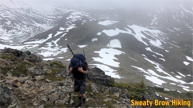
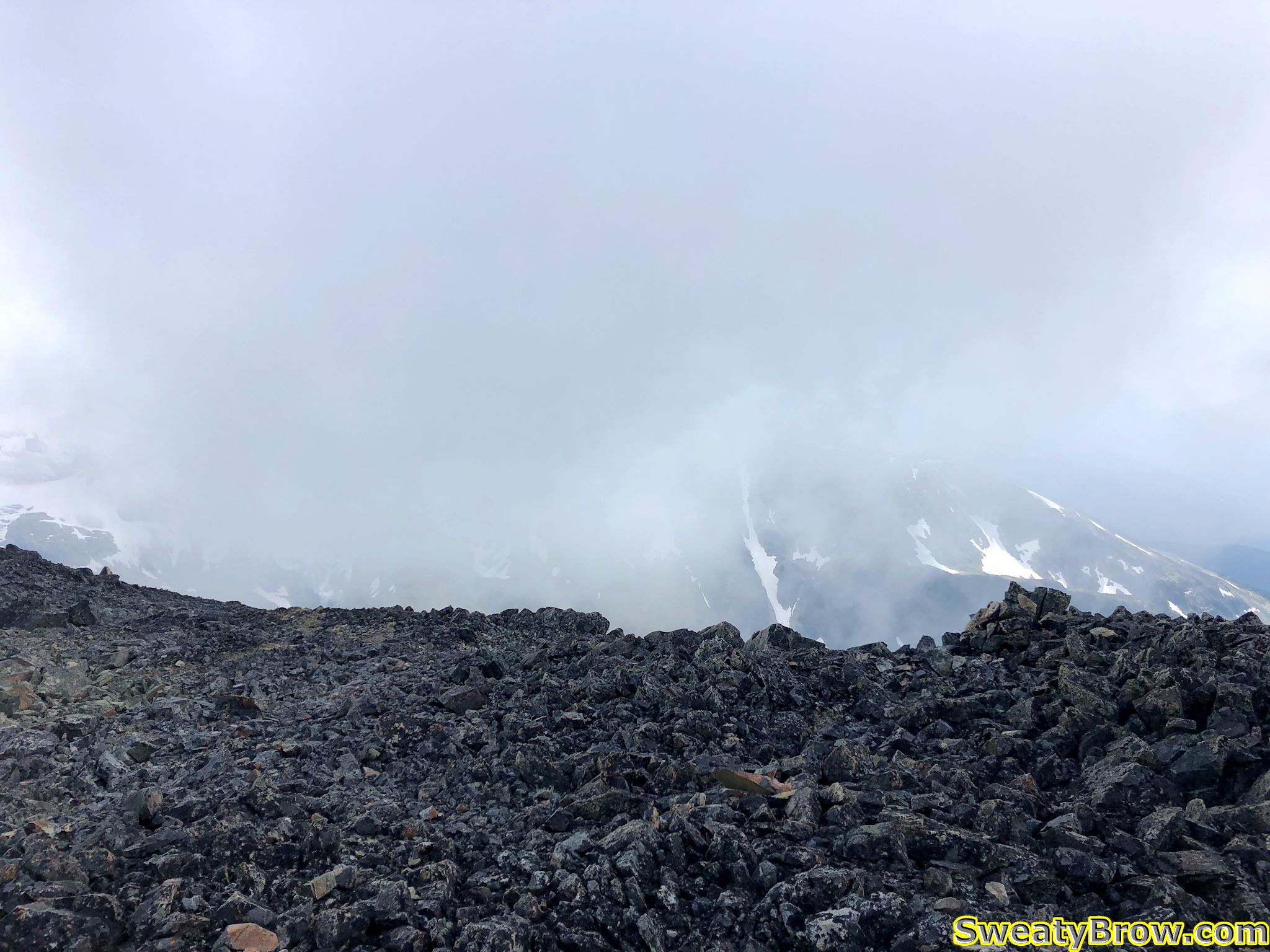
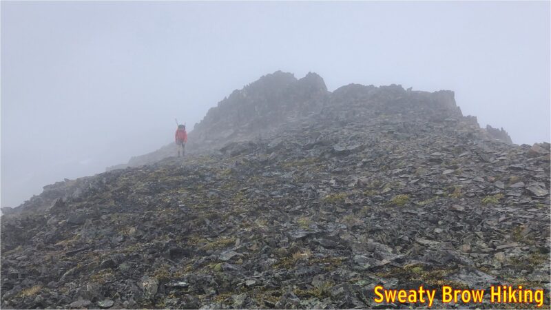
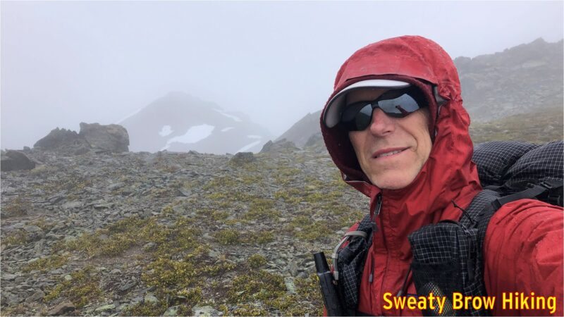
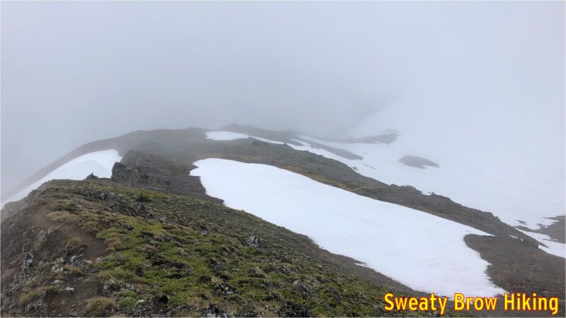
As we followed the ridge, the rain began to spatter down, and we were totally engulfed in cloud. Because we couldn’t see very far, we couldn’t tell whether it was possible to bypass the various bumps and peaks along the ridge. Rather than risk attempting to bypass these features, and end up cliffed out as the terrain got steeper and steeper, we ended up going up and over every single feature along the ridge, adding a lot of unnecessary up and down to the approach. I didn’t take any photos once the fog got really thick, but you can get the idea of deteriorating conditions below…

The fog begins to close in.

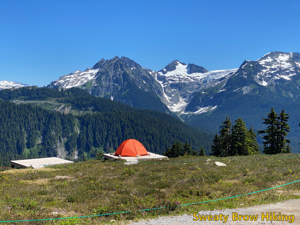
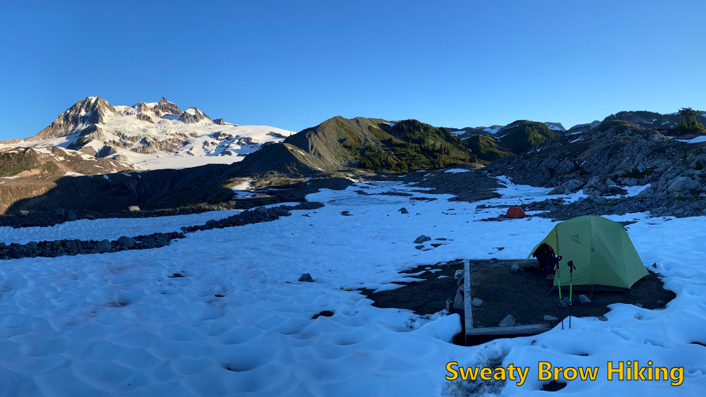
Finally, 7 hours after beginning the approach, and thoroughly tired and wet, we reached the head of Helm Glacier, and started the steep descent down slippery grass meadows into Gentian Pass, our destination for the night.

Our route drops down into this saddle, and off the left side into the abyss of Gentian Pass.

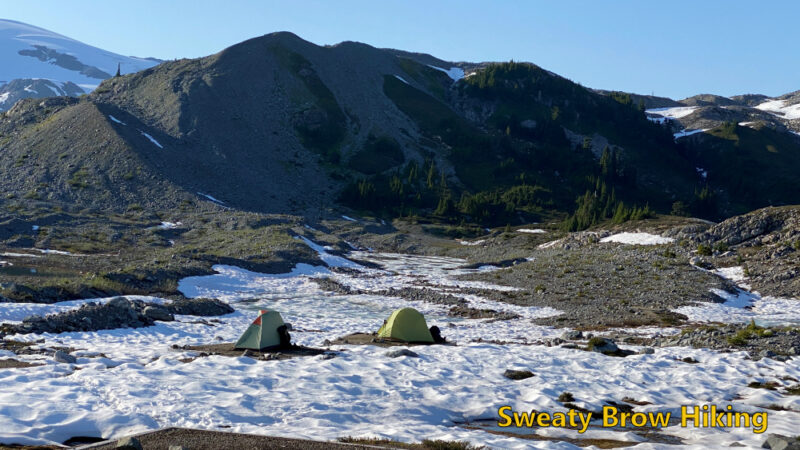
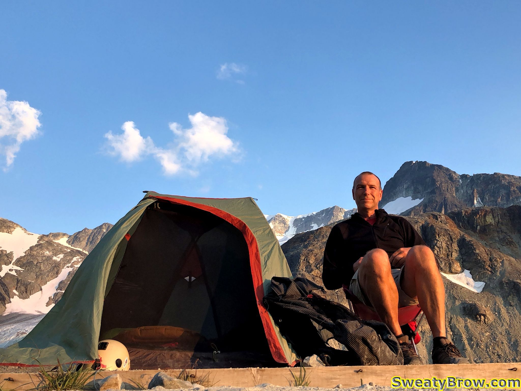
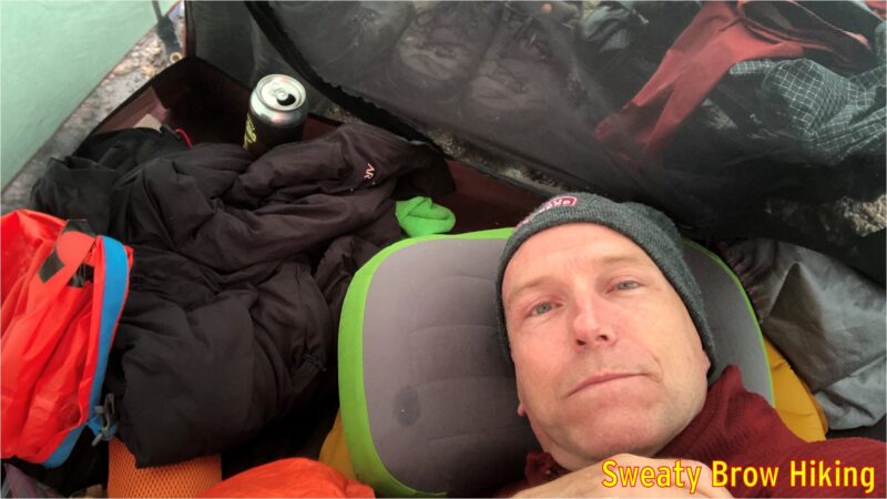
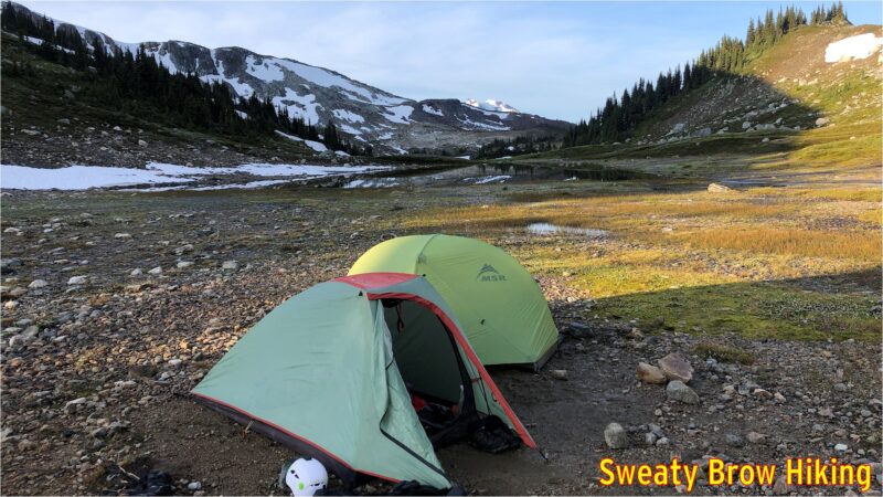
When we arrived at our planned camping area, at about 4 PM, the wind was driving, and the rain was like needles on our skin. We decided it was best to set up our tents as quickly as possible, rather than stand shivering in the elements. Conditions were not suitable for taking photos!

Setting up the tents was quite a challenge under those conditions, and when we finally did get them pitched, we each crawled into our respective abodes for a bit of shelter in our bedraggled states. We each also cracked open a beer to reward ourselves for a job well done. I managed to doze off for a little while, as well.

Settling in for a nap. Note the (now empty) beer can next to the door of the tent.

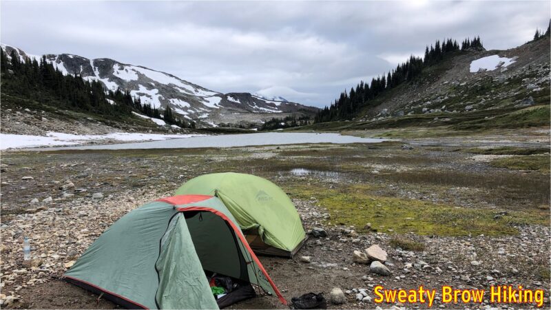
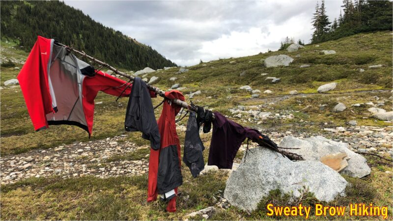
Things eventually quieted down outside, and we emerged from our tents around 7 PM to think about dinner. The rain had cleared off, the wind had dropped to almost nothing, and there were once again breaks in the clouds! We hung some of our wet things out to dry on some nearby snags, and set about preparing some hot food.

Our campsite for the night.
The drying pole.

Bellies filled, we retired to our sleeping bags to rest up for a big day to follow..

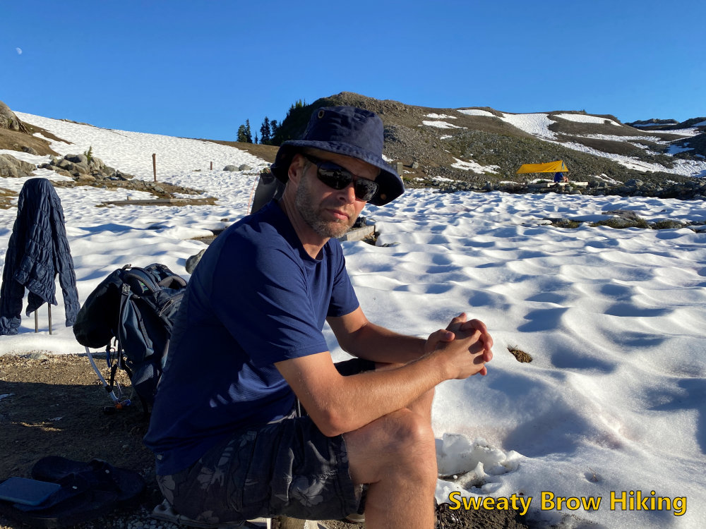
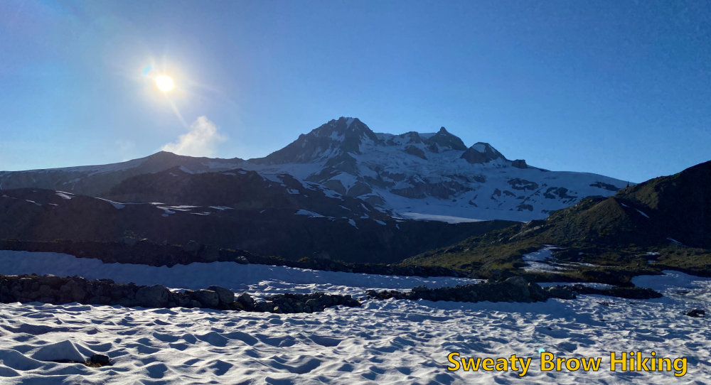
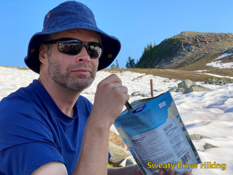
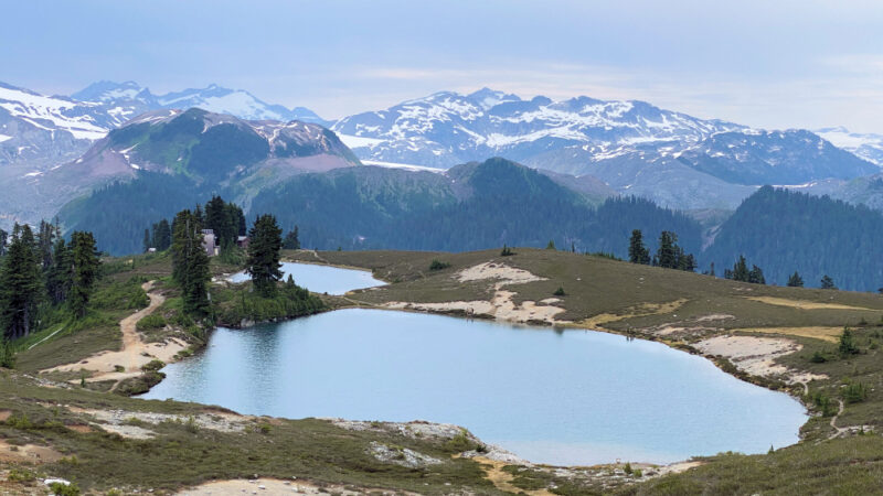
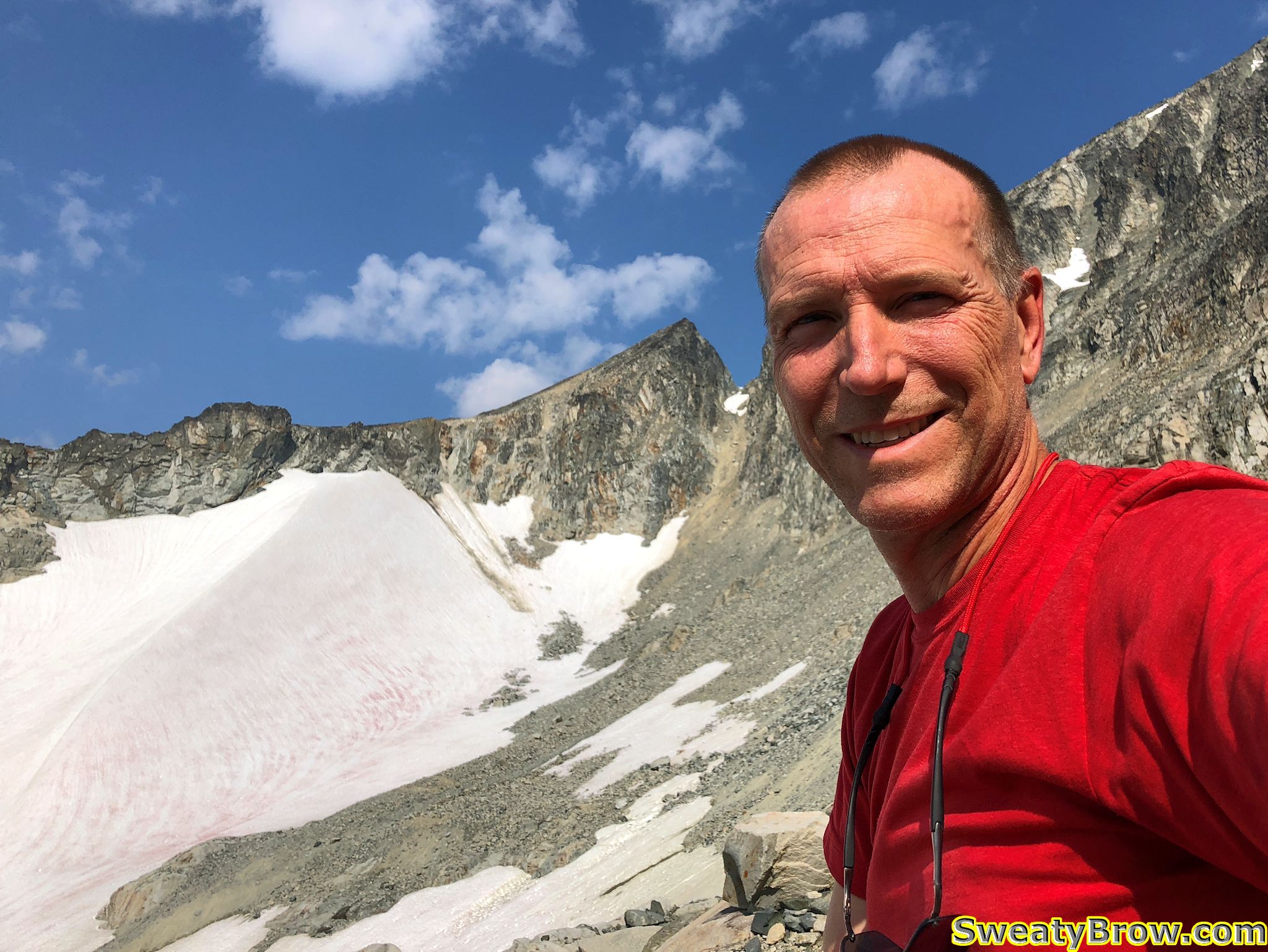
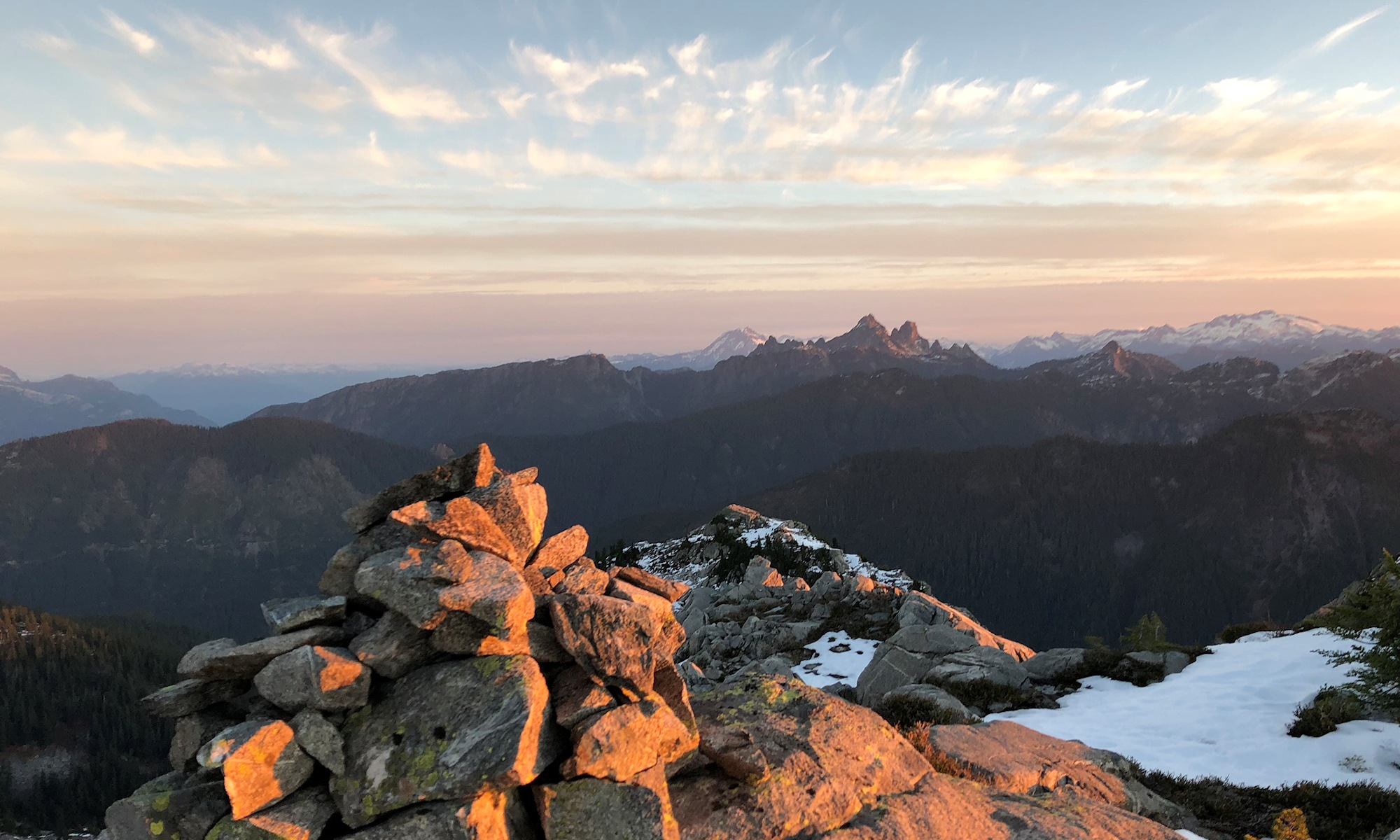
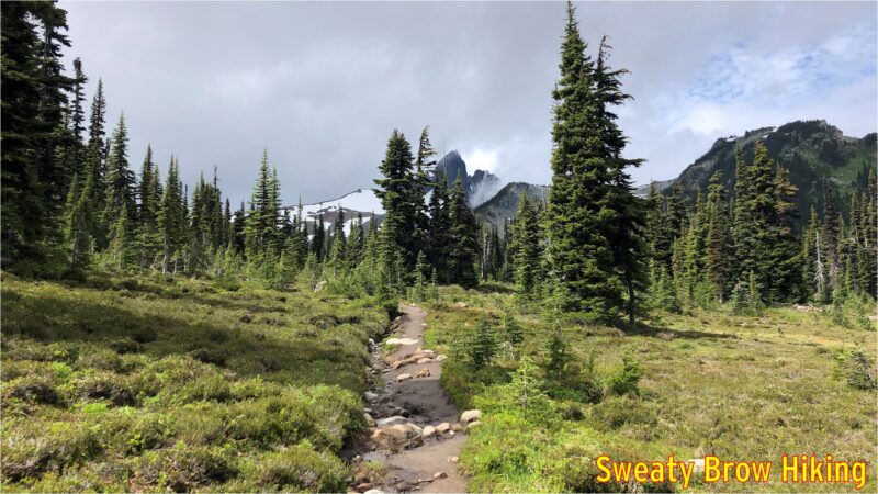
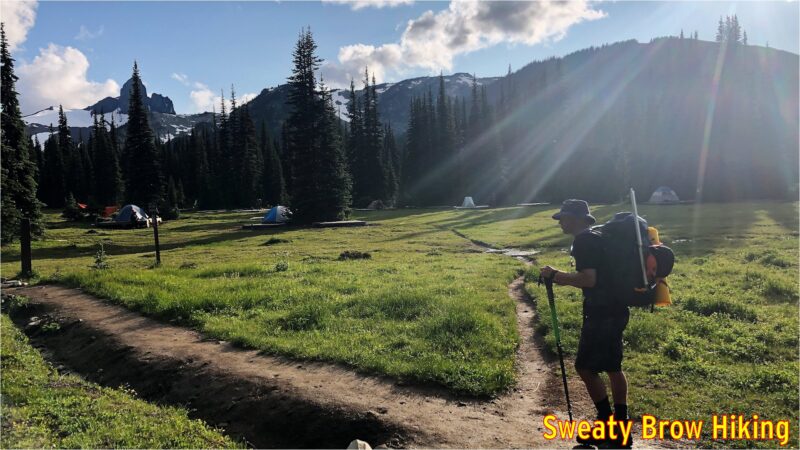
The next morning we were up bright and early, and the day was looking fantastic. There were a few scattered low clouds around and some high wispy cirrus clouds, but nothing appeared threatening. We had some breakfast, and tidied up camp, packing everything into our tents before we left.

A bright, sunny morning!

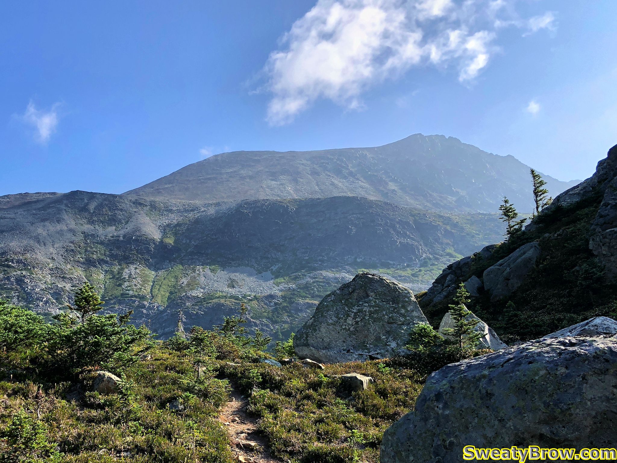
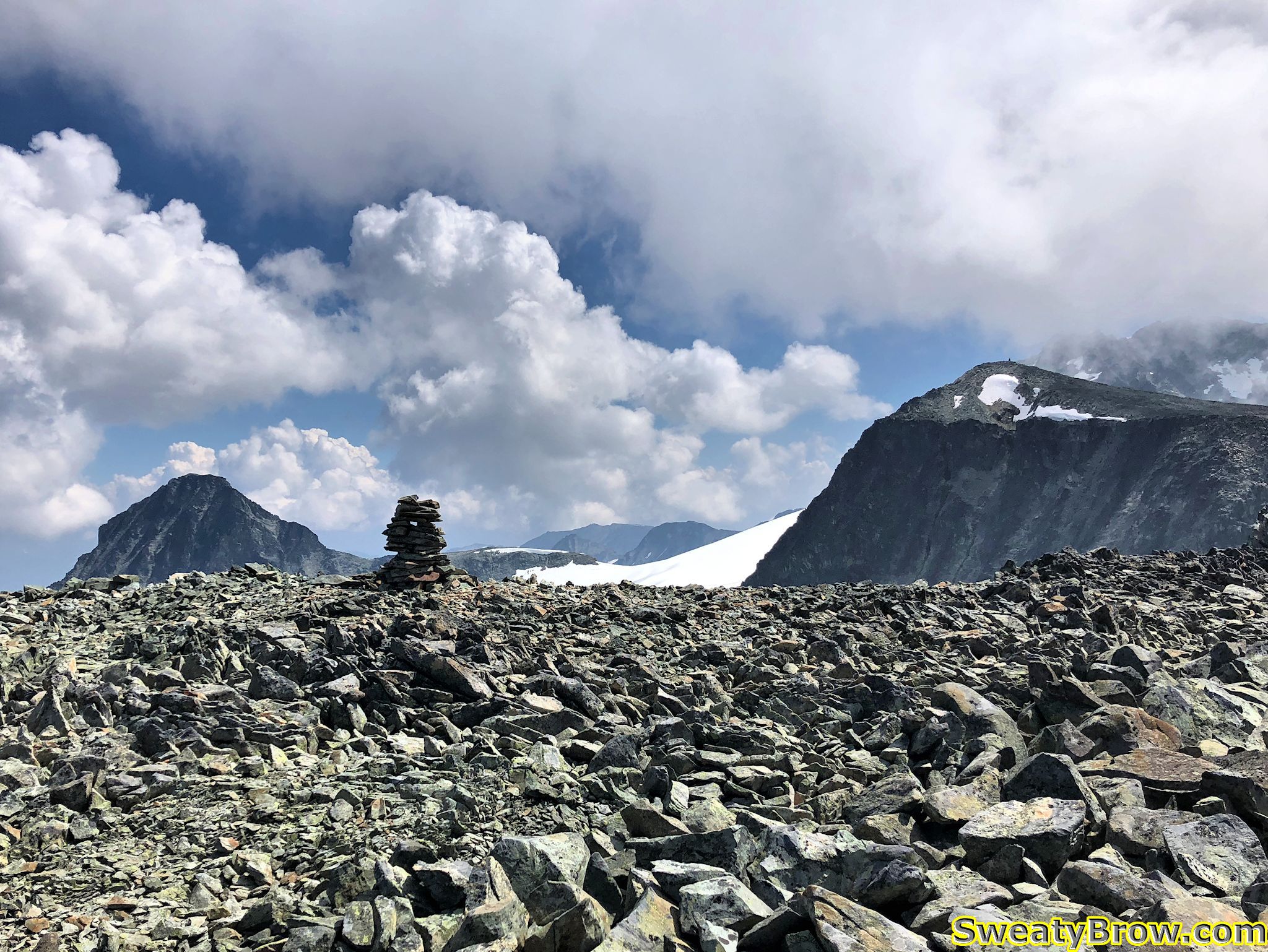
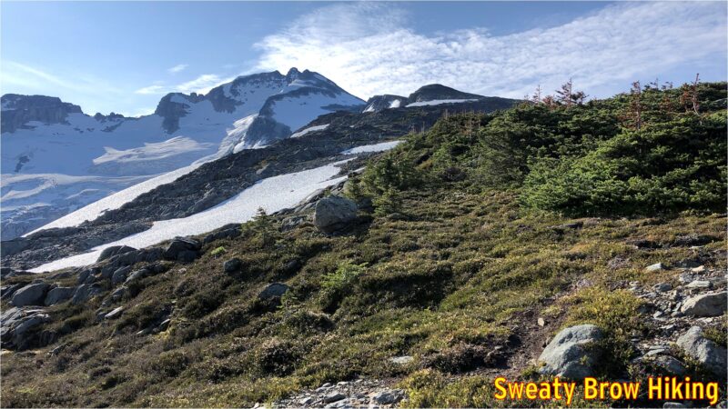
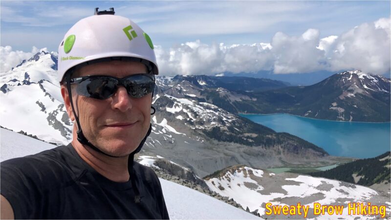
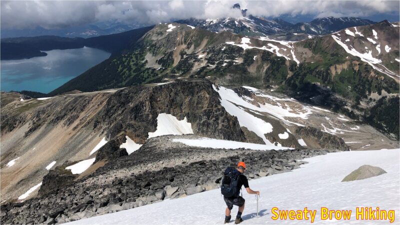
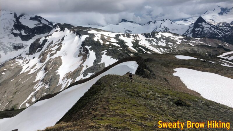
Again, 8:15 was out departure time, and we made quick time heading out of camp up toward Polemonium Ridge. That quick pace didn’t last very long, however, as the route was a long, steady climb up, up, up. Still, we managed to reach the top of the ridge in just over an hour. As we moved up, the views continually improved.

Starting up toward the summit of Gentian Ridge. Castle Towers is the tallest summit just left of centre.
The views opening up over Garibaldi Lake. Labels via the Peakfinder App.

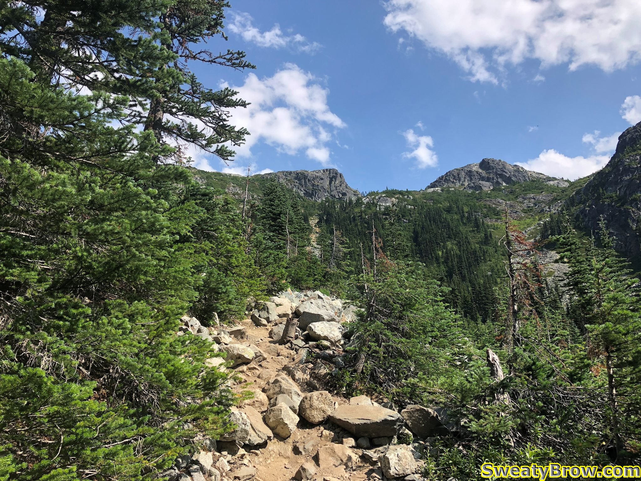
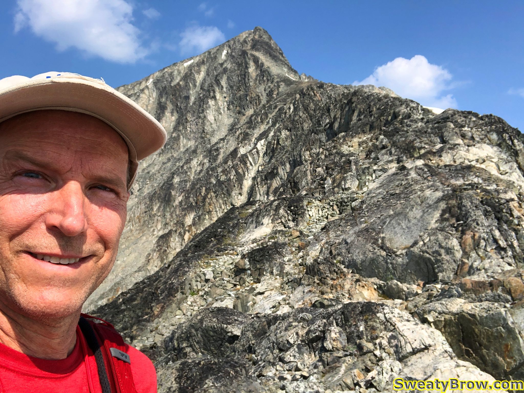
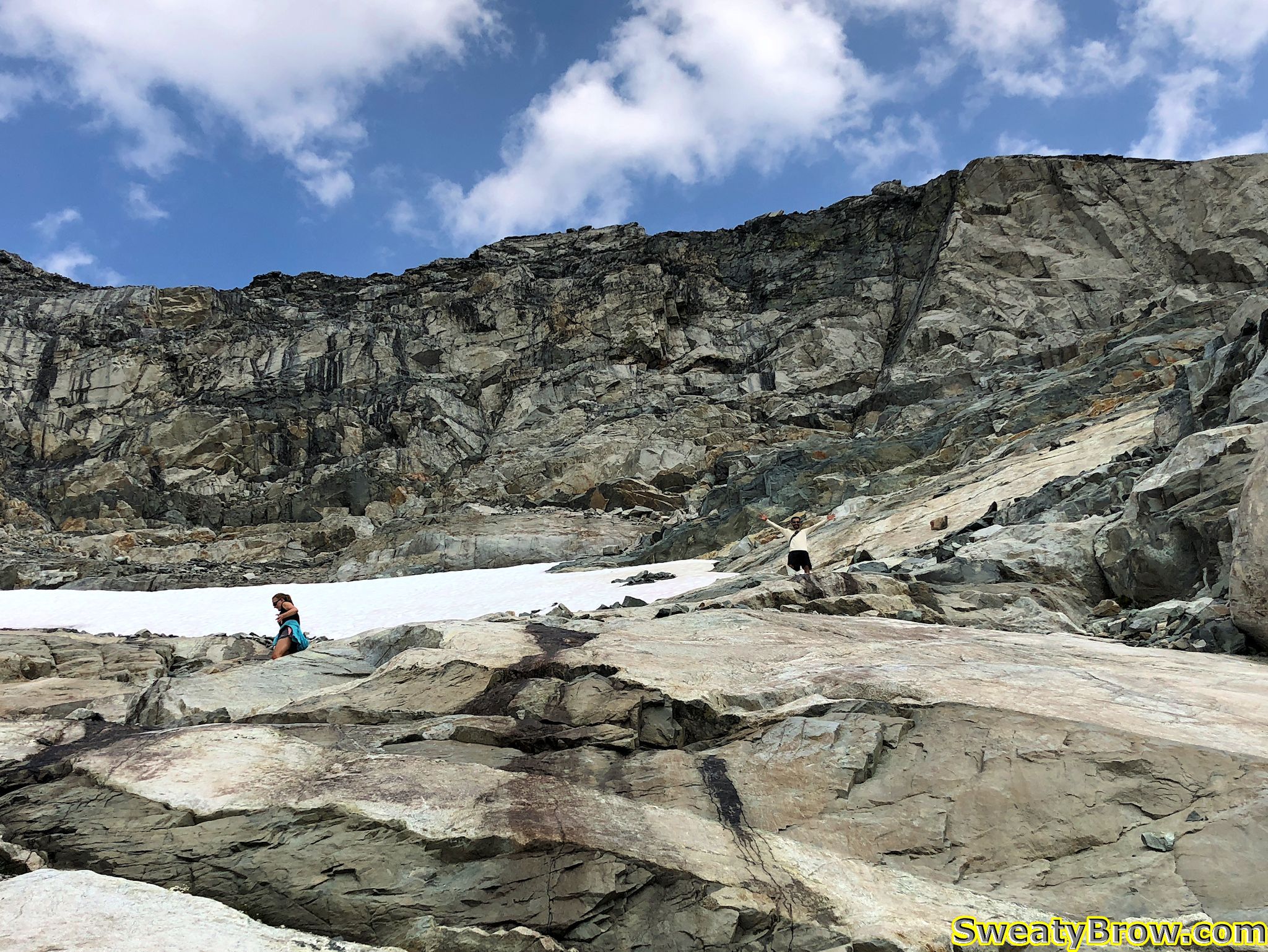
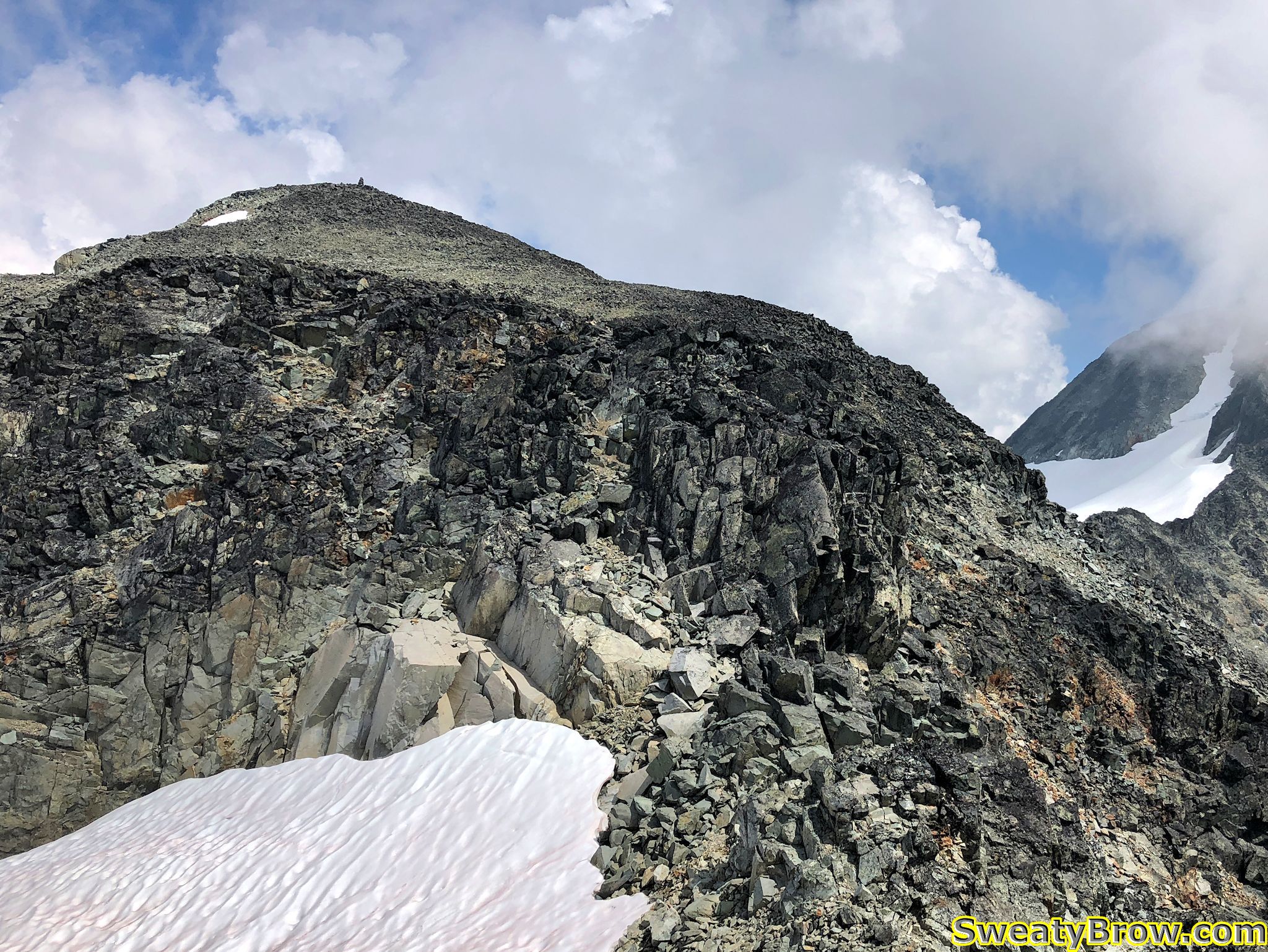
We stopped for a quick snack, and strapped on our helmets before starting a steep, rocky descent down the other end of the ridge. Soon we were out of danger from loose rock, and started up the other side of the pass toward Castle Towers.

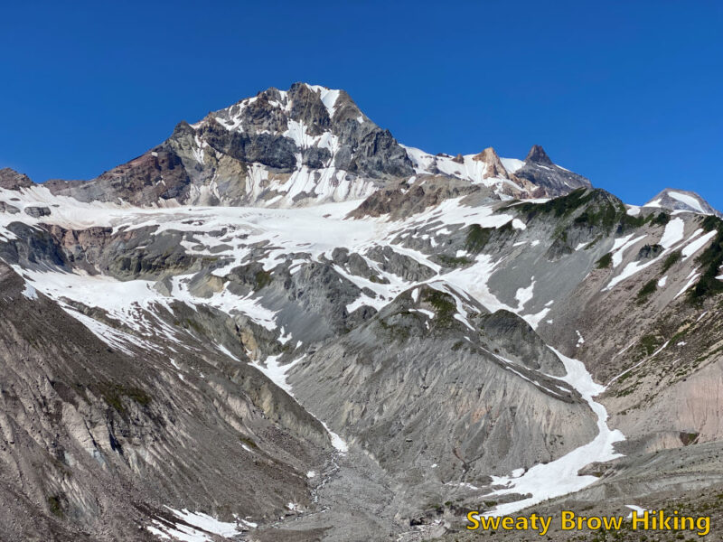
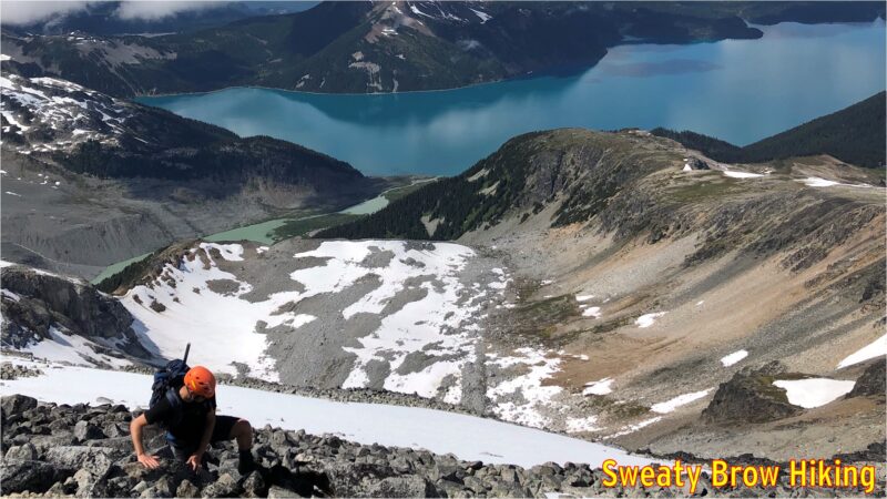
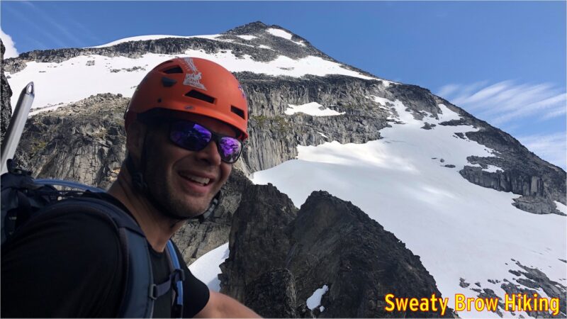
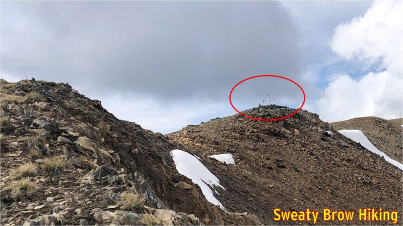
The top of Castle Towers (well, not actually the “top” as the route only goes to the lower of two summits – the true summit was beyond our comfort level!) is only about 1 km travel from the pass, but an ascent of over 400 meters. You could call it steep!

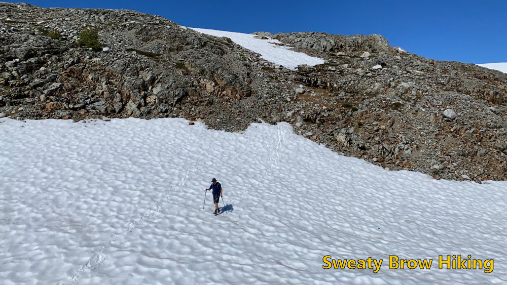
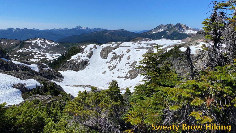
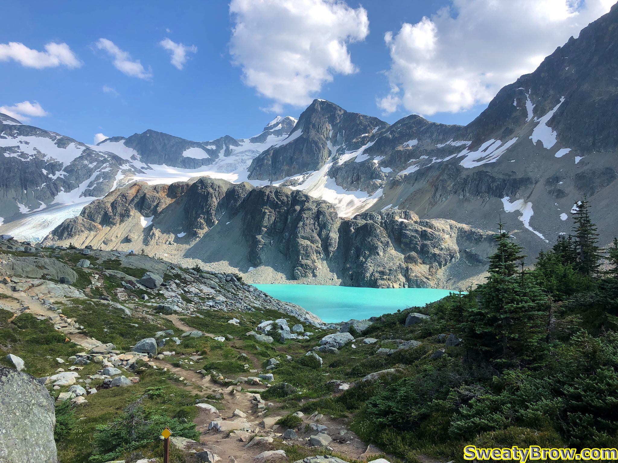
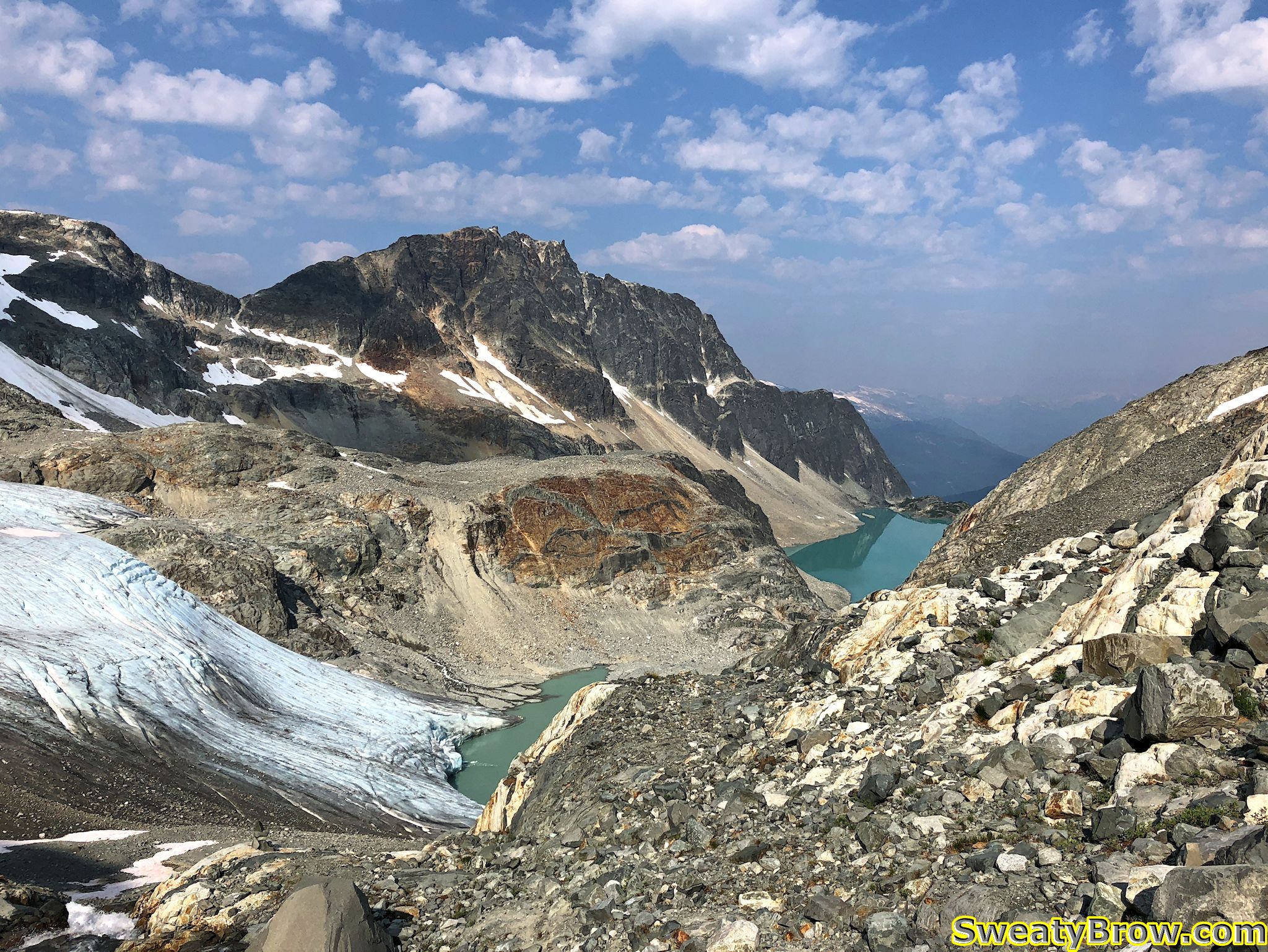
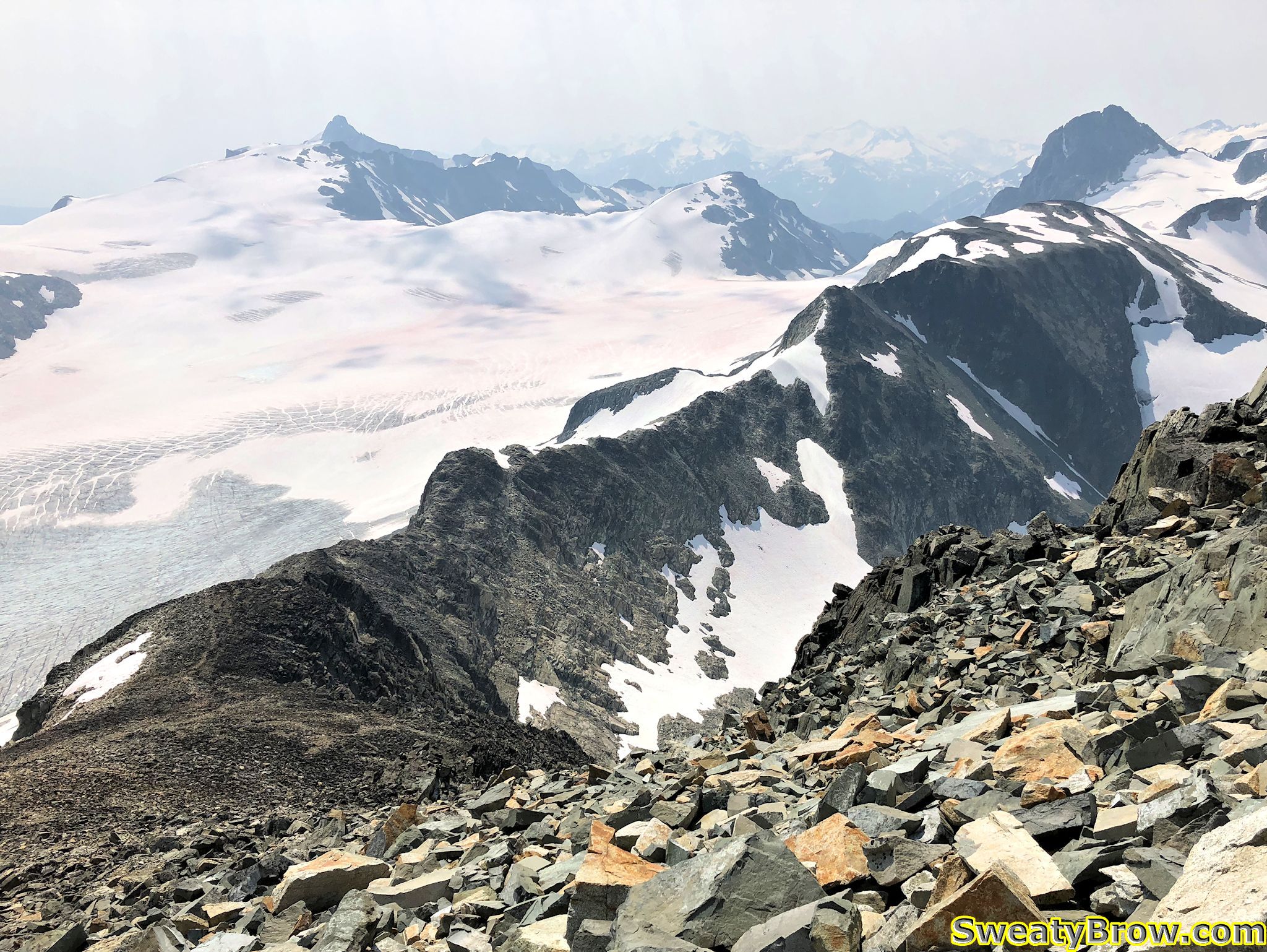
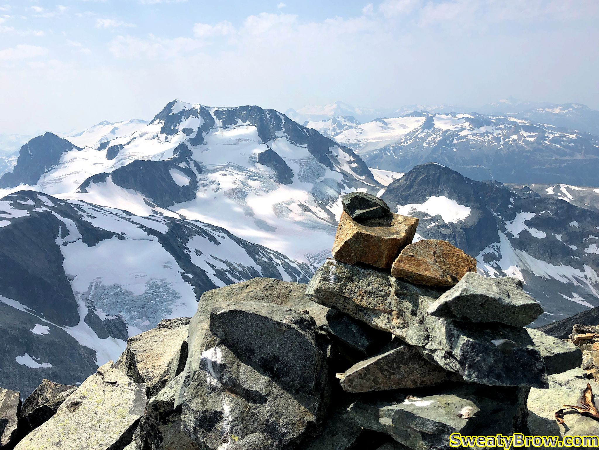
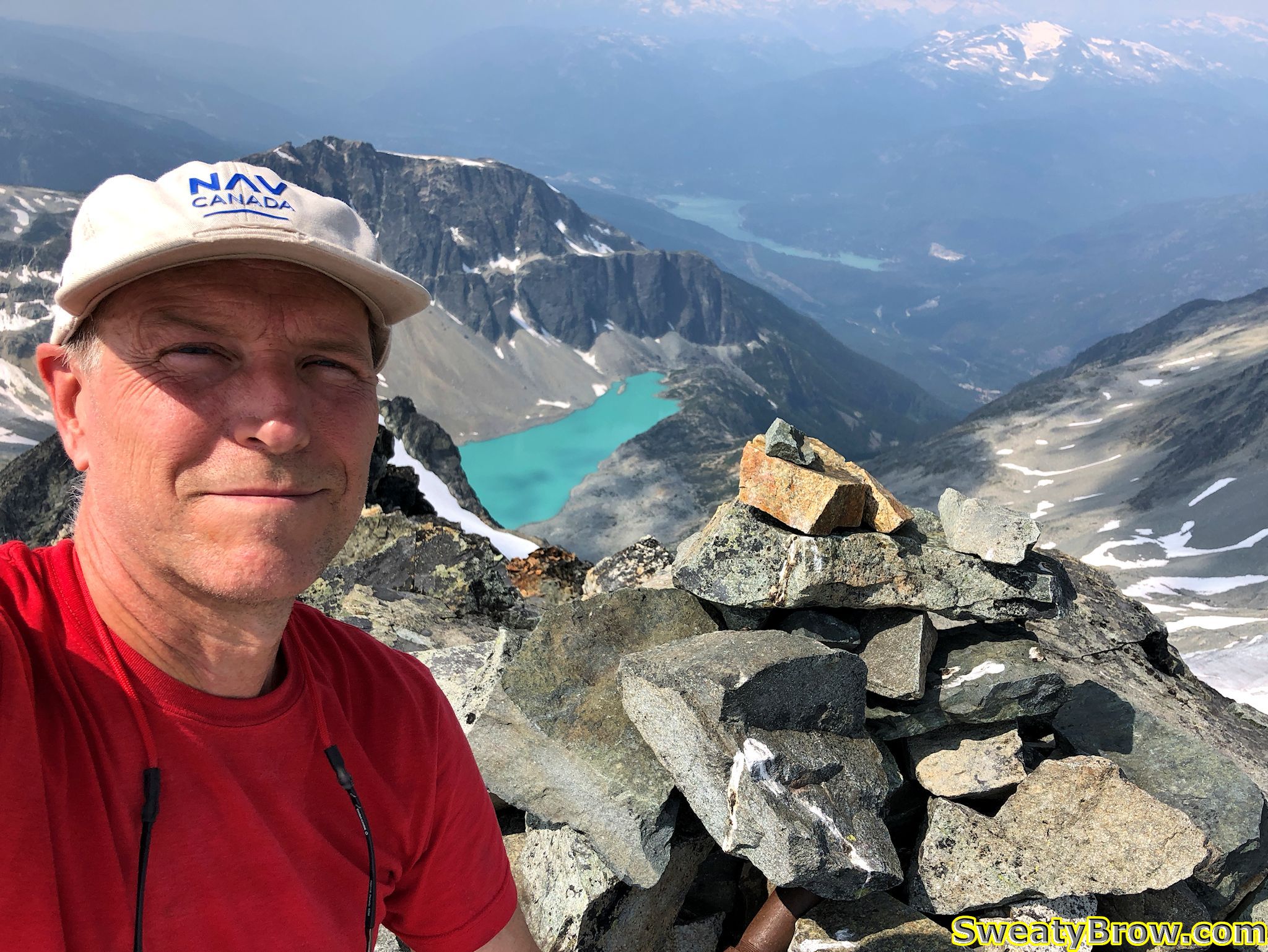
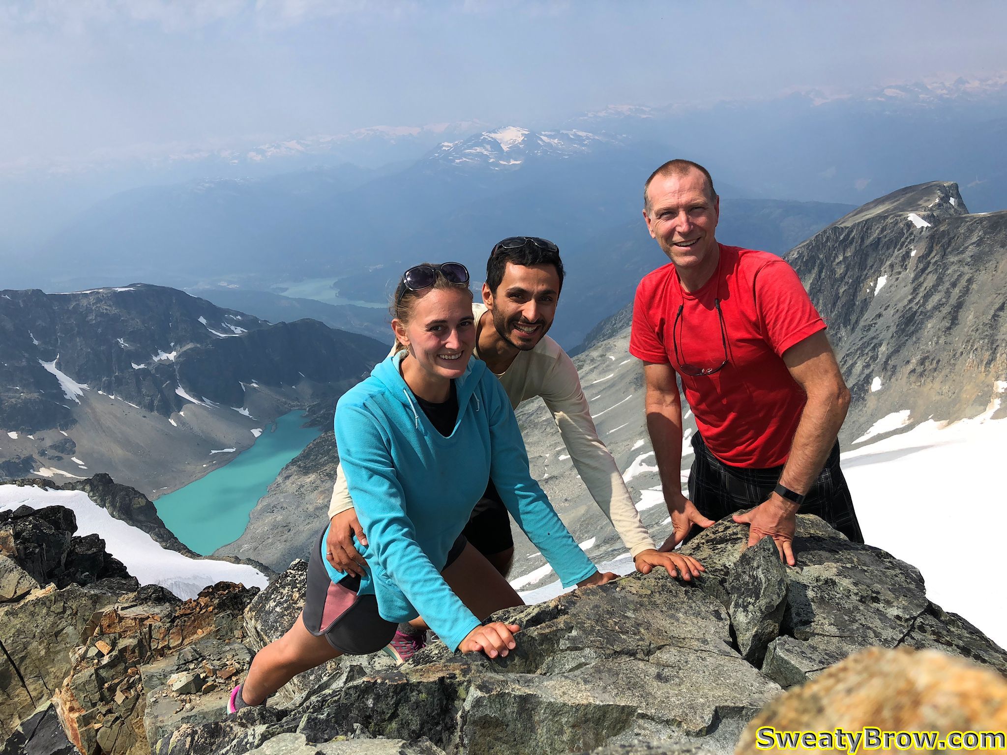
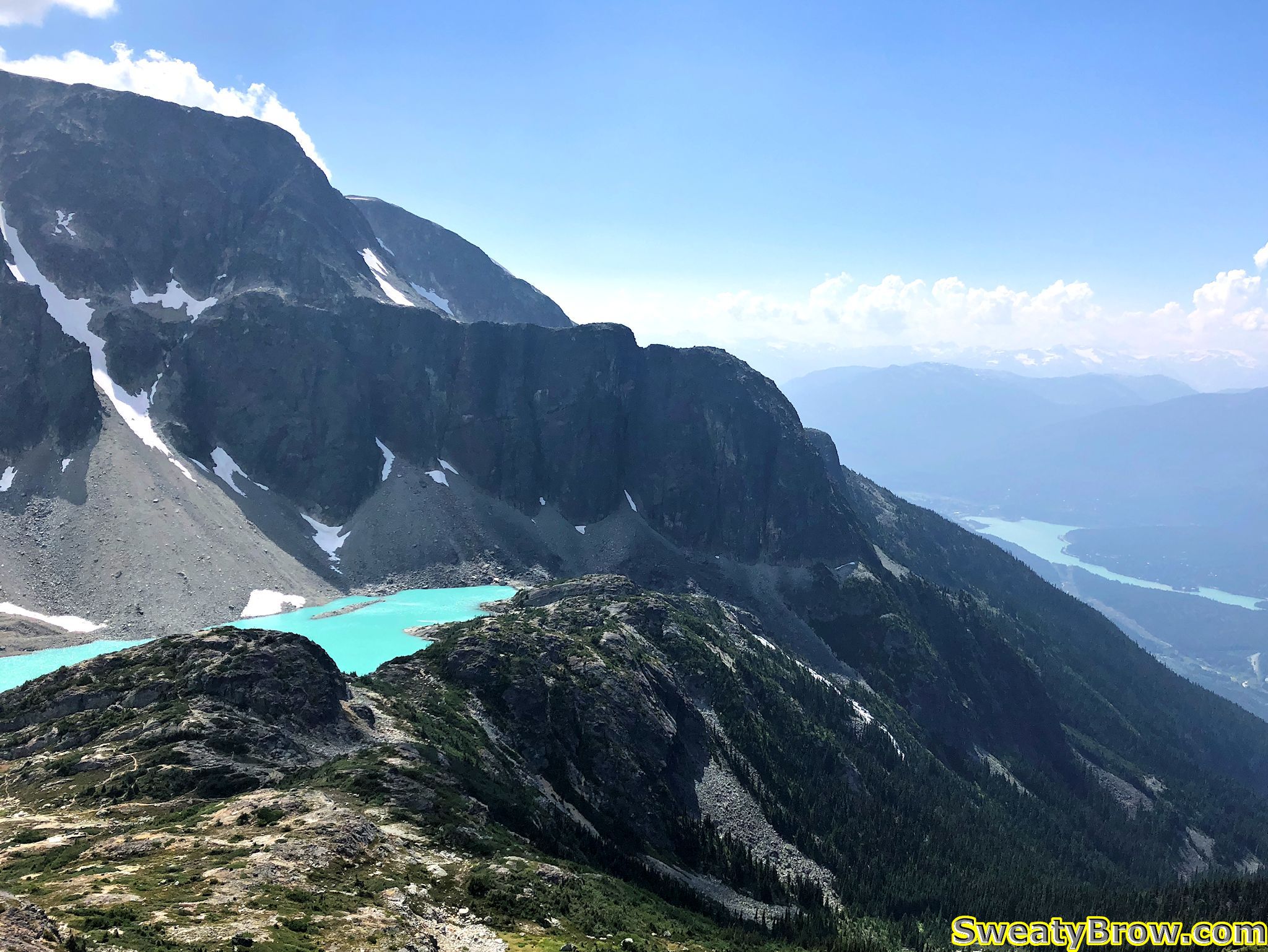
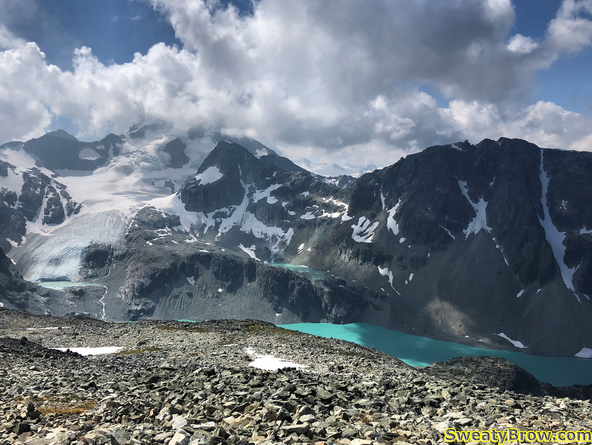
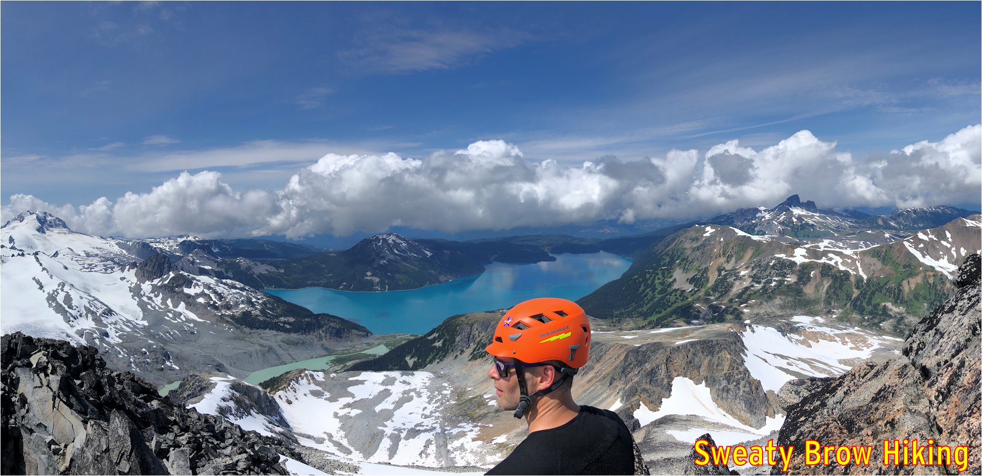
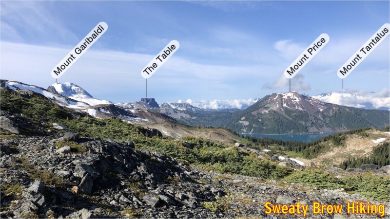
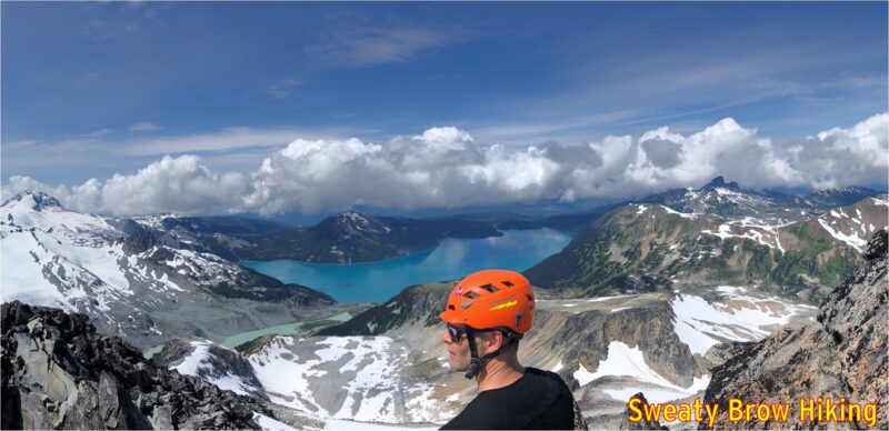
There were a couple of steep snow fields along the way, and we pulled out our helmets, crampons and ice axes to be safe. Again, the views opened up magnificently, particularly over Garibaldi Lake.

Snow time. Ice axe, helmet, and crampons coming out.
Great spot for a selfie!
Jeff scrambling up some of the rocks close to the summit.

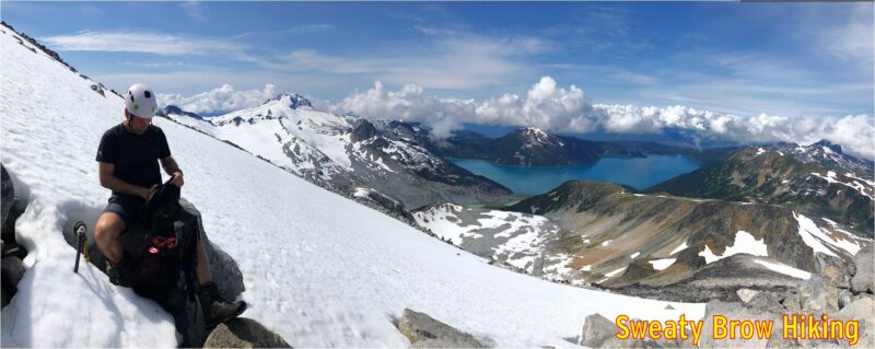
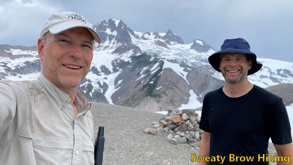
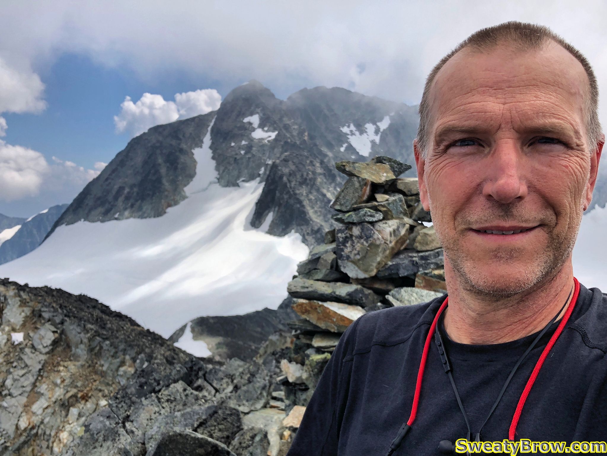
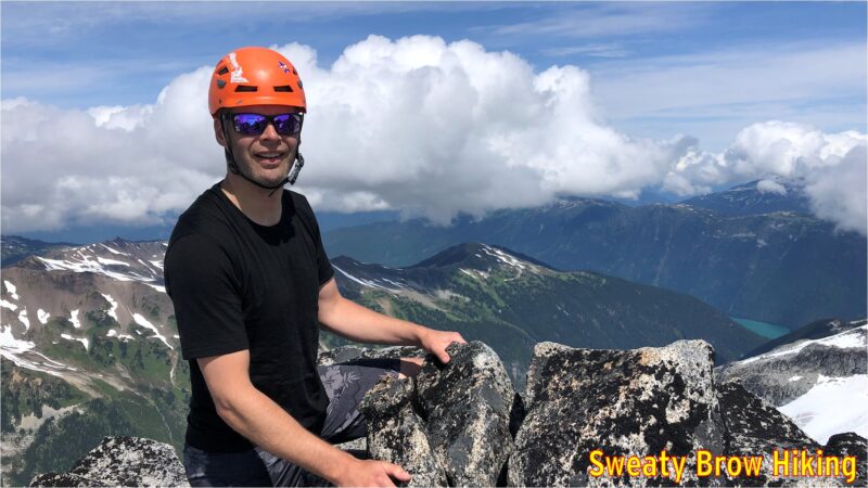
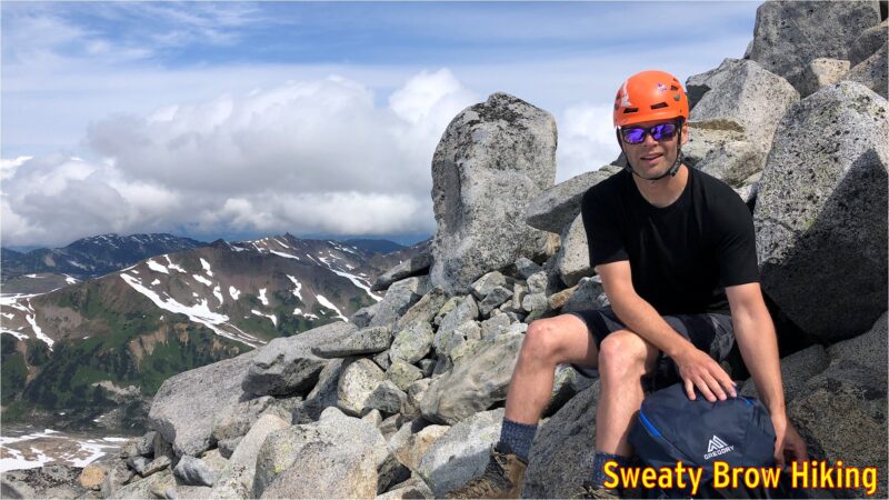
We reached the summit (well, our summit) a few minutes after noon, and took a couple of photos. We then dropped to just below the summit block, and snacked for a little bit.

Looking northeast, with a peek-a-boo view of Cheakamus Lake.
Looking northwest, with The Black Tusk dominating the left skyline.
Great views as we enjoy a snack.

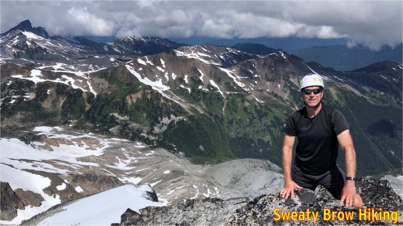
Looking around, we could see that there were some troubling clouds beginning to gather around the area. The Black Tusk began to play peek-a-boo, and there was a lot of development down towards Squamish, beyond Mount Garibaldi. Soon, we began our descent.

Starting down one of the snow slopes. The Black Tusk is now partly shrouded in cloud.
Stopping to pack away our ice axes

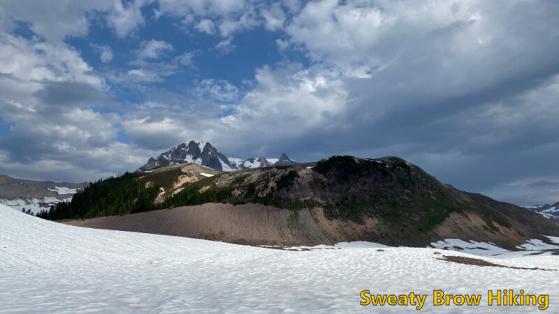
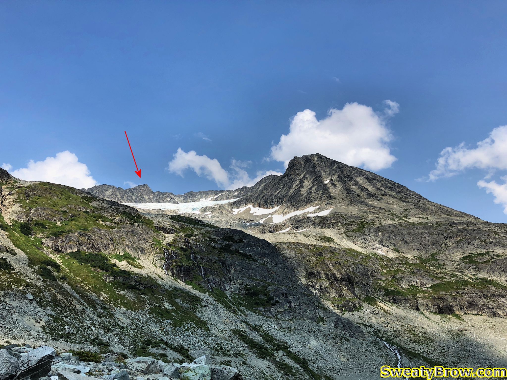
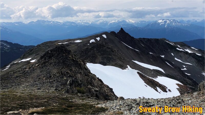
Once again, we stopped atop Polemonium Ridge for a bite to eat, and to get a few last photos of the day’s destination. Then, the long, steady trip back down to camp.

Climbing out of the pass toward the summit of Polemonium Ridge, looking back up where we’d been shortly before.
Rounding the top of Polemonium Ridge on the way back.

When we were approaching camp, and our tents grew from tiny specks on the gravel into recognizable objects, something didn’t appear right. Jeff’s tent looked… messed up. It appeared to be partly opened, and no longer fully standing. We became very concerned that perhaps a bear had gone for a little look-see in camp.

As we were coming down the ridge, we took this photo to try zoom in and see what was happening with the tent on the left.

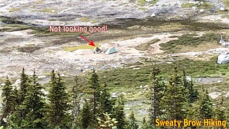
When we actually reached the tents, there was a great sense of relief. The gravel that we had set up on had just softened with all the rain the previous day, and one or two of Jeff’s tent pegs had pulled out, causing one side of the tent to collapse in on itself. No bears here!

We had taken quite a while to get to the summit and back. A trip of 3 km each way, so 6 in total, had taken us six hours. Yup, we averaged 1 km/h. Probably one of the slower hikes I’ve done! But we were in no rush, there was a bit of complicated micro-terrain to work through in a couple of places, and we still had a long hike out ahead of us.

We packed up our tents, and began the hike out shortly before 4 PM. We knew that the hike out would take quite a while, and we would be pushing dark by the time we got back, but it was a well established trail, and we had headlamps!

The trip back was much easier than the hike in had been, and the views much more pleasant. Once we climbed up and out of Gentian Pass (up, up, up the slippery grassy meadows), the trip along the ridge toward Helm Peak had much more expansive views. What’s more, we could actually see where we were going, and bypass some of the bumps along the way.

Starting back up Gentian Ridge. Castle Towers is on the left, and starting to get socked in by cloud.
Heading up the ridge, we passed this strange, spindly, space probe looking thing. Turns out it was a weather station recording information for a university program.
Some of the peaks along Gentian Ridge that we were able to skirt around, because we could see the terrain on the way back!
Helm Peak, the evil looking spire just right of centre, looks intimidating, even from here. It’s even scarier close up, as I learned in the summer of 2020.

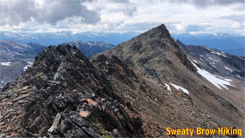
The route back down to Helm Creek Campground was also more straightforward, following the ridge down almost all the way to the groomed trail, rather than the makeshift route we took up the side of the valley on the way in. The ridge is still brutally steep, coming up or going down, but at least there is a rudimentary trail.

At 7:15, we passed through the campground, and continued down the hill.

Once again, we passed through Helm Creek Campground, and the clouds were starting to clear away. The previous day, there was one party in the campground, and they were on their way out. This time, it was a Friday evening, and there were a lot more people up to enjoy the weekend.

We reached the bridge across Cheakamus Creek at 9:00, and grabbed our chilled beverages on the way by. We cruised back along the trail, and reached the parking lot just around full dark, at 9:35.

Overall, we hiked about 31 km in total, and climbed/descended over 2900 meters of elevation, over the course of two days. The trip was a memorable experience, getting deep into the backcountry of Garibaldi Park.

Garibaldi Park – Open Again!

As BC started reopening its provincial parks in June 2020, it was nice to be able to get back out and visit some of them. However, others remained closed, since they were expected to be too busy due to their popularity. This included two of my favourite parks, Garibaldi Park and Stawamus Chief Park.

However, as of July 27, these parks are open to visitors – utilizing a new “day pass” system for day visitors, but also including overnight stays in established campgrounds.

So it was that my friend Jeff and I reserved a pair of tent pads in one of Garibaldi’s more remote campgrounds, Rampart Ponds. We booked two nights, Wednesday and Thursday, July 29 and 30. We knew that the hike in would be fairly arduous, but wanted to get deeply into the park, and away from other visitors at the much more popular Elfin Lakes Campground.

We arrived at the trailhead a little after 8:30, and had our permits checked by a ranger stationed in the parking lot. There were around 6 other vehicles parked there at the time. We were on the trail by 9:00.

Conditions were lovely, and the day was certainly warming up. As we headed up the old road toward Red Heather shelter, we stopped after 2.5 km and stashed a couple cans of light, frothy refreshments into a creek, for the trip back. We saw a couple of people on their way back from Elfin Lakes, and there were just a few people there when we arrived.

One of the very few tents set up at Elfin Lakes.

We were also pleased to see the following sign posted at the campground there:

Well done, Garibaldi rangers!

We stopped for a quick snack, then kept going.

After Elfin Lakes, the trail does a long descent into Ring Creek, and climbs back out the other side, up to the base of Opal Cone (an ancient cinder cone beside Mount Garibaldi).

Looking up toward Garibaldi, while climbing out of Ring Creek.

After rounding the base of Opal Cone, the trail drops into a shallow, wide valley that used to contain Lava Glacier. This glacier appears to be mostly gone, now, and there is a lake in the middle of a snowfield now.

The valley where Lava Glacier used to lie.

I’ve included an image from a paper entitled “Glacier change in Garibaldi Provincial Park, southern Coast Mountains, British Columbia, since the Little Ice Age” (Koch et al. 2009). The paper makes fascinating reading. It is available here: https://backcountrybc.ca/component/edocman/glacierchangeingaribaldiprovincialparksincelittleiceage-pdf/viewdocument?Itemid=

I have superimposed the approximate location of the trail we hiked to Rampart Ponds, in red. The darkest area shows the extent of the glacier around 1700 AD, the maximum extent during the Little Ice Age, and then at various years through the 20th century.

At about 3:45, 6 hours and 45 minutes after setting out, we arrived at Rampart Ponds. There were two other people staying at the camping area that night. One had already arrived and set up his site prior to our arrival, and the other arrived just after us (she had stayed at Elfin Lakes the night before, and climbed Opal Cone on her way to Rampart Ponds.)

Jeff and I set up at two adjacent tent pads, which were partly covered in snow. After some dinner, some beer, and some conversation, we watched the sun disappear behind the shoulder of Mount Garibaldi.

As soon as the sun was down, it got cold fast! We hopped into our tents and bedded down for the night. I hadn’t taken my warmest down quilt – just my lightweight synthetic, and I ended up a little bit cold during the night. I have regrets…

In the morning, I was up as soon as the sun fully lit Garibaldi, across from us. The shadow of the ridge behind us soon crept along the valley floor, and things warmed up quickly!

The others at the campsite packed up and left, heading back toward Elfin Lakes and the exit. We had one more night to spend, and decided to spend the day doing some exploring. On the way in, we had talked about making an ascent of Opal Cone, but decided that we would save that for the final day, on our way back toward Elfin Lakes and the trailhead.

After a leisurely breakfast, we were on our way at about 10:00. We headed northwest, up onto the ridge that is visible at the centre of the photo above.

We followed the ridge north for a while, through some snowfields, talus slopes, and rock slabs, until we were looking over a creek draining the Bishop Glacier into Pitt Creek. From there we turned east and followed the ridge further.

The point at which we turned east.

After about an hour and a half, we turned around to head back to camp.

The view from our high point, looking back toward camp (down the valley, and toward the left.)

On the way down the ridge, we ran into a guy who was day hiking in the area. He had ridden a bike up to Elfin Lakes, and hiked from there. He had certainly come a long way, already, and had a long way to go back out! He told us about some of his explorations around the area, and was quite inspiring!

By 1:00 we were back at camp, where we gathered some things (like lunch and towels) and set off for Mamquam Lake. It was about 2 km away, with a drop of about 250 m on the way, and took half an hour to reach. By this time, the day had gotten very warm – like vicinity of 30 degrees warm. We reached the lake and were swimming in no time! We couldn’t stay in long, however – the air was warm, but the lake was cold! We ate a few snacks, and lingered a while.

Photo from the shore of Mamquam Lake. I would love to say that there wasn’t a cloud in the sky, but there was… That tiny puffball in the photo.

After a little over an hour, swimming, eating, relaxing, we started back up the hill. Progress was slow, but steady, and after about 55 minutes we were back at camp.

When we got back, the heat was oppressive. There was no shade in the campsite other than behind the outhouse, the food lockers, and a large sign board that didn’t really have anything posted on it. We were hungry, and didn’t have many options – so we sat behind the sign, in its small square of shade, and prepared dinner.

Cowering behind the sign, avoiding the glaring sun.
“Enjoying” a freeze-dried meal in the only shady spot around.
The sunshine bathing the entire campground. So hot…

Again, the sun disappeared behind the horizon around 8:10 PM (quite early, due to the high ridge of Mount Garibaldi) and it got cold fast. Fortunately, this night didn’t get as cold as the previous one, and I was a comfortable temperature all night.

In the early morning hours, a little bit of rain spattered our tents. At 7:12, I took a bit of video, mainly to capture the sound…

The sky was pretty mixed – there were some lovely patches of blue, but waves of showery clouds kept passing through. Fortunately, the rain never came down heavily – it was really quite gentle, and not particularly cold.

Some of the moody clouds on Friday morning.

We packed up our tents, and by 9:00 we started to retrace our route back out of the park. Upon reaching the base of Opal Cone, we started up a trail that curls around from the south slopes, toward the east side of the mountain. The trail follows the crest of a lateral moraine from the old Lava Glacier, and is just a lovely path to follow.

Approaching Opal Cone from the east, while hiking out. The trail follows the crest of the “ramp” rising from the left side, before turning steeply uphill.

Finally, the trail reaches the base of a gully that heads steeply upwards. We dropped our packs, and started up. It didn’t take long before we were approaching the top of this ancient volcanic cone, and we looked left and right, trying to determine the best way to get to the highest point – and where exactly that “highest point” was.

We turned left, for what seemed to be a likely target, and slogged our way up to a summit. After a moment, we realized that the actual high point was much further around the cone. We deliberated for a couple of minutes – say “close enough” and head back, or continue down, and up, and down, and up around to the summit? It didn’t take long, and we decided that we would make a complete circuit around the entire ancient, crumbly crater.

The first high point we reached atop Opal Cone.

That was certainly the right decision! Following the ridge all the way around Opal Cone took us maybe half an hour, and was just gorgeous. The views were spectacular, and the terrain was really interesting to hike around.

After our full circuit, we slid and scrambled back down the steep gully to our packs, then followed the sharp ridge of that lateral moraine back to the main trail. From there, it was the long, long descent into Ring Creek, and back up the other side. On occasion, we were still getting short showers passing through, but they were quite refreshing. We were just happy not to have the heat of the previous day, as we laboured uphill with full packs.

Crossing the bridge over Ring Creek.
Jeff keeping his spirits up, approaching Elfin Lakes.

We reached Elfin Lakes at 1:00 and enjoyed a bit of lunch, and refilled our empty water bottles/bladders for the balance of the trip. After half an hour, we were on our way again.

A little cloudy and gloomy, hiking away from Elfin Lakes.

In another hour and a half, we reached our stashed beverages, and enjoyed them as we hiked the last forty minutes to the parking lot. The many people we saw hiking the other way, steeply uphill, looked as if they wished they’d thought that far ahead as well.

We reached the (crowded!) parking lot at 3:45, and changed into fresh t-shirts and sandals. Finally, we headed back to Squamish, where we stopped for a hearty meal at The Copper Coil.

Looking back on the trip, we were amazed at how quiet the park still was. The park had opened again on Monday, and we were there on Wednesday and Thursday nights. And yet, once we were past Elfin Lakes, we only saw a grand total of four other human beings. Stunning wilderness, only a couple of hours from the bustling metropolis, in almost perfect weather, and we just about had it to ourselves… An opportunity to be savoured, and long remembered!

Wedgemount Lake – Camping and Hiking/Scrambling

Monday, the 30 July, 2018, I hiked up to Wedgemount Lake, in Garibaldi Provincial Park, intending to stay for three nights. The hike was rather grueling, and was done in very hot, sunny weather. Distance was about 7 km (just under 5 miles), according to all the websites I read (I didn’t bother tracking it on my GPS) with an elevation gain of almost 1200 m (4000 feet).

Nearing the top of the trail to Wedgemount Lake, just over the ridgeline ahead.

Cresting the hill, arriving at Wedgemount Lake

It took me 2 hours 45 minutes to the hut, and another 1 km along the lake (in 15 minutes) to get to my camping spot. The lake is just gorgeous, set within a circle of imposing mountains – to the southeast, Wedge Mountain, the highest mountain in Garibaldi Provincial Park, with Parkhurst mountain to the west of it, and the imposing Mount Rethel directly south of the Wedgemount Hut itself. To the northeast is Mount Weart, the second highest peak in the park, after Wedge. From much of the lake, the peak itself is not visible, due to a subsidiary peak (very daunting, itself) in between. And west of Weart is Mount Cook, directly north of the hut, which appears as a large ridge dominating the northern skyline.

A view of Mount Rethel from my campsite alongside Wedgemount Lake, July 2018

Mount Weart, behind a sibsidiary peak, viewed from east of Wedgemount Hut.

On Tuesday morning, I hiked up to Mount Weart, which tops out at 2835 m (9301 feet). The round trip was a little over 7 km, with a gain (and subsequent loss!) of almost 980 meters. The trip took 7 1/2 hours, of which an hour and a half was spent on the summit (enjoying lunch, taking photos, re-applying sunscreen, and generally soaking up the ambiance).

The bottom of Wedgemount Glacier, east of Wedgemount Lake.

A view from higher up the route
A view from higher up the route, with the glacier on the left, and Wedgemount Lake farther beyond on the right.

Some snow, higher on the route to Mount Weart.

Climbing toward the ridgeline on Mount Weart. Still smiling!

Finally on top of the southeast ridge of Mount Weart.
Finally on top of the southeast ridge of Mount Weart. About half an hour or so to the summit…

Looking back down the ridge, when nearing the summit of Mount Weart.

On the summit, I took some photos, and sat to enjoy lunch. I also discovered that I had cell service, so I contacted my wife, and then posted a photo to Instagram. (Did it really happen, otherwise?)

The cairn atop Mount Weart, with Wedge Mountain beyond.

Summit of Mount Weart, with Wedgemount Lake below.

I also met up with a couple that arrived a little while after me, at the summit of Mount Weart. We had discussed, down at the lake, whether they had time to do the hike or not, since they had commitments later that evening, in Whistler. They decided to give it a go, and were glad they did! I think they ended up being late for their barbecue, but it was, most assuredly, worth it!

On the summit of Mount Weart, with new friends!

The trip back down the mountain was fairly arduous, and took almost as long as the ascent. I started down just after these new friends, and caught up to them on the ridge. We walked for a while together, but they stopped for a while when we reached the snow slopes below the headwall.

Descending below the headwall of Mount Weart.

I continued on my own, checking behind me once in a while, seeing how they were progressing as well.  There was a lot of very loose rock, particularly just below those snow slopes.  At one point, I felt a large boulder that I stepped on begin to shift, and I leapt forward to firmer ground. The boulder let loose, and carried another, both of them about 75-100 cm in diameter, downhill. They hit some larger rocks 10 meters down the slope, an shattered into pieces. I hit my foot hard when landing on solid ground, and still feel the bruising in my heel while writing this 10 days later… Could have been much worse!

When just reaching the edge of the glacier, and prior to the route turning further west (where I could no longer see them), I watched until the other guys got below what I considered to be the trickiest part of the route – a series of cliffy steps beside a steep waterfall. When they appeared to be past the worst of that, I continued along much easier terrain back to camp. I saw them head past my tent a while later, looking tired, but very pleased with the day!

Tuesday evening, after climbing Mount Weart, camping alongside Wedgemount Lake.

For the first time, I carried my lightweight camp chair (only $26 USD on Amazon.com!) on a backpacking trip. Light, small, and comfortable. Unfortunately, the horseflies were ferocious while at camp, and the wind just wasn’t strong enough to keep them off – and Deet was useless. I ended up spending most of my time inside the tent, despite the heat. (I had to lift the edges of the tent fly significantly for better ventilation from the occasional wafts of breeze.)

Wednesday morning, I was planning to head up Mount Rethel. It is located on the other side of the lake, and requires you to cross the outlet of the lake, then cross a long scree slope along the lake, before heading up some steep snow slopes. I packed up my ice axe and micro-spike trail crampons, and set you. After about a half an hour of hunting around, I finally found my way to the lake’s outlet.

Unfortunately, the traverse of the outlet was a little more than I had bargained for.  I was hoping for a few boulders that I could carefully negotiate. What I found was either: 1) lower down, a raging torrent with huge gaps between boulders, or 2) higher up, a wide (15-20 m)  expanse of shallow (maybe 15-20 cm), slower moving water with jagged, rocky footing. There really wasn’t a spot that I could “boulder hop” across.  If I had had some sandals/crocs and maybe hiking poles, I would have crossed it, but there was no way I could do it in bare feet. The footing was too sharp, and if I lost my balance and fell, there was a chance I could be quite hurt, or worse, carried into the torrent below.

The outlet of Wedgemount Lake, higher up, where it was wide and shallow, but very rocky.

A view showing where the outlet of Wedgemount Lake becomes narrower, faster, and deeper.

I decided to change my goal for the day, and head up Mount Cook. It was the mountain that I had planned to hike up on Thursday morning, prior to hiking packing up and hiking back to the car. I turned around, and started up Cook instead. Unfortunately, I carried the extra weight of the trail crampons and ice axe, which would not be needed on that hike. Oh well…

My first really good view of Mount Cook, after leaving the outlet of Wedgemount Creek. West Summit on the left side of the ridge, true summit on the right.

The other problem with the change in destination is that I didn’t bring the beta along with me. Now, the beta was pretty simple – along the lines of, “go up a junipery and bouldery gully to a scree slope, go uphill, turn right, and keep going.” But there was a photo of the approach, with an arrow, giving the gist of the route. I didn’t have that with me – and I got it wrong…

To begin with, the route I took was fine.  I headed back past the hut, and followed a trail toward the slopes heading north. On the way, a trio of marmots curiously peeked at me…

A trio of marmots
Three marmots looking at me from alongside the trail. Can’t see them all? Click the photo to see a full size version with arrows pointing them out!

Turns out I went too far left, too soon. The route I took got me there, but it was not pretty. Lots of bashing through a nasty bunch of scrubby tree, with terrible footing around them, then up a super steep meadow with boulder chutes, to reach the proper ridgeline.

Looking down at Wedgemount Lake from the scree slopes of Mount Cook.

And speaking of the ridge – it is truly ugly. I have slogged my way up some nasty slopes before, but this was one of the nastiest, slipperiest, most prolonged slog-fests I have ever experienced. In some sections, it felt like every step was about to bring the entire mountain down around me.

An idea of the scree slopes heading up Mount Cook.
An idea of the scree slopes heading up Mount Cook. Very loose and sharp.

The steep ridge brought me to the “west summit”, after which the gently ascending line to the main summit was much nicer. There was even a nice notch to drop down into, and scramble up the other side – that bit was actually quite fun.

West summit of Mount Cook.

Scrambling section prior to the summit of Mount Cook. The route was big and blocky and only slightly exposed.

The summit of Mount Cook has great views, but there was a lot of cloud coming into the area from the southeast. Weart played peekaboo through the inconsistent cloud – now you see me, now you don’t. I was glad I’d been up there the day before, rather than this day.

Looking past the summit cairn on Mount Cook toward the summit of Mount Weart.

After a few selfies and an Instagram post (yeah, I’m that guy, I guess) I started back down, with hopes of finding the correct route, this time. Just as I approached the West Summit again (about to drop down the steep stuff…) the clouds, which had been holding well above me up until now, suddenly threatened to sock in the hill.  A big, thick mass came at me, and for a moment everything became very dim. Fortunately, that single low-lying cloud moved on, and I was in the clear again.

Threatening clouds while descending the Mount Cook rubble pile.

Long story only slightly less long, I did manage to find the correct route down, and the return to the lake was much more pleasant that the approach had been.

Total travel time up  (although this includes the time exploring the option of crossing the lake outlet toward Mount Rethel) was about 3 hours 50 minutes (!!) – for a hike that is listed as 1.5-2 hours up, in the guidebook. That covered a total of 5 km, and almost 800 m of ascent. The return trip, on the other hand (via the correct route) was just under 3.5 km, in 2 hours.

When I got back to the lake, I decided that I might as well pack up and head back down to the car, rather than staying the one additional night I had planned. I was not going to be ascending another peak in the morning, and I still had lots of time to get back down. In addition, in bashing through the mini trees while off-route in the morning, I had managed to get tree sap all over my hands and forearms, as well as on the front of my knees and thighs. I really didn’t want to get that stuff all over my quilt, and I didn’t have any faith that I’d be able to wash it off without soap.

So, that’s what I did – packed up, and headed back to the car. The three hour trip up was almost exactly 2 hours in reverse. By the end of the day, including Mount Cook, I’d ascended about 800 meters, and descended over 1900 m.

A long, tiring day, to finish a tiring, but fulfilling trip!