Well, another week has passed, and here it is Sunday night, and I’m updating on time. Wow!
So the bad news: I’ve had to cancel my trip to Scotland, which was supposed to begin tomorrow afternoon. The even worse news is that my little buddy Chester the wheaten terrier is still not in a good way. He is responding to treatment at the doggie hospital, but not as quickly or as strongly as we had hoped.
Right now the plan is to bring him home on Monday or Tuesday, depending on his blood creatinine values. We will do our best to improve his kidney health through medication and fluid therapy (we will be learning to give him subcutaneous injections of fluid solutions) and spoil him for as long as we can. It may be a week, or it may be months – no way of knowing for sure yet, but we think it will be at the shorter end of that range.
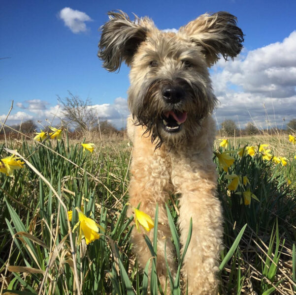
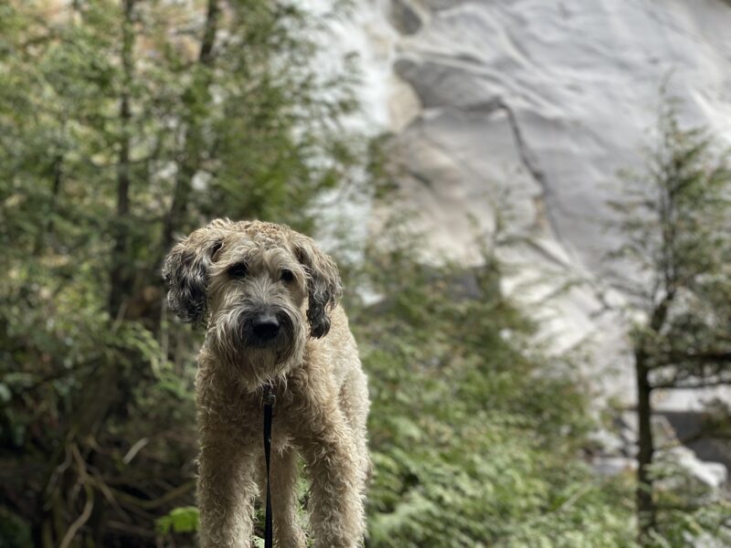
My derpy little buddy enjoying spring weather in 2017
One fortunate thing is that my planned Scotland vacation has me off work for almost three weeks, and if Chester makes it that long, I plan to spoil him and spend as much time with him as I can over that time.
Another fortunate thing: my airfare was fully refundable (thank you for that, at least, Covid).
Last week I did better than I expected with my fitness goals, considering that A) I was working a cycle of midnight shifts, and B) Chester ended up in the hospital. Both of those factors contributed mightily to an elevated resting heartrate!
Here are the details for the previous week:
Stats for 1 May – 7 May, 2022
Steps: 96394 (avg 13771) up 11% from last week
Floors: 328 (avg 68) up 26% from last week
Calories burned: 21754 (avg 3108) no change from last week
Average resting heart rate: 51.1 (down from 52.1 the week before)
And for this week:
Stats for 8 May – 14 May, 2022
Steps: 95284 (avg 13612) down 1% from last week
Floors: 252 (avg 36) down 23% from last week
Calories burned: 21905 (avg 3129) up 1% from last week
Average resting heart rate: 53.7 (up from 51.1 the week before)
Here it is Friday again, and my weekly update was due on Sunday. Only three days until my trip to Scotland, but it looks like there is a chance I will cancel the trip.
Our eight year old dog, Chester, is not doing well. He has had kidney problems (protein-losing nephropathy – PLN) for a couple of years now, but his issues have taken a drastic turn for the worse. Over the last couple of weeks, he lost his appetite, and we had to keep tempting him with various foods to convince him to eat.
Two days ago, he stopped drinking. Yesterday we took him to the animal hospital, where he is on IV fluids. His latest blood tests show that his kidneys have mostly stopped functioning. We are not sure what has caused the sudden worsening of his condition.
It’s possible that Chester has only a few days to live. If that is the case, I will be canceling my trip to Scotland. Hopefully, he will recover from this, and go on to live a few more happy days, weeks, months… Who knows?
At the moment, I don’t feel up to writing about my exercise, my steps, my heartrate…
I’ll just finish this post with a photo of Chester from our walk on Tuesday.
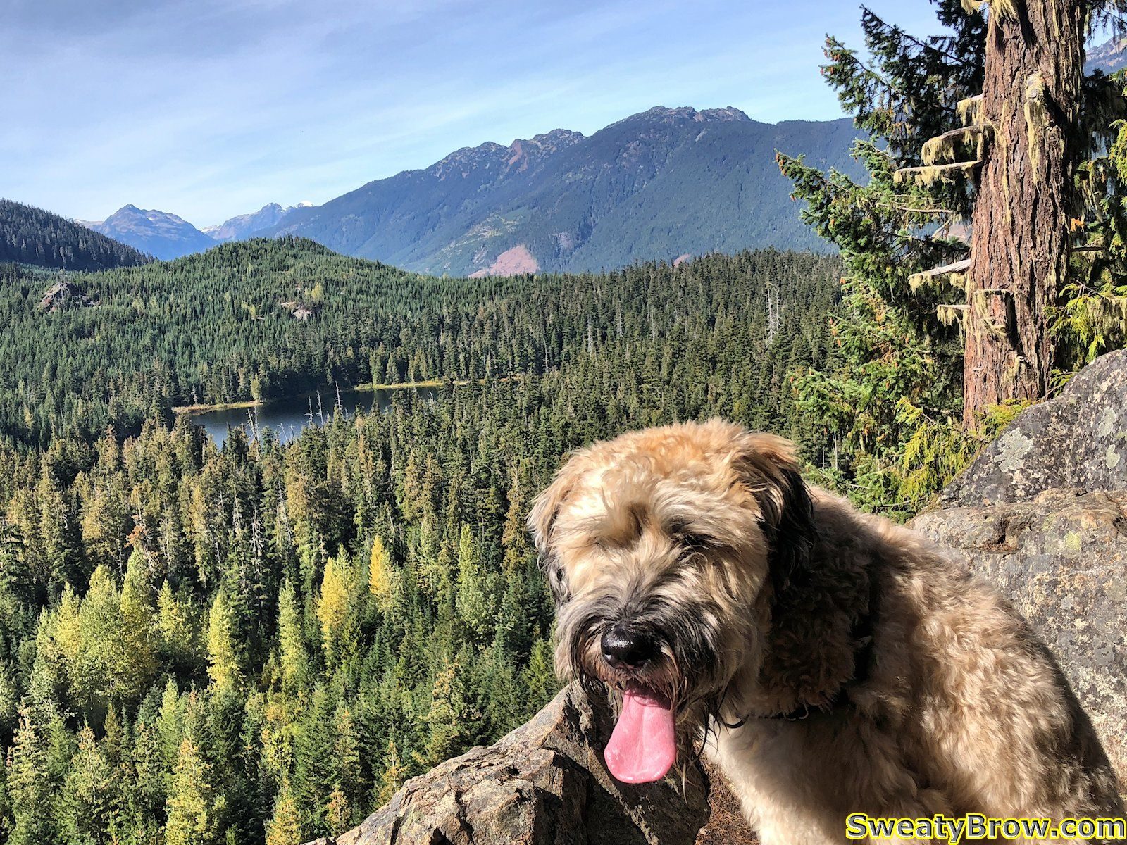
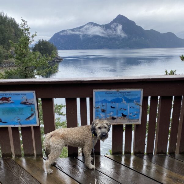
Chester at Lily Point, Point Roberts WA 10 May 2022
This is coming up quickly! I’ve written most of my weekly updates on Sunday (my weekly Fitbit numbers updates run Sunday to Saturday) but this time I’ve put it off until Monday. Which means that it in exactly two weeks from today I will be departing to Scotland for a two-week hiking/scrambling trip!
This past week I have not been as active as I would have liked. My Fitbit numbers are down across the board, and my resting heartrate is up. Still, I’m feeling better about the upcoming trip than I did a month ago. I’m planning on covering a lot of ground, and ascending a lot of meters!
I’ve been working on some plans for an itinerary, and currently I have the following climbing goals in my sights:
Stac Pollaidh
Suilven
Central Cuillin Ridge on Skye (including the Inaccessible Pinnacle)
An Teallach
Ledge Route on Ben Nevis, with descent via the CMD Arete
A lot will depend on weather – where it is clear, and when.
Anyway, the past week’s numbers are as follows:
Stats for 17 April – 23 April, 2022
Steps: 86985 (avg 12426) down 28% from last week
Floors: 260 (avg 37) down 52% from last week
Calories burned: 21720 (avg 3103) down 11% from last week
Average resting heart rate: 52.1 (barely up from 52.0 the week before)
Another week has passed, and I’m keeping the movement going – the movement of steps across the ground, that is. Lots of steps, at work, and in the woods. Quite a few stairs climbed at work as well.
This week, I was off Thursday through Saturday. On Thursday I took the dog camping at Porteau Cove, along the road up to Squamish. The weather was nasty when we got there, but cleared up in late afternoon. While it was still raining, we drove into Squamish, and just took a short walk up to the base of Shannon Falls. The falls weren’t really raging, and the rain wasn’t really pouring, and the wind wasn’t really howling. It was a pleasant, short, walk.
Chester posing at a (partial) viewpoint of Shannon Falls.
We returned to Porteau Cove, and spent a while walking around the campground and park.
Chester checking out the view at Porteau Cove.
We had a pleasant fire, as the evening cooled off, and we were in the tent shortly after 8. It began to rain again a short while later, and continued to rain for most of the night. In the morning, however, it had cleared up again, and the rest of the day was very spring-like and almost warm.
After packing up, we headed back to North Vancouver, where we met up with a friend for a hike in between Lynn Valley and Seymour Valley, south of Rice Lake. Around 8 km or so, and a bit of up and down. The dog was tired by the end…
“More stairs???”
Yet another hike on Saturday, as well, with some members of the Swedish Cultural Society. Again, we started at the top of Lynn Valley Road, and hiked the Lynn Loop, via Cedar Mill Trail to the Third Debris Chute, then back down the Headwaters Trail, and on to Rice Lake for a little snack.
All in all, a good week of keeping the steps up, and upping the ante a little bit on elevation gained – flights climbed. My resting heart rate climbed a bit, mostly due to drinking too much on Wednesday night (an evening at the pub with my Swedish class!) and sleeping poorly that night, and while camping. My blood pressure has dropped a bit, as well, which is always a (genetic) concern for me.
Stats for 17 April – 23 April, 2022
Steps: 120075 (avg 17154) up 5% from last week
Floors: 547 (avg78) up 14% from last week
Calories burned: 24362 (avg 3480) up 3% from last week
Average resting heart rate: 51.9 (up from 49.7 the week before)
Some more hiking, a bunch of treadmill time, and new toys.
I bought some new lighter-weight goodies this week. I replaced my old DeLorme InReach SE with a newer Garmin InReach Mini, which cut the weight in half, from about 200g to 103g. I am hoping that the newer one is a little more reliable than the old one was. I was somewhat disappointed that the old one was quite finicky about its view of the sky – sometimes it just did not want to send, even with a good portion of the sky in view.
Old InReach (197g) beside the InReach Mini (103g)
I also bought a new, lighter charging block for charging up my Anker 20000 mAH power bank. The 511 nano is a 20W USB C charger that weighs only 31g. It will charge the power bank fully in 10 hours, so great for a motel stay while on the PCT. Top-ups now and then will keep me going in between.
I ordered a new headlamp, the Petzl Bindi. Only 35g (compared to my BD Spot at about 85g) and has a rechargeable built-in battery, so I don’t have to keep spare AAAs on hand. Helpful on trail, when I’ll always have the power bank along.
Finally, I’d been thinking about trying out new shoes. I’ve been wearing Merrell Moab shoes in the Wide variety for many years now, and they work great for me. I can always rely on the fit, and they take no breaking in whatsoever – I can buy a new pair and take them on a 10 hour hike with no foot issues at all. The downside is that they are very heavy shoes – about 1 kg for the pair.
I have heard a lot about the Altra Lone Peak trail running shoe, and how the footbox is very wide. Knowing that I have a very wide foot, I was hoping that the shoes would fit me well. I went to Mountain Equipment Co-op, and tried on a pair. They felt so good on my feet, without having to size-up for the width, that I bought a pair immediately. Worth a try!
I used the shoes on the treadmill, initially, doing 90 minutes at 3 mph (stupid imperial treadmill) at a six to twelve percent grade. The shoes felt great, so I’ve tried them out on some trails, walking the dog, for an hour at a time, twice now. Today, I finally spent the whole day in them, at work. So far, so good! We’ll see how they hold up for some more serious hiking in coming weeks.
Anyway, the weekly totals are down a bit from last week, but I’m still pretty happy overall. The best thing is that the work is showing real benefits in my resting heart rate. January through March, my resting rate averaged 52 -53, and so far in April (as of the 17th) it is averaging just under 50. Much better, and more like it should be!
Stats for 10 April – 16 April, 2022
Steps: 114261 (avg 16323) down 5% from last week
Floors: 478 (avg 68) up 26% from last week
Calories burned: 23610 (avg 3373) down 2% from last week
Average resting heart rate: 49.7 (down from 50.1 the week before)
Sunday and Monday were busy days, again, with helping the in-laws move. Both evenings, though, I made a serious effort to build up the steps on the treadmill. Keep in mind, I don’t really run on the thing; mostly just walk in the 3-3.5 mph range, with a 4-10% grade.
On Monday night, I revisited a concert video that a work friend told me about a couple years ago. In the late 80’s and early 90’s, I was a huge fan of the band The Pixies. This video was taken in 1991, the band’s heyday, at the Brixton Academy. The quality is excellent, and the music just gives me so much energy. I spend 40 minutes oscillating between a steady walk and frantic trot, depending on the tempo and energy of the songs. Many calories were burned, and a smile was etched on my furrowed, wrinkly gob.
Tuesday I took a trip out to North Vancouver and spend about 4 1/2 hours on the Baden-Powell Trail, hiking from Skyline Drive into Lynn Valley, around the Lynn Loop, and then back to Skyline. 18 km, 690 m elevation gain/loss, and 3.5 hours of fat burning and cardio time. Weather was cool, but pleasant, and the day ended up with over 28,000 steps. Nice!
On Thursday, I had my Swedish class, which takes place at the Scandinavian Cultural Centre in Burnaby. It is very close to Burnaby Lake, so I loaded about 20 pounds into my backpack, and headed out early to walk around the lake prior to class. The loop was 10 km, and took a little under two hours.
Overall, a good week. Here are the Fitbit stats for the week:
Stats for 3 April – 9 April, 2022
Steps: 120794 (avg 17256) up 33% from last week
Floors: 380 (avg 54) up 225% from last week
Calories burned: 24214 (avg 3459) up 8% from last week
Well, it’s been a busy week of helping my in-laws move, but that is almost done. Hoping that I’ll actually be able to get away for a hike later in the week, on Tuesday or Thursday (I’m working on Wednesday, Friday, Saturday and beyond.)
In the middle of last week I decided that it is important to get in my steps every day. So the goal, for the time being, is to manage 12,000 steps on at least 6 out of 7 days a week, burn 3000 calories or more a day, and to total 100,000 steps per week. I didn’t manage it last week, but I’ve got my hopes up for this week!
Today (Sunday) I watched a few videos on YouTube by “Old Man and the AT” – Mike Current (trail name: Energizer). Mike hiked the PCT in 2020, at the same age I’ll be when heading out there, and absolutely nailed it. His video on preparing mentally to hike the AT this year is just excellent. I also watched his video on physically preparing for the trail, but that one was a little tougher for me. A large part of it is that my bad left knee won’t let me do any running for cardio, but for that I plan to keep working up on my elliptical time, and steep hikes. I also don’t really have the time to hike for a few hours a day right now. I’ll just have to do as much as I can, and be persistent.
I’ve been sampling a few different PCT YouTubers this year, and having a hard time selecting what I’d like to keep watching. Shaky footage; way too much walking with wide-angle, vertigo inducing camera work; inconsistent sound volume levels; people who don’t seem all that serious, hiking 6-8 miles a day, day after day. I guess I’m pretty demanding, but I’m sure I’ll settle on a couple of accounts that will offer what I’m after…
Anyway, here is this week’s rundown of Fitbit stats for the past week:
So, with about one year until I (attempt to?) make the transition from a regular working Joe to a long distance hiker, I want to start logging regular updates here… I’ll try to do so every weekend. A bit about exercise, a bit about experiences, a bit about gear and planning.
This past week, I didn’t get as many steps in as I’d like to have, but some of them were pretty high quality. I went for a walk/hike with my friends Åsa and Karine at Mundy Park in Coquitlam, and managed about 16000 steps, on Sunday. On Tuesday, I spent about 3 hours walking on the Baden-Powell Trail with my dog Chester. Got 14000 steps in, and 142 floors.
I spent a lot of the week working, and getting in the range of 4-6000 steps a day. Today (Saturday) I was supposed to go for a hike with some folks from the Swedish Cultural Society, up in West Vancouver. However, I ended up agreeing to work a midnight shift on Friday night, so wasn’t up for a hike today. When I finally woke up, I did a lot of chores around the house, then spent 45 minutes on the treadmill (I only walk, on a steep incline) and elliptical trainer. Managed over 12000 steps today, while watching YouTube videos of people starting their PCT journeys this year, and some hill-walking videos from Scotland.
I’ve had some knee pain over the past month or two, but it is starting to ease off as I begin to do a little bit more exercise. Whether that’s because the knee it toughening up, or simply becoming numb to the pain, I’m not sure. I was quite worried for a while, both about my hiking this year (Scotland in 7 weeks!) and the thought of 2650 miles of hiking next year. But I’ll take it as it goes, and hope to keep things strong and stable throughout.
I’m updating this post a week later, because I’m going to be including my weekly Fitbit totals in this weekly updates. The totals will run from Sunday through Saturday. Here goes:
According to my (current) grand plan, one year from today, 22 March 2023, will be my last working day at my current job. Almost exactly 31 years after I began my training as an air traffic controller, I will be making my final transmission to an aircraft.
Unfortunately, I’ve let myself get a little bit out of shape over the past year, despite a couple of good trips last summer and fall. This gives me a year to get into “post-career” shape. And why am I keen to get into better shape for my retirement? Because I plan to hike!
The purpose behind retiring at that time of year is quite simply so that I can leave my job, and begin a five-month long hike.
I intend to fly down to the US/Mexican border, and walk all the way, via the Pacific Crest Trail, home to Canada, where I will begin my life without work.
A lot of people say that hiking the 2650 miles (4265 km) of the PCT is a life-changing experience. I figure, why not do so when my life is about to undergo one of the most dramatic changes in my day-to-day life that I will ever experience?
Plans for this summer
I already have a few adventures planned for the next few months.
Two weeks in Scotland in May
A week in the Rockies in July
A trip around the Bowron Lakes Canoe Circuit in September
Hopefully, a trip up to Lake Lovelywater this summer
I hope to be a little more regular in updating this blog, documenting both my ongoing adventures, and my preparations for one of the biggest undertakings I expect I’ll ever set out on.
Don’t know whether anyone will read this, but I really want to chronicle it somewhere, even if it is only for myself.
It was the morning of June 10, and I had covered about 67 km of the West Highland Way. I was up fairly early, and after a couple of fairly rough days at the start of the route, I felt like I was starting to hit my stride. I picked up a couple of things in the wee shop in the Beinglas Farm campground, and made some breakfast in the well equipped campers’ kitchen.
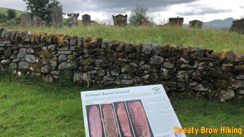
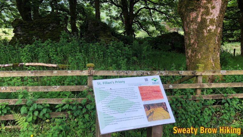
I was soon on my way, and began covering some distance. After about 15 km, there are some signs as you pass through a place called Kirkton. They point out an old burial ground dating back to the 8th century, and the ruins of an old priory dating to the 13th century. I love seeing this kind of history!
If watching Time Team has taught me anything, it’s that old burial grounds are pretty cool.Old ruins that have been mostly reclaimed by foliage and trees. There is history everywhere around here.
I passed through the little town of Tyndrum around 1:30 or so, and stopped in at the Tyndrum Inn for a pint of Guinness. There was a dog sitting at its owner’s feet over at the bar, which I just loved. How I wish we could take our dogs in to pubs at home…
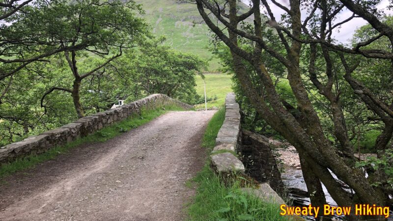
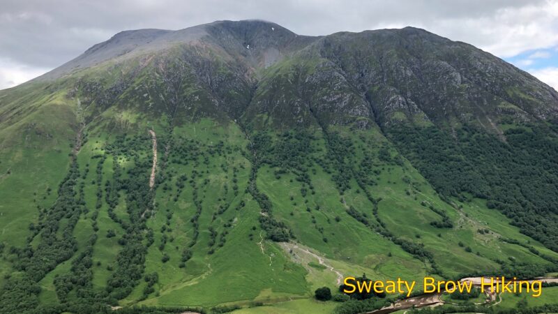
Crossing the Allt Kinglass on an 18th Century bridge, north of Tyndrum. The mountain climbing out of frame ahead is Beinn Dorain, a Munro of 1076 m elevation.
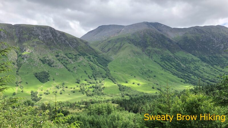
I think that the Guinness, much like Red Bull is supposed to, gave me wings. I continued through Bridge of Orchy, and along to Inveroran. A couple of hundred meters past the Inveroran Hotel, there is a small field beside a bridge over a small stream called Allt Tolaghan. This field is used for “wild camping” – that is to say, camping in an area that is not a serviced campground.
Descending a long gentle grade to Inveroran. The cluster of white buildings just left of centre is the Inveroran Hotel, a 19th century drover’s inn. The wild camping area is beyond the trees behind the hotel.
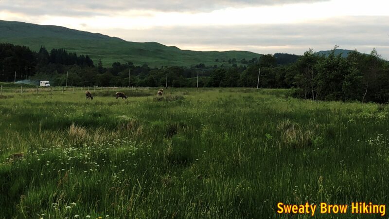
When I arrived and set up my tent, there were a couple of young women camping there as well. We sat together for a little while and chatted. One of the women was from Japan, but had lived in Scotland a few years previously, and was back to visit, traveling with a Scottish friend. I had the feeling there was possibly something romantic between them, but who knows? We didn’t stay out long visiting, because as the day approached night, the midges became pretty much unbearable, as they had been throughout the trip.
As I was heading back to my tent, a few deer wandered into the field beside the camping area, browsing in the grass and along the side of the stream, and I took a couple of photos.
Deer browsing in the field beside the wild camping area.
I had covered 34 km this day, and was asleep before dark. (Of course dark wasn’t until almost 11 in mid-June, at that latitude!)
Day 5
It was now Monday morning, June 11, and I had covered a little over 100 km of the West Highland Way, leaving just over 50 km to Fort William. I was up and on my way quite early (for me) at about 7:45. I wanted to get the balance of the trip done by Tuesday evening, as the weather was supposed to take a turn for the worse on Wednesday.
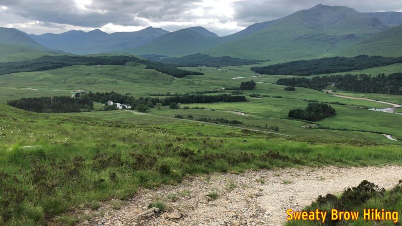
Climbing away from Inveroran and Loch Tulla, up toward Rannoch Moor.
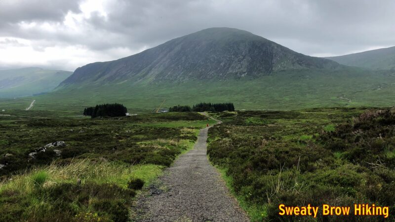
This was one of my favourite days on the trail, due to the scenery on the way. It was a fairly steady pull uphill for the first couple of hours, up and over a shoulder of a mountain at the Glencoe Mountain Resort, a ski area near Kingshouse, on Rannoch Moor. The trail then drops down to the Kingshouse Hotel, which was under renovation when I was there, so I wasn’t able to stop for a big fancy meal. The restrooms were open, though, so that was quite pleasant.
Dropping down into Kingshouse. The hotel is down among the trees. The mountain beyond is Beinn a’ Chrulaiste.
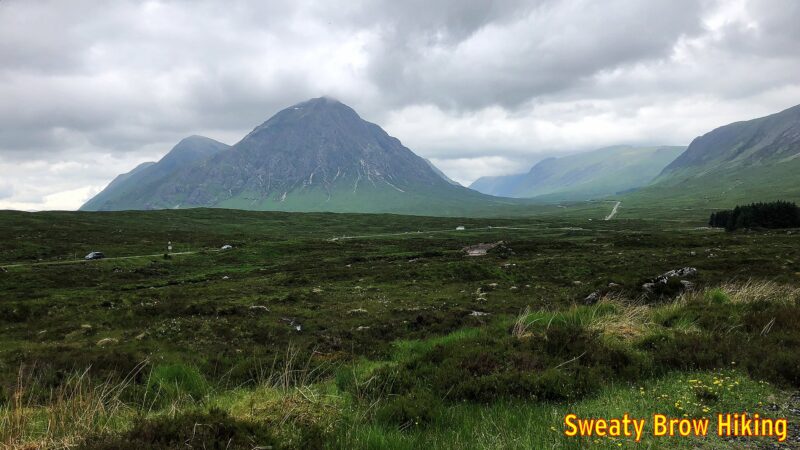
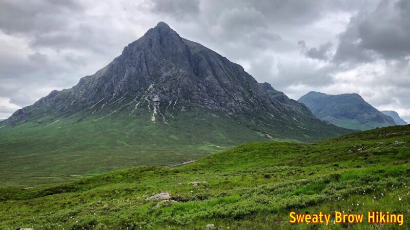
From Kingshouse, the trail continues across Rannoch Moor toward one of the most recognizable, and beautiful, mountains in Scotland: Buachaille Etive Mor.
One of my first views of Buachaille Etive Mor, while approaching Kingshouse. The renowned Glen Coe is the large rounded valley to the right of the mountain.A gorgeous view of Buachaille Etive Mor.
As I hiked towards this captivating view, I was so distracted that I missed a turn on the trail. I continued until the gravel path I was on met up with, and crossed, the A82. I realized that the WHW stayed on the north side of the A82 along here, and figured out my mistake. I had to backtrack about 400 meters to get back on route. At least it wasn’t further…
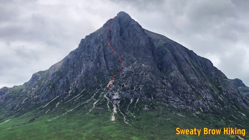
I later learned that Buachaille Etive Mor (“The great shepherd of Glen Etive”) has one of the most famous scrambles in Scotland up its flanks – Curved Ridge – and I swore I would come back to climb it. (Less than a year later, I did!)
This zoomed in view shows the approximate route of Curved Ridge, up the mountain.
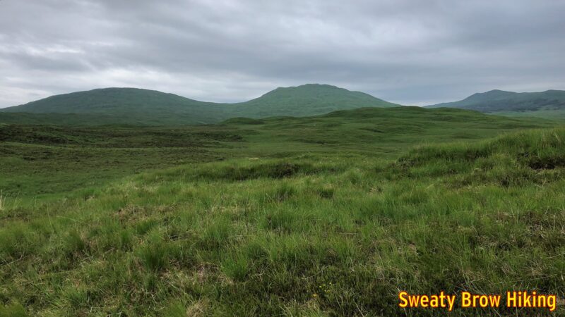
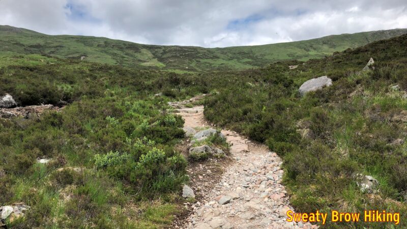
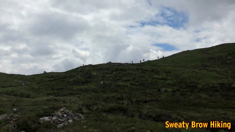
Back to the present, however, and the trail traversed along across the valley from the Buachaille, just uphill from the A82, offering great views along the way. Suddenly, just as the roadway turns down the top of the famed Glen Coe, the trail veers off to the right, and starts up the infamous Devil’s Staircase. Over the course of about 1.5 km, it gains about 250m. Now, that’s not a massively steep climb when you’re used to hoofing up BC’s coastal mountains – or the Munros of Scotland – but it does come as a bit of shock after a pleasant ramble along Rannoch Moor.
Getting started up the Devil’s Staircase. So far, so good.Some people heading up the Devil’s Staircase.
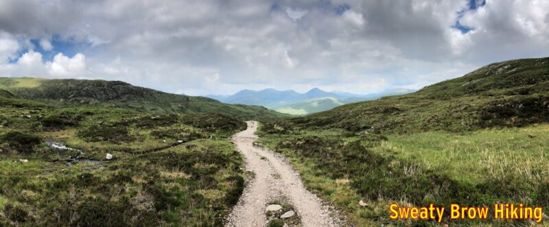
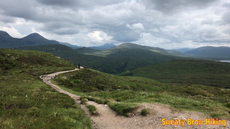
The Devil’s Staircase takes you up and over a mountain pass, then drops down into the valley of the River Leven. On the way, there are some great views, first to the left, where you can see the south side of Glen Coe, then to the right, across the Blackwater Reservoir. As you descend into Kinlochleven, there are views ahead of the Mamores, a series of Munros to the north.
Coming over the top of the Devil’s Staircase, with views opening up. And starting to round the corner toward Kinlochleven. The edge of the Blackwater Reservoir is visible on the right.Starting the descent to Kinlochleven, some peaks of the Mamores range come into view across the valley.
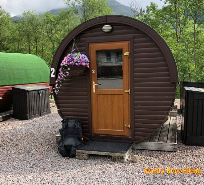
As I was hiking for the day, I decided to book a night in a camping pod at Kinlochleven. The pods looked very cozy, and I could get away from the midges! I covered about 30 km this day, and arrived in Kinlochleven around 3 PM.
My cozy “glamping” pod for the night, at the Blackwater Hostel.
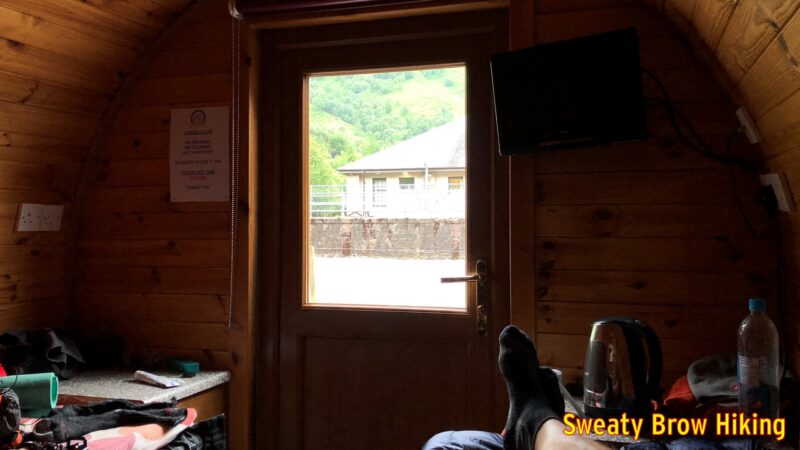
The place was very nice, with good shower and eating facilities, and the pod was quite pleasant. However, it had warmed up a lot that day, and it was actually very hot and stuffy inside the pod. The thing I couldn’t believe was that the midges seemed able to get into the pod somehow. I had a window open, but it had mesh across it. Maybe the mesh wasn’t fine enough.
Relaxing in my little wooden tube. This was before the midges infiltrated.
I lay upon the bed, on top of my quilt, trying to cool off, but the midges just kept attacking. I looked like I had measles, from all the bites on my torso. Over the past few days I’d learned that the midges don’t really emerge until the very end of May, and (as a bonus) that May is pretty much the driest month in the Scottish Highlands. I texted my wife that I would never camp or hike in Scotland in June ever again…
As the evening went on, I had a hard time deciding between being entirely under the covers, and sweltering, or staying uncovered and being bitten. Even after closing the window, and smacking every midge I could spot, it took hours before they thinned out enough to sit comfortably on top of my quilt. By about 1:30 AM, I was able to fall deeply asleep.
Day 6
This was it – the final day on the West Highland Way. The alarm woke me from a deep sleep at 8:00 AM. I had some breakfast and packed up my things. By 9 I set off to cover the last 25 km to Fort William.
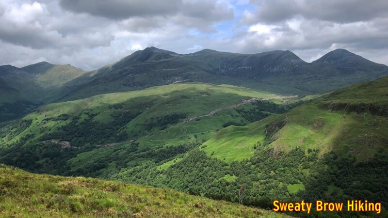
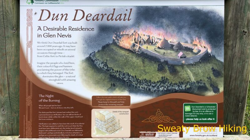
After a couple of hours, I rounded a curve in a valley, to where Ben Nevis (the UK’s tallest mountain) should be visible, but the summit was wreathed in cloud. A short time later, I broke off from the trail to hike a short, steep spur up to an old Iron Age hill fort, Dun Deardail. The fort was built over 2000 years ago, and destroyed by fire sometime between 100 and 200 years later.
A sign depicting how the old hill fort would have appeared upon the brink its demise.
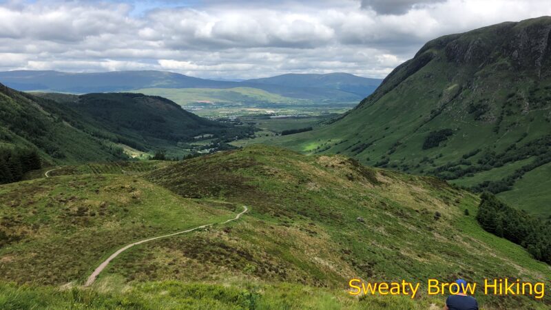
There wasn’t much to be seen at the hill fort, just a raised embankment in a roughly oval shape, with some stone projecting up out of the soil. The views across to Ben Nevis, and down the valley toward Fort William were quite spectacular, though!
Looking down Glen Nevis, toward Fort William (around the corner, to the left).Looking across toward Ben Nevis from the hill fort location.
I continued down the trail toward Glen Nevis, the valley that leads to Fort William, and arrived at the visitor centre around 1:15 PM. I bought a drink and some crisps, and enjoyed them outside on a bench. Refreshed, I continued the final 4 km into Fort William.
Another view toward Ben Nevis, from further down the glen.
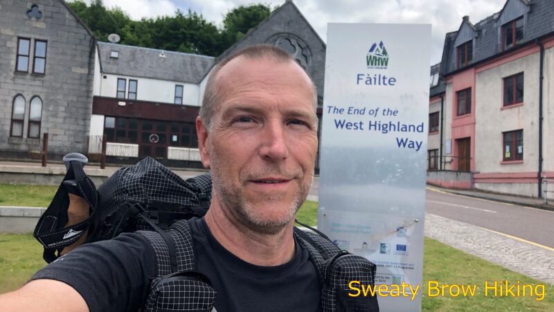
I strolled through town, and arrived at the end point of the West Highland Way at 2:30, tired and happy to be done – and to have done it! It was time to hit the pub!