Wedgemount Lake – Camping and Hiking/Scrambling

Monday, the 30 July, 2018, I hiked up to Wedgemount Lake, in Garibaldi Provincial Park, intending to stay for three nights. The hike was rather grueling, and was done in very hot, sunny weather. Distance was about 7 km (just under 5 miles), according to all the websites I read (I didn’t bother tracking it on my GPS) with an elevation gain of almost 1200 m (4000 feet).

Nearing the top of the trail to Wedgemount Lake, just over the ridgeline ahead.
Cresting the hill, arriving at Wedgemount Lake

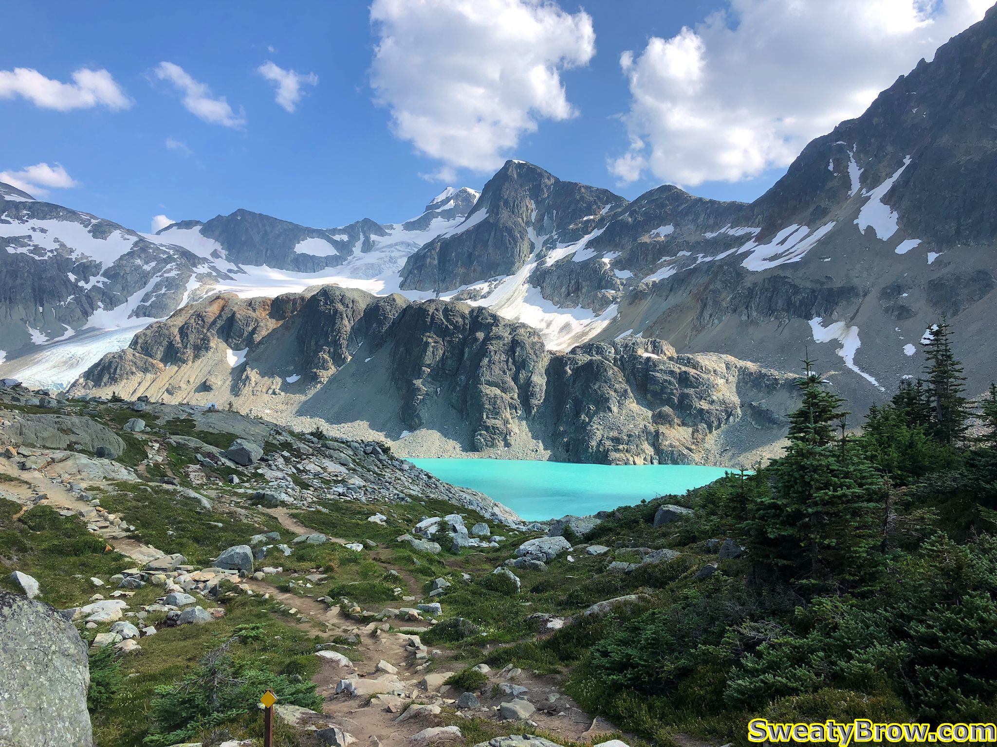
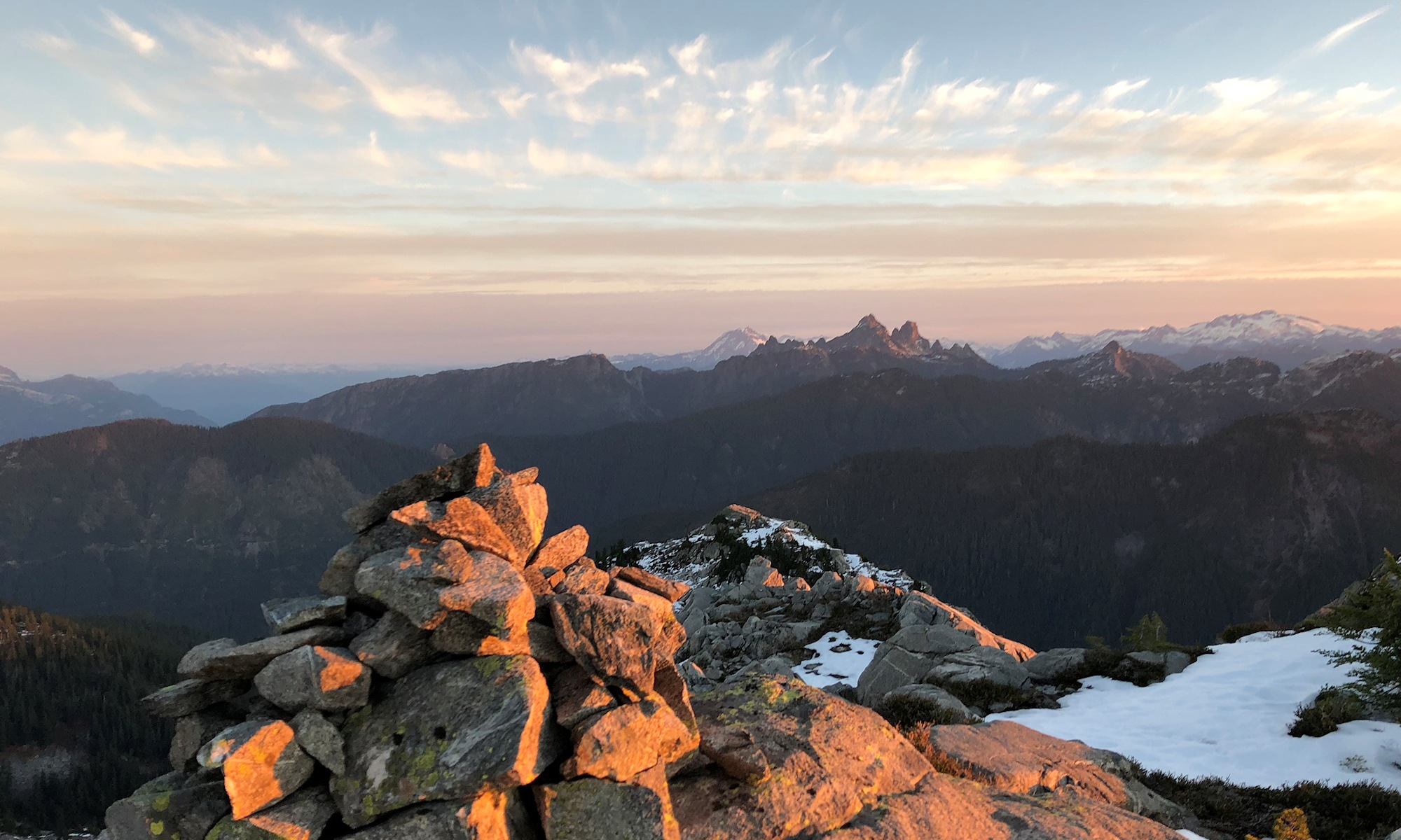
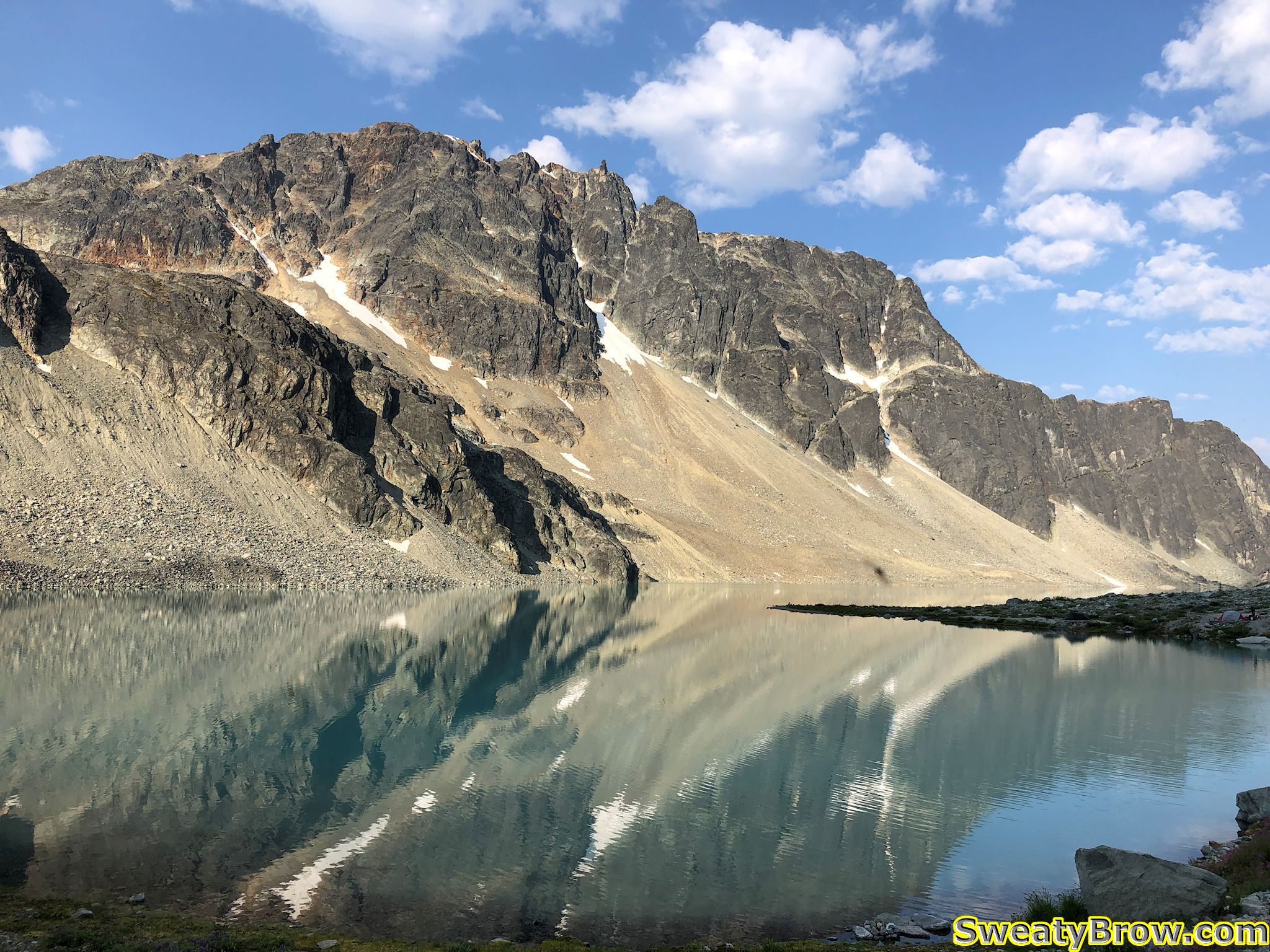
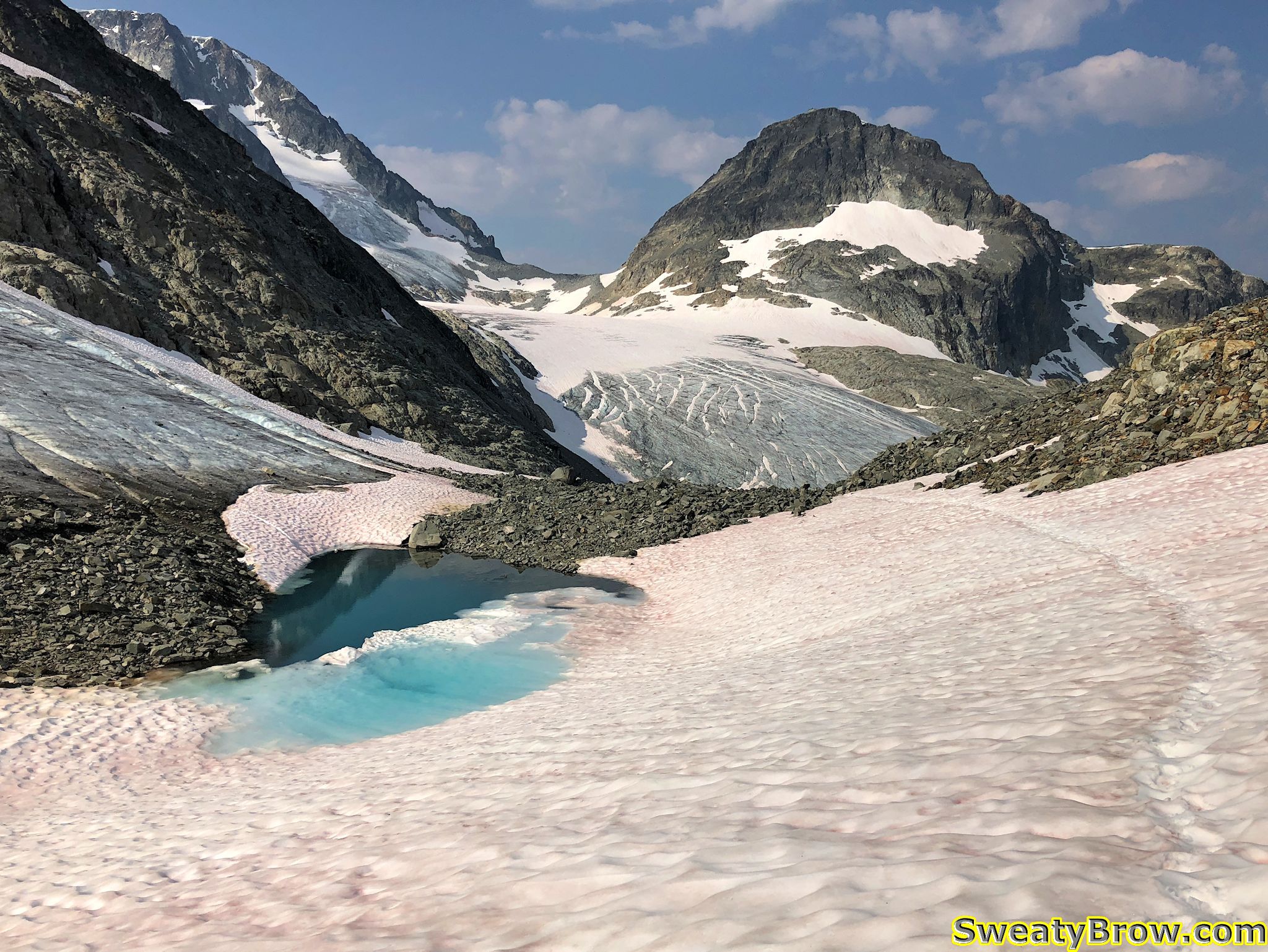
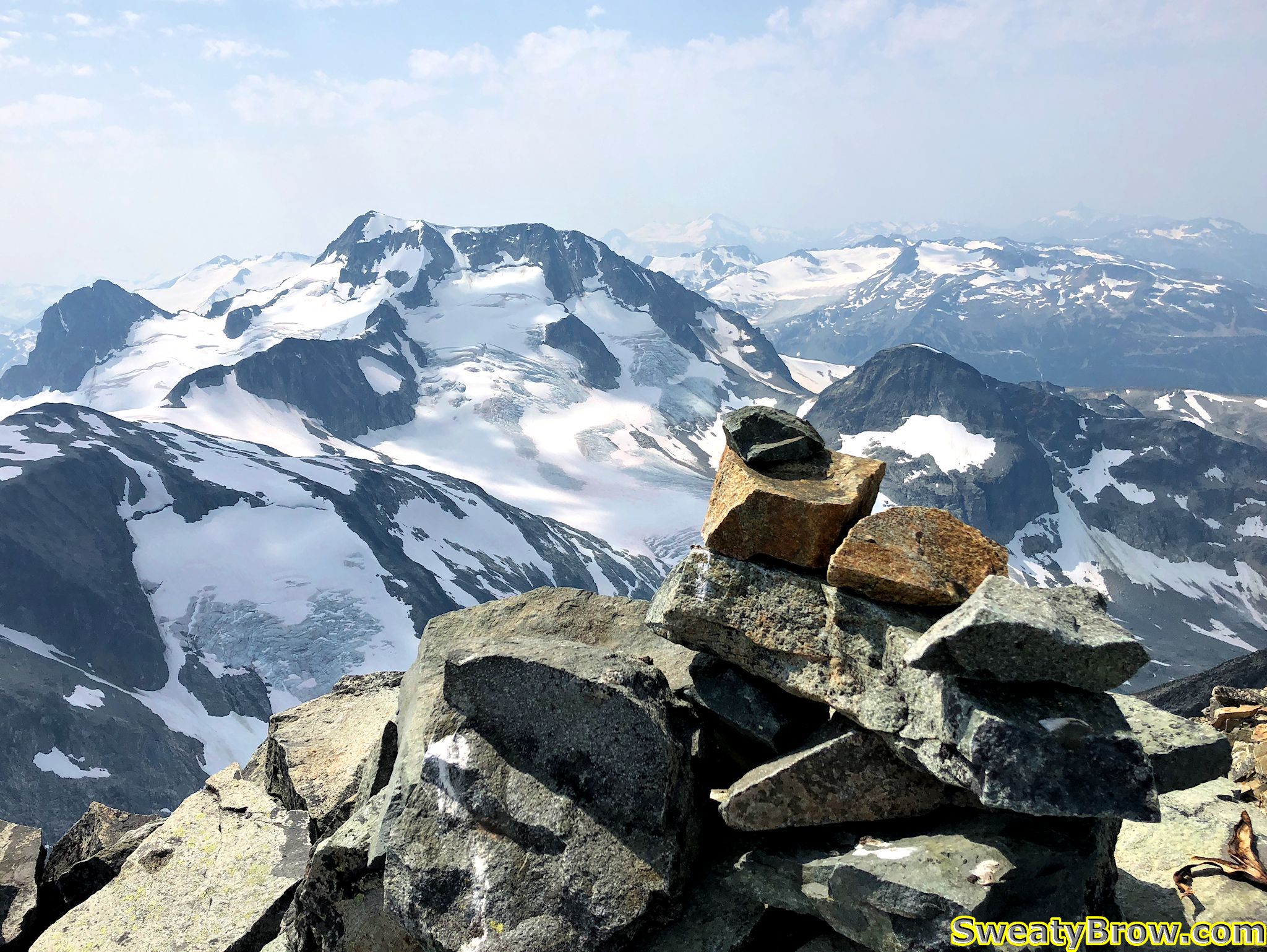
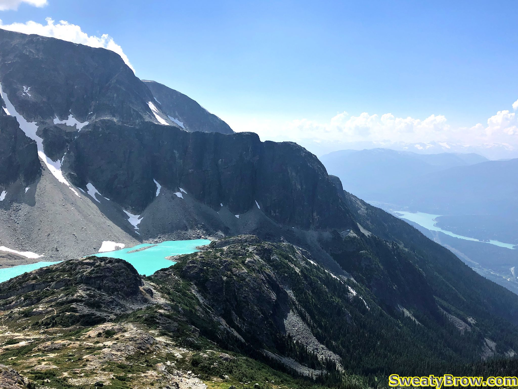
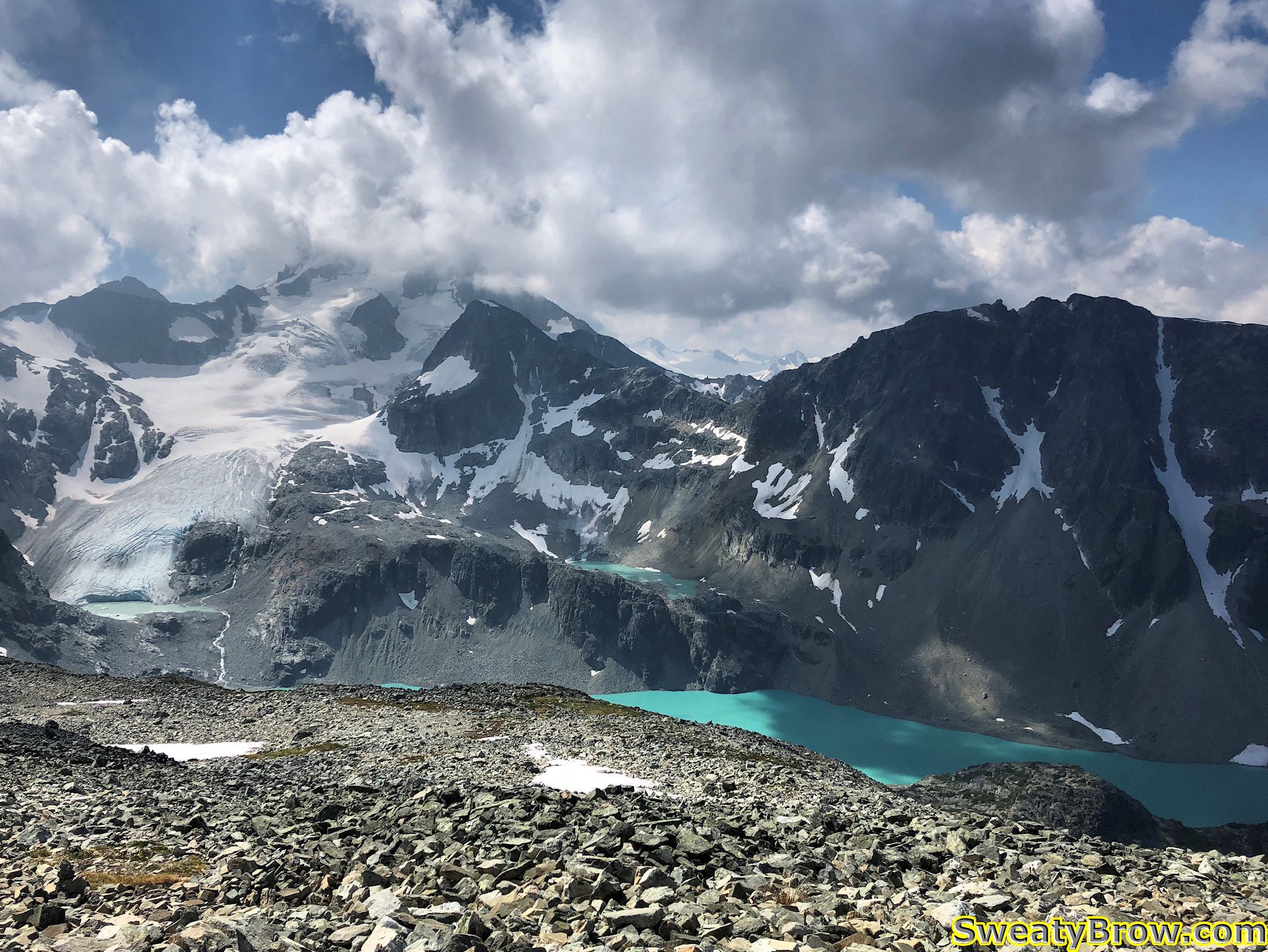
It took me 2 hours 45 minutes to the hut, and another 1 km along the lake (in 15 minutes) to get to my camping spot. The lake is just gorgeous, set within a circle of imposing mountains – to the southeast, Wedge Mountain, the highest mountain in Garibaldi Provincial Park, with Parkhurst mountain to the west of it, and the imposing Mount Rethel directly south of the Wedgemount Hut itself. To the northeast is Mount Weart, the second highest peak in the park, after Wedge. From much of the lake, the peak itself is not visible, due to a subsidiary peak (very daunting, itself) in between. And west of Weart is Mount Cook, directly north of the hut, which appears as a large ridge dominating the northern skyline.

A view of Mount Rethel from my campsite alongside Wedgemount Lake, July 2018
Mount Weart, behind a sibsidiary peak, viewed from east of Wedgemount Hut.

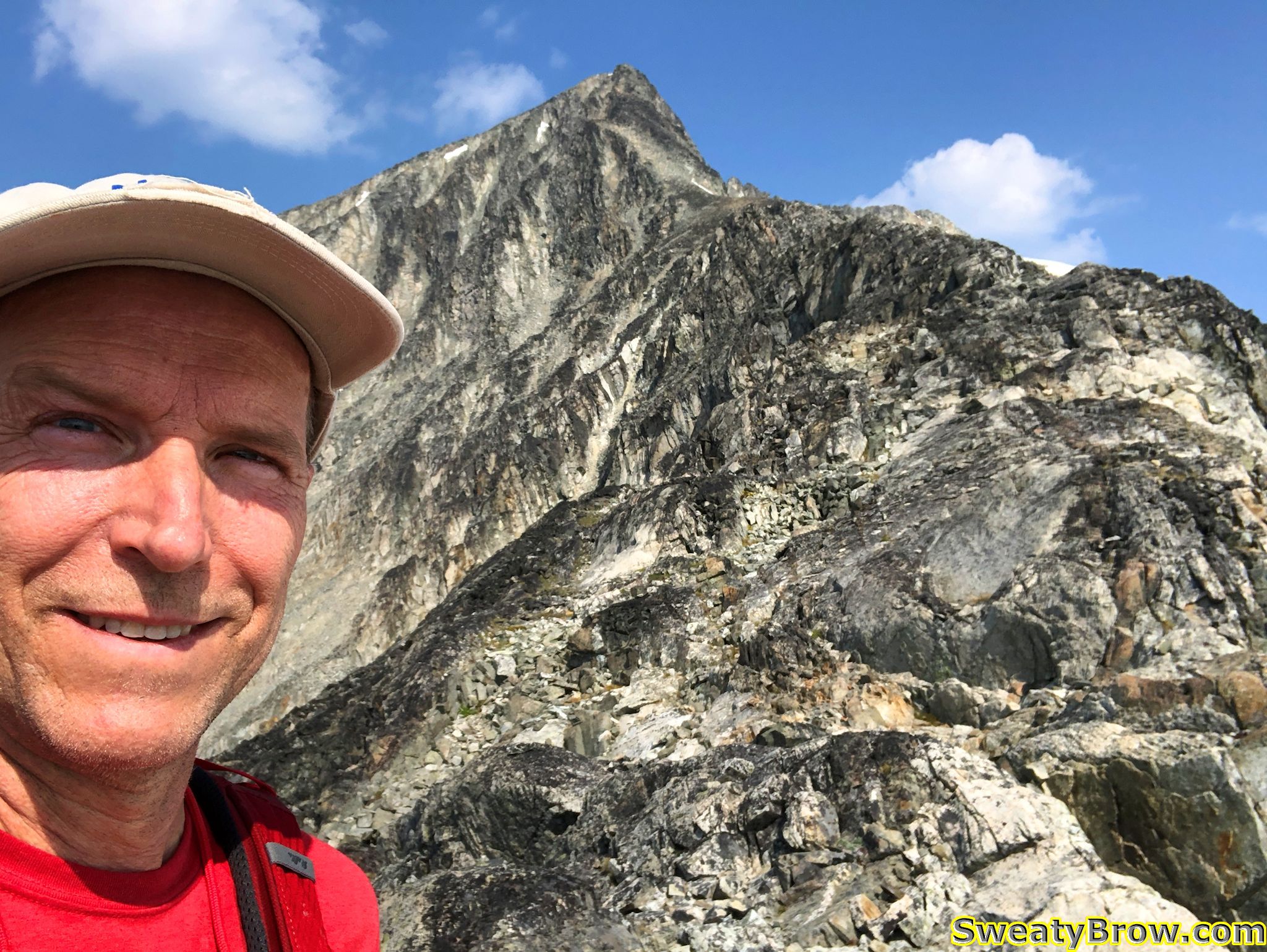
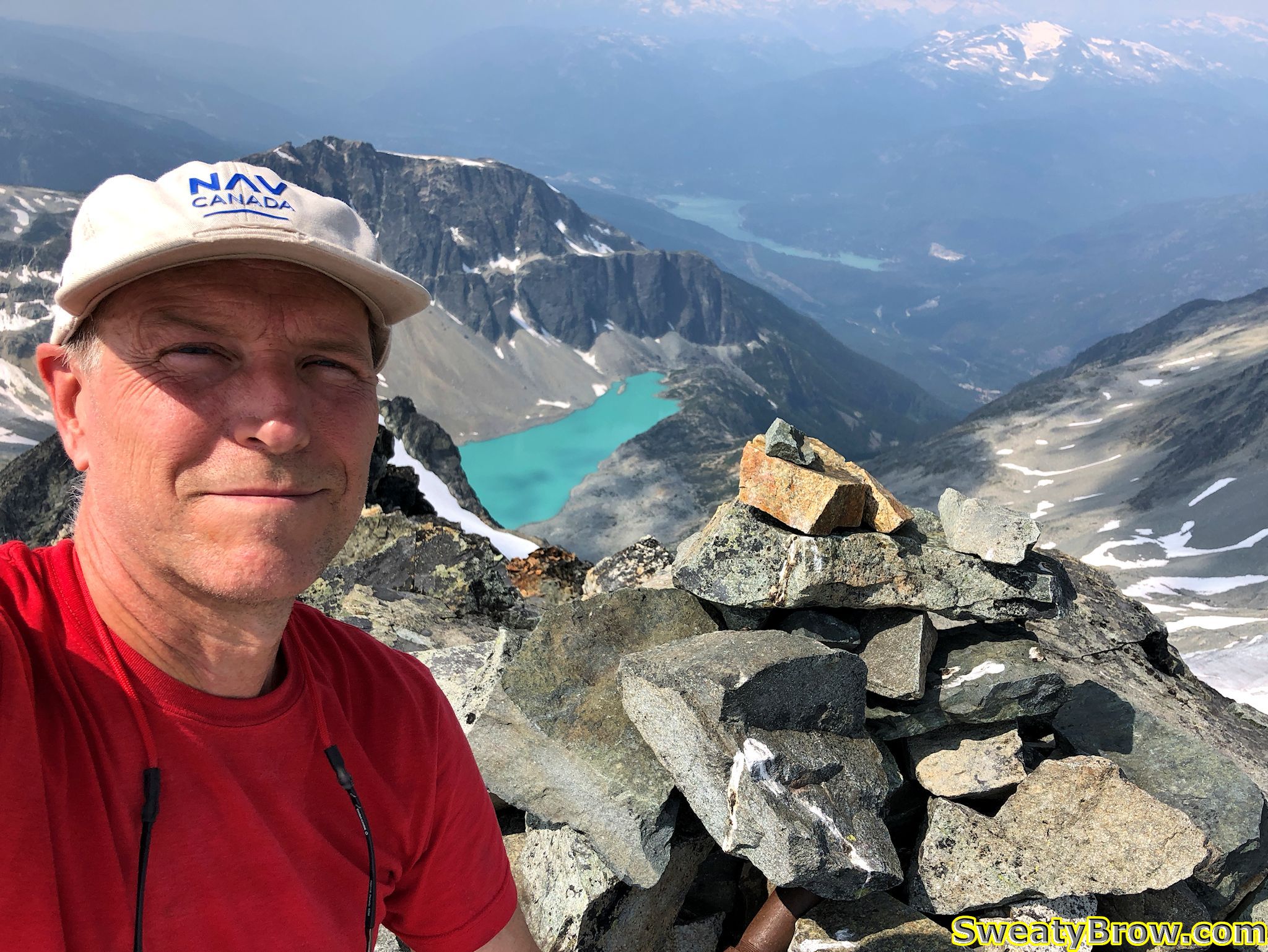
On Tuesday morning, I hiked up to Mount Weart, which tops out at 2835 m (9301 feet). The round trip was a little over 7 km, with a gain (and subsequent loss!) of almost 980 meters. The trip took 7 1/2 hours, of which an hour and a half was spent on the summit (enjoying lunch, taking photos, re-applying sunscreen, and generally soaking up the ambiance).

The bottom of Wedgemount Glacier, east of Wedgemount Lake.
A view from higher up the route
A view from higher up the route, with the glacier on the left, and Wedgemount Lake farther beyond on the right.
Some snow, higher on the route to Mount Weart.
Climbing toward the ridgeline on Mount Weart. Still smiling!
Finally on top of the southeast ridge of Mount Weart.
Finally on top of the southeast ridge of Mount Weart. About half an hour or so to the summit…
Looking back down the ridge, when nearing the summit of Mount Weart.

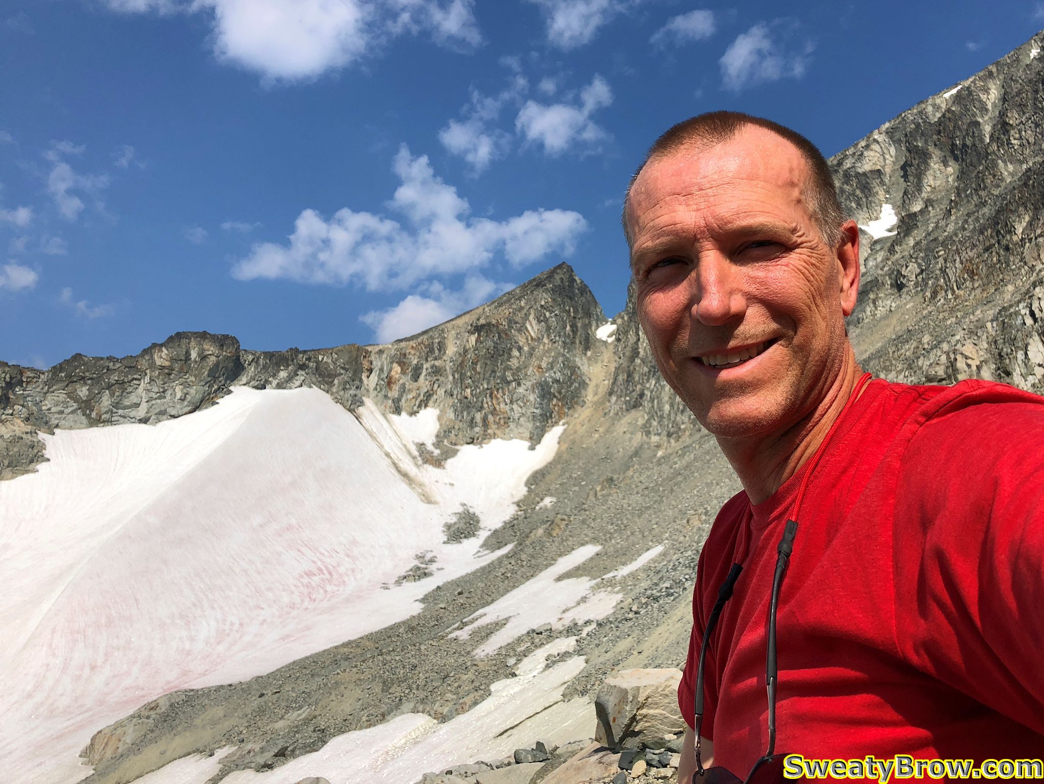
On the summit, I took some photos, and sat to enjoy lunch. I also discovered that I had cell service, so I contacted my wife, and then posted a photo to Instagram. (Did it really happen, otherwise?)

The cairn atop Mount Weart, with Wedge Mountain beyond.
Summit of Mount Weart, with Wedgemount Lake below.

I also met up with a couple that arrived a little while after me, at the summit of Mount Weart. We had discussed, down at the lake, whether they had time to do the hike or not, since they had commitments later that evening, in Whistler. They decided to give it a go, and were glad they did! I think they ended up being late for their barbecue, but it was, most assuredly, worth it!

On the summit of Mount Weart, with new friends!

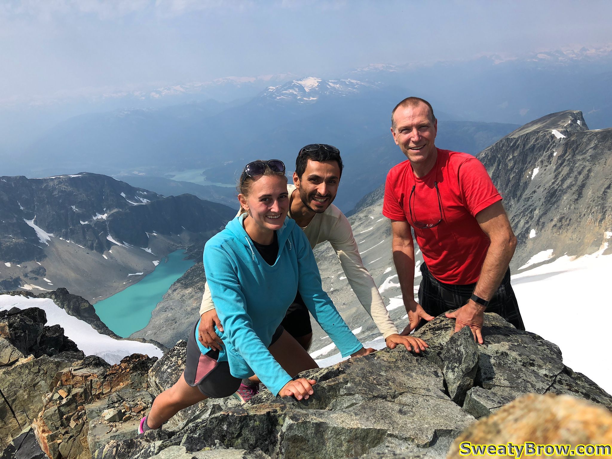
The trip back down the mountain was fairly arduous, and took almost as long as the ascent. I started down just after these new friends, and caught up to them on the ridge. We walked for a while together, but they stopped for a while when we reached the snow slopes below the headwall.

Descending below the headwall of Mount Weart.

I continued on my own, checking behind me once in a while, seeing how they were progressing as well.  There was a lot of very loose rock, particularly just below those snow slopes.  At one point, I felt a large boulder that I stepped on begin to shift, and I leapt forward to firmer ground. The boulder let loose, and carried another, both of them about 75-100 cm in diameter, downhill. They hit some larger rocks 10 meters down the slope, an shattered into pieces. I hit my foot hard when landing on solid ground, and still feel the bruising in my heel while writing this 10 days later… Could have been much worse!

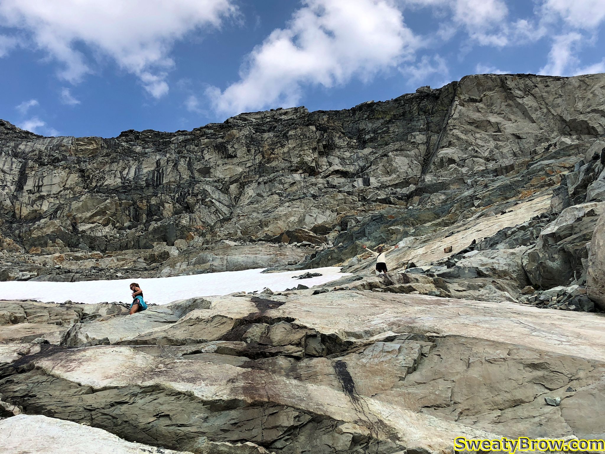
When just reaching the edge of the glacier, and prior to the route turning further west (where I could no longer see them), I watched until the other guys got below what I considered to be the trickiest part of the route – a series of cliffy steps beside a steep waterfall. When they appeared to be past the worst of that, I continued along much easier terrain back to camp. I saw them head past my tent a while later, looking tired, but very pleased with the day!

Tuesday evening, after climbing Mount Weart, camping alongside Wedgemount Lake.

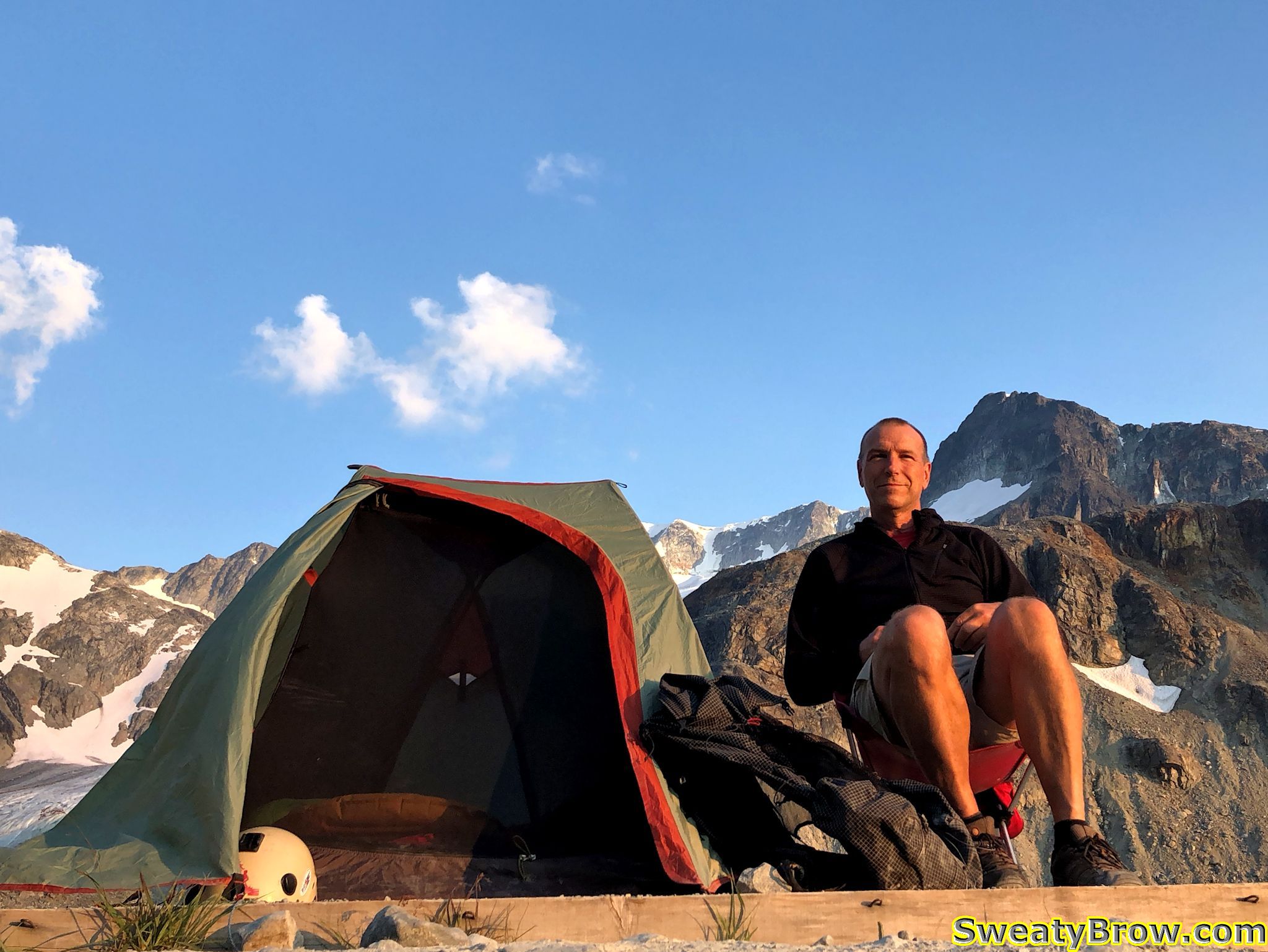
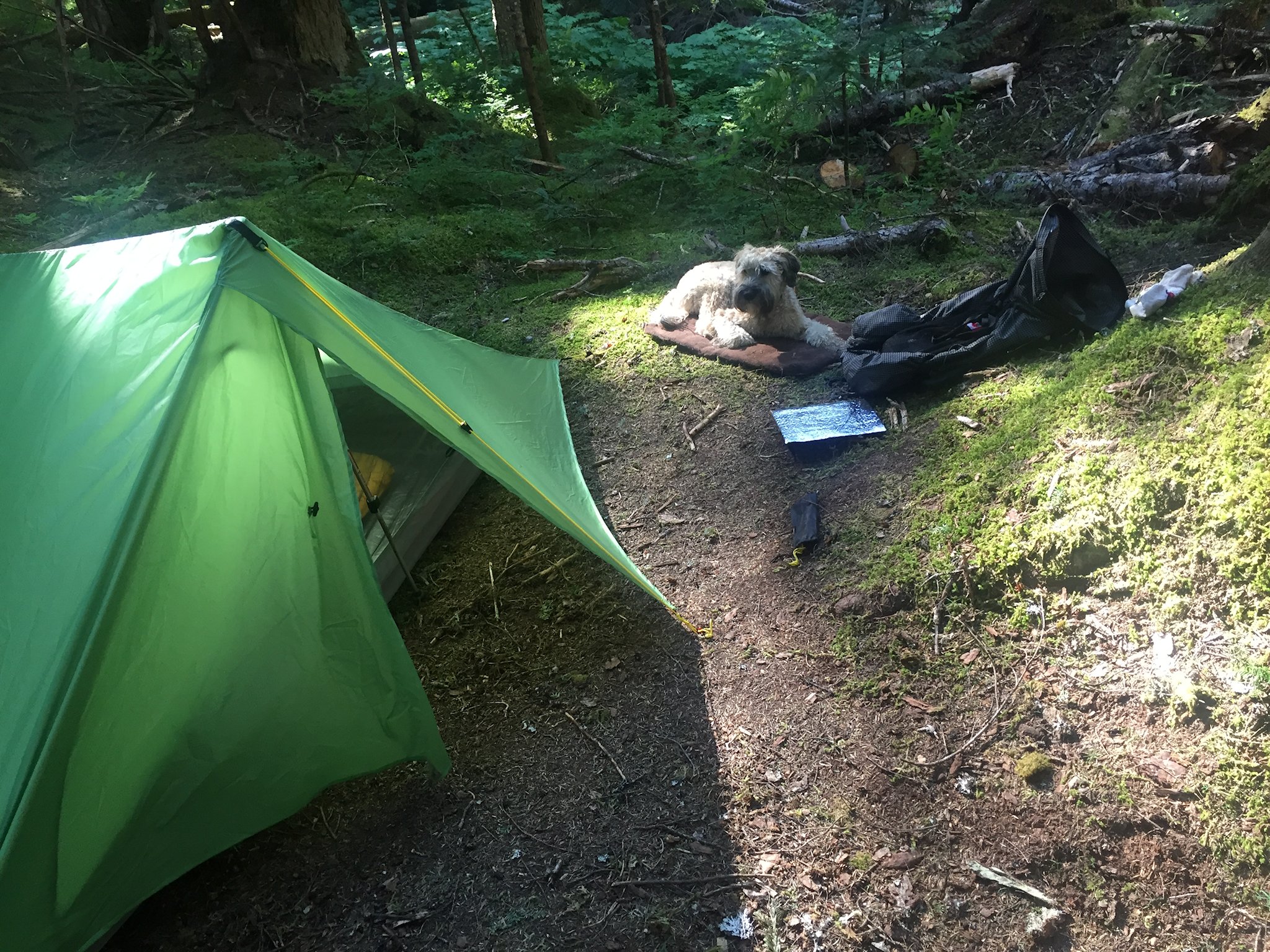
For the first time, I carried my lightweight camp chair (only $26 USD on Amazon.com!) on a backpacking trip. Light, small, and comfortable. Unfortunately, the horseflies were ferocious while at camp, and the wind just wasn’t strong enough to keep them off – and Deet was useless. I ended up spending most of my time inside the tent, despite the heat. (I had to lift the edges of the tent fly significantly for better ventilation from the occasional wafts of breeze.)

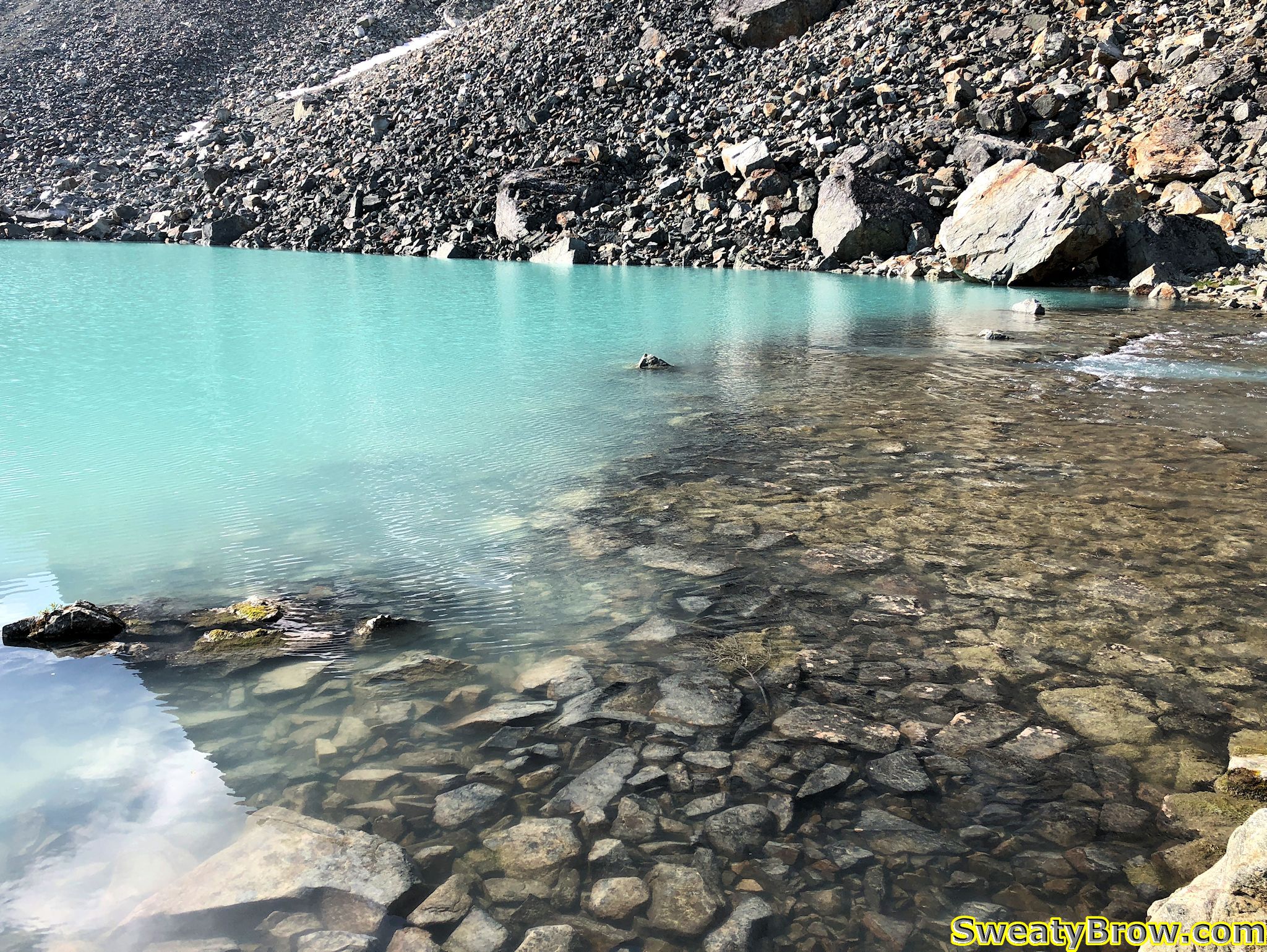
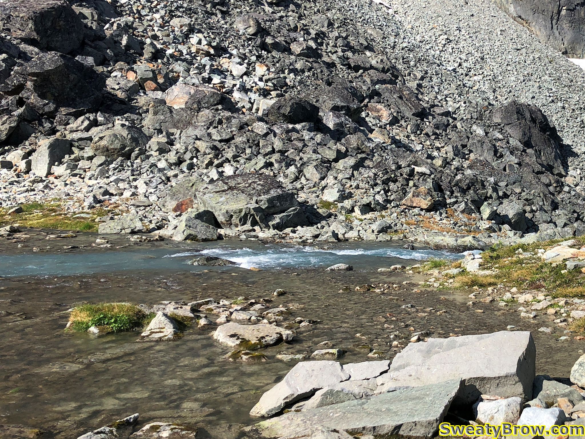
Wednesday morning, I was planning to head up Mount Rethel. It is located on the other side of the lake, and requires you to cross the outlet of the lake, then cross a long scree slope along the lake, before heading up some steep snow slopes. I packed up my ice axe and micro-spike trail crampons, and set you. After about a half an hour of hunting around, I finally found my way to the lake’s outlet.

Unfortunately, the traverse of the outlet was a little more than I had bargained for.  I was hoping for a few boulders that I could carefully negotiate. What I found was either: 1) lower down, a raging torrent with huge gaps between boulders, or 2) higher up, a wide (15-20 m)  expanse of shallow (maybe 15-20 cm), slower moving water with jagged, rocky footing. There really wasn’t a spot that I could “boulder hop” across.  If I had had some sandals/crocs and maybe hiking poles, I would have crossed it, but there was no way I could do it in bare feet. The footing was too sharp, and if I lost my balance and fell, there was a chance I could be quite hurt, or worse, carried into the torrent below.

The outlet of Wedgemount Lake, higher up, where it was wide and shallow, but very rocky.
A view showing where the outlet of Wedgemount Lake becomes narrower, faster, and deeper.

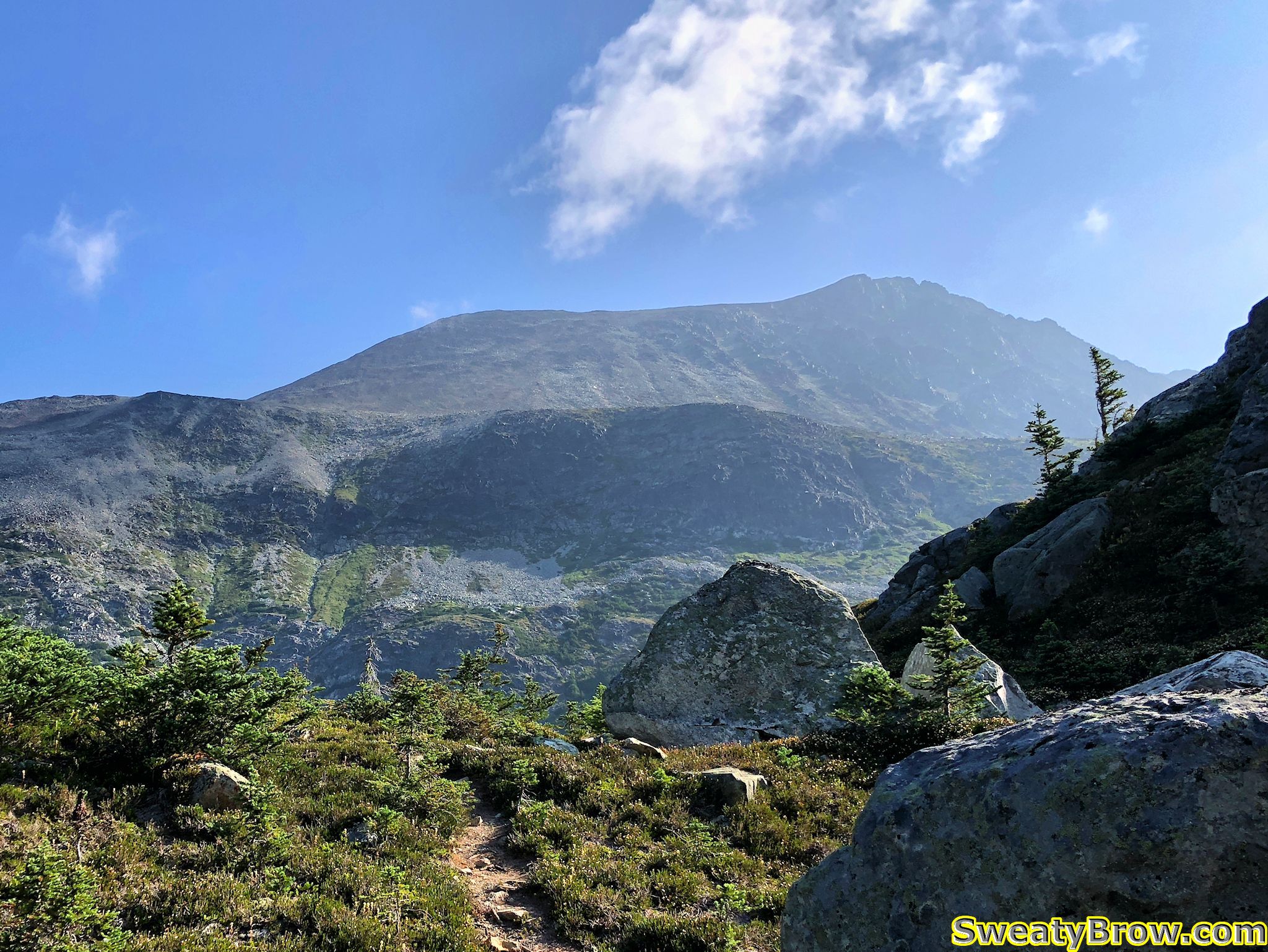
I decided to change my goal for the day, and head up Mount Cook. It was the mountain that I had planned to hike up on Thursday morning, prior to hiking packing up and hiking back to the car. I turned around, and started up Cook instead. Unfortunately, I carried the extra weight of the trail crampons and ice axe, which would not be needed on that hike. Oh well…

My first really good view of Mount Cook, after leaving the outlet of Wedgemount Creek. West Summit on the left side of the ridge, true summit on the right.

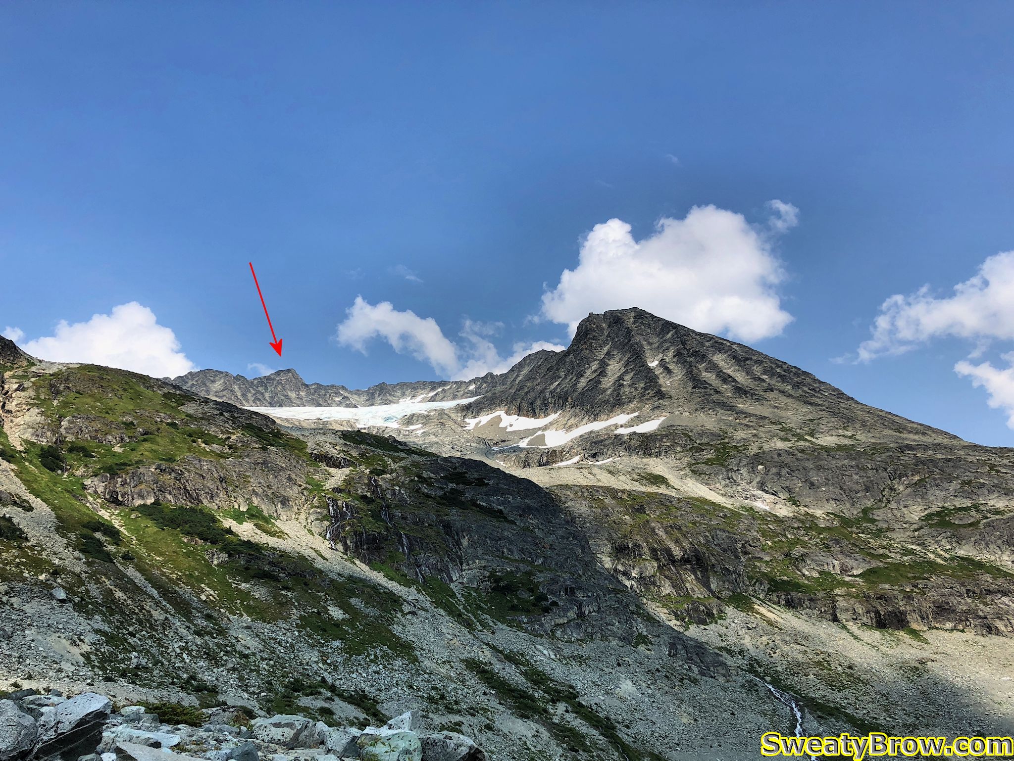
The other problem with the change in destination is that I didn’t bring the beta along with me. Now, the beta was pretty simple – along the lines of, “go up a junipery and bouldery gully to a scree slope, go uphill, turn right, and keep going.” But there was a photo of the approach, with an arrow, giving the gist of the route. I didn’t have that with me – and I got it wrong…

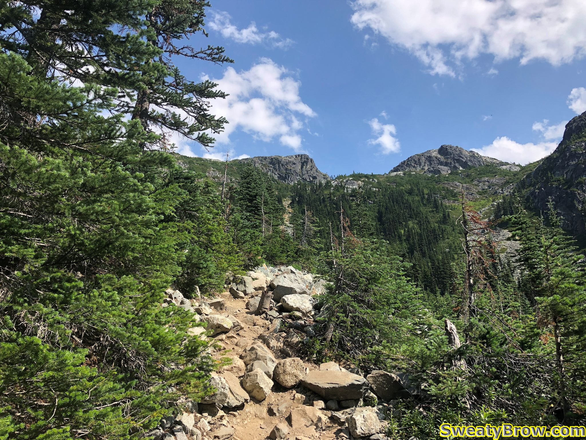
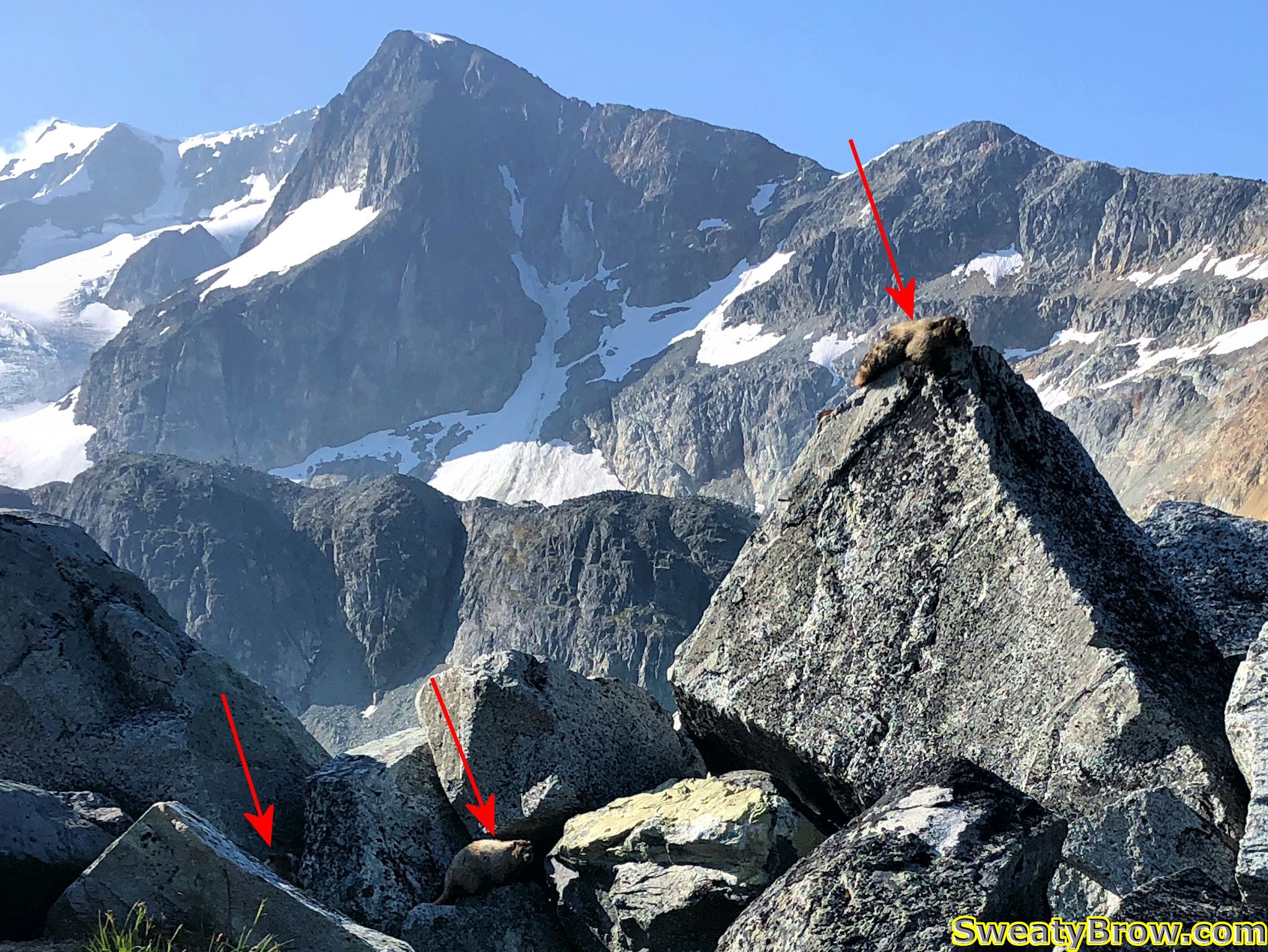
To begin with, the route I took was fine.  I headed back past the hut, and followed a trail toward the slopes heading north. On the way, a trio of marmots curiously peeked at me…

A trio of marmots
Three marmots looking at me from alongside the trail. Can’t see them all? Click the photo to see a full size version with arrows pointing them out!

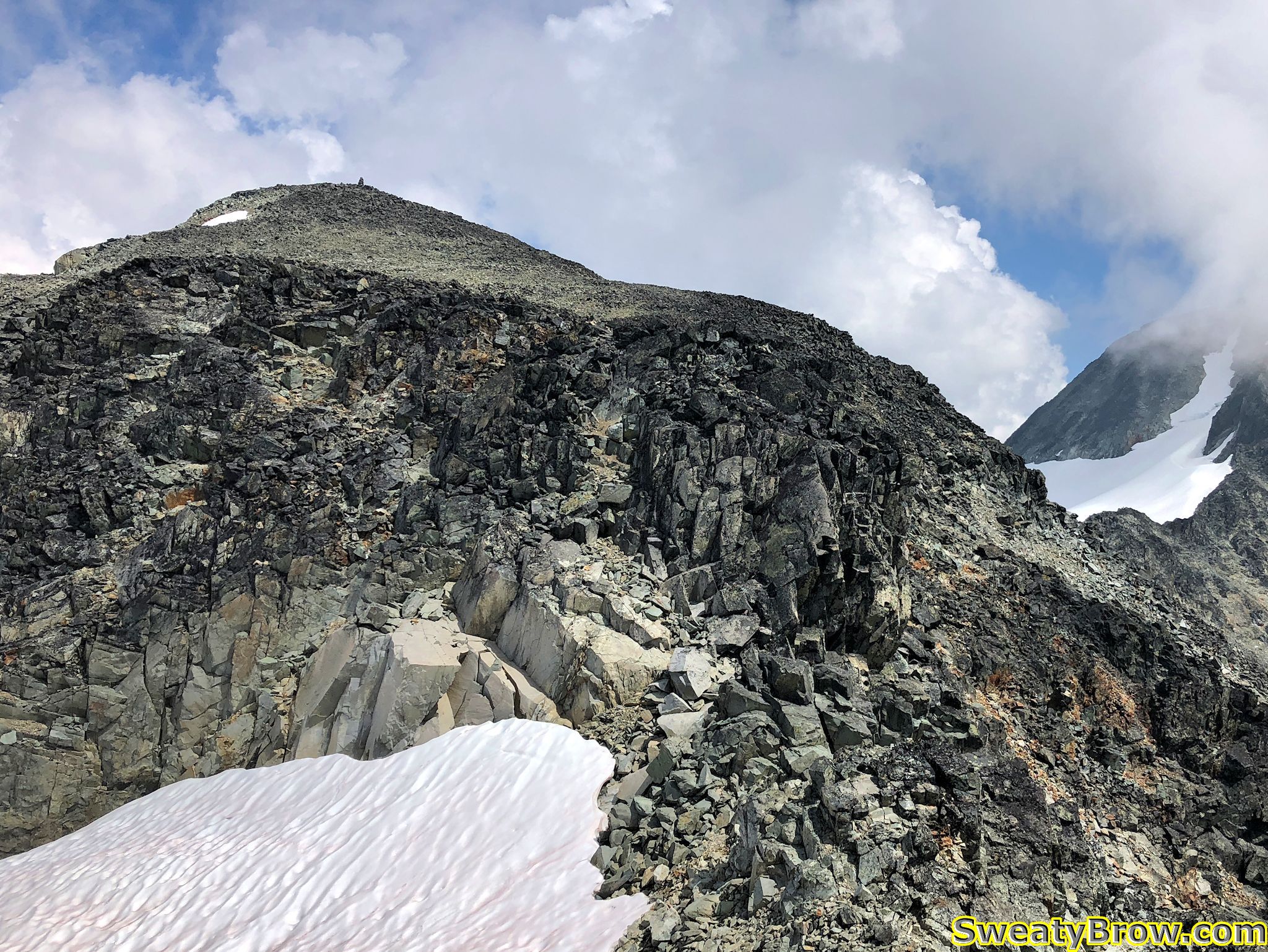
Turns out I went too far left, too soon. The route I took got me there, but it was not pretty. Lots of bashing through a nasty bunch of scrubby tree, with terrible footing around them, then up a super steep meadow with boulder chutes, to reach the proper ridgeline.

Looking down at Wedgemount Lake from the scree slopes of Mount Cook.

And speaking of the ridge – it is truly ugly. I have slogged my way up some nasty slopes before, but this was one of the nastiest, slipperiest, most prolonged slog-fests I have ever experienced. In some sections, it felt like every step was about to bring the entire mountain down around me.

An idea of the scree slopes heading up Mount Cook.
An idea of the scree slopes heading up Mount Cook. Very loose and sharp.

The steep ridge brought me to the “west summit”, after which the gently ascending line to the main summit was much nicer. There was even a nice notch to drop down into, and scramble up the other side – that bit was actually quite fun.

West summit of Mount Cook.
Scrambling section prior to the summit of Mount Cook. The route was big and blocky and only slightly exposed.

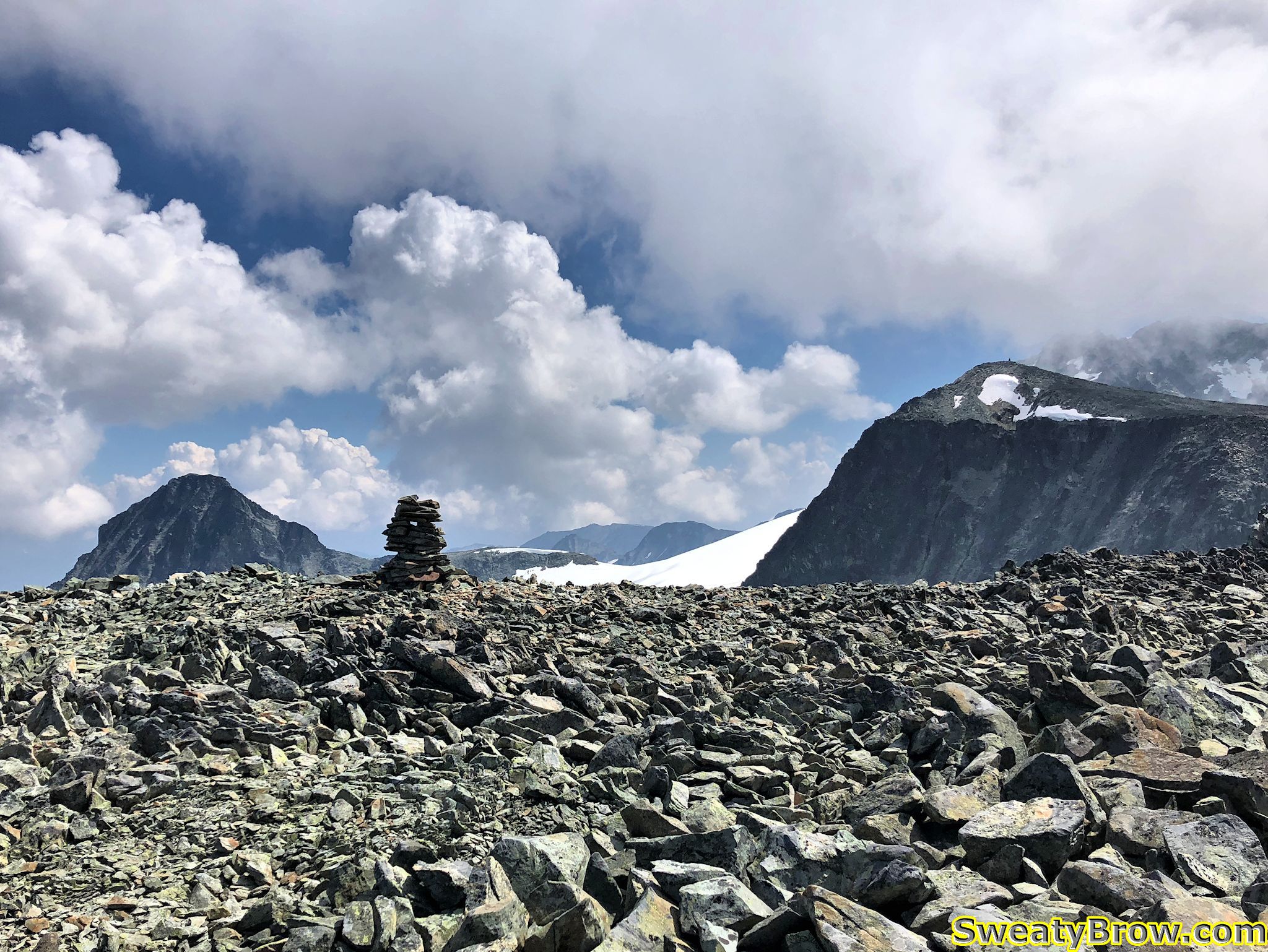
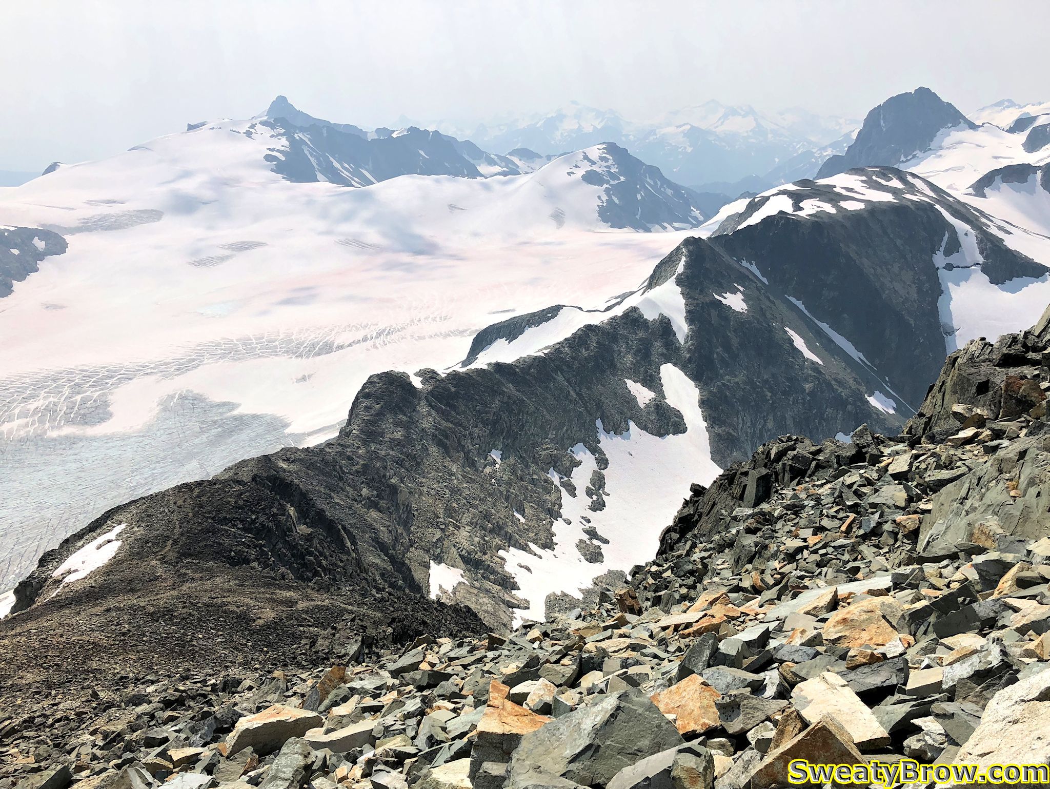
The summit of Mount Cook has great views, but there was a lot of cloud coming into the area from the southeast. Weart played peekaboo through the inconsistent cloud – now you see me, now you don’t. I was glad I’d been up there the day before, rather than this day.

Looking past the summit cairn on Mount Cook toward the summit of Mount Weart.

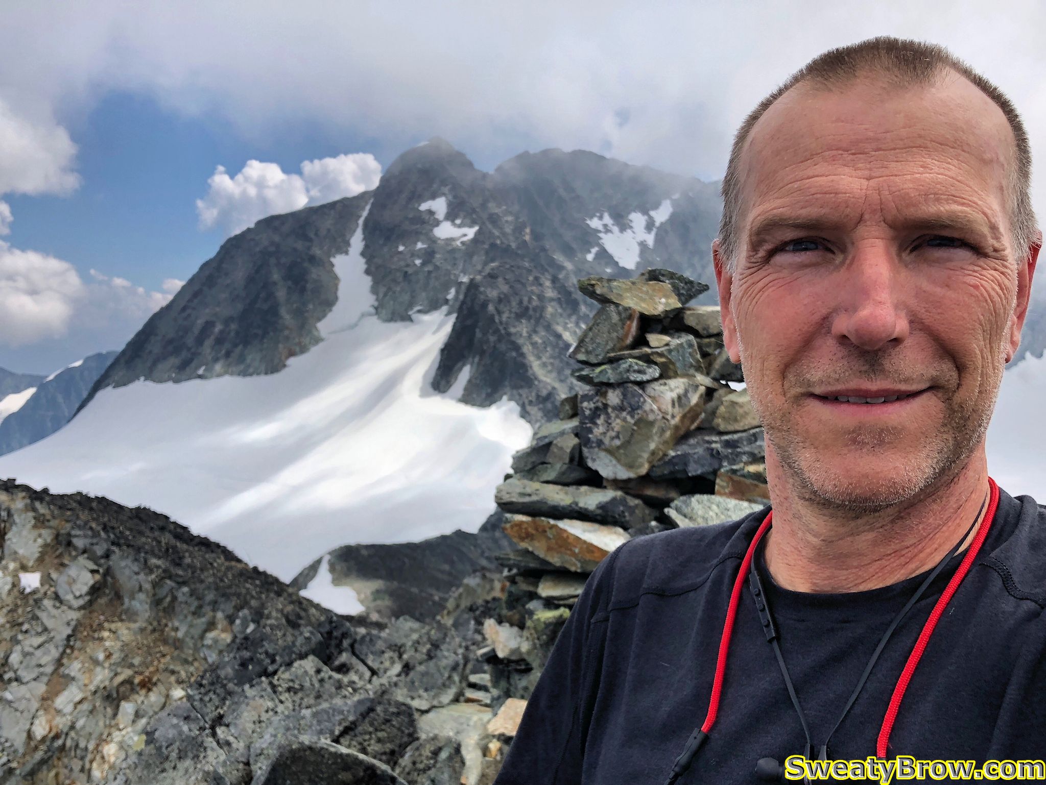
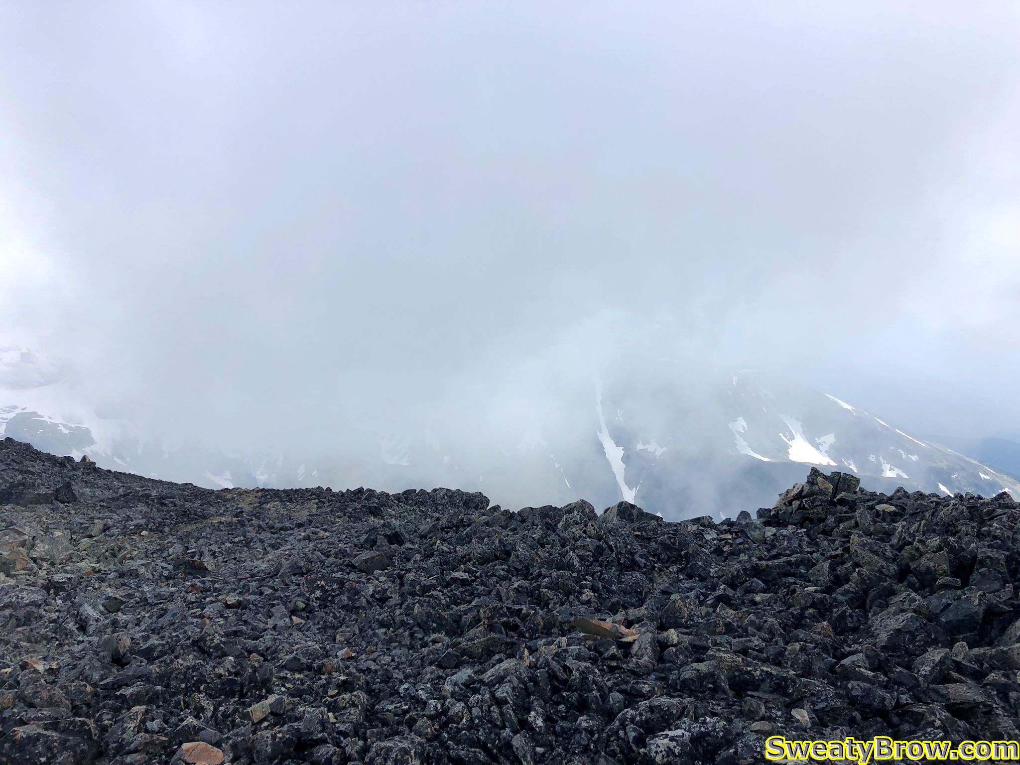
After a few selfies and an Instagram post (yeah, I’m that guy, I guess) I started back down, with hopes of finding the correct route, this time. Just as I approached the West Summit again (about to drop down the steep stuff…) the clouds, which had been holding well above me up until now, suddenly threatened to sock in the hill.  A big, thick mass came at me, and for a moment everything became very dim. Fortunately, that single low-lying cloud moved on, and I was in the clear again.

Threatening clouds while descending the Mount Cook rubble pile.

Long story only slightly less long, I did manage to find the correct route down, and the return to the lake was much more pleasant that the approach had been.

Total travel time up  (although this includes the time exploring the option of crossing the lake outlet toward Mount Rethel) was about 3 hours 50 minutes (!!) – for a hike that is listed as 1.5-2 hours up, in the guidebook. That covered a total of 5 km, and almost 800 m of ascent. The return trip, on the other hand (via the correct route) was just under 3.5 km, in 2 hours.

When I got back to the lake, I decided that I might as well pack up and head back down to the car, rather than staying the one additional night I had planned. I was not going to be ascending another peak in the morning, and I still had lots of time to get back down. In addition, in bashing through the mini trees while off-route in the morning, I had managed to get tree sap all over my hands and forearms, as well as on the front of my knees and thighs. I really didn’t want to get that stuff all over my quilt, and I didn’t have any faith that I’d be able to wash it off without soap.

So, that’s what I did – packed up, and headed back to the car. The three hour trip up was almost exactly 2 hours in reverse. By the end of the day, including Mount Cook, I’d ascended about 800 meters, and descended over 1900 m.

A long, tiring day, to finish a tiring, but fulfilling trip!

The Hudson Bay Brigade Trail Part II

We had spend two days on the Hudson Bay Brigade Trail, taking us to the Sowaqua Creek Forest Service Road. The morning of the third day, we had an emergency take place in camp, and one of the groups that had shared the camp had to be evacuated.  (See:  The Hudson Bay Brigade Trail Part I)

By the time the affected group had been evacuated, and we were packed and ready to go, it was after one in the afternoon. Fortunately, the trip back to the previous night’s campsite was just a short one.  By 4:30 PM, the tent was set up in Colvile Camp, and we settled in for a relaxed dinner and evening.

Chester relaxing outside the tent at Colvile Camp.

At this point, we (that is, my dog Chester and I) had kind of joined up with the group of three that we had met on the first day; we were kind of a loose confederation of hiking groups. We didn’t hike together along the trail, but we met up now and then when stopping for a break, and leap-frogged along the trail.

We had a pleasant evening at Colvile Camp, and played some cards and conversed late into the evening. Another group also joined us the the fire for a while, and the company was enjoyable.

A bit of socializing by the fire at Colvile Camp.

The next morning, July 4th, was the final day on the trail. We packed up, and were on our way sometime around 9:30 or so.  This last section of trail, which had been the first day’s travel coming the other way, was to be about 11 km, with 600 m of elevation gain, and 1100 m of loss. In other words, not an easy day, but no marathon.

Between Colvile and Manson’s Camp (halfway back to the car) Chester and I got quite a way ahead of the other group. We stopped at Manson’s Camp and rested for a bit. We had quite a bit to drink (there is a small stream there) and lay down in the shade for a bit. Chester was particularly tuckered, and I got out his sleeping pad for a bit of a nap.

A tuckered Chester takes a well deserved rest at Manson’s Camp.

After a while, the other guys caught up to us, just as we were preparing to head out again. We said our goodbyes, and wished one another the best. Chester and I, all rested up, would easily beat them back to the parking lot, so this was the last we would see of them – or so we thought!

Another ten minutes along the trail, and Chester suddenly refused to go any farther.  I coaxed and cajoled as best I could, but he just wouldn’t continue. We had another 5 km to travel, and about 500 m to descend. He seemed to be exhausted and overheated, and unwilling to go another step. After a bit, I tried to carry him for a while, but I couldn’t keep that up for long. I tried rigging up his pack as a kind of sling, and it helped for a bit, but only temporarily.

Chester gave up and laid down next to the trail. He would go no further.

Eventually, I just stopped, and waited for the others to catch up. I was exhausted and discouraged.  I’m not sure what I had in mind – perhaps see if they could carry some of my load, and try to put Chester into my pack? At this point I don’t even remember exactly…

After a while, I heard their voices approaching from up the trail. Chester heard them, too, and jumped up to see them as they came into view.  Well, he got very excited to see them again. Turns out, that was all it took to get him hiking again, and he was fine the rest of the way to the car!

Chester was happy to follow his new friends all the way back to the car!

A short while later, we were back to the car, and on our way home in air conditioned comfort…


The Hudson Bay Brigade Trail Part I

July 2017. I had the first eleven days of the month off of work, and wanted to do some backpacking. I had a new home made tent, and a new home made down quilt and I wanted to try them out. I had a 3 week long backpacking trip planned, starting in eight weeks, and was keen to get working on trail-shape!

I planned two “solo” trips for my time off; the first one (this trip) included my dog, Chester, and the second was without him.

My hiking buddy, Chester

I had never heard of the Hudson Bay Brigade Trail before, but while looking online for nearby trail ideas, I began to learn about it. It seemed like a good option for a trail on which I could take Chester along.

We arrived at the trailhead on the morning of July 1st, and found one car parked there. While we unpacked the car (and took photos for Chester’s Instagram page) another car arrived, with three guys planning a very similar trip to mine. We discussed how we had no idea whether we would see zero cars at the trailhead, or twenty – the trail was that unfamiliar to all of us. We didn’t know it at the time, but we would end up sharing campsites for all three nights on the trail.

Chester posing nicely at the trailhead

Turns out the trail is well marked, and in quite good shape, considering how relatively unknown it is. The designated campsites don’t have a whole lot of infrastructure (tent pads in particular) but there were some amenities available…

The first day, we ran into a few other parties who were also on the trail. Chester and I mostly hiked alone. The day comprised a total of about 12km of hiking, and an elevation gain of about 1200m, and loss of about 600m.

One of the trail markers along the route


Chester near Manson's Ridge
Chester near Manson’s Ridge

When we arrived at the first night’s camp, there was one couple there, already setting up. Another few parties trickled in as well, and a nice evening was spent at the picnic table and benches, visiting with the neighbours.

Tuckered dog in camp, after the first day's hiking
Tuckered dog in camp, after the first day’s hiking

On day two, some of the folks from camp were heading west, while we continued east, aiming for Sowaqua Camp that night – a much less ambitious day than day one had been! This time we covered about 7.5km, gained 415m, and lost 595m, over a short trip of under four hours travelling.

On the morning of day three, I considered hiking up toward Deer Camp, which would take us up into alpine territory and what looked like a lovely area. We could leave most of our gear behind, hike up, then return and hike back to Colville Camp, where we had spend the first night.

However, that plan was not to be. While packing up the tent, we heard some noise from the logging road that passed close by camp. A guy had driven by on an ATV a while earlier, at great speed. When he returned the other way, one of the guys camping along the road’s edge flagged him down, and asked if could go more slowly when passing campers along the road. ATV-guy invited him to engage in a sex act with himself, and roared off. I know, shocking, right?

Well, young buck camper dude wasn’t about to take that lying down. He reached down to grab a rock, and hurl it at ATV-guy — and violently dislocated his shoulder doing so. The air became thick and blue with the sound of his own cursing…

So there we were, young dude and his significant other (and their dog), the three other guys I’d first met at the trailhead, and Chester and I. We helped get the victim comfortable, lying under the shade of a tarp (it was turning into a very hot day.)

Shoulder guy under a tarp, with girlfriend and dog nearby.

We were many hours of hiking away from a road or a phone. There was no cell coverage whatsoever. But what did I have in my pack? An InReach satellite communication device. For the first time ever, I activated the SOS function.

Long story only very slightly shorter, a couple of ATVs with Hope SAR volunteers and a paramedic showed up a while later. They stabilized the afflicted dude, and prepared to transport him out.

Injured hiker heading for the ATV to ride down to a waiting ambulance

Via my InReach, my wife let me know that the BC Ambulance people were going to send in a helicopter. ATV guys said it wasn’t necessary, and tried to call it off over the radio – but the message never got through. Just as dude was getting in the ATV, the helicopter arrived.

Helicopter arrival

Good thing, too, because they couldn’t possibly have evacuated his girlfriend, the dog, and the TEN TONS of gear they had in their packs, via the ATVs. With young dude winging away in the chopper, the logistics worked out, and a few minutes later, all was quiet again in camp.

Chester tied up away from the helicopter landing area

The party of four, and Chester and I finished packing up, and set off on the return journey toward the cars…

To be continued…