Planning
6 June, 2018. It was about 4 in the afternoon when I arrived back at my campground for the night. I had just spent 8 hours hiking up and over Càrn Mòr Dearg and Ben Nevis, and I was bone tired. More than that, I was incredibly discouraged. The hike had been only about 18.5km, with a cumulative elevation gain and loss of less than 1500m. On top of that, the whole thing began and ended very close to sea level. There was no reason that it should have tired me out the way it did! I was in good shape, and very accustomed to trips of that length and difficulty.
I thought about the general plans I had over the next few days. Nothing really well defined, but the goal was to do a lot of vertical, up and down a bunch of Munros for the next week or so. Feeling the way I did after Day 1, I realized I wasn’t ready for it.
I think the major problem was the jet lag, and lack of sleep from my sleepless 9 hour red-eye flight. An additional issue was that I was a bit anemic – a situation spotted during a platelet donation just a couple of days prior to my trip. I am basically a vegetarian (I do eat some seafood) and had not been keeping up on my supplemental iron recently. It was showing. I wasn’t desperately low on iron, but low enough that I had to be deferred for a couple of months. The low iron count was certainly a factor in the fatigue I felt.
Anyway, long story only very slightly less long, I didn’t feel up to tons of ascents and descents right away.
I hopped on the internet, and looked into some options. One that jumped out at me right away was the West Highland Way. When I was driving from Glasgow to Fort William, I had seen glimpses of people hiking a trail alongside the road, along this route.
The West Highland Way starts on the outskirts of Glasgow, and winds 154 km to Fort William. The elevation gain was fairly substantial overall (I ended up averaging about 600m of gain/loss per day over six days) but it started slowly over the first couple of days, increasing as the trail went on.
Anyway, with very little preparation, I lay in my tent that evening, and arranged my transportation online. I packed up my backpack, and tried to get some sleep.
Day 1
I woke early on the 7th of June, and packed up. Everything went either into my backpack, or into the trunk of my rental VW Golf. I drove into Fort William, and tried to figure out where to park for a week, where I wouldn’t be towed. The “long term” lots around town were no good for anything over 24 hours. Finally I went and asked in the train station. I was told that I could park around the back of the station, at my own risk. No cost, no time limit, perfect!
I parked the car, and then kept looking back, hoping I had everything I needed. Mostly, I did…
I hopped on the CityLink bus to Glasgow, and we pulled out at 9:00 AM. While we traveled, I tried to figure out (on my phone) where I would stay that first night. I knew that I would be in a national park that had limited opportunities for camping permits. There were none available for that night, however. I did find a hotel in Drymen, though, which would give me a 19 km first day. No problem.
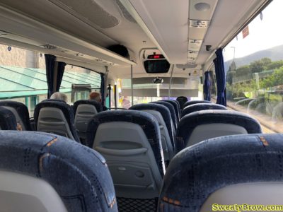
After almost three hours, I arrived at the Anniesland station in Glasgow, and changed onto a train for the 12 minute, £2.80 trip to Milngavie.
It was just after 12:30 in the afternoon, and I had about 4-5 hours of walking ahead of me. I decided not to linger. I realized that I had left my toothpaste and toothbrush in the car, and made a quick stop in a grocery store to grab those things. At 12:45, I found the start of the walk, and began my trek!
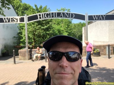
I realized later that I probably should have picked up some sort of guide or map or something near the start of the route. Turns out I never would pick one up, and just got by using Google Maps and my GPS app…
The first day took me through a lot of farmlands on the outskirts of Glasgow. It was more rural than suburban, but definitely was a very settled area. There were a lot of gates that needed opening and closing, to keep livestock from escaping. One thing that I found very cool was all of the cuckoos that I kept hearing! That’s something we don’t have in BC, and it was strange to hear such a familiar sound (of a cuckoo clock) out in nature.
The 19 km trip, with about 250 meters of total elevation gain and loss was utterly exhausting for me. It took almost five hours, and I was really dragging my feet by the time I arrived at my hotel!
When I got checked in, I found it impossible to leave the room. I had thought I might head to a pub for food and a pint, but there was no way. I boiled water in the supplied kettle, and ate one of my dehydrated meals. Then I slept. I slept fitfully, unfortunately, but at least I slept…
That first night, I realized that I’d forgotten a couple of other things in the car. I had no contact lens case with me. That night, I ended up emptying a couple of small cream containers from the complimentary in-room coffee service, giving them a good wash, and filling them with contact lens solutions – which I fortunately had!
I also realized I’d forgotten my travel electrical adapter, so I had no way to plug in my USB charger. I was able to borrow one at some of the places I stayed at night (hotels and campgrounds) but I did have to be careful with my phone usage!
One more important lesson this day: I learned that there are also private campgrounds in the area, in addition to the park campgrounds. Turns out I could have stayed in an £8 campsite instead of the £60 hotel…
Day 2
I was up fairly early on the 8th. I found the closest chemist and asked about a contact lens case. Well, the only way I could get one was included in a pack of two travel-sized bottles of solution. So that added to my pack weight…
Once I had that sorted, it was off for a bit of breakfast at Skoosh. This place is a wee tearoom on the Drymen high street, and they make an excellent breakfast! I had a full Scottish breakfast, with all the vegetarian options, and it was an excellent way to start the day!
Back to the hotel, to load up the pack and check out, and I was on the road at the crack of 10:30!
About an hour into the day, I started getting some glimpses of Loch Lomond in the distance. It disappeared again for a while, as the trail climbed up the east side of Conic Hill. Cresting the top of Conic Hill, two and a half hours into the day, there was a lovely view encompassing the southern third of the Loch. Lots of people were on top of the hill, about 350 meters above the lake. Pretty impressive, considering it was early on a Friday afternoon.
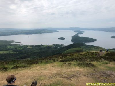
After taking a few photos, I started down the west side of Conic Hill, headed for the wee village of Balmaha. Once there, I popped in to the Oak Tree Inn for a pub lunch – Cullen Skink – and pint of Guinness. Some fine sustenance for the rest of the day.
I continued up the side of Loch Lomond, northbound, and at about 4:00 I reached Sallochy Campground, my home for the night. I had booked it online the night before, and was pleased to get a site in this location. It made for another 20 km day, which was just fine, as I was still very tired and having trouble covering a lot of distance. This second day also included a lot more elevation than the first had – more than twice as much, at around 550 meters total. The weather had been fairly warm through the day, and I drank a lot of water when I arrived!
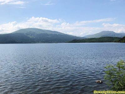
The campsite was just fantastic! I was in one of the lochside spots (Site 6), and it was quite secluded from the other sites. An idyllic spot with great views over the loch. The campground was quite busy in the large, central common camping field, it being a Friday evening. It was certainly quiet in my site, though.
—-
