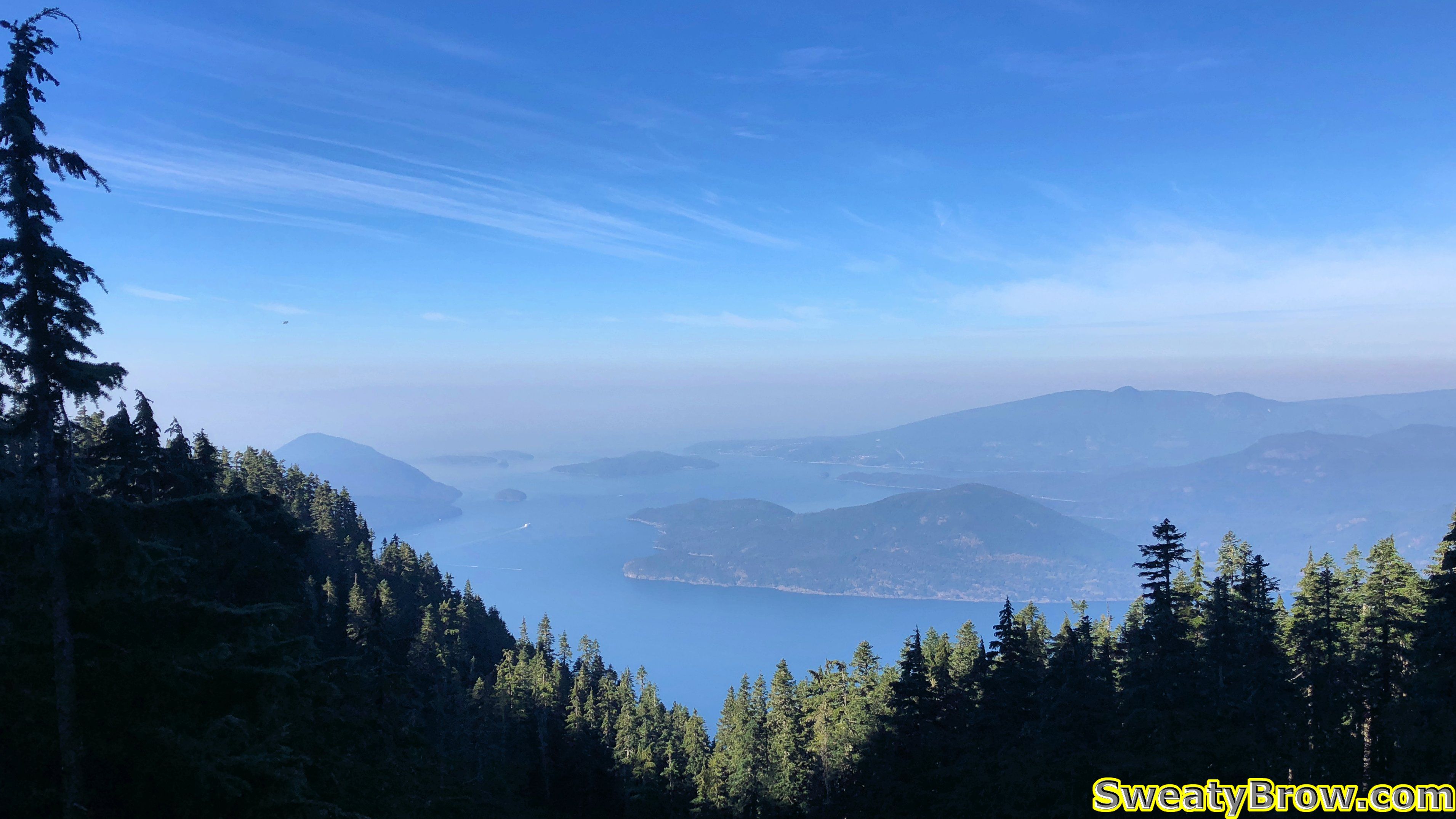
Thursday, 6 September was going to be my first of twelve days off, and the weather was looking really promising – to be followed by a rainy Friday. I decided I would get out and do a good, long hike for the day. Looking for ideas, I decided on one of the final mountains I needed to hike along the Howe Sound Crest, north of Cypress Bowl ski resort and the Lions.
I have hiked many of the mountains along this stretch, but still had a few more to hit – one of them being Mount Hanover, a little northeast of Brunswick Mountain. I read up on the mountain, and the route, and decided to give it a try. What I read was that the final ascent, up either of two parallel gullies to the summit, was fairly difficult, with a bit of exposure. I read that some people started up, and decided against it due to difficulty, but that others said it wasn’t so bad… I figured that if I decided to turn back, I would divert on the trip back, and climb Hat Mountain, a non-technical peak that I hadn’t yet climbed. And if things went well, and I felt up to it, I could also do Hat Mountain on the way back!
I arrived in Lions Bay at about 7:15. There were a couple of other vehicles there, and I chatted briefly with a fellow who was planning to climb Mount Brunswick – mostly we talked about the crappy parking machine, which would not connect and accept our credit cards. We both ended up downloading and installing the Whoosh app – of course, not the parking apps already on our phones – to pay for the day…
At 7:30, I was on my way. The route follows the Brunswick Trail up to the crossing of the Howe Sound Crest Trail, at which point I made a left turn and headed north through Hat Pass. The guy I chatted with in the parking lot left just a few minutes before me, and I never caught up to him on the way up – he was making good time.
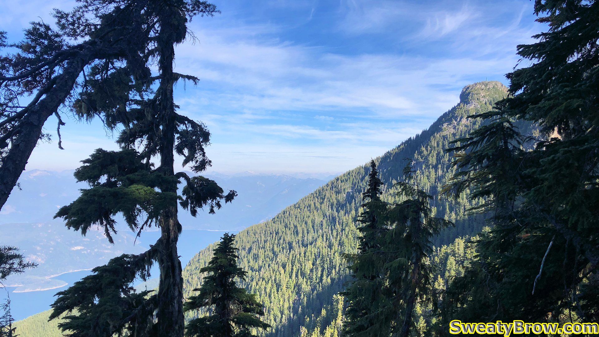
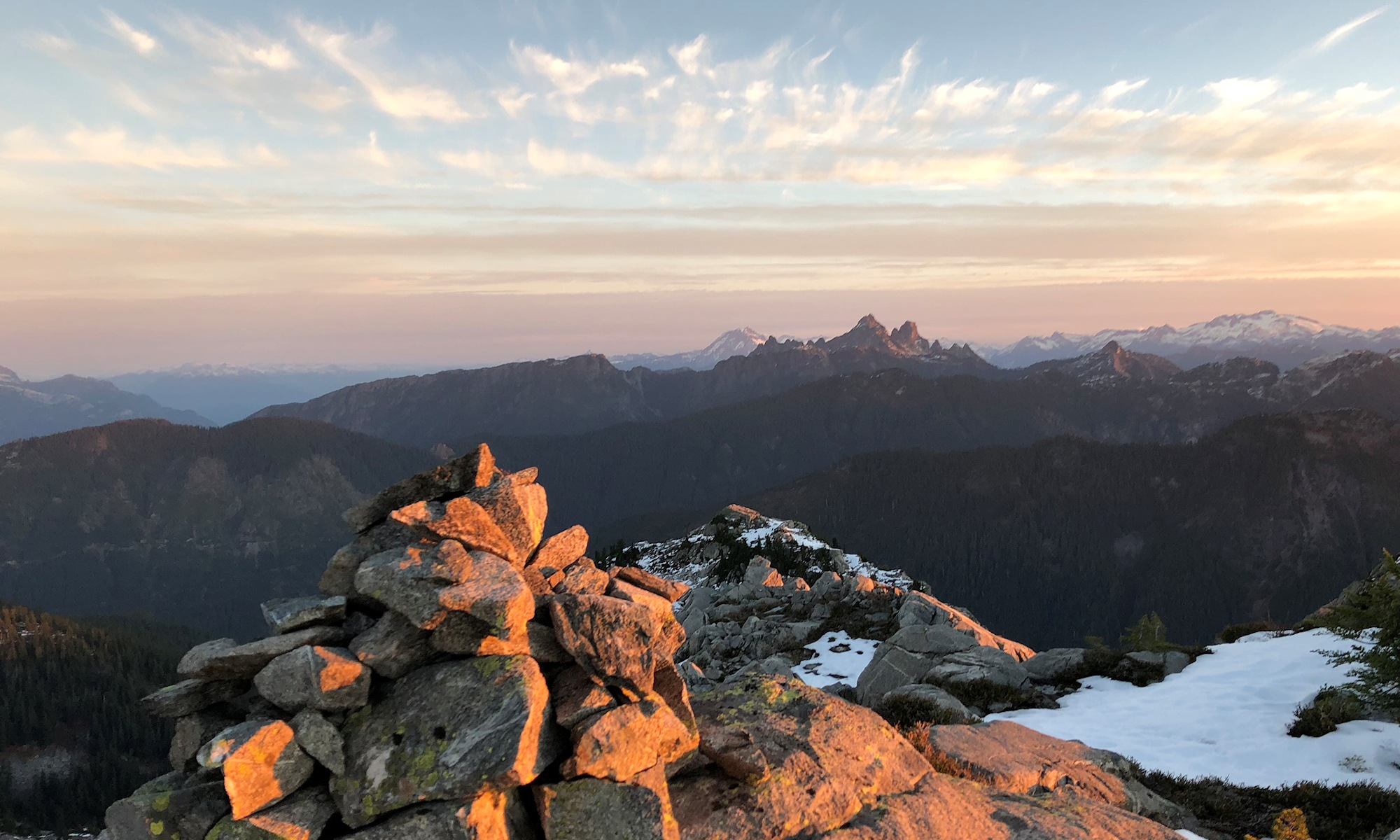
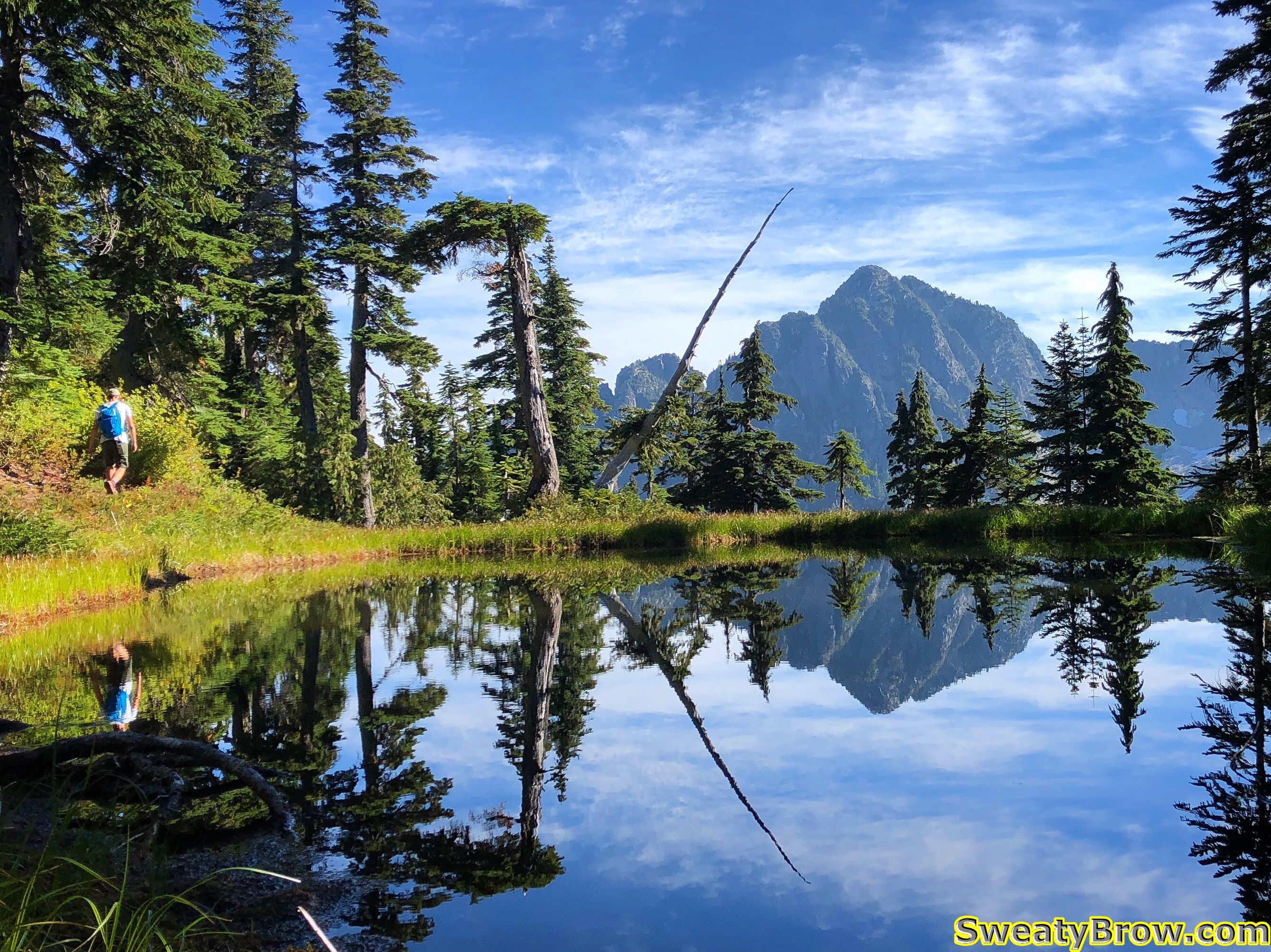
I reached the HSCT at about 10:00, having seen no one else on the trail yet. Just as I was heading over Hat Pass, to begin the descent toward Brunswick Lake, I spotted a little tarn with a lovely reflection of my destination across the valley. As I stepped off the trail to take a photo, I was overtaken by a guy headed the same direction as me. We said hello, and he carried on while I took my photos.
I stayed just a little behind him for a ways, then lost sight of him. When I broke away from the trail to head across country toward the peak, I spotted him again ahead of me. Aha – so he was heading the same place as me!
A little further on, I caught up with him after he stopped for a drink. We chatted a bit, and decided to carry on together. His name was Jan (pronounced with a “Y” at the start) and we ended up hiking the rest of the day together. A very fine trail companion, although I felt a little bad about holding him up a bit!
Jan had started about an hour before me, and headed up the Mount Harvey trail, over the top of the peak, and down to the HSCT. He then caught me on the way to Mount Hanover. Fit and fast!
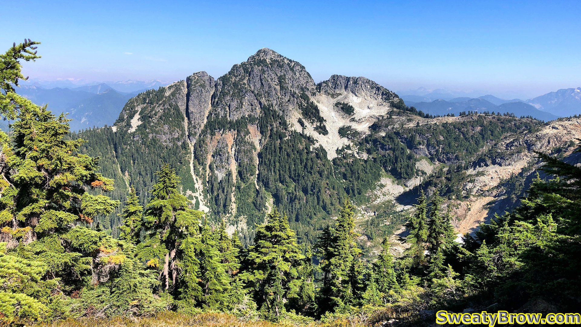
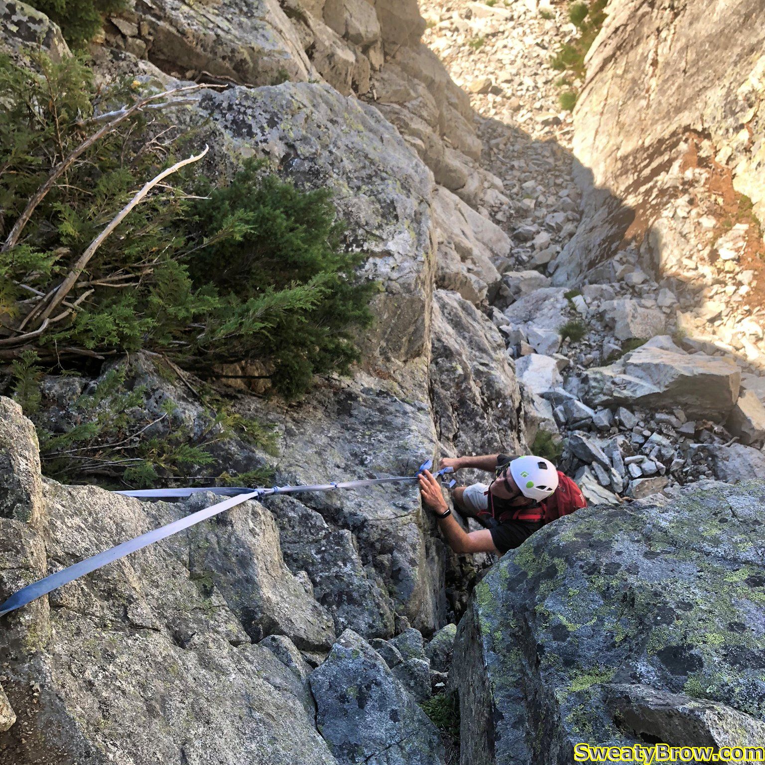
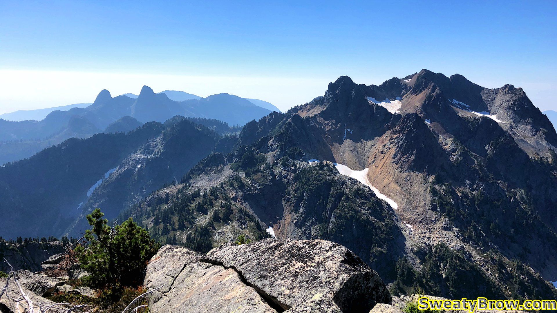
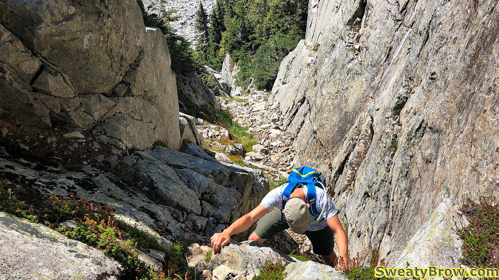
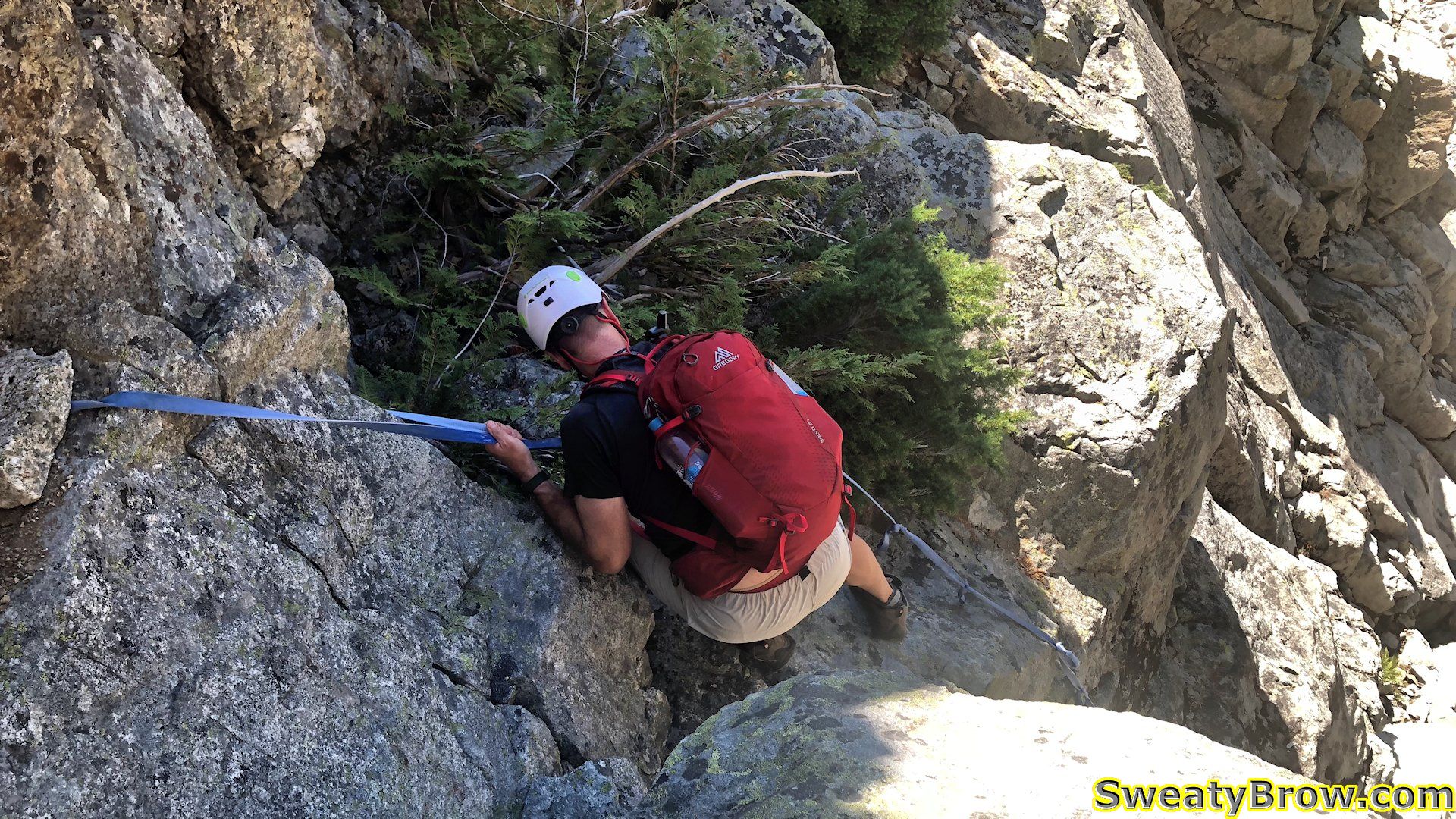
We found our way along the rolling terrain to the bottom of a gully that rose to a major boulder field above. We ascended the boulders (oh, I was lagging behind, despite some serious sweating!) to the base of the two parallel gullies rising to the summit. The online and guidebook consensus was that the left gully was easier, but more sustained, while the right side had a couple of harder, more exposed cruxes, combined with some easier terrain.
We agreed to take the left gully, and started up. Almost immediately, we reached a length of blue, knotted webbing hanging down from the right wall. Jan went up first, while I donned my helmet – just in case.
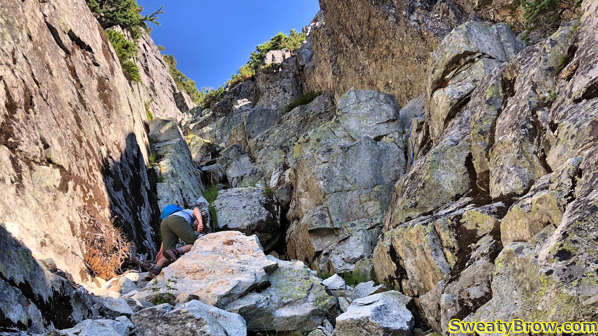
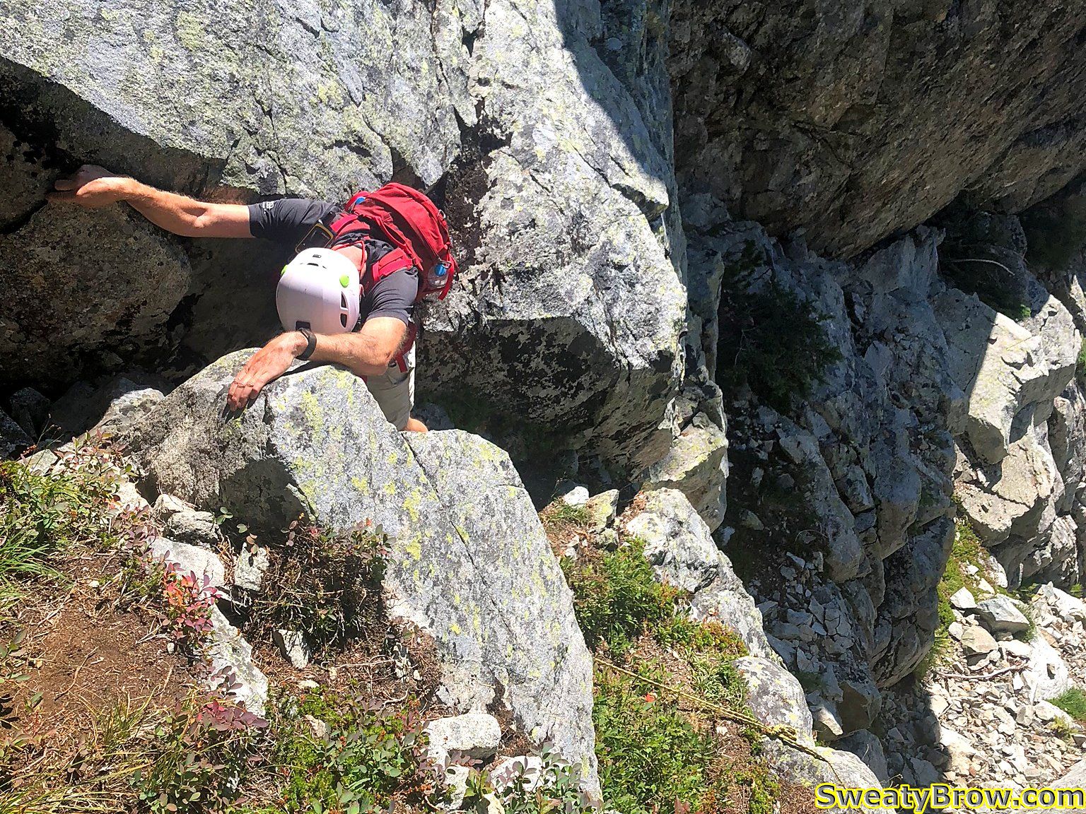
I followed him up, and we were soon at another obstacle, with a length of yellow rope hanging down. This time, I went first. There was a bit of hunting around here and there for the best route as we continued up.
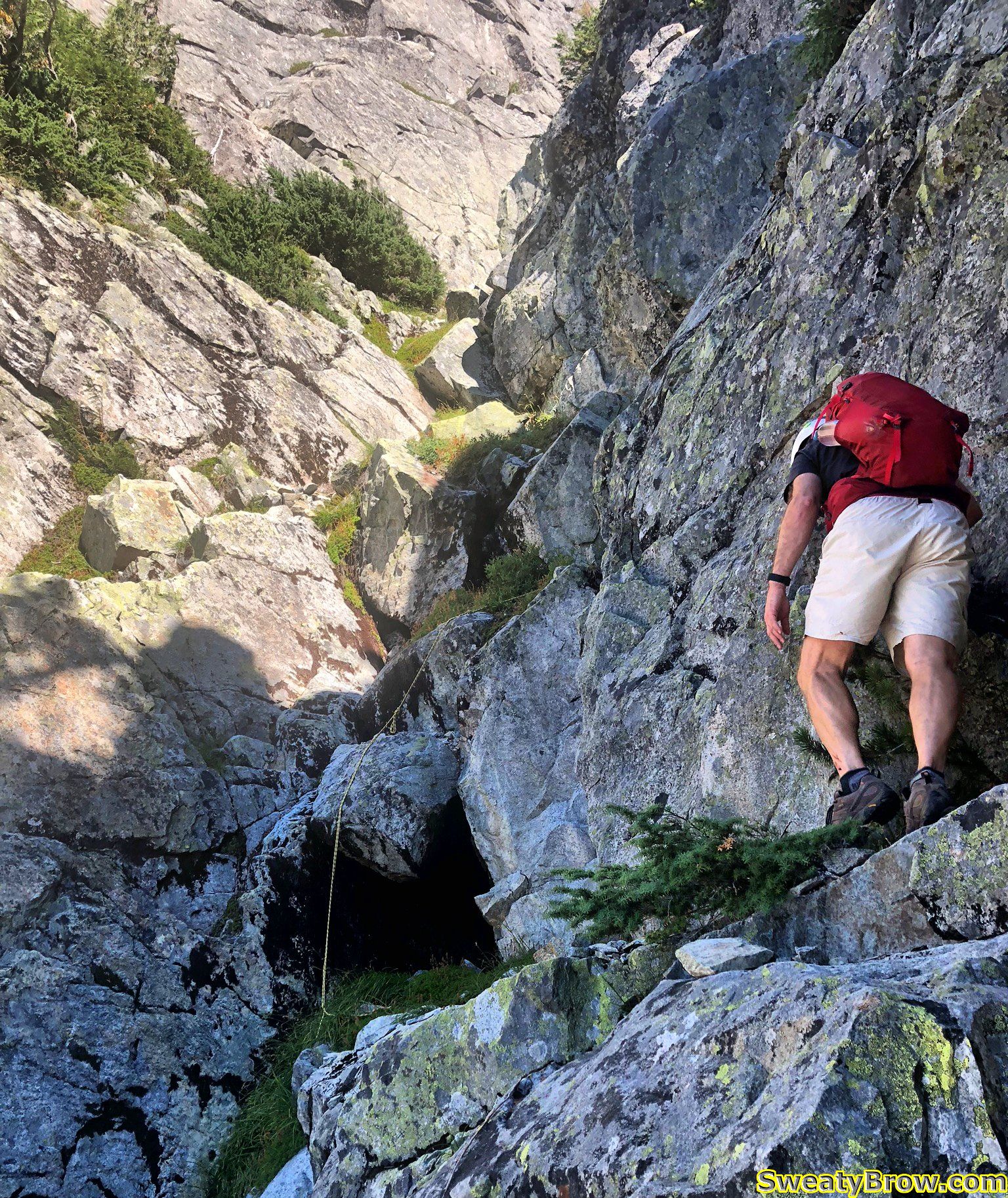
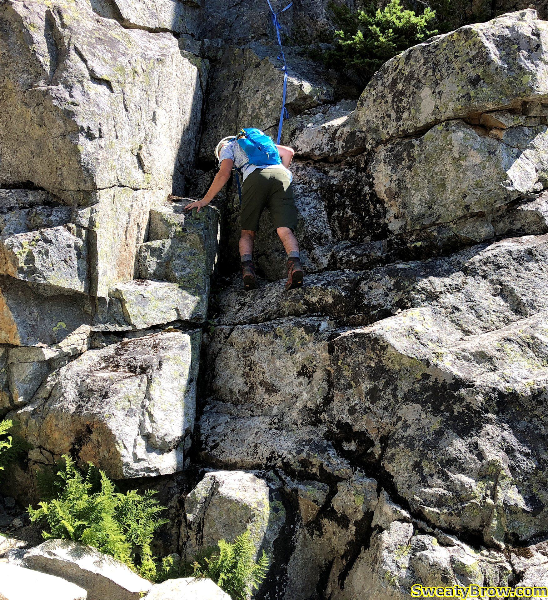
There was one spot where I tried to decide the best option – an airy lower-angled slab with a few spaced out footholds, or a cramped, somewhat awkward scramble up a short narrow chimney. I opted for the airy slab, and at the top, we thought that it might be a bit challenging on the descent.
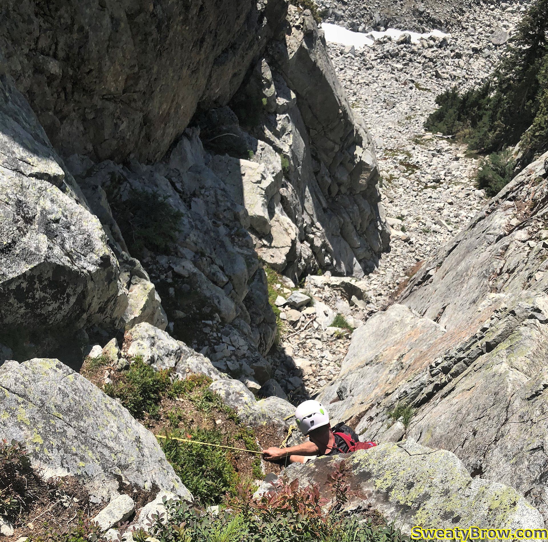
After a bit of bushwhacking near the top of the gully, we made it to the top a couple of minutes after noon. We turned left, to hit the summit, but when we got there, we realized that it was actually slightly lower than a right turn would have taken us!
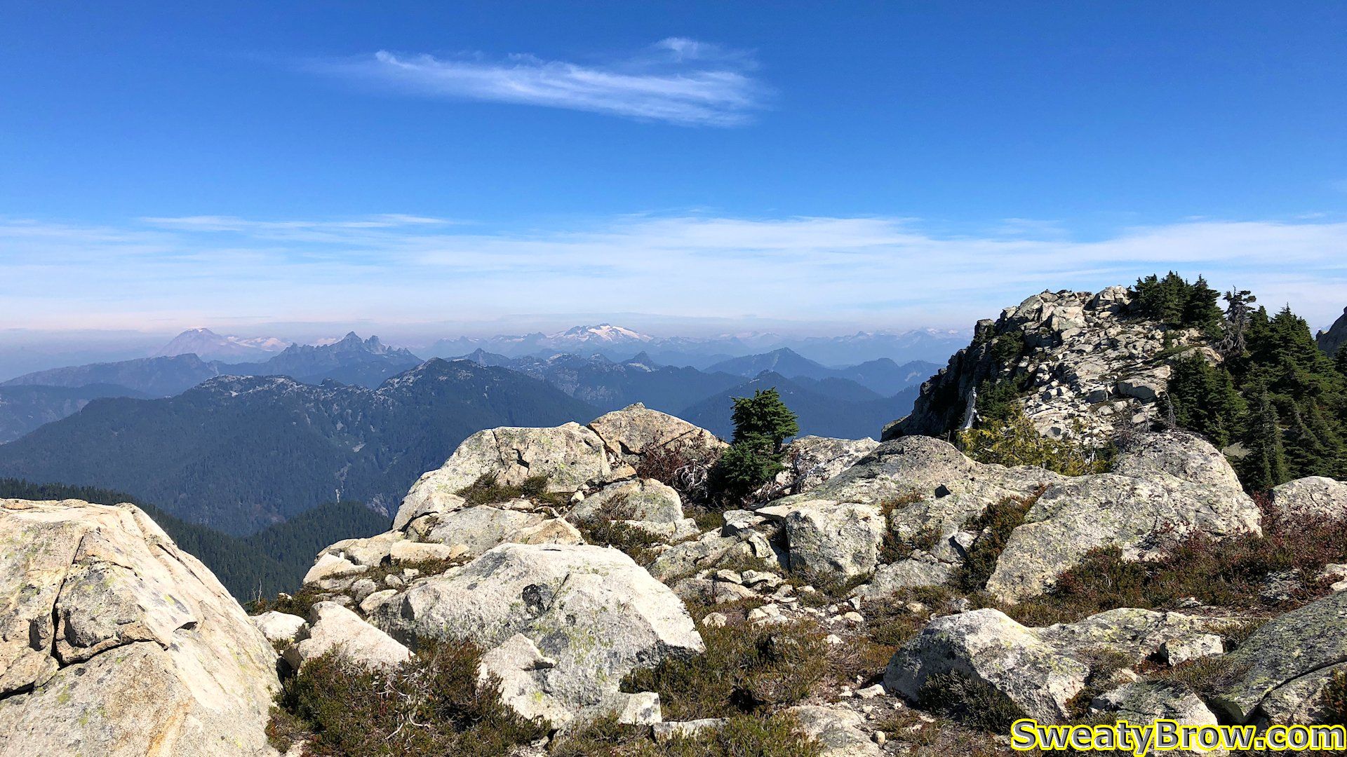
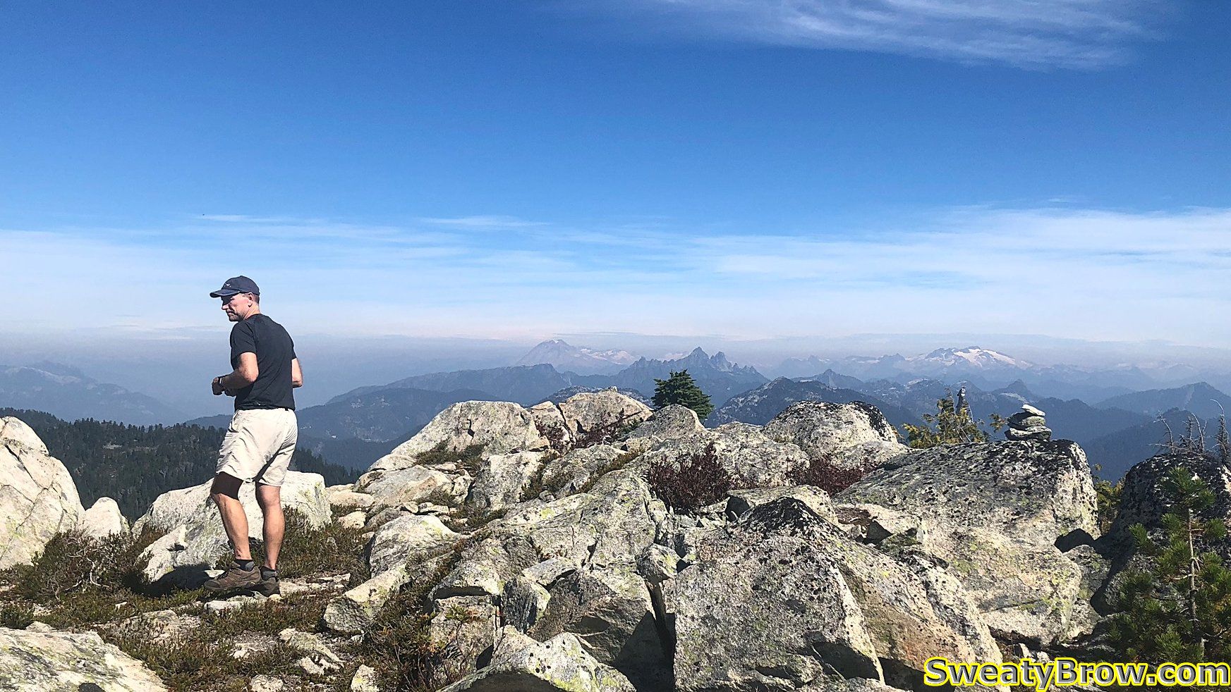
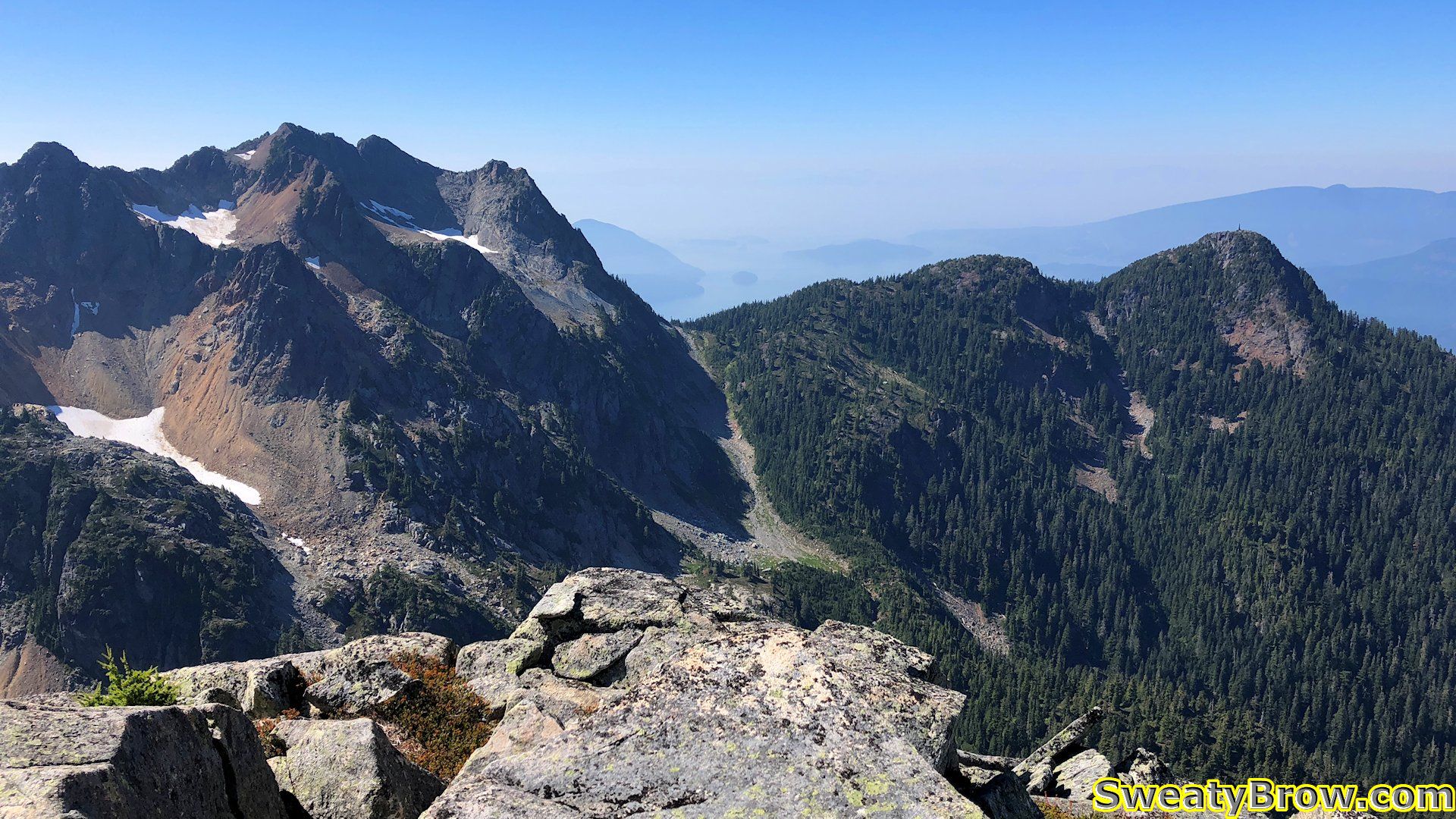
We stayed a few minutes, hydrated, and took photos, then crossed over to the actual peak. After a short time on this summit, we started down around 12:30 or so.
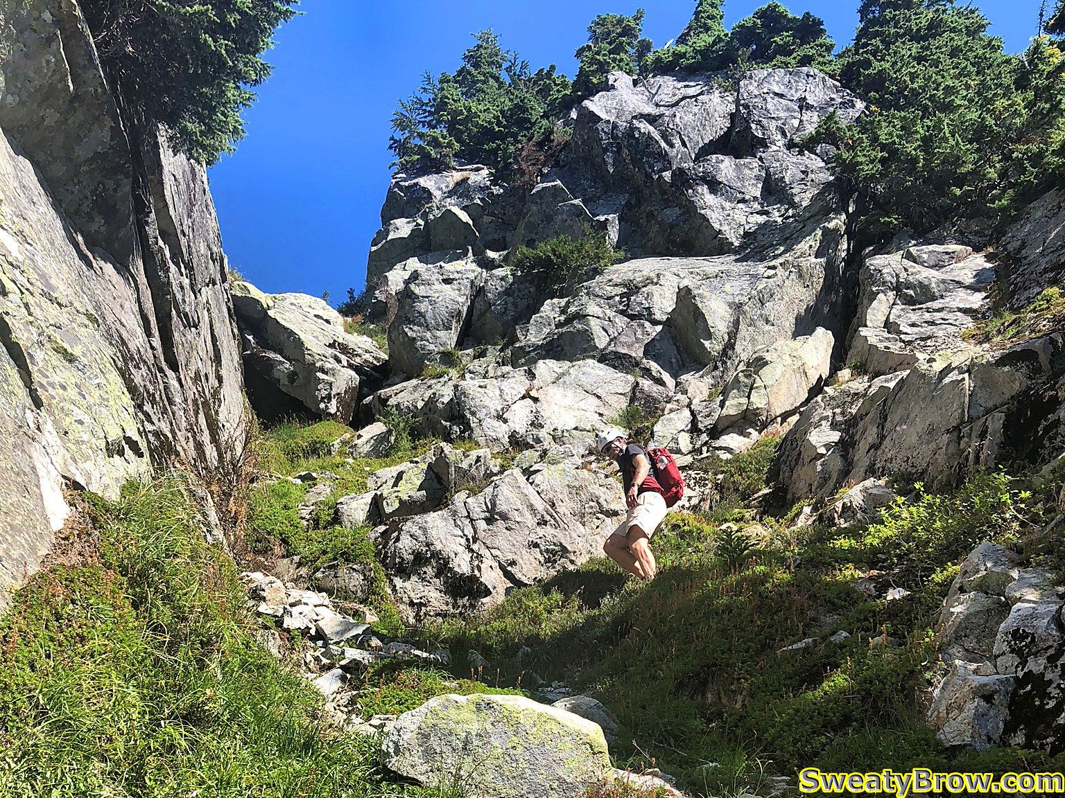
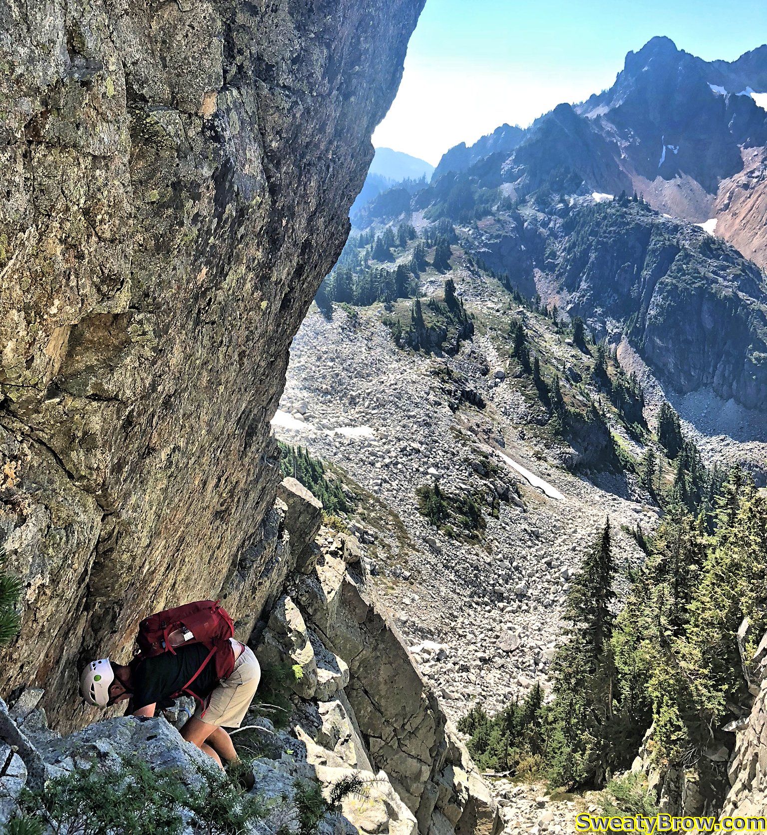
Again, we took turns taking the lead, and Jan arrived at the top of the slab/chimney choice. He decided that it would be too difficult heading down the slab, without being able to see any foot placements, and with a lot of air underneath. He moved over to the groove above the chimney and started down. Definitely the right choice. The foot placements and hand holds all appeared in just the right places, with just a little bit of hunting around.
All in all, the scramble portion was a little bit tougher than I had expected. I was very glad to have another person with me, though I don’t think that being solo would have stopped me from continuing.
It took about half an hour or so to descend the gully, and we were back to descending the big boulder slope. I told Jan that if I was holding him up (and I was – he was definitely faster than me!) that I’d be fine if he wanted to continue on his own, and get back to the parking lot sooner. It was great to have a companion for the challenging scramble section, but I didn’t want to impede his pace.
Jan, however, was fine with continuing together. When I told him that I was also hoping to hit Hat Mountain on the way back, he asked whether it was OK to tag along. Of course!
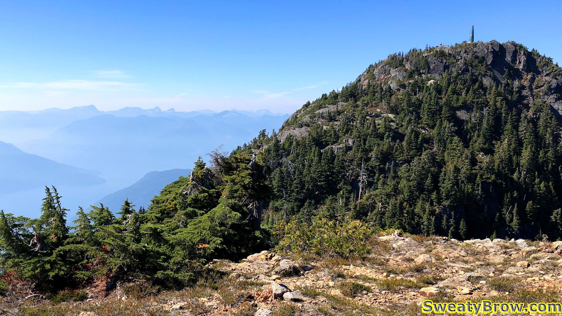
We got back up to Hat Pass, and found the small trail that leads off, over Fat Ass Peak (hey, I don’t name these things) and then continues down into a gully and back up Hat Mountain.
By this time, I was lagging pretty badly. We got to the top of Fat Ass Peak, and looked down into the gully beyond. It was a lot further down than I had thought – perhaps 75m or more – and I really didn’t feel up descending the gully, climbing the other side, and then doing it again in reverse!
I offered Jan the option of doing it himself – I would be more than happy to stay where I was and wait for him, if he wanted to complete the H trifecta: Harvey, Hanover, and Hat – but he decided that he was fine without it. He checked his GPS and it said he’d already ascended 2500m for the day. That would do! Mine said a shade under 2100m, and I figured that was sufficient. Hat could wait for another day.
We retraced out steps, down Fat Ass, along the HSCT, and finally down the Brunswick Trail.
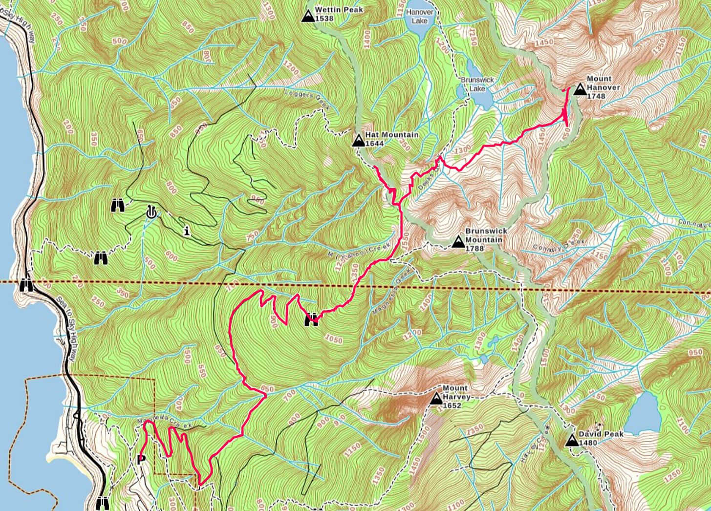
After a total of (for me) 9 hours, 21 km, and 2100m of elevation gain/loss, we were back at the parking lot at 4:30. This was a pretty big day for me – I was really hitting the wall on the way back down. The next day I had an appointment to donate platelets in the city, and that was about all I could manage for the whole day – otherwise it was a write-off!