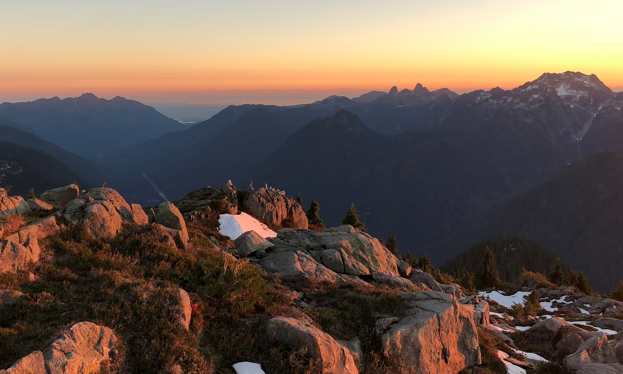
It was Thursday morning, and I had been camping in Squamish at the Chief’s Climber’s Campground since Monday. The last couple of days, I had gotten up fairly early, driven up to Whistler, and headed up the lifts to scramble up some peaks in the area. I decided it was time to do something closer (later start in the morning) via the Sea to Sky Gondola.
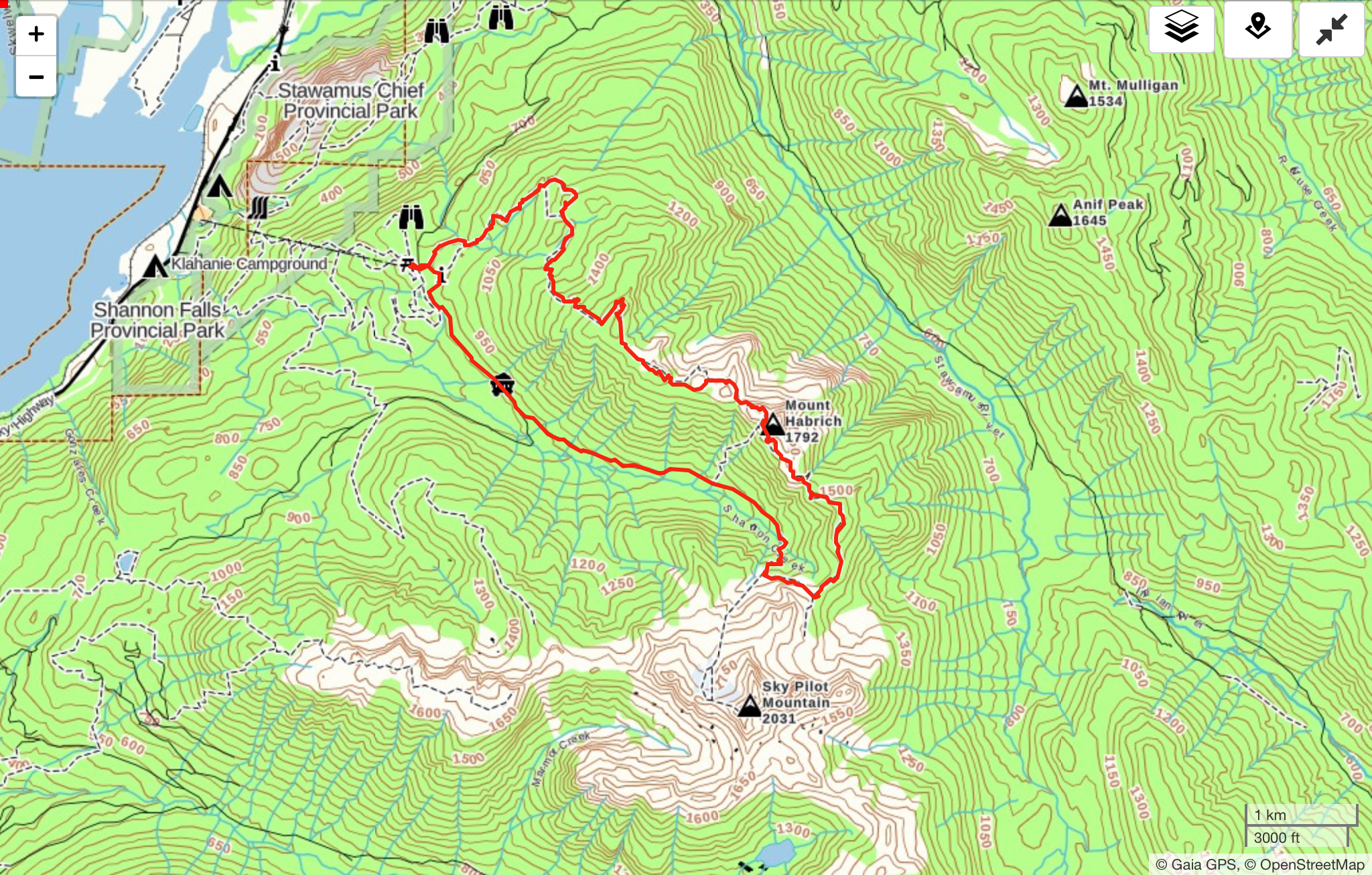
I decided that I would begin with what Marc Bourdon calls the “Sky Pilot to Mount Habrich Loop” in his book, “Squamish Hiking” but remain on the top of Habrich Ridge, all the way out to the end, then follow marked trails (Robin’s Connector, and Al’s Habrich Ridge Trail) back to the Gondola. In Marc’s book, the ridge is shown as having an “intermittent, poorly marked” trail west of Mount Habrich. I had also read online that people were occasionally having trouble over the past couple of years with linking up the full ridge.
I figured that the trip would be fairly difficult, and a long day out, but wanted to give it a try!
I was on the gondola fairly early, and began hiking up Sky Pilot Valley shortly before 10:00 AM. Shortly after 11, I broke out into an open talus slope at the top of the valley, and turned off of the Sky Pilot Mountain route.
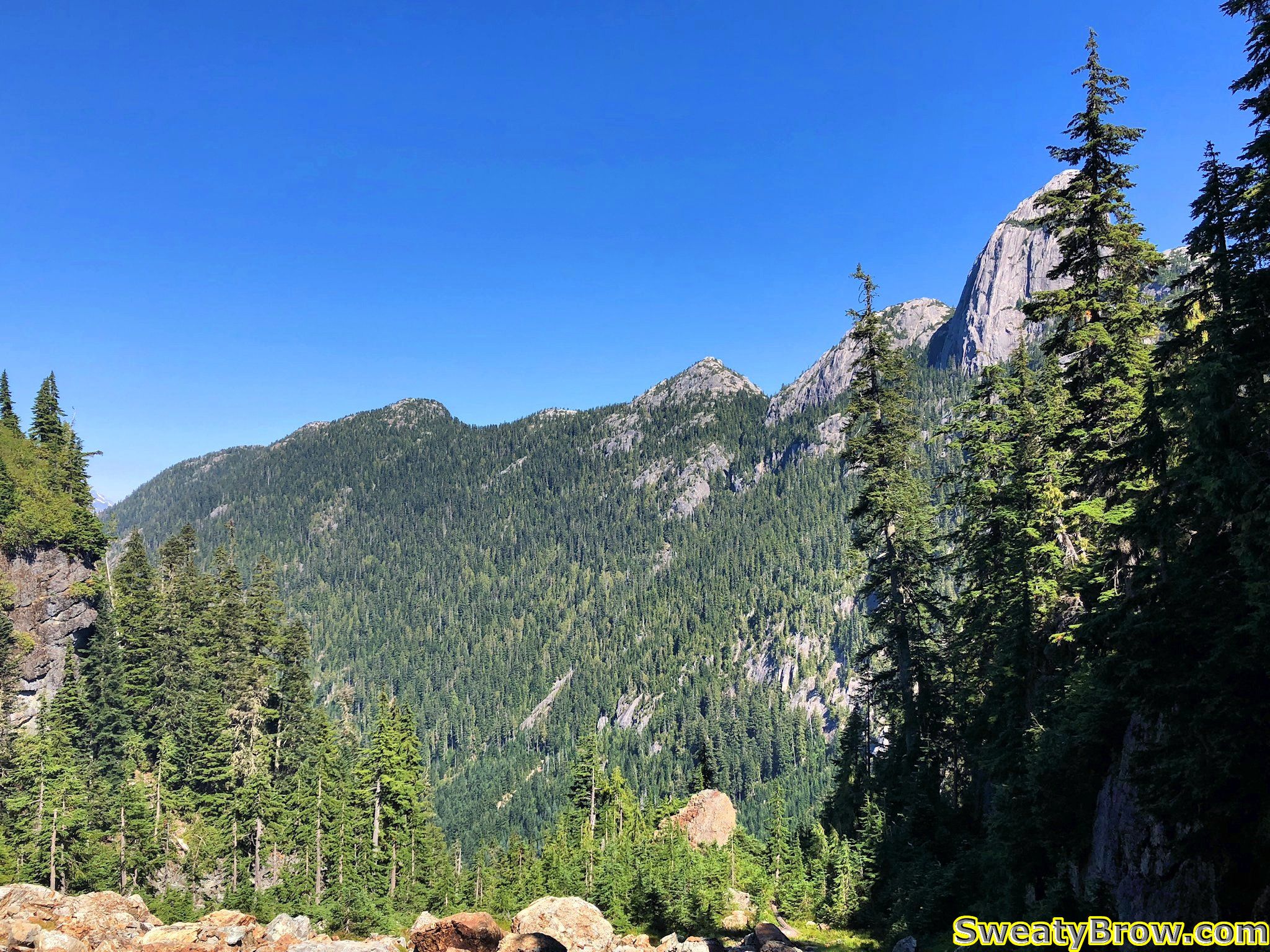
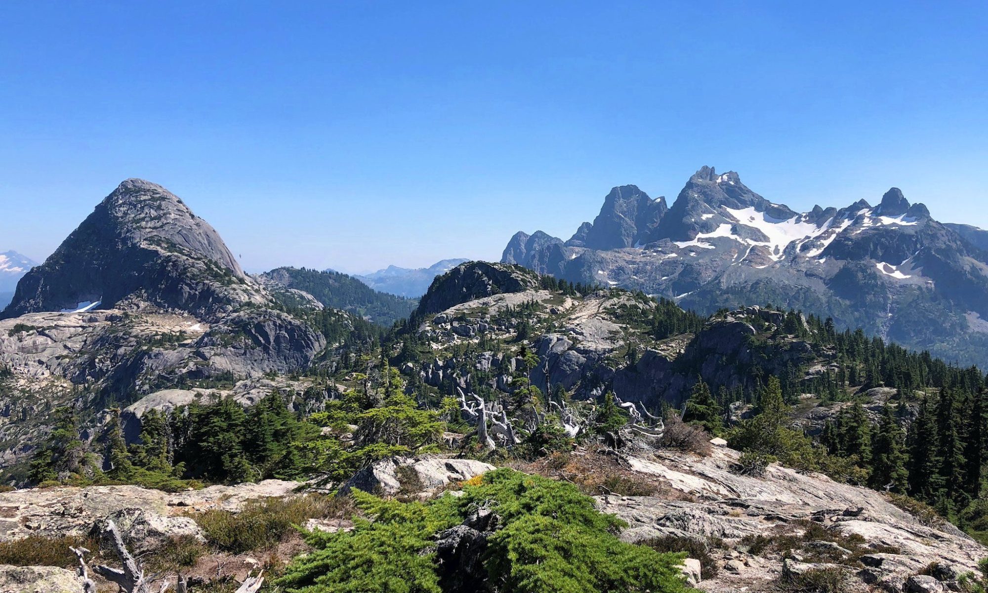
The route then took me through some forest and across some meadows, toward the col between Sky Pilot and Habrich.
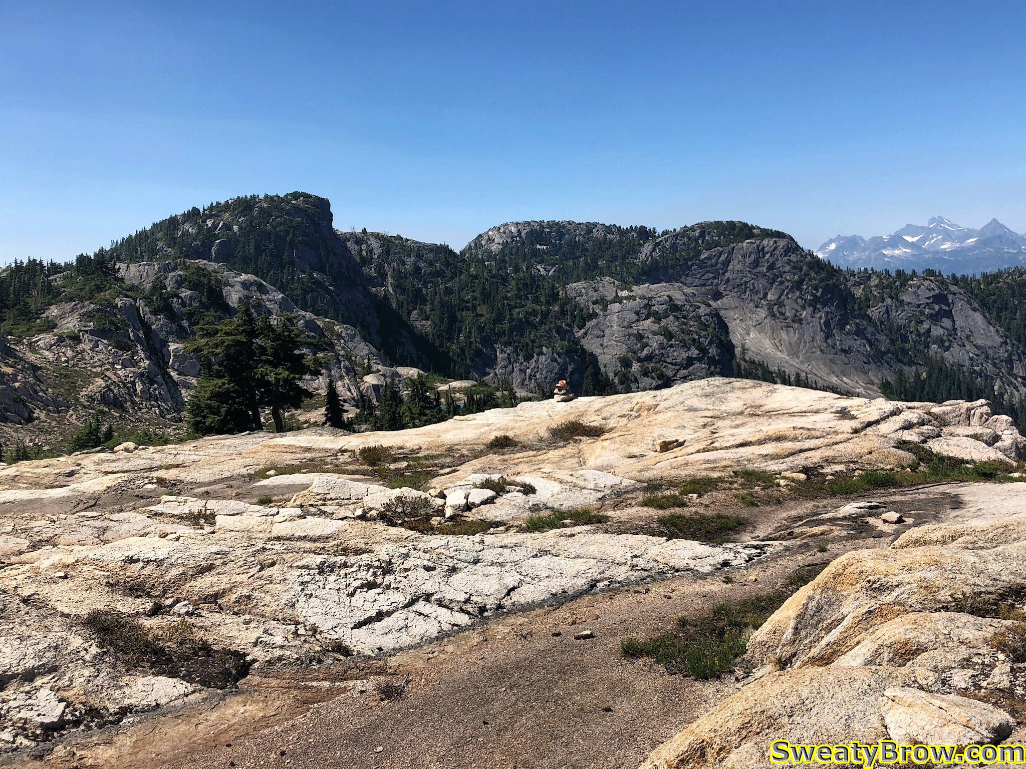
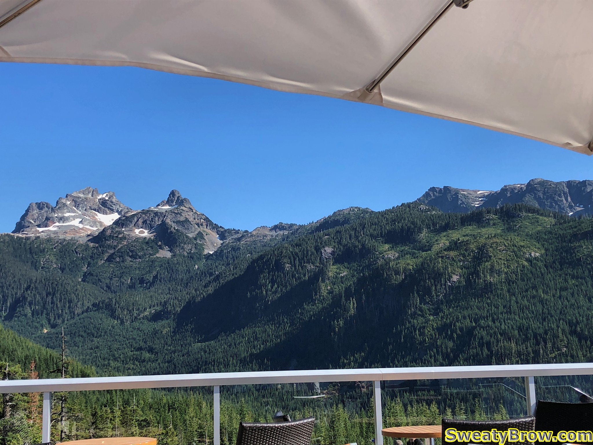
The low point was about 1440 meters, and then quickly climbed again to about 1600 meters. This was very close to the highest point of the day – there was one minor summit just west of Habrich that was slightly higher, at about 1650 meters. The rest of the day was to be relatively short, but frequent and steep, up- and downhill ridge-walking. Atop the 1600 meter bump, I stopped for about 20 minutes to have some water, and take some photos. The views were getting good!
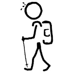
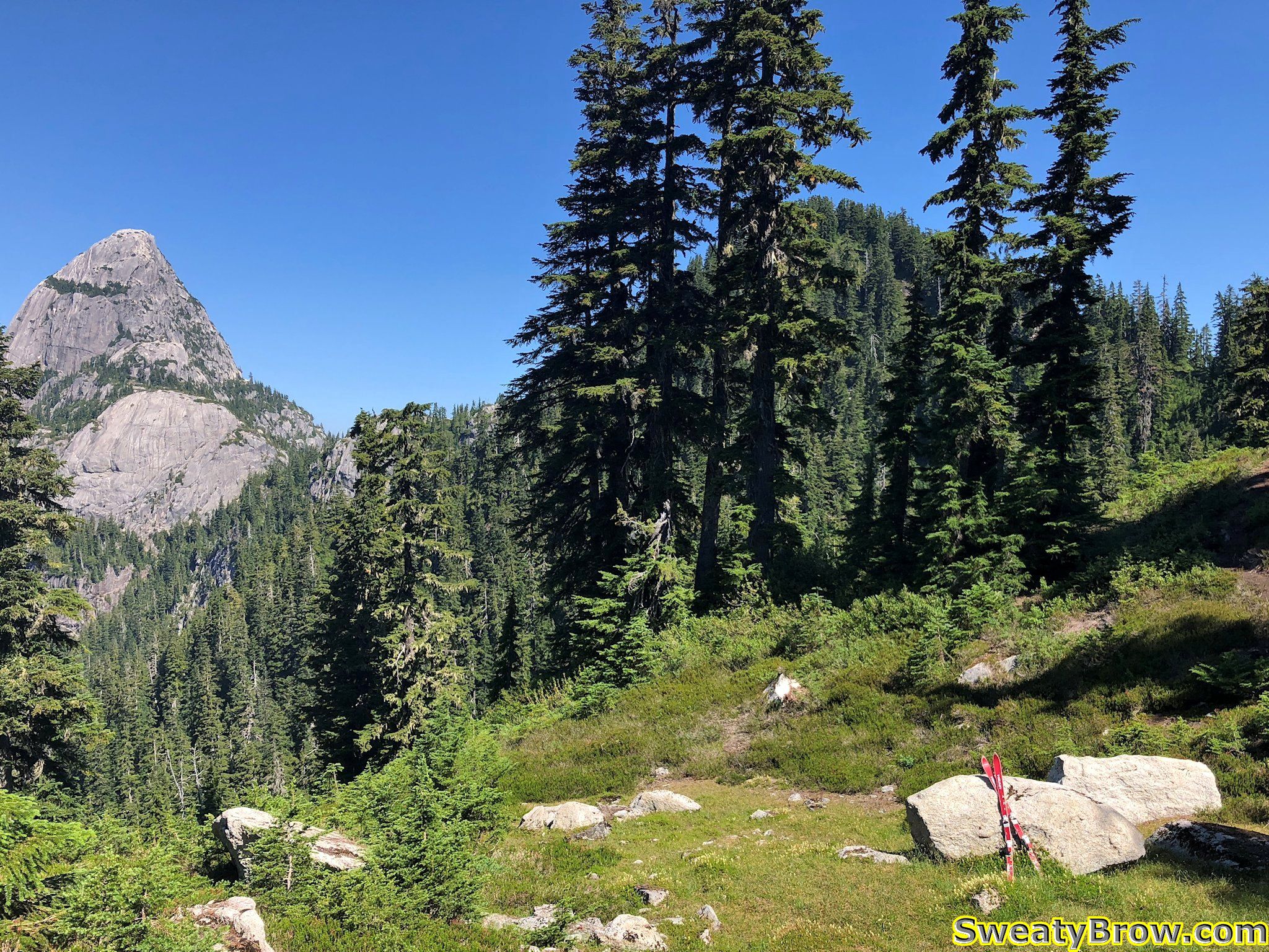
There is a feature on the southeast side of Mount Habrich that was about to become rather important to the progress of my day… The large rounded cliff just below and to the left of the peak is known as “The Brain”.
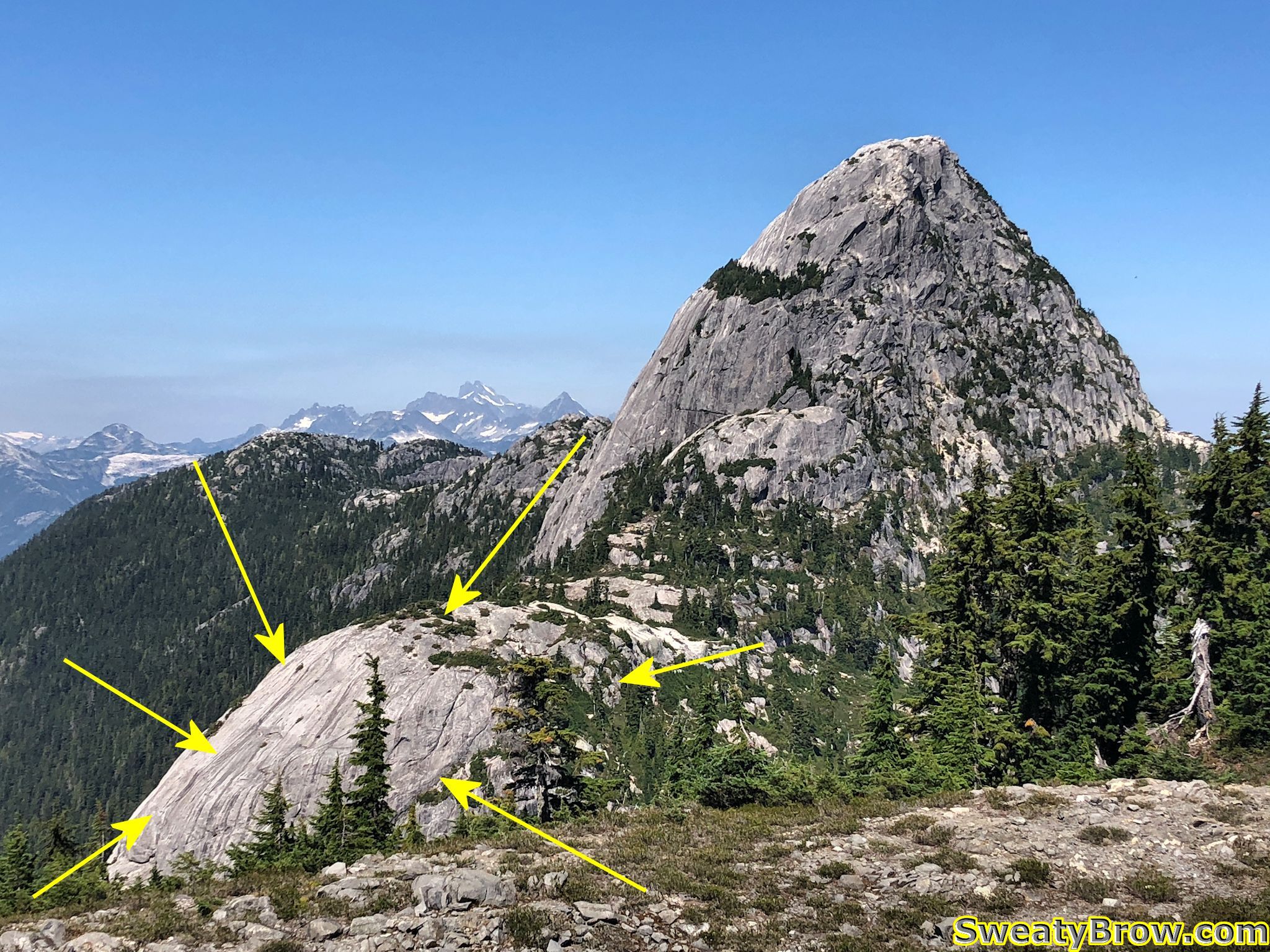
I read through the description of the route in the Squamish Hiking guidebook earlier in the day, and I was aware that I would need to use a fixed rope to ascend the right side of The Brain. The book said that if I had any doubts about my ability to complete the loop (returning to the valley below via a gully on the far side of Mount Habrich), then this high point would be a good point to return the way I came. I was operating under the premise that I would be comfortable completing the loop, so I continued.
Down a few steep gullies, a couple of semi-exposed steps, etc. and I was soon at another low point on the ridge. The Brain stood before me, mostly to my left, with the right edge of it directly in front of me. A clear path headed straight ahead, leading to a steep cliff with a rock corner and a knotted rope hanging down from a tree about 8 meters up. I could see another rope following a steep ramp above and to the right of it.
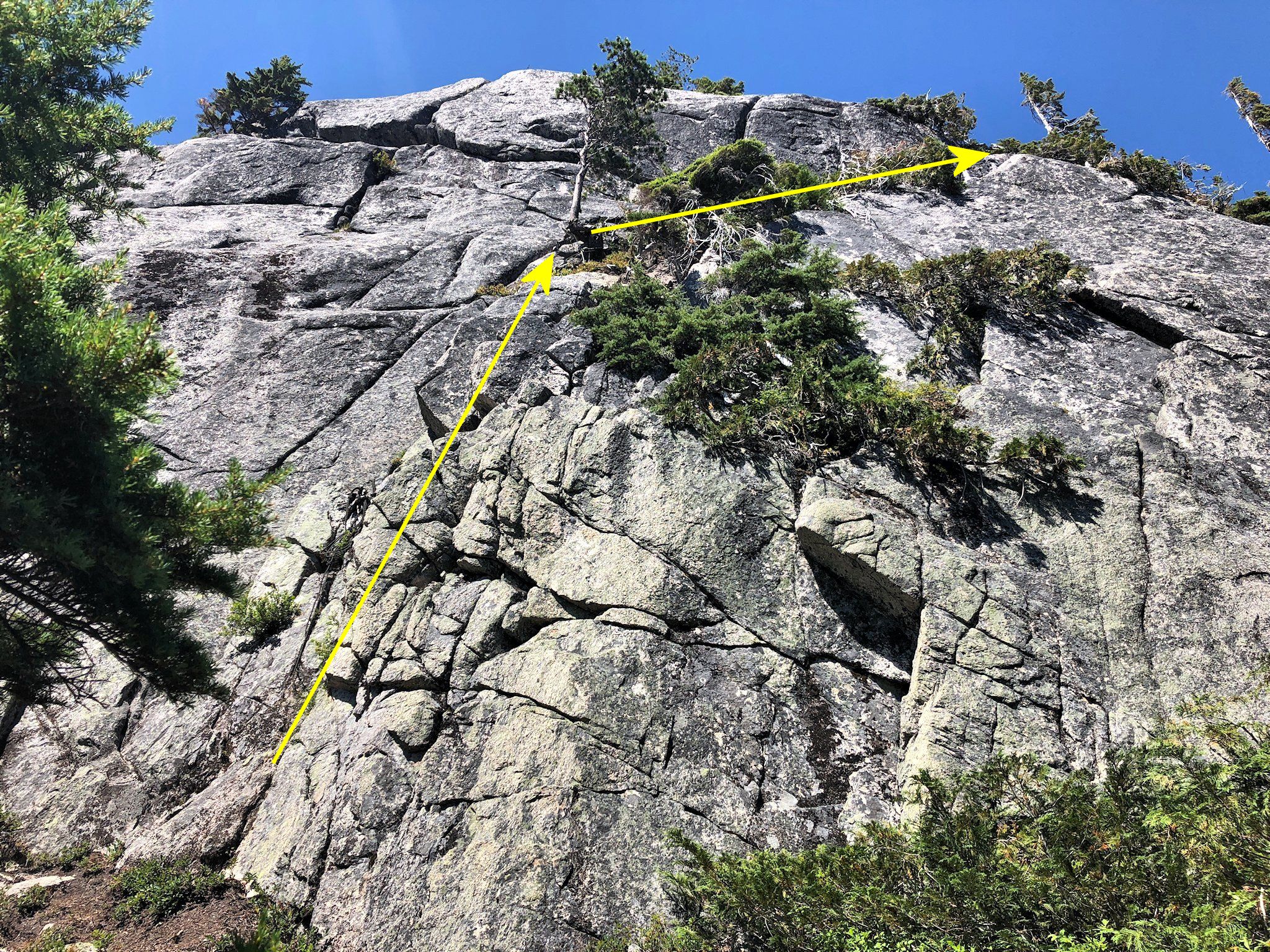
Naturally, I saw the ropes, and didn’t need to pull out the guidebook and check the description. It was right in front of me!
Before I knew it, I was batmanning up a super steep (almost vertical) corner, with very sparse footholds, and was about 6-7 meters off the deck. I scrambled my way onto a tiny stance beside a small tree, and gathered my wits. When my heart rate had eased off a bit, I continued up the steep ramp, again protected by a steep rope.
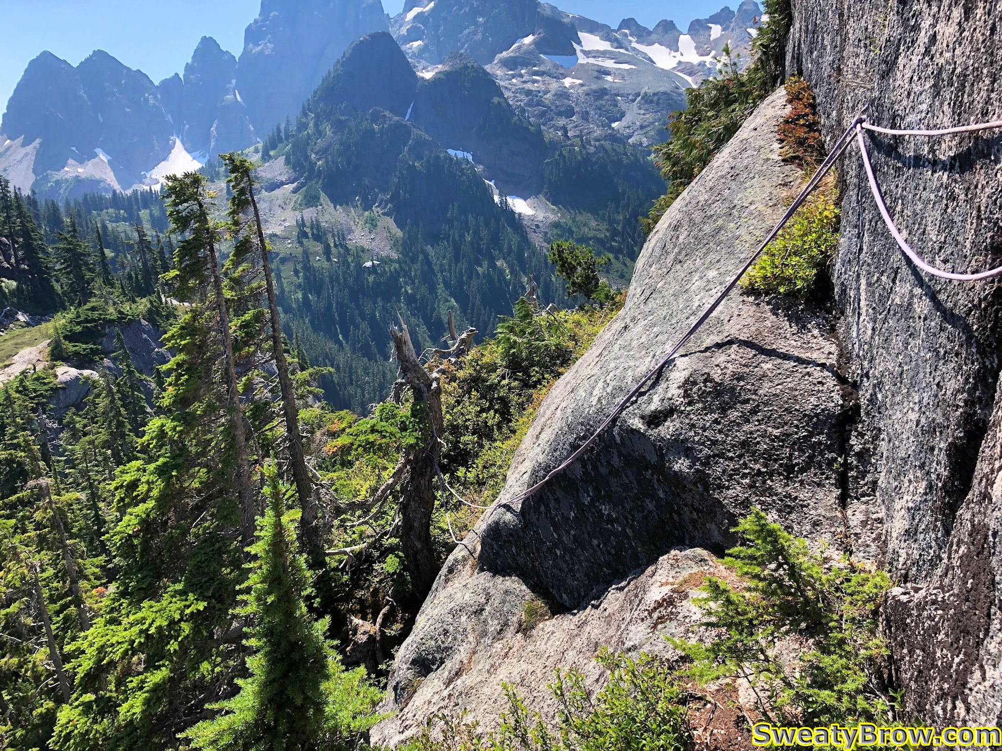
I continued up some steep, much less exposed, ground for a couple of minutes, then reached a bulge extending out from the wall. There was a barely discernible “ledge” traversing to the far side, protected by a couple of ropes (one of which was rather frayed at its attach point on the nearer side), and with a serious drop, probably 25 meters, into a gully below.
Unfortunately, I didn’t take a photo or video prior to traversing it. I gathered my wits, steeled my resolve, hiked up my big boy shorts, and started across…
I survived. I knew that I would, but wow… Being solo, and having forgotten to bring along my InReach satellite communicator, I had no way of telling anyone where I was, or where to look if I were never heard from again. Oops. This was pretty much the most committing move I’d ever made while entirely on my own.
After this traverse, there was a little more travel up steep, rope-protected ramps, then things eased right off. It was about 1:00 PM, so just over three hours into the day. As I walked along a little farther, I spotted a gully coming up from the right, with a rope hanging down it. Of course, I had to then pull out the guidebook and have a look. Turns out, I was not supposed to head straight up the wall – the “hiking” route dropped way down to the right, at that point, and then up a long, steep, grassy gully. In fact, later that evening, I stopped by the guidebook’s webpage, and looked at the latest updates:
When following the route described in the guidebook, I’ve been told that some hikers are missing the handline descent into the gully just prior to reaching the “Brain”. Instead, they are following a well-defined trail which leads directly to the base of the Brain and a very steep rock wall with a rope fixed in place. Ascending this fixed rope leads to very dangerous and exposed fifth-class rock climbing terrain, which gains the top of the Brain. This is not the route described in the book. Look for the descent into the wide gully right (east) of the base of the Brain to stay on route.
Aha! OK, I did that wrong… The rest of this thing should be much easier!
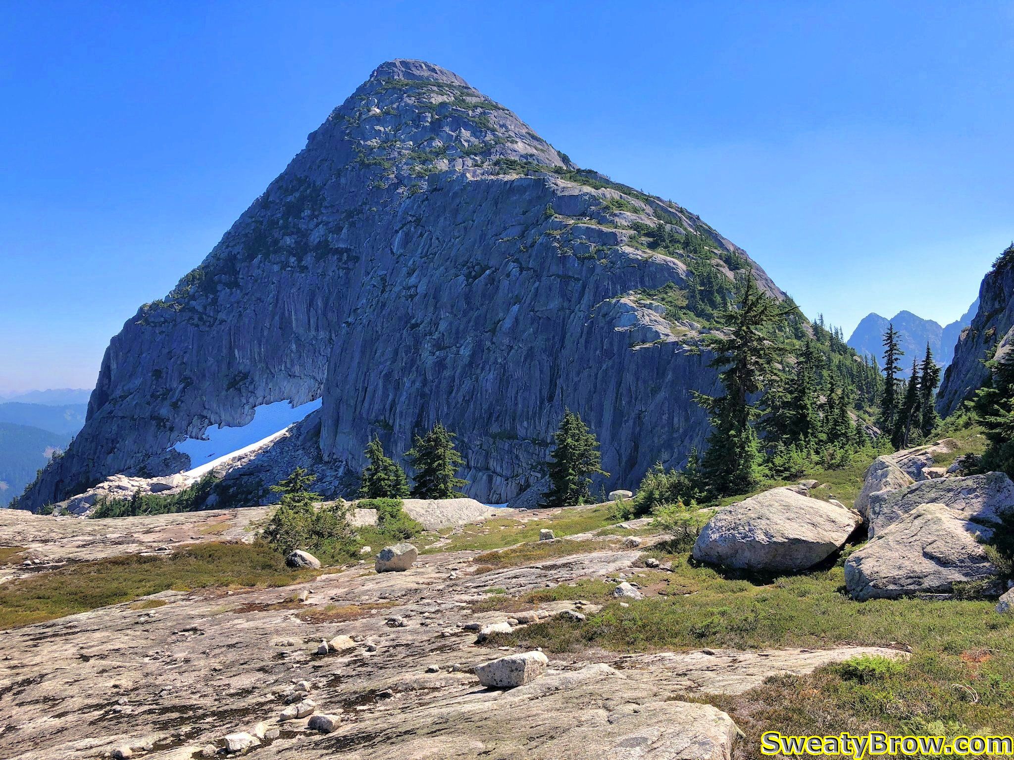
After overcoming The Brain, it was time to traverse below the south face of Mount Habrich. There was a gully to drop down, again with a fixed rope, and a little bit of exposure, then a trail along the bottom of the face. It popped back into the forest, and almost immediately started downhill. There was a fainter, but well flagged, trail that broke off to the right, though, and headed very steeply uphill. I followed this.
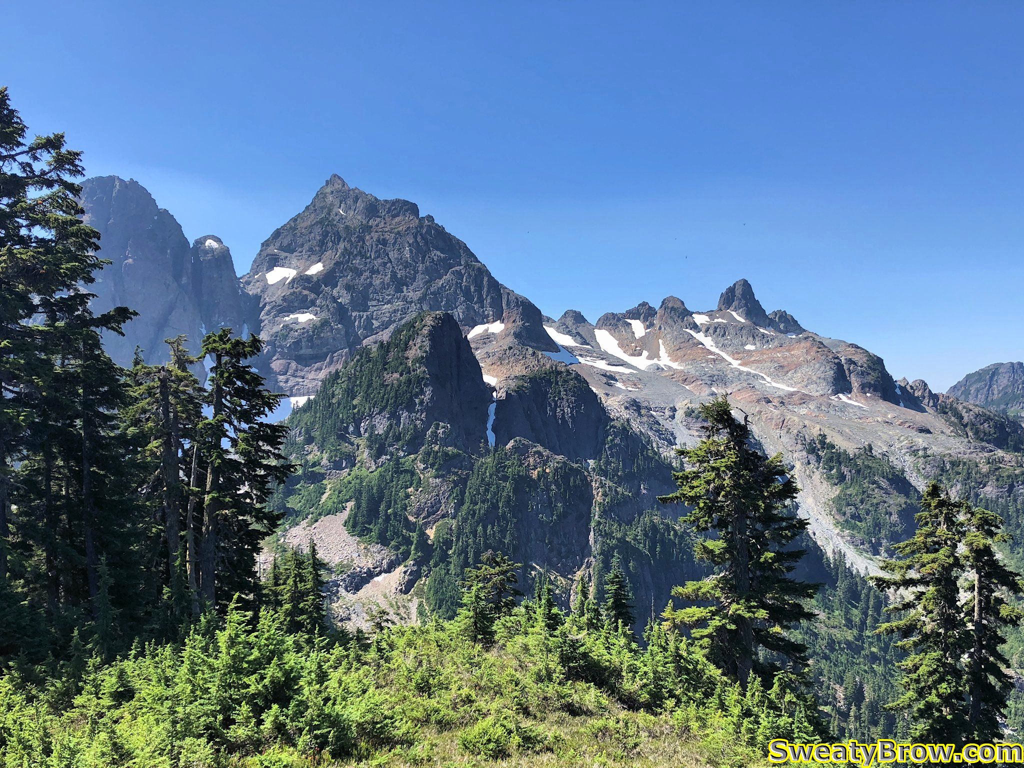
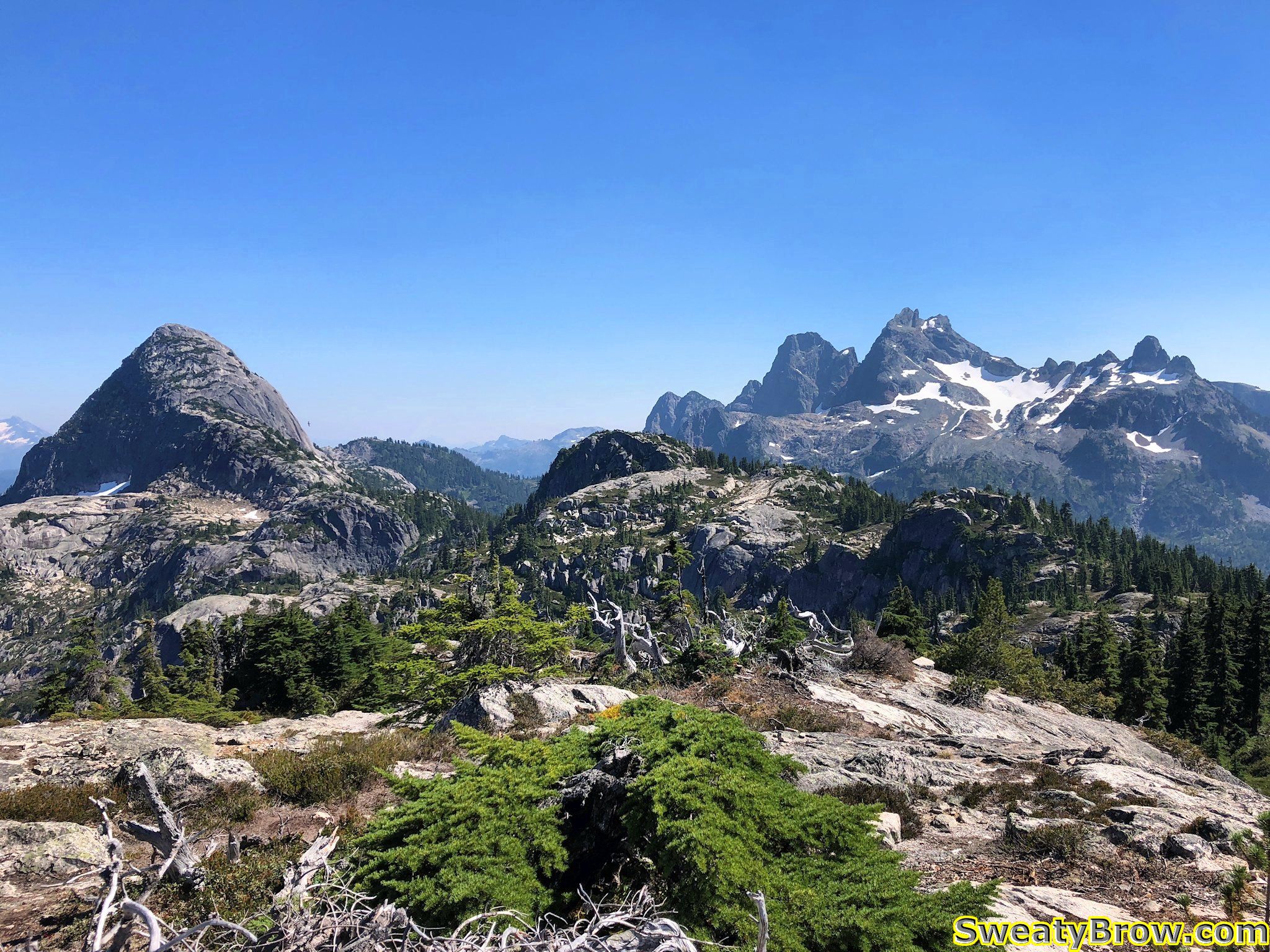
Did I mention steep? Very steeply, up through the trees. The trail popped out into the bottom of a notch between Mount Habrich and the next summit along the ridge. This summit was the highest point reached for the day, at about 1650 meters. The terrain through here was fun, pleasant scrambling, in a glorious location – the views to the north and south were just gorgeous.
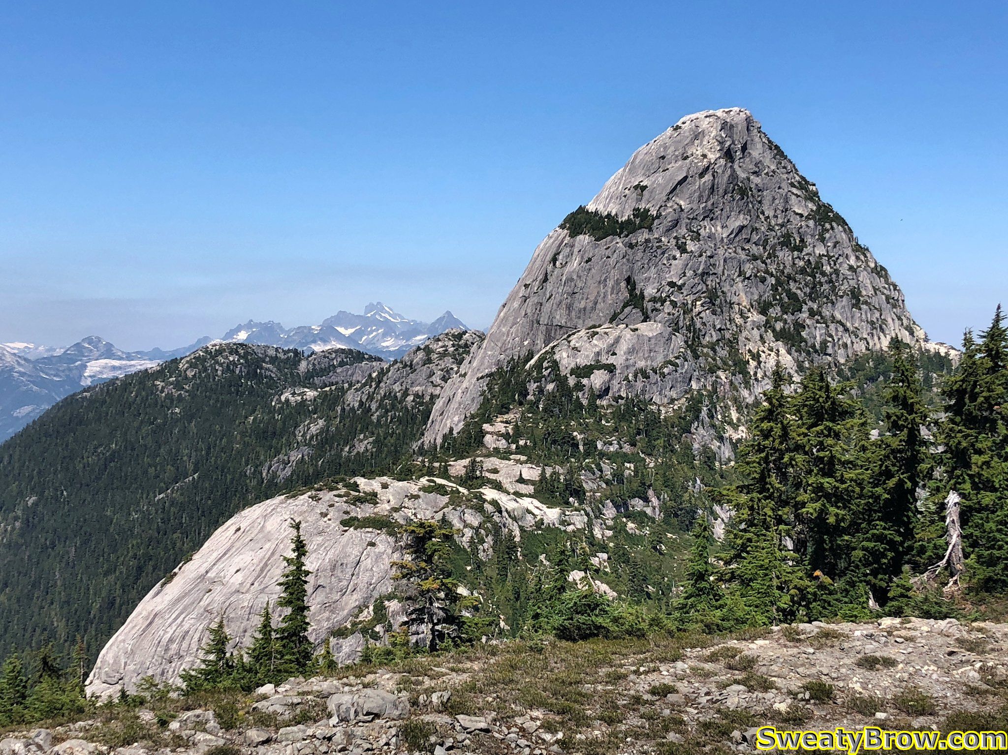
After going up and over that first summit on the ridge, I came around the north side of the next summit, along a huge, flat slab system. I then dropped through a little basin area, where I ran into a group of four people coming the other way!
They were laden with a bunch of climbing equipment, and were off to ascend “Life on Earth” – a 5 pitch, 5.10c-ish rock route up the southwest arete of Mount Habrich. I stopped to have a little snack and some water with them, and chatted briefly. One of the fellows was celebrating his birthday (which was the following day) with this climb. They joked about how they’d picked the hottest day of the year to do it, and that they hoped they’d be able to finish the climb and return to the gondola in time for the last ride down at 9:00 PM. It did seem a little dubious… Hope they made it!
I continued along for a while, up and down along the ridge. There were a couple of descents that had ropes fixed in place, but they were mostly in places where there were steep, dirty hills, which would be slippery in wetter conditions. There was one spot where I had to make a bit of an exposed step around an arete that had no real protection, and I was surprised because there had been some ropes in spots where they seemed unnecessary. Nevertheless, everything was pretty easy after the ascent I made up the side of The Brain!
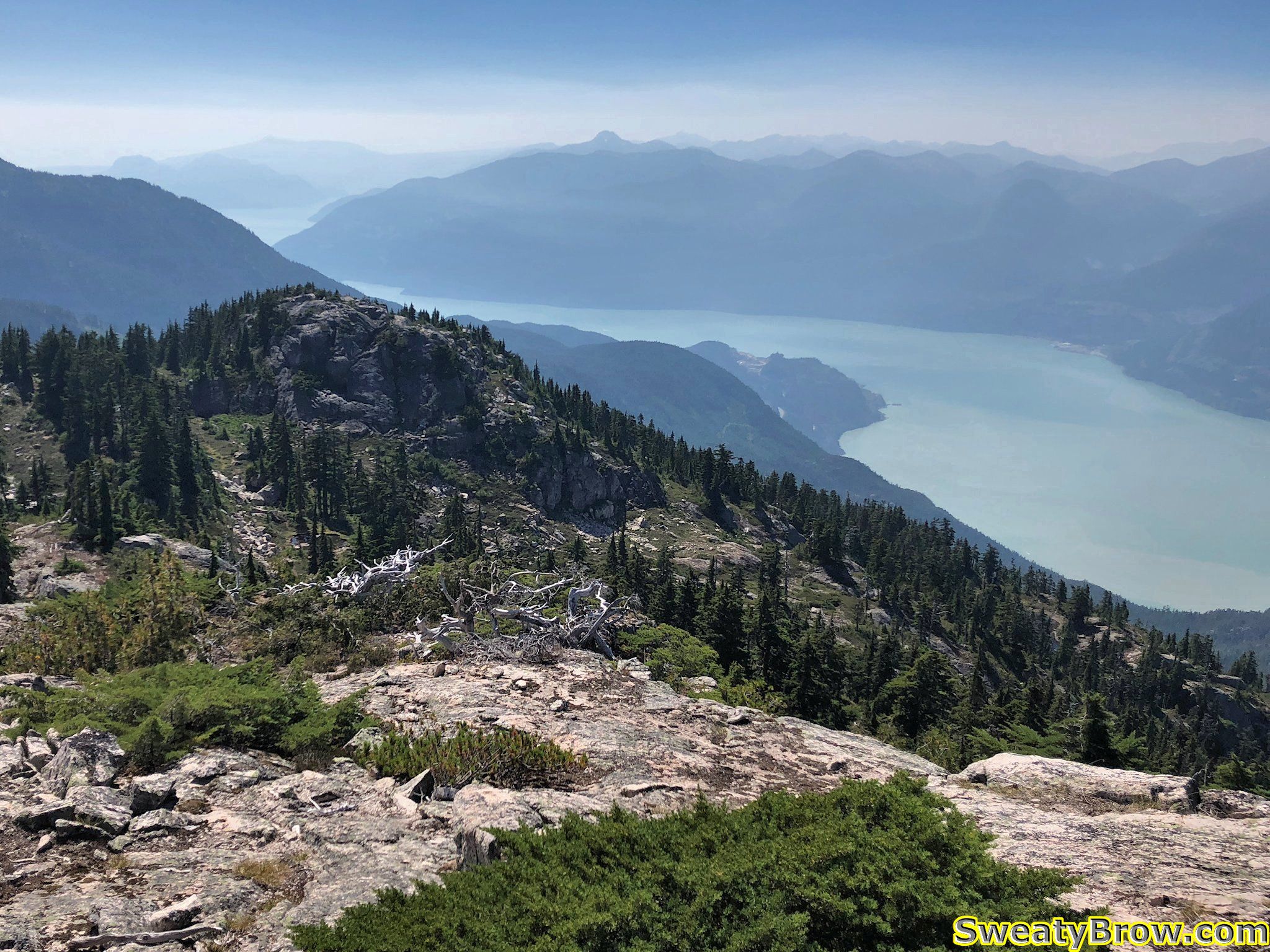
Finally, shortly before 4:00 I reached the far western end of the ridge, where my GPS and the guidebook showed “Robin’s Connector Trail” reaching the same promontory from the other side – from the gondola.
I stopped here for a while, taking some photos – and chatting/gloating online with a work colleague about what a great spot I was in!
I started hunting around for the trail, and had some difficulty finding it. Eventually, I found a bit of a footbed, and began following it downhill, but kept losing and finding it again along some rocky, talus filled slopes. I ended up being unable to find the actual “Robin’s Connector Trail”, but was able to follow another trail that is marked in the guidebook. It is a steeper, and apparently less well marked, trail that leads down to Neverland Lake, where it joins “Al’s Habrich Trail”.
I followed this down, down, down, and eventually managed to reach the Gondola shortly after 5:40.
I feasted upon a plate of Victory Fries, and a massive Caesar Salad, washed down with a can of Guinness Stout. Truly, a meal of champions.
As I mentioned at the start, I was camping at the Squamish Chief Climbers Campground, a short 5-10 minute walk from the bottom of the Gondola. This meant that my tent was merely stumbling distance from my ride down the hill. Naturally, more beer was consumed, as I continued to celebrate a wonderful day in the mountains!
Total time: 7:50 (6:10 “moving” – says Gaia GPS)
Distance: 16.9 km
Elevation: 1450 m gain/loss